
How to get from West Salem (airport) (Illinois) to Bowling Green (Kentucky)
Calculate route from West Salem (airport) (Illinois, United States) to Bowling Green (Kentucky, United States).
The flight distance (as the crow flies) between West Salem (airport) and Bowling Green is 221.2 km.
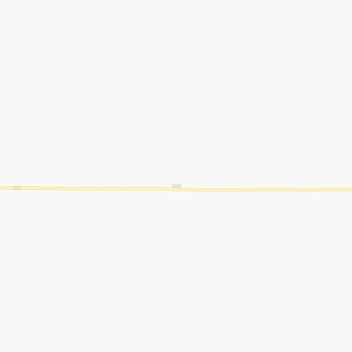
Roadmap (route) to go from West Salem Airport to Bowling Green detailed above, you can also see the course layout on the map.
While doing trip West Salem (airport) - Bowling Green by car, the calculated route ends at a distance , or more straight.
Distance and duration of the route between West Salem (airport) and Bowling Green
Calculation of distance and route from Bowling Green to West Salem (airport) :
221.2268.9 km3h11mn
Continue 0h1mn 530 mTurn right 0h4mn 2.0 kmTurn left onto 500E 0h13mn 17.3 kmTurn left onto East Walnut Street 0h1mn 530 mTurn right onto South 1st Street 0h13mn 12.8 kmKeep right 0h0mn 37 mTurn slight right onto North Court Street 0h4mn 4.8 kmTurn right 0h5mn 8.9 kmKeep right and take SR 69 South toward New Harmony, Mount Vernon, Griffin 0h0mn 516 mTurn right onto SR 69 0h7mn 8.6 kmTurn left onto State Highway 66 0h23mn 31.6 kmTurn right onto Mesker Park Drive 0h2mn 2.1 kmTurn right onto St Joseph Avenue 0h1mn 1.2 kmTurn left onto West Lloyd Expressway 0h1mn 1.4 kmKeep right 0h0mn 308 mTurn right onto South Fulton Avenue 0h1mn 1.7 kmContinue onto Veterans Memorial Parkway 0h2mn 2.8 kmKeep right and take US 41 toward Henderson, Kentucky, Vincennes 0h0mn 289 mKeep right and take US 41 South toward Henderson, Kentucky 0h12mn 15.2 kmKeep right and drive toward Owensboro 0h23mn 38.3 kmKeep right and take US 60 East toward Hawesville 0h7mn 10.6 kmKeep right and take I 165 South toward Bowling Green 1h60mn 101.1 kmKeep right 0h0mn 269 mTurn left onto Morgantown Road 0h3mn 2.8 kmTurn left onto Old Morgantown Road 0h3mn 1.6 kmTurn left onto University Boulevard 0h1mn 920 mTurn right onto East 12th Avenue 0h0mn 143 mTurn left onto Center Street 0h0mn 65 mTurn right onto East 12th Avenue 0h1mn 294 mTurn left onto State Street 0h0mn 124 mTurn right 0h0mn 19 mTurn right 0h0mn 37 mArrive at destination 0h0mn 0 m
Travel from West Salem (airport) (Kentucky) to a selection of major cities.
Distances from West Salem Airport to biggest cities in Illinois
- South Lawndale,73,826 inhabitants.370 km
- Logan Square,73,702 inhabitants.378 km
- Decatur,73,254 inhabitants.166 km
- West Ridge,72,211 inhabitants.387 km
- Palatine,69,308 inhabitants.398 km
- Lincoln Park,66,959 inhabitants.379 km
- Portage Park,64,841 inhabitants.382 km
- Skokie,64,821 inhabitants.390 km
- Des Plaines,58,677 inhabitants.390 km
- Orland Park,58,619 inhabitants.345 km
- Tinley Park,57,143 inhabitants.339 km
- Oak Lawn,56,781 inhabitants.354 km
- Irving Park,56,520 inhabitants.382 km
- Berwyn,56,368 inhabitants.370 km
- Chicago Lawn,55,551 inhabitants.362 km
- Uptown,55,137 inhabitants.383 km
- Edgewater,54,873 inhabitants.385 km
- Mount Prospect,54,747 inhabitants.393 km
- Rogers Park,54,402 inhabitants.388 km
- Normal,54,373 inhabitants.235 km
Other major cities in country :
- Seattle [WA], 684,451 inhabitants. 2,938 km
- Denver [CO], 682,545 inhabitants. 1,468 km
- El Paso [TX], 681,124 inhabitants. 1,837 km
- Detroit [MI], 677,116 inhabitants. 598 km
- Boston [MA], 667,137 inhabitants. 1,497 km
- Memphis [TN], 655,770 inhabitants. 417 km
- New South Memphis [TN], 641,608 inhabitants. 424 km
- Portland [OR], 632,309 inhabitants. 2,943 km
- Oklahoma City [OK], 631,346 inhabitants. 909 km
- Las Vegas [NV], 623,747 inhabitants. 2,404 km
- Baltimore [MD], 621,849 inhabitants. 992 km
- Washington, D.C. [DC], 601,723 inhabitants. 956 km
- Milwaukee [WI], 600,155 inhabitants. 502 km
- South Boston [MA], 571,281 inhabitants. 1,497 km
- Albuquerque [NM], 559,121 inhabitants. 1,700 km
- Tucson [AZ], 531,641 inhabitants. 2,186 km
- Nashville [TN], 530,852 inhabitants. 286 km
- Fresno [CA], 520,052 inhabitants. 2,791 km
- Sacramento [CA], 490,712 inhabitants. 2,896 km
- Kansas City [MO], 475,378 inhabitants. 571 km
Route from Bowling Green to major cities (United States).
- Distance Bowling Green New York City1,154 km
- Distance Bowling Green Los Angeles2,886 km
- Distance Bowling Green Chicago551 km
- Distance Bowling Green Brooklyn1,156 km
- Distance Bowling Green Houston1,154 km
- Distance Bowling Green Queens1,167 km
- Distance Bowling Green Philadelphia1,036 km
- Distance Bowling Green Phoenix2,357 km
- Distance Bowling Green Manhattan1,159 km
- Distance Bowling Green San Antonio1,401 km
- Distance Bowling Green San Diego2,834 km
- Distance Bowling Green The Bronx1,170 km
- Distance Bowling Green Dallas1,055 km
- Distance Bowling Green San Jose3,126 km
- Distance Bowling Green Austin1,286 km
- Distance Bowling Green Jacksonville863 km
- Distance Bowling Green San Francisco3,164 km
- Distance Bowling Green Columbus447 km
- Distance Bowling Green Fort Worth1,100 km
- Distance Bowling Green Indianapolis310 km
Nearest cities to West Salem (airport) :
- Indianapolis, 829,718 inhabitants. 212 km
- Nashville, 530,852 inhabitants. 286 km
- St. Louis, 315,685 inhabitants. 189 km
- Fort Wayne, 260,326 inhabitants. 381 km
- Louisville, 243,639 inhabitants. 201 km
- Clarksville, 149,176 inhabitants. 231 km
- Joliet, 147,861 inhabitants. 333 km
- Murfreesboro, 126,118 inhabitants. 333 km
- Evansville, 119,943 inhabitants. 75 km
- Springfield, 116,565 inhabitants. 198 km
- Peoria, 115,070 inhabitants. 275 km
- North Peoria, 113,004 inhabitants. 277 km
- Davenport, 102,582 inhabitants. 397 km
- Carmel, 88,713 inhabitants. 231 km
- Champaign, 86,096 inhabitants. 177 km
- O'Fallon, 85,040 inhabitants. 234 km
- Bloomington, 84,067 inhabitants. 148 km
- Bloomington, 78,292 inhabitants. 232 km
- Fishers, 76,794 inhabitants. 235 km
- Jonesboro, 73,907 inhabitants. 382 km
- Decatur, 73,254 inhabitants. 166 km
- Franklin, 72,639 inhabitants. 308 km
- Lafayette, 71,111 inhabitants. 232 km
- Muncie, 70,087 inhabitants. 293 km
- Jackson, 66,975 inhabitants. 332 km
- Saint Charles, 65,794 inhabitants. 215 km
- Bowling Green, 63,616 inhabitants. 222 km
- Terre Haute, 60,825 inhabitants. 117 km
- Noblesville, 59,093 inhabitants. 242 km
- Owensboro, 59,042 inhabitants. 117 km
- Kokomo, 57,995 inhabitants. 272 km
- Hendersonville, 56,018 inhabitants. 278 km
- Greenwood, 55,586 inhabitants. 205 km
- Anderson, 55,305 inhabitants. 268 km
- Normal, 54,373 inhabitants. 235 km
- Saint Peters, 52,575 inhabitants. 227 km
- Florissant, 52,268 inhabitants. 201 km
- Chesterfield, 47,864 inhabitants. 222 km
- Lawrence, 47,809 inhabitants. 226 km
- Jeffersonville, 46,960 inhabitants. 202 km
- Columbus, 46,690 inhabitants. 198 km
- Smyrna, 46,607 inhabitants. 314 km
- West Lafayette, 45,550 inhabitants. 232 km
- Moline, 42,681 inhabitants. 393 km
- Urbana, 42,311 inhabitants. 176 km
- Belleville, 42,034 inhabitants. 170 km
- Brentwood, 41,763 inhabitants. 300 km
- Cape Girardeau, 39,462 inhabitants. 189 km
- Rock Island, 38,620 inhabitants. 396 km
- Columbia, 36,800 inhabitants. 337 km
Location West Salem (airport) (Illinois) :
| Country flag |  |
| Location | West Salem (airport) |
| State | Illinois |
| County | Edwards County |
| Country | United States |
| Country code / ISO 2 | US |
| Latitude | 38.5333800 |
| Longitude | -88.0339200 |
| Altitude | 155 meters |
| Time zone | America/Chicago |
Location Bowling Green (Kentucky) :
| Country flag | |
| Location | Bowling Green |
| State | Kentucky |
| County | Warren County |
| Country | United States |
| Country code / ISO 2 | US |
| Latitude | 36.9903200 |
| Longitude | -86.4436000 |
| Altitude | 161 meters |
| Time zone | America/Chicago |


