
How to get from Greenville (airport) (Illinois) to Owensboro (Kentucky)
Calculate route from Greenville (airport) (Illinois, United States) to Owensboro (Kentucky, United States).
The flight distance (as the crow flies) between Greenville (airport) and Owensboro is 229.6 km.
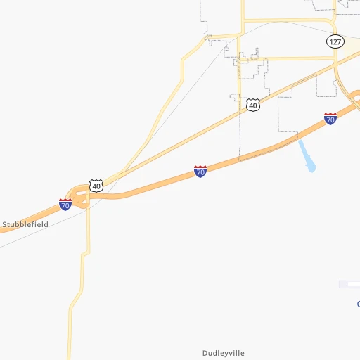
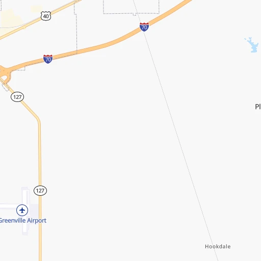
Roadmap (route) to go from Greenville Airport to Owensboro detailed above, you can also see the course layout on the map.
While doing trip Greenville (airport) - Owensboro by car, the calculated route ends at a distance , or more straight.
Distance and duration of the route between Greenville (airport) and Owensboro
Calculation of distance and route from Owensboro to Greenville (airport) :
229.6290.5 km4h37mn
Continue onto Chuck Bunting Lane 0h0mn 213 mTurn right onto IL 127 0h23mn 25.0 kmContinue onto 12th St 0h26mn 25.6 kmTurn left 0h22mn 37.3 kmKeep right onto I 64 toward I 57 South, I 64 East 0h5mn 7.3 kmKeep left onto I 64 and take I 64 East toward Louisville 1h54mn 91.4 kmKeep right and take SR 69 South toward New Harmony, Mount Vernon, Griffin 0h0mn 516 mTurn right onto SR 69 0h7mn 8.6 kmTurn left onto State Highway 66 0h23mn 31.6 kmTurn right onto Mesker Park Drive 0h2mn 2.1 kmTurn right onto St Joseph Avenue 0h1mn 1.2 kmTurn left onto West Lloyd Expressway 0h1mn 1.4 kmKeep right 0h0mn 308 mTurn right onto South Fulton Avenue 0h1mn 1.7 kmContinue onto Veterans Memorial Parkway 0h2mn 2.8 kmKeep right and take US 41 toward Henderson, Kentucky, Vincennes 0h0mn 289 mKeep right and take US 41 South toward Henderson, Kentucky 0h7mn 8.0 kmTurn left onto Watson Lane 0h2mn 1.8 kmTurn left onto US 60 1h39mn 43.1 kmTurn left onto Frederica Street 0h0mn 184 mArrive at destination 0h0mn 0 m
Travel from Greenville (airport) (Kentucky) to a selection of major cities.
Distances from Greenville Airport to biggest cities in Illinois
- South Lawndale,73,826 inhabitants.363 km
- Logan Square,73,702 inhabitants.372 km
- Decatur,73,254 inhabitants.118 km
- West Ridge,72,211 inhabitants.380 km
- Palatine,69,308 inhabitants.382 km
- Lincoln Park,66,959 inhabitants.374 km
- Portage Park,64,841 inhabitants.373 km
- Skokie,64,821 inhabitants.382 km
- Des Plaines,58,677 inhabitants.378 km
- Orland Park,58,619 inhabitants.337 km
- Tinley Park,57,143 inhabitants.333 km
- Oak Lawn,56,781 inhabitants.348 km
- Irving Park,56,520 inhabitants.374 km
- Berwyn,56,368 inhabitants.362 km
- Chicago Lawn,55,551 inhabitants.357 km
- Uptown,55,137 inhabitants.378 km
- Edgewater,54,873 inhabitants.379 km
- Mount Prospect,54,747 inhabitants.380 km
- Rogers Park,54,402 inhabitants.382 km
- Normal,54,373 inhabitants.190 km
Other major cities in country :
- Seattle [WA], 684,451 inhabitants. 2,821 km
- Denver [CO], 682,545 inhabitants. 1,347 km
- El Paso [TX], 681,124 inhabitants. 1,739 km
- Detroit [MI], 677,116 inhabitants. 661 km
- Boston [MA], 667,137 inhabitants. 1,593 km
- Memphis [TN], 655,770 inhabitants. 415 km
- New South Memphis [TN], 641,608 inhabitants. 422 km
- Portland [OR], 632,309 inhabitants. 2,824 km
- Oklahoma City [OK], 631,346 inhabitants. 813 km
- Las Vegas [NV], 623,747 inhabitants. 2,287 km
- Baltimore [MD], 621,849 inhabitants. 1,103 km
- Washington, D.C. [DC], 601,723 inhabitants. 1,069 km
- Milwaukee [WI], 600,155 inhabitants. 484 km
- South Boston [MA], 571,281 inhabitants. 1,594 km
- Albuquerque [NM], 559,121 inhabitants. 1,590 km
- Tucson [AZ], 531,641 inhabitants. 2,080 km
- Nashville [TN], 530,852 inhabitants. 375 km
- Fresno [CA], 520,052 inhabitants. 2,672 km
- Sacramento [CA], 490,712 inhabitants. 2,776 km
- Kansas City [MO], 475,378 inhabitants. 451 km
Route from Owensboro to major cities (United States).
- Distance Owensboro New York City1,175 km
- Distance Owensboro Los Angeles2,824 km
- Distance Owensboro Chicago456 km
- Distance Owensboro Brooklyn1,178 km
- Distance Owensboro Houston1,173 km
- Distance Owensboro Queens1,188 km
- Distance Owensboro Philadelphia1,063 km
- Distance Owensboro Phoenix2,302 km
- Distance Owensboro Manhattan1,180 km
- Distance Owensboro San Antonio1,404 km
- Distance Owensboro San Diego2,777 km
- Distance Owensboro The Bronx1,190 km
- Distance Owensboro Dallas1,041 km
- Distance Owensboro San Jose3,052 km
- Distance Owensboro Austin1,287 km
- Distance Owensboro Jacksonville969 km
- Distance Owensboro San Francisco3,088 km
- Distance Owensboro Columbus432 km
- Distance Owensboro Fort Worth1,084 km
- Distance Owensboro Indianapolis237 km
Nearest cities to Greenville (airport) :
- Nashville, 530,852 inhabitants. 375 km
- St. Louis, 315,685 inhabitants. 75 km
- Aurora, 200,661 inhabitants. 338 km
- Clarksville, 149,176 inhabitants. 312 km
- Joliet, 147,861 inhabitants. 319 km
- Naperville, 147,100 inhabitants. 345 km
- Murfreesboro, 126,118 inhabitants. 425 km
- Evansville, 119,943 inhabitants. 185 km
- Columbia, 119,108 inhabitants. 257 km
- Springfield, 116,565 inhabitants. 110 km
- Peoria, 115,070 inhabitants. 208 km
- North Peoria, 113,004 inhabitants. 210 km
- Davenport, 102,582 inhabitants. 316 km
- Champaign, 86,096 inhabitants. 173 km
- O'Fallon, 85,040 inhabitants. 115 km
- Bloomington, 84,067 inhabitants. 249 km
- Bloomington, 78,292 inhabitants. 187 km
- Hammond, 77,614 inhabitants. 345 km
- Gary, 77,156 inhabitants. 352 km
- Bolingbrook, 74,306 inhabitants. 338 km
- Iowa City, 74,220 inhabitants. 364 km
- Jonesboro, 73,907 inhabitants. 353 km
- Decatur, 73,254 inhabitants. 118 km
- Franklin, 72,639 inhabitants. 392 km
- Lafayette, 71,111 inhabitants. 277 km
- Saint Charles, 65,794 inhabitants. 96 km
- Bowling Green, 63,616 inhabitants. 329 km
- Terre Haute, 60,825 inhabitants. 183 km
- Owensboro, 59,042 inhabitants. 230 km
- Orland Park, 58,619 inhabitants. 337 km
- Tinley Park, 57,143 inhabitants. 333 km
- Oak Lawn, 56,781 inhabitants. 348 km
- Hendersonville, 56,018 inhabitants. 372 km
- Chicago Lawn, 55,551 inhabitants. 357 km
- Normal, 54,373 inhabitants. 190 km
- Saint Peters, 52,575 inhabitants. 109 km
- Florissant, 52,268 inhabitants. 82 km
- South Shore, 51,451 inhabitants. 360 km
- Downers Grove, 49,732 inhabitants. 351 km
- Chesterfield, 47,864 inhabitants. 106 km
- Smyrna, 46,607 inhabitants. 406 km
- Auburn Gresham, 45,842 inhabitants. 355 km
- West Lafayette, 45,550 inhabitants. 276 km
- Brighton Park, 44,202 inhabitants. 361 km
- Jefferson City, 43,169 inhabitants. 245 km
- Ashburn, 42,752 inhabitants. 354 km
- Moline, 42,681 inhabitants. 313 km
- Plainfield, 42,527 inhabitants. 326 km
- Urbana, 42,311 inhabitants. 174 km
- Belleville, 42,034 inhabitants. 64 km
Location Greenville (airport) (Illinois) :
| Country flag |  |
| Location | Greenville (airport) |
| State | Illinois |
| County | Bond County |
| Country | United States |
| Country code / ISO 2 | US |
| Latitude | 38.8345400 |
| Longitude | -89.3739600 |
| Altitude | 163 meters |
| Time zone | America/Chicago |
Location Owensboro (Kentucky) :
| Country flag | |
| Location | Owensboro |
| State | Kentucky |
| County | Daviess County |
| Country | United States |
| Country code / ISO 2 | US |
| Latitude | 37.7742200 |
| Longitude | -87.1133300 |
| Altitude | 120 meters |
| Time zone | America/Chicago |


