
How to get from Statesboro (Georgia) to Douglasville (Georgia)
Calculate route from Statesboro (Georgia, United States) to Douglasville (Georgia, United States).
The flight distance (as the crow flies) between Statesboro and Douglasville is 311.6 km.
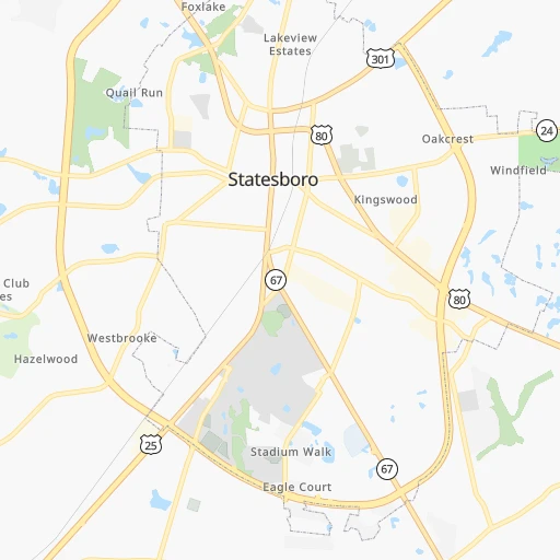
Roadmap (route) to go from Statesboro to Douglasville detailed above, you can also see the course layout on the map.
While doing trip Statesboro - Douglasville by car, the calculated route ends at a distance , or more straight.
Distance and duration of the route between Statesboro and Douglasville
Calculation of distance and route from Douglasville to Statesboro :
311.6356.1 km4h1mn
Continue onto East Main Street 0h1mn 483 mKeep left onto Johnson Street 0h0mn 183 mKeep right onto Denmark Street 0h22mn 18.6 kmTurn right onto GA 46 0h19mn 20.2 kmTurn sharp left onto GA 57 0h0mn 163 mKeep right and take I-16 West toward Macon 2h32mn 155.4 kmKeep right and take I 75 North toward Atlanta 1h50mn 84.2 kmKeep left and drive toward Express Lanes 0h0mn 675 mContinue onto I-75 South Metro Express Lanes 0h10mn 15.7 kmKeep right and take I 75 North toward Downtown Atlanta 0h10mn 15.8 kmKeep right and take GA 331 toward Forest Park, Farmers Market 0h1mn 838 mKeep left 0h4mn 4.1 kmKeep right 0h0mn 451 mTurn sharp left and take GA 139 South toward Riverdale Road 0h0mn 83 mTurn right toward I 285 West 0h1mn 642 mContinue onto Atlanta Bypass / The Perimeter 0h5mn 7.8 kmKeep right and drive toward Camp Creek Parkway, Atlanta Airport Domestic 0h0mn 257 mKeep left and take GA 6 West toward Georgia Department of Revenue, Motor Vehicle Division 0h8mn 10.2 kmTurn left onto Campbellton Road 0h15mn 18.3 kmTurn left onto Fairburn Road 0h1mn 1.4 kmTurn left onto Veterans Memorial Highway 0h1mn 612 mArrive at destination 0h0mn 0 m
Travel from Statesboro (Georgia) to a selection of major cities.
Distances from Statesboro to biggest cities in Georgia
- Gainesville,38,712 inhabitants.280 km
- Milton,37,547 inhabitants.300 km
- Newnan,37,291 inhabitants.300 km
- Mableton,37,115 inhabitants.302 km
- Rome,36,323 inhabitants.373 km
- Martinez,35,795 inhabitants.122 km
- East Point,35,467 inhabitants.283 km
- Peachtree City,35,240 inhabitants.283 km
- Dalton,33,853 inhabitants.392 km
- Kennesaw,33,584 inhabitants.317 km
- Hinesville,33,398 inhabitants.69 km
- Redan,33,015 inhabitants.262 km
- Douglasville,32,897 inhabitants.312 km
- Lawrenceville,30,493 inhabitants.265 km
- Woodstock,29,898 inhabitants.314 km
- LaGrange,29,588 inhabitants.311 km
- Duluth,29,193 inhabitants.280 km
- Evans,29,011 inhabitants.125 km
- Chamblee,28,244 inhabitants.284 km
- Stockbridge,28,202 inhabitants.259 km
Other major cities in country :
- Charlotte [NC], 827,097 inhabitants. 321 km
- Seattle [WA], 684,451 inhabitants. 3,790 km
- Denver [CO], 682,545 inhabitants. 2,231 km
- El Paso [TX], 681,124 inhabitants. 2,326 km
- Detroit [MI], 677,116 inhabitants. 1,106 km
- Boston [MA], 667,137 inhabitants. 1,452 km
- Memphis [TN], 655,770 inhabitants. 821 km
- New South Memphis [TN], 641,608 inhabitants. 820 km
- Portland [OR], 632,309 inhabitants. 3,776 km
- Oklahoma City [OK], 631,346 inhabitants. 1,489 km
- Las Vegas [NV], 623,747 inhabitants. 3,080 km
- Baltimore [MD], 621,849 inhabitants. 893 km
- Washington, D.C. [DC], 601,723 inhabitants. 836 km
- Milwaukee [WI], 600,155 inhabitants. 1,295 km
- South Boston [MA], 571,281 inhabitants. 1,451 km
- Albuquerque [NM], 559,121 inhabitants. 2,314 km
- Tucson [AZ], 531,641 inhabitants. 2,733 km
- Nashville [TN], 530,852 inhabitants. 618 km
- Fresno [CA], 520,052 inhabitants. 3,491 km
- Sacramento [CA], 490,712 inhabitants. 3,633 km
Route from Douglasville to major cities (United States).
- Distance Douglasville New York City1,226 km
- Distance Douglasville Los Angeles3,081 km
- Distance Douglasville Chicago937 km
- Distance Douglasville Brooklyn1,226 km
- Distance Douglasville Houston1,098 km
- Distance Douglasville Queens1,236 km
- Distance Douglasville Philadelphia1,097 km
- Distance Douglasville Phoenix2,526 km
- Distance Douglasville Manhattan1,233 km
- Distance Douglasville San Antonio1,388 km
- Distance Douglasville San Diego3,008 km
- Distance Douglasville The Bronx1,244 km
- Distance Douglasville Dallas1,127 km
- Distance Douglasville San Jose3,367 km
- Distance Douglasville Austin1,285 km
- Distance Douglasville Jacksonville480 km
- Distance Douglasville San Francisco3,409 km
- Distance Douglasville Columbus709 km
- Distance Douglasville Fort Worth1,175 km
- Distance Douglasville Indianapolis681 km
Nearest cities to Statesboro :
- Jacksonville, 868,031 inhabitants. 236 km
- Charlotte, 827,097 inhabitants. 321 km
- Atlanta, 463,878 inhabitants. 283 km
- Fayetteville, 201,963 inhabitants. 395 km
- Tallahassee, 189,907 inhabitants. 326 km
- Savannah, 145,674 inhabitants. 76 km
- Columbia, 133,803 inhabitants. 186 km
- Charleston, 132,609 inhabitants. 177 km
- Gainesville, 130,128 inhabitants. 316 km
- Athens, 116,714 inhabitants. 224 km
- North Charleston, 108,304 inhabitants. 175 km
- Sandy Springs, 105,330 inhabitants. 292 km
- Roswell, 94,501 inhabitants. 297 km
- Macon, 91,351 inhabitants. 179 km
- Concord, 87,696 inhabitants. 348 km
- Johns Creek, 83,335 inhabitants. 285 km
- Palm Coast, 82,893 inhabitants. 323 km
- Mount Pleasant, 81,317 inhabitants. 184 km
- Albany, 74,843 inhabitants. 244 km
- Gastonia, 74,543 inhabitants. 318 km
- Warner Robins, 73,490 inhabitants. 174 km
- Rock Hill, 71,548 inhabitants. 284 km
- Greenville, 64,579 inhabitants. 274 km
- Alpharetta, 63,693 inhabitants. 296 km
- Marietta, 59,067 inhabitants. 307 km
- Smyrna, 56,146 inhabitants. 300 km
- Valdosta, 55,724 inhabitants. 229 km
- Huntersville, 52,704 inhabitants. 341 km
- Brookhaven, 51,910 inhabitants. 285 km
- Stonecrest, 50,000 inhabitants. 260 km
- Summerville, 48,848 inhabitants. 163 km
- Dunwoody, 48,733 inhabitants. 290 km
- Augusta, 43,459 inhabitants. 115 km
- Peachtree Corners, 40,978 inhabitants. 283 km
- Sumter, 40,816 inhabitants. 212 km
- Goose Creek, 40,633 inhabitants. 174 km
- Hilton Head Island, 40,512 inhabitants. 102 km
- North Atlanta, 40,456 inhabitants. 285 km
- St. Johns, 40,000 inhabitants. 264 km
- Gainesville, 38,712 inhabitants. 280 km
- Florence, 38,228 inhabitants. 270 km
- Spartanburg, 37,867 inhabitants. 279 km
- Milton, 37,547 inhabitants. 300 km
- Mableton, 37,115 inhabitants. 302 km
- Hilton Head, 37,099 inhabitants. 100 km
- Indian Trail, 37,073 inhabitants. 310 km
- Martinez, 35,795 inhabitants. 122 km
- East Point, 35,467 inhabitants. 283 km
- Ponte Vedra Beach, 35,400 inhabitants. 249 km
- Peachtree City, 35,240 inhabitants. 283 km
Location Statesboro (Georgia) :
| Country flag |  |
| Location | Statesboro |
| State | Georgia |
| County | Bulloch County |
| Country | United States |
| Country code / ISO 2 | US |
| Latitude | 32.4487900 |
| Longitude | -81.7831700 |
| Altitude | 77 meters |
| Time zone | America/New_York |
Location Douglasville (Georgia) :
| Country flag | |
| Location | Douglasville |
| State | Georgia |
| County | Douglas County |
| Country | United States |
| Country code / ISO 2 | US |
| Latitude | 33.7515000 |
| Longitude | -84.7477100 |
| Altitude | 366 meters |
| Time zone | America/New_York |


