

How to get from Liberty Hill (airport) (Georgia) to Panama City (Florida)
Calculate route from Liberty Hill (airport) (Georgia, United States) to Panama City (Florida, United States).
The flight distance (as the crow flies) between Liberty Hill (airport) and Panama City is 362.2 km.
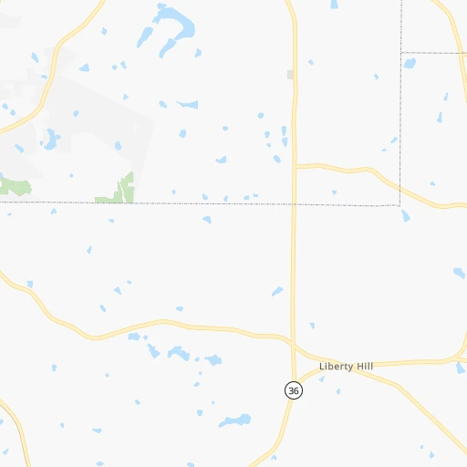
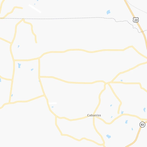
Roadmap (route) to go from Liberty Hill Airport to Panama City detailed above, you can also see the course layout on the map.
While doing trip Liberty Hill (airport) - Panama City by car, the calculated route ends at a distance , or more straight.
Distance and duration of the route between Liberty Hill (airport) and Panama City
Calculation of distance and route from Panama City to Liberty Hill (airport) :
362.2416.2 km5h13mn
Continue onto Liberty Trace 0h1mn 255 mTurn left onto Barnesville-Jackson Road 0h6mn 7.8 kmContinue onto Barnesville-Jackson Road 0h28mn 29.9 kmTurn slight right onto East Main Street 0h0mn 424 mTurn left onto South Green Street 0h21mn 25.3 kmTurn left onto Old Alabama Road 0h7mn 3.6 kmTurn left onto GA 36, GA 41 0h1mn 1.2 kmTurn right onto GA 36 and take GA 36 West toward Waverly Hall 0h15mn 19.6 kmTurn left onto Warm Springs Road 0h21mn 29.9 kmTurn left onto University Avenue 0h0mn 197 mTurn sharp right onto Gentian Boulevard 0h6mn 5.6 kmTurn slight right onto 19th Street 0h0mn 116 mTurn left onto 2nd Avenue 0h2mn 1.8 kmTurn right onto 10th Street 0h0mn 408 mTurn left onto Front Avenue 0h0mn 134 mTurn right onto Dillingham Street 0h1mn 564 mTurn left onto General Colin Powell Parkway 0h0mn 99 mKeep right onto Martin Luther King Jr Parkway North 2h46mn 155.3 kmKeep left 0h0mn 35 mTurn left onto Montgomery Highway 2h35mn 132.2 kmTurn left onto Harrison Avenue 0h2mn 1.7 kmTurn left onto East 7th Street 0h0mn 69 mTurn right onto Luverne Avenue 0h0mn 131 mArrive at destination 0h0mn 0 m
Travel from Liberty Hill (airport) (Florida) to a selection of major cities.
Distances from Liberty Hill Airport to biggest cities in Georgia
- Gainesville,38,712 inhabitants.131 km
- Milton,37,547 inhabitants.110 km
- Newnan,37,291 inhabitants.67 km
- Mableton,37,115 inhabitants.85 km
- Rome,36,323 inhabitants.156 km
- Martinez,35,795 inhabitants.196 km
- East Point,35,467 inhabitants.65 km
- Peachtree City,35,240 inhabitants.51 km
- Dalton,33,853 inhabitants.196 km
- Kennesaw,33,584 inhabitants.107 km
- Hinesville,33,398 inhabitants.279 km
- Redan,33,015 inhabitants.66 km
- Douglasville,32,897 inhabitants.88 km
- Statesboro,30,721 inhabitants.234 km
- Lawrenceville,30,493 inhabitants.91 km
- Woodstock,29,898 inhabitants.112 km
- LaGrange,29,588 inhabitants.84 km
- Duluth,29,193 inhabitants.95 km
- Evans,29,011 inhabitants.191 km
- Chamblee,28,244 inhabitants.84 km
Other major cities in country :
- Charlotte [NC], 827,097 inhabitants. 381 km
- Seattle [WA], 684,451 inhabitants. 3,569 km
- Denver [CO], 682,545 inhabitants. 2,000 km
- El Paso [TX], 681,124 inhabitants. 2,101 km
- Detroit [MI], 677,116 inhabitants. 1,027 km
- Boston [MA], 667,137 inhabitants. 1,538 km
- Memphis [TN], 655,770 inhabitants. 588 km
- New South Memphis [TN], 641,608 inhabitants. 586 km
- Portland [OR], 632,309 inhabitants. 3,551 km
- Oklahoma City [OK], 631,346 inhabitants. 1,256 km
- Las Vegas [NV], 623,747 inhabitants. 2,846 km
- Baltimore [MD], 621,849 inhabitants. 961 km
- Washington, D.C. [DC], 601,723 inhabitants. 904 km
- Milwaukee [WI], 600,155 inhabitants. 1,149 km
- South Boston [MA], 571,281 inhabitants. 1,537 km
- Albuquerque [NM], 559,121 inhabitants. 2,082 km
- Tucson [AZ], 531,641 inhabitants. 2,505 km
- Nashville [TN], 530,852 inhabitants. 414 km
- Fresno [CA], 520,052 inhabitants. 3,257 km
- Sacramento [CA], 490,712 inhabitants. 3,400 km
Route from Panama City to major cities (United States).
- Distance Panama City New York City1,577 km
- Distance Panama City Los Angeles3,090 km
- Distance Panama City Chicago1,314 km
- Distance Panama City Brooklyn1,576 km
- Distance Panama City Houston937 km
- Distance Panama City Queens1,585 km
- Distance Panama City Philadelphia1,448 km
- Distance Panama City Phoenix2,519 km
- Distance Panama City Manhattan1,585 km
- Distance Panama City San Antonio1,242 km
- Distance Panama City San Diego2,995 km
- Distance Panama City The Bronx1,596 km
- Distance Panama City Dallas1,097 km
- Distance Panama City San Jose3,426 km
- Distance Panama City Austin1,162 km
- Distance Panama City San Francisco3,474 km
- Distance Panama City Columbus1,118 km
- Distance Panama City Fort Worth1,143 km
- Distance Panama City Indianapolis1,071 km
- Distance Panama City Charlotte722 km
Nearest cities to Liberty Hill (airport) :
- Jacksonville, 868,031 inhabitants. 392 km
- Atlanta, 463,878 inhabitants. 71 km
- Birmingham, 212,461 inhabitants. 251 km
- Montgomery, 200,602 inhabitants. 220 km
- Columbus, 200,579 inhabitants. 111 km
- Huntsville, 190,582 inhabitants. 286 km
- Tallahassee, 189,907 inhabitants. 302 km
- Knoxville, 185,291 inhabitants. 313 km
- Chattanooga, 176,588 inhabitants. 237 km
- East Chattanooga, 154,024 inhabitants. 237 km
- Murfreesboro, 126,118 inhabitants. 364 km
- Athens, 116,714 inhabitants. 115 km
- Sandy Springs, 105,330 inhabitants. 89 km
- Roswell, 94,501 inhabitants. 99 km
- Macon, 91,351 inhabitants. 58 km
- Asheville, 88,512 inhabitants. 309 km
- Hoover, 84,848 inhabitants. 250 km
- Johns Creek, 83,335 inhabitants. 98 km
- Albany, 74,843 inhabitants. 175 km
- Gastonia, 74,543 inhabitants. 359 km
- Warner Robins, 73,490 inhabitants. 76 km
- Franklin, 72,639 inhabitants. 398 km
- Dothan, 68,567 inhabitants. 245 km
- Greenville, 64,579 inhabitants. 249 km
- Alpharetta, 63,693 inhabitants. 104 km
- Auburn, 62,059 inhabitants. 139 km
- Marietta, 59,067 inhabitants. 97 km
- Smyrna, 56,146 inhabitants. 89 km
- Valdosta, 55,724 inhabitants. 270 km
- Decatur, 55,437 inhabitants. 309 km
- Brookhaven, 51,910 inhabitants. 81 km
- Stonecrest, 50,000 inhabitants. 62 km
- Dunwoody, 48,733 inhabitants. 90 km
- Madison, 46,962 inhabitants. 296 km
- Smyrna, 46,607 inhabitants. 383 km
- Cleveland, 43,898 inhabitants. 234 km
- Augusta, 43,459 inhabitants. 204 km
- Brentwood, 41,763 inhabitants. 402 km
- Peachtree Corners, 40,978 inhabitants. 92 km
- North Atlanta, 40,456 inhabitants. 82 km
- Hickory, 40,374 inhabitants. 385 km
- Gainesville, 38,712 inhabitants. 131 km
- Panama City, 38,286 inhabitants. 363 km
- Spartanburg, 37,867 inhabitants. 285 km
- Phenix City, 37,570 inhabitants. 111 km
- Milton, 37,547 inhabitants. 110 km
- Newnan, 37,291 inhabitants. 67 km
- Mableton, 37,115 inhabitants. 85 km
- Columbia, 36,800 inhabitants. 382 km
- Rome, 36,323 inhabitants. 156 km
Location Liberty Hill (airport) (Georgia) :
| Country flag |  |
| Location | Liberty Hill (airport) |
| State | Georgia |
| County | Lamar County |
| Country | United States |
| Country code / ISO 2 | US |
| Latitude | 33.1501200 |
| Longitude | -84.1374200 |
| Altitude | 216 meters |
| Time zone | America/New_York |
Location Panama City (Florida) :
| Country flag | |
| Location | Panama City |
| State | Florida |
| County | Bay County |
| Country | United States |
| Country code / ISO 2 | US |
| Latitude | 30.1594600 |
| Longitude | -85.6598300 |
| Altitude | 8 meters |
| Time zone | America/Chicago |


