

How to get from Flying H Ranch Inc (airport) (Georgia) to Gainesville (Georgia)
Calculate route from Flying H Ranch Inc (airport) (Georgia, United States) to Gainesville (Georgia, United States).
The flight distance (as the crow flies) between Flying H Ranch Inc (airport) and Gainesville is 124.6 km.
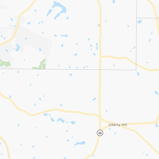
Roadmap (route) to go from Flying H Ranch Inc Airport to Gainesville detailed above, you can also see the course layout on the map.
While doing trip Flying H Ranch Inc (airport) - Gainesville by car, the calculated route ends at a distance , or more straight.
Distance and duration of the route between Flying H Ranch Inc (airport) and Gainesville
Calculation of distance and route from Gainesville to Flying H Ranch Inc (airport) :
124.6150.9 km2h45mn
Continue onto High Falls Road 0h2mn 1.4 kmTurn left onto Barnesville-Jackson Road 0h1mn 1.8 kmTurn left and take I 75 North toward Atlanta 0h10mn 17.1 kmKeep right and drive toward Locust Grove, Hampton, Jackson 0h0mn 359 mKeep right and drive toward Locust Grove, Jenkinsburg, Jackson, Georgia Department of Driver Services 0h0mn 57 mTurn slight right onto Bill Gardner Parkway 0h0mn 231 mTurn left onto Market Place Boulevard 0h1mn 868 mTurn left onto US 23, GA 42 0h6mn 7.9 kmTurn right onto South Zack Hinton Parkway 0h3mn 2.8 kmTurn left onto Turner Street 0h1mn 290 mTurn right onto Sims Street 0h15mn 19.0 kmAt roundabout, take exit 2 onto Snapfinger Road 0h3mn 4.6 kmAt roundabout, take exit 1 onto Snapfinger Road 0h7mn 8.1 kmKeep right 0h3mn 3.2 kmTurn left onto Covington Highway 0h2mn 2.6 kmKeep right and take I 285 North toward Greenville 0h10mn 14.8 kmKeep right and take I 85 toward Greenville, Atlanta 0h1mn 1.2 kmKeep right and take I 85 North toward Greenville 0h0mn 158 mKeep right and drive toward Northcrest Road, Pleasantdale Road 0h1mn 768 mKeep left and take I 85 North toward Greenville, Pleasantdale Road 0h0mn 160 mKeep left and take I 85 North toward Greenville 0h15mn 25.3 kmKeep right onto I 85 0h1mn 1.9 kmKeep left onto Lanier Parkway and take I 985 North toward Gainesville 0h19mn 31.8 kmKeep right and take GA 60, GA 53 toward Candler Road, Gainesville 0h0mn 410 mKeep left and take GA 60 North, GA 53 Connector North toward Georgia Department of Driver Services 0h0mn 80 mTurn left onto Queen City Parkway 0h3mn 3.4 kmTurn sharp right onto Jesse Jewell Parkway Southwest 0h0mn 185 mTurn slight right onto Jesse Jewell Parkway Southwest 0h0mn 504 mTurn right onto Green Street 0h0mn 12 mArrive at destination 0h0mn 0 m
Travel from Flying H Ranch Inc (airport) (Georgia) to a selection of major cities.
Distances from Flying H Ranch Inc Airport to biggest cities in Georgia
- Gainesville,38,712 inhabitants.125 km
- Milton,37,547 inhabitants.106 km
- Newnan,37,291 inhabitants.70 km
- Mableton,37,115 inhabitants.83 km
- Rome,36,323 inhabitants.155 km
- Martinez,35,795 inhabitants.190 km
- East Point,35,467 inhabitants.63 km
- Peachtree City,35,240 inhabitants.52 km
- Dalton,33,853 inhabitants.193 km
- Kennesaw,33,584 inhabitants.104 km
- Hinesville,33,398 inhabitants.278 km
- Redan,33,015 inhabitants.61 km
- Douglasville,32,897 inhabitants.87 km
- Statesboro,30,721 inhabitants.231 km
- Lawrenceville,30,493 inhabitants.85 km
- Woodstock,29,898 inhabitants.108 km
- LaGrange,29,588 inhabitants.90 km
- Duluth,29,193 inhabitants.90 km
- Evans,29,011 inhabitants.185 km
- Chamblee,28,244 inhabitants.80 km
Other major cities in country :
- Charlotte [NC], 827,097 inhabitants. 374 km
- Seattle [WA], 684,451 inhabitants. 3,570 km
- Denver [CO], 682,545 inhabitants. 2,002 km
- El Paso [TX], 681,124 inhabitants. 2,106 km
- Detroit [MI], 677,116 inhabitants. 1,021 km
- Boston [MA], 667,137 inhabitants. 1,531 km
- Memphis [TN], 655,770 inhabitants. 591 km
- New South Memphis [TN], 641,608 inhabitants. 589 km
- Portland [OR], 632,309 inhabitants. 3,552 km
- Oklahoma City [OK], 631,346 inhabitants. 1,259 km
- Las Vegas [NV], 623,747 inhabitants. 2,850 km
- Baltimore [MD], 621,849 inhabitants. 953 km
- Washington, D.C. [DC], 601,723 inhabitants. 896 km
- Milwaukee [WI], 600,155 inhabitants. 1,145 km
- South Boston [MA], 571,281 inhabitants. 1,530 km
- Albuquerque [NM], 559,121 inhabitants. 2,085 km
- Tucson [AZ], 531,641 inhabitants. 2,510 km
- Nashville [TN], 530,852 inhabitants. 413 km
- Fresno [CA], 520,052 inhabitants. 3,260 km
- Sacramento [CA], 490,712 inhabitants. 3,403 km
Route from Gainesville to major cities (United States).
- Distance Gainesville New York City1,122 km
- Distance Gainesville Los Angeles3,155 km
- Distance Gainesville Chicago905 km
- Distance Gainesville Brooklyn1,122 km
- Distance Gainesville Houston1,199 km
- Distance Gainesville Queens1,131 km
- Distance Gainesville Philadelphia993 km
- Distance Gainesville Phoenix2,604 km
- Distance Gainesville Manhattan1,129 km
- Distance Gainesville San Antonio1,487 km
- Distance Gainesville San Diego3,086 km
- Distance Gainesville The Bronx1,141 km
- Distance Gainesville Dallas1,215 km
- Distance Gainesville San Jose3,430 km
- Distance Gainesville Austin1,383 km
- Distance Gainesville Jacksonville486 km
- Distance Gainesville San Francisco3,471 km
- Distance Gainesville Columbus635 km
- Distance Gainesville Fort Worth1,264 km
- Distance Gainesville Indianapolis643 km
Nearest cities to Flying H Ranch Inc (airport) :
- Jacksonville, 868,031 inhabitants. 393 km
- Nashville, 530,852 inhabitants. 413 km
- Atlanta, 463,878 inhabitants. 68 km
- Birmingham, 212,461 inhabitants. 255 km
- Montgomery, 200,602 inhabitants. 227 km
- Columbus, 200,579 inhabitants. 118 km
- Huntsville, 190,582 inhabitants. 287 km
- Tallahassee, 189,907 inhabitants. 308 km
- Knoxville, 185,291 inhabitants. 308 km
- Chattanooga, 176,588 inhabitants. 235 km
- East Chattanooga, 154,024 inhabitants. 234 km
- Savannah, 145,674 inhabitants. 306 km
- Murfreesboro, 126,118 inhabitants. 363 km
- Athens, 116,714 inhabitants. 107 km
- Sandy Springs, 105,330 inhabitants. 85 km
- Roswell, 94,501 inhabitants. 95 km
- Macon, 91,351 inhabitants. 58 km
- Asheville, 88,512 inhabitants. 302 km
- Hoover, 84,848 inhabitants. 255 km
- Johns Creek, 83,335 inhabitants. 93 km
- Albany, 74,843 inhabitants. 180 km
- Gastonia, 74,543 inhabitants. 352 km
- Warner Robins, 73,490 inhabitants. 78 km
- Franklin, 72,639 inhabitants. 397 km
- Dothan, 68,567 inhabitants. 252 km
- Greenville, 64,579 inhabitants. 241 km
- Alpharetta, 63,693 inhabitants. 100 km
- Auburn, 62,059 inhabitants. 146 km
- Marietta, 59,067 inhabitants. 94 km
- Smyrna, 56,146 inhabitants. 86 km
- Valdosta, 55,724 inhabitants. 274 km
- Decatur, 55,437 inhabitants. 310 km
- Brookhaven, 51,910 inhabitants. 77 km
- Stonecrest, 50,000 inhabitants. 57 km
- Dunwoody, 48,733 inhabitants. 86 km
- Madison, 46,962 inhabitants. 297 km
- Smyrna, 46,607 inhabitants. 382 km
- Cleveland, 43,898 inhabitants. 230 km
- Augusta, 43,459 inhabitants. 199 km
- Brentwood, 41,763 inhabitants. 401 km
- Peachtree Corners, 40,978 inhabitants. 87 km
- North Atlanta, 40,456 inhabitants. 78 km
- Hickory, 40,374 inhabitants. 378 km
- Gainesville, 38,712 inhabitants. 125 km
- Spartanburg, 37,867 inhabitants. 278 km
- Phenix City, 37,570 inhabitants. 118 km
- Milton, 37,547 inhabitants. 106 km
- Newnan, 37,291 inhabitants. 70 km
- Mableton, 37,115 inhabitants. 83 km
- Columbia, 36,800 inhabitants. 382 km
Location Flying H Ranch Inc (airport) (Georgia) :
| Country flag |  |
| Location | Flying H Ranch Inc (airport) |
| State | Georgia |
| County | Lamar County |
| Country | United States |
| Country code / ISO 2 | US |
| Latitude | 33.1976600 |
| Longitude | -84.0845000 |
| Altitude | 212 meters |
| Time zone | America/New_York |
Location Gainesville (Georgia) :
| Country flag | |
| Location | Gainesville |
| State | Georgia |
| County | Hall County |
| Country | United States |
| Country code / ISO 2 | US |
| Latitude | 34.2978800 |
| Longitude | -83.8240700 |
| Altitude | 381 meters |
| Time zone | America/New_York |


