


Home
››
Apalachee Bluff Riverfront Airpark
››
Roadmap from Apalachee Bluff Riverfront Airpark to Stonecrest
How to get from Apalachee Bluff Riverfront Airpark (Georgia) to Stonecrest (Georgia)
Calculate route from Apalachee Bluff Riverfront Airpark (Georgia, United States) to Stonecrest (Georgia, United States).
The flight distance (as the crow flies) between Apalachee Bluff Riverfront Airpark and Stonecrest is 53.2 km.
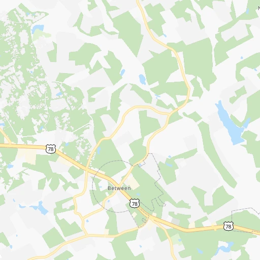
Roadmap (route) to go from Apalachee Bluff Riverfront Airpark to Stonecrest detailed above, you can also see the course layout on the map.
While doing trip Apalachee Bluff Riverfront Airpark - Stonecrest by car, the calculated route ends at a distance , or more straight.
Distance and duration of the route between Apalachee Bluff Riverfront Airpark and Stonecrest
Calculation of distance and route from Stonecrest to Apalachee Bluff Riverfront Airpark :
53.263.1 km1h51mn
Continue 0h1mn 288 mTurn right onto Cheek Road 0h0mn 118 mTurn sharp left onto Cheek Road 0h4mn 1.9 kmTurn left onto US 78, GA 10 0h11mn 14.1 kmKeep right and take GA 138 toward Conyers 0h1mn 602 mTurn left onto Martin Luther King, Junior Boulevard 0h25mn 31.3 kmTurn right and take I 20 West, US 278 West, GA 12 West toward Atlanta 0h7mn 11.4 kmKeep right and drive toward Evans Mill Road, Lithonia Industrial Boulevard, Lithonia 0h1mn 738 mKeep left and drive toward Luther Rice Seminary 0h0mn 46 mContinue onto Old Hillandale Drive 0h2mn 1.4 kmTurn right onto Lithonia Industrial Boulevard 0h0mn 321 mTurn left onto Hillandale Drive 0h1mn 719 mTurn right 0h0mn 117 mArrive at destination 0h0mn 0 m
Travel from Apalachee Bluff Riverfront Airpark (Georgia) to a selection of major cities.
Distances from Apalachee Bluff Riverfront Airpark to biggest cities in Georgia
- Gainesville,38,712 inhabitants.54 km
- Milton,37,547 inhabitants.72 km
- Newnan,37,291 inhabitants.124 km
- Mableton,37,115 inhabitants.92 km
- Rome,36,323 inhabitants.152 km
- Martinez,35,795 inhabitants.145 km
- East Point,35,467 inhabitants.81 km
- Peachtree City,35,240 inhabitants.107 km
- Dalton,33,853 inhabitants.163 km
- Kennesaw,33,584 inhabitants.97 km
- Hinesville,33,398 inhabitants.291 km
- Redan,33,015 inhabitants.52 km
- Douglasville,32,897 inhabitants.108 km
- Statesboro,30,721 inhabitants.230 km
- Lawrenceville,30,493 inhabitants.39 km
- Woodstock,29,898 inhabitants.90 km
- LaGrange,29,588 inhabitants.162 km
- Duluth,29,193 inhabitants.54 km
- Evans,29,011 inhabitants.140 km
- Chamblee,28,244 inhabitants.66 km
Other major cities in country :
- Charlotte [NC], 827,097 inhabitants. 294 km
- Seattle [WA], 684,451 inhabitants. 3,561 km
- Denver [CO], 682,545 inhabitants. 2,011 km
- El Paso [TX], 681,124 inhabitants. 2,151 km
- Detroit [MI], 677,116 inhabitants. 944 km
- Boston [MA], 667,137 inhabitants. 1,446 km
- Memphis [TN], 655,770 inhabitants. 610 km
- New South Memphis [TN], 641,608 inhabitants. 609 km
- Portland [OR], 632,309 inhabitants. 3,549 km
- Oklahoma City [OK], 631,346 inhabitants. 1,287 km
- Las Vegas [NV], 623,747 inhabitants. 2,875 km
- Baltimore [MD], 621,849 inhabitants. 868 km
- Washington, D.C. [DC], 601,723 inhabitants. 811 km
- Milwaukee [WI], 600,155 inhabitants. 1,089 km
- South Boston [MA], 571,281 inhabitants. 1,445 km
- Albuquerque [NM], 559,121 inhabitants. 2,116 km
- Tucson [AZ], 531,641 inhabitants. 2,550 km
- Nashville [TN], 530,852 inhabitants. 388 km
- Fresno [CA], 520,052 inhabitants. 3,283 km
- Sacramento [CA], 490,712 inhabitants. 3,420 km
Route from Stonecrest to major cities (United States).
- Distance Stonecrest New York City1,188 km
- Distance Stonecrest Los Angeles3,138 km
- Distance Stonecrest Chicago957 km
- Distance Stonecrest Brooklyn1,187 km
- Distance Stonecrest Houston1,149 km
- Distance Stonecrest Queens1,197 km
- Distance Stonecrest Philadelphia1,058 km
- Distance Stonecrest Phoenix2,583 km
- Distance Stonecrest Manhattan1,195 km
- Distance Stonecrest San Antonio1,441 km
- Distance Stonecrest San Diego3,065 km
- Distance Stonecrest The Bronx1,206 km
- Distance Stonecrest Dallas1,183 km
- Distance Stonecrest San Jose3,422 km
- Distance Stonecrest Austin1,340 km
- Distance Stonecrest Jacksonville443 km
- Distance Stonecrest San Francisco3,464 km
- Distance Stonecrest Columbus703 km
- Distance Stonecrest Fort Worth1,232 km
- Distance Stonecrest Indianapolis698 km
Nearest cities to Apalachee Bluff Riverfront Airpark :
- Charlotte, 827,097 inhabitants. 294 km
- Atlanta, 463,878 inhabitants. 75 km
- Montgomery, 200,602 inhabitants. 302 km
- Columbus, 200,579 inhabitants. 203 km
- Huntsville, 190,582 inhabitants. 292 km
- Knoxville, 185,291 inhabitants. 236 km
- Chattanooga, 176,588 inhabitants. 206 km
- East Chattanooga, 154,024 inhabitants. 203 km
- Savannah, 145,674 inhabitants. 305 km
- Columbia, 133,803 inhabitants. 236 km
- Murfreesboro, 126,118 inhabitants. 338 km
- Athens, 116,714 inhabitants. 23 km
- Sandy Springs, 105,330 inhabitants. 73 km
- Roswell, 94,501 inhabitants. 74 km
- Macon, 91,351 inhabitants. 113 km
- Asheville, 88,512 inhabitants. 216 km
- Johns Creek, 83,335 inhabitants. 59 km
- Albany, 74,843 inhabitants. 259 km
- Gastonia, 74,543 inhabitants. 270 km
- Warner Robins, 73,490 inhabitants. 138 km
- Rock Hill, 71,548 inhabitants. 264 km
- Dothan, 68,567 inhabitants. 339 km
- Johnson City, 66,027 inhabitants. 296 km
- Greenville, 64,579 inhabitants. 156 km
- Alpharetta, 63,693 inhabitants. 69 km
- Auburn, 62,059 inhabitants. 224 km
- Marietta, 59,067 inhabitants. 89 km
- Smyrna, 56,146 inhabitants. 86 km
- Kingsport, 53,014 inhabitants. 314 km
- Huntersville, 52,704 inhabitants. 305 km
- Brookhaven, 51,910 inhabitants. 70 km
- Stonecrest, 50,000 inhabitants. 53 km
- Dunwoody, 48,733 inhabitants. 70 km
- Smyrna, 46,607 inhabitants. 357 km
- Kannapolis, 46,144 inhabitants. 327 km
- Cleveland, 43,898 inhabitants. 187 km
- Augusta, 43,459 inhabitants. 156 km
- Peachtree Corners, 40,978 inhabitants. 60 km
- Hilton Head Island, 40,512 inhabitants. 324 km
- North Atlanta, 40,456 inhabitants. 69 km
- Hickory, 40,374 inhabitants. 293 km
- Gainesville, 38,712 inhabitants. 54 km
- Spartanburg, 37,867 inhabitants. 195 km
- Phenix City, 37,570 inhabitants. 203 km
- Milton, 37,547 inhabitants. 72 km
- Newnan, 37,291 inhabitants. 124 km
- Mableton, 37,115 inhabitants. 92 km
- Hilton Head, 37,099 inhabitants. 322 km
- Indian Trail, 37,073 inhabitants. 300 km
- Rome, 36,323 inhabitants. 152 km
Location Apalachee Bluff Riverfront Airpark (Georgia) :
| Country flag |  |
| Location | Apalachee Bluff Riverfront Airpark |
| State | Georgia |
| County | Walton County |
| Country | United States |
| Country code / ISO 2 | US |
| Latitude | 33.8585400 |
| Longitude | -83.5881800 |
| Altitude | 220 meters |
| Time zone | America/New_York |
Location Stonecrest (Georgia) :
| Country flag | |
| Location | Stonecrest |
| State | Georgia |
| County | DeKalb County |
| Country | United States |
| Country code / ISO 2 | US |
| Latitude | 33.7084900 |
| Longitude | -84.1348500 |
| Altitude | 0 meters |
| Time zone | America/New_York |


