

How to get from Sugar Loaf Shores (airport) (Florida) to Indianapolis (Indiana)
Calculate route from Sugar Loaf Shores (airport) (Florida, United States) to Indianapolis (Indiana, United States).
The flight distance (as the crow flies) between Sugar Loaf Shores (airport) and Indianapolis is 1,733.6 km.
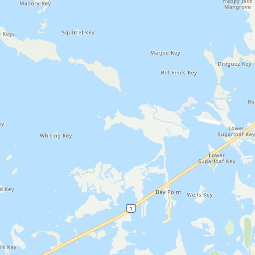
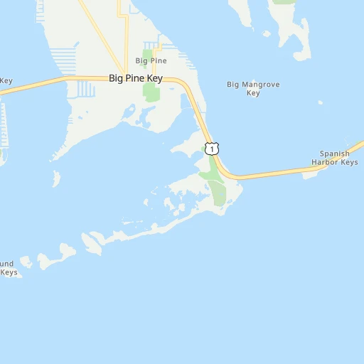
Roadmap (route) to go from Sugar Loaf Shores Airport to Indianapolis detailed above, you can also see the course layout on the map.
While doing trip Sugar Loaf Shores (airport) - Indianapolis by car, the calculated route ends at a distance , or more straight.
Distance and duration of the route between Sugar Loaf Shores (airport) and Indianapolis
Calculation of distance and route from Indianapolis to Sugar Loaf Shores (airport) :
1,733.62,055.2 km23h14mn
Continue 0h1mn 122 mTurn left 0h0mn 36 mTurn slight right onto Bat Tower Road 0h2mn 610 mKeep right onto Bat Tower Road 0h0mn 27 mTurn left onto Overseas Highway 3h30mn 179.9 kmKeep left 0h1mn 564 mTurn right onto Southwest 177th Avenue 1h46mn 55.5 kmContinue 1h57mn 86.6 kmTurn right onto Southwest 1st Avenue 0h1mn 739 mTurn right onto West Palm Beach Road 0h10mn 10.9 kmContinue onto Belle Glade Road 0h9mn 10.2 kmTurn right onto Pelican Lake Drive 0h6mn 6.1 kmTurn left onto US 98, US 441 1h31mn 40.1 kmTurn right onto Southeast 86th Boulevard 0h1mn 1.4 kmTurn left onto FL 710 0h10mn 11.7 kmTurn right onto Northeast 6th Avenue 0h1mn 586 mTurn left onto Northeast 6th Street 0h1mn 567 mTurn right onto Parrott Avenue 1h38mn 52.6 kmTurn sharp right onto FL 60 0h1mn 633 mTurn left 0h0mn 330 mKeep left and take Florida's Turnpike North toward Orlando 2h50mn 185.9 kmContinue onto Florida's Turnpike and take I 75 North toward Ocala 5h44mn 483.6 kmKeep left onto Larry Justice Highway and take I 475 North toward Atlanta 1h3mn 105.2 kmKeep right onto Terrell Starr Parkway and take I 675 North toward Augusta, Greenville 0h5mn 8.3 kmKeep right and drive toward Forest Parkway 0h0mn 494 mTurn left onto Forest Parkway 0h1mn 1,000 mTurn right onto Moreland Avenue 0h10mn 11.2 kmTurn left onto McDonough Boulevard Southeast 0h2mn 2.1 kmTurn right onto Boulevard Southeast 0h5mn 5.0 kmTurn left onto Irwin Street Northeast 0h1mn 537 mTurn right toward I 75 North, I 85 North 0h3mn 3.8 kmKeep left toward I 75 North 0h19mn 29.2 kmContinue onto Larry McDonald Memorial Highway and take I 75 North toward Chattanooga, Barrett Parkway, Kennesaw 1h28mn 146.1 kmKeep right and take TN 153 toward Chickamauga Dam, Airport 0h8mn 13.0 kmTurn slight right onto TN 153 0h7mn 7.6 kmKeep right and drive toward Dayton, Soddy-Daisy 0h10mn 15.7 kmKeep left onto TN 111 0h19mn 28.5 kmTurn slight right onto TN 8, TN 111 1h0mn 84.8 kmKeep right onto SR 136 0h1mn 643 mTurn left onto South Jefferson Avenue 0h9mn 6.9 kmTurn left onto East Broad Street 0h0mn 131 mTurn right onto North Dixie Avenue 0h2mn 1.8 kmTurn left onto West 12th Street 0h14mn 14.0 kmTurn right onto South Grundy Quarles Memorial Highway 0h15mn 16.1 kmTurn left onto Jennings Creek Highway 0h10mn 10.7 kmKeep right onto Keeling Branch Highway 0h21mn 21.2 kmTurn sharp right onto Old Union Hill Road 0h1mn 415 mKeep left onto Clementsville Road 0h3mn 2.3 kmTurn left onto Clementsville Road 0h7mn 6.1 kmTurn left onto Gamaliel Road 0h2mn 2.1 kmKeep right onto Fountain Run Road 0h11mn 12.4 kmKeep right onto Flippin Lamb Road 0h27mn 32.8 kmTurn left onto Bunche Avenue 0h0mn 291 mTurn right onto South Green Street 0h1mn 747 mTurn left onto West Main Street 0h0mn 77 mContinue onto West Main Street 0h0mn 24 mTurn right onto North Race Street 0h1mn 966 mTurn left onto Happy Valley Road 0h15mn 17.5 kmTurn right 3h10mn 313.8 kmKeep left and take I 70 West toward Saint Louis 0h1mn 1.2 kmKeep right and drive toward Meridian Street 0h0mn 550 mTurn slight right onto Madison Avenue 0h2mn 1.3 kmEnter roundabout 0h0mn 4 mArrive at destination 0h0mn 0 m
Travel from Sugar Loaf Shores (airport) (Indiana) to a selection of major cities.
Distances from Sugar Loaf Shores Airport to biggest cities in Florida
- Lakeland,104,401 inhabitants.379 km
- Brandon,103,483 inhabitants.373 km
- Davie,100,882 inhabitants.208 km
- Spring Hill,98,621 inhabitants.436 km
- Boca Raton,93,235 inhabitants.242 km
- Plantation,92,560 inhabitants.214 km
- Miami Beach,92,312 inhabitants.193 km
- Deltona,88,474 inhabitants.474 km
- Lehigh Acres,86,784 inhabitants.220 km
- Sunrise,84,439 inhabitants.221 km
- Palm Coast,82,893 inhabitants.551 km
- Largo,81,000 inhabitants.382 km
- Melbourne,80,127 inhabitants.394 km
- Deerfield Beach,79,768 inhabitants.238 km
- Town 'n' Country,78,442 inhabitants.387 km
- Alafaya,78,113 inhabitants.437 km
- Kendall,75,371 inhabitants.171 km
- Fort Myers,74,013 inhabitants.221 km
- Boynton Beach,73,966 inhabitants.258 km
- Lauderhill,71,579 inhabitants.215 km
Other major cities in country :
- Seattle [WA], 684,451 inhabitants. 4,391 km
- Denver [CO], 682,545 inhabitants. 2,757 km
- El Paso [TX], 681,124 inhabitants. 2,562 km
- Detroit [MI], 677,116 inhabitants. 1,973 km
- Boston [MA], 667,137 inhabitants. 2,196 km
- Memphis [TN], 655,770 inhabitants. 1,425 km
- New South Memphis [TN], 641,608 inhabitants. 1,420 km
- Portland [OR], 632,309 inhabitants. 4,338 km
- Oklahoma City [OK], 631,346 inhabitants. 1,947 km
- Las Vegas [NV], 623,747 inhabitants. 3,446 km
- Baltimore [MD], 621,849 inhabitants. 1,695 km
- Washington, D.C. [DC], 601,723 inhabitants. 1,642 km
- Milwaukee [WI], 600,155 inhabitants. 2,127 km
- South Boston [MA], 571,281 inhabitants. 2,194 km
- Albuquerque [NM], 559,121 inhabitants. 2,674 km
- Tucson [AZ], 531,641 inhabitants. 2,983 km
- Nashville [TN], 530,852 inhabitants. 1,375 km
- Fresno [CA], 520,052 inhabitants. 3,866 km
- Sacramento [CA], 490,712 inhabitants. 4,051 km
- Kansas City [MO], 475,378 inhabitants. 2,020 km
Route from Indianapolis to major cities (United States).
- Distance Indianapolis New York City1,037 km
- Distance Indianapolis Los Angeles2,909 km
- Distance Indianapolis Chicago264 km
- Distance Indianapolis Brooklyn1,042 km
- Distance Indianapolis Houston1,394 km
- Distance Indianapolis Queens1,051 km
- Distance Indianapolis Philadelphia939 km
- Distance Indianapolis Phoenix2,411 km
- Distance Indianapolis Manhattan1,041 km
- Distance Indianapolis San Antonio1,610 km
- Distance Indianapolis San Diego2,876 km
- Distance Indianapolis The Bronx1,049 km
- Distance Indianapolis Dallas1,230 km
- Distance Indianapolis San Jose3,102 km
- Distance Indianapolis Austin1,492 km
- Distance Indianapolis Jacksonville1,127 km
- Distance Indianapolis San Francisco3,133 km
- Distance Indianapolis Columbus271 km
- Distance Indianapolis Fort Worth1,271 km
- Distance Indianapolis Charlotte690 km
Nearest cities to Sugar Loaf Shores (airport) :
- Miami, 441,003 inhabitants. 187 km
- Hialeah, 237,069 inhabitants. 188 km
- Fort Lauderdale, 178,590 inhabitants. 218 km
- Cape Coral, 175,229 inhabitants. 216 km
- Pembroke Pines, 166,611 inhabitants. 203 km
- Port Saint Lucie, 164,603 inhabitants. 319 km
- Hollywood, 149,728 inhabitants. 209 km
- Miramar, 137,132 inhabitants. 201 km
- Coral Springs, 129,485 inhabitants. 223 km
- Miami Gardens, 113,187 inhabitants. 197 km
- Pompano Beach, 107,762 inhabitants. 229 km
- West Palm Beach, 106,779 inhabitants. 276 km
- Davie, 100,882 inhabitants. 208 km
- Boca Raton, 93,235 inhabitants. 242 km
- Plantation, 92,560 inhabitants. 214 km
- Miami Beach, 92,312 inhabitants. 193 km
- Lehigh Acres, 86,784 inhabitants. 220 km
- Sunrise, 84,439 inhabitants. 221 km
- Deerfield Beach, 79,768 inhabitants. 238 km
- Kendall, 75,371 inhabitants. 171 km
- Fort Myers, 74,013 inhabitants. 221 km
- Boynton Beach, 73,966 inhabitants. 258 km
- Lauderhill, 71,579 inhabitants. 215 km
- Weston, 69,959 inhabitants. 200 km
- Homestead, 66,498 inhabitants. 144 km
- Delray Beach, 66,255 inhabitants. 252 km
- Tamarac, 64,681 inhabitants. 219 km
- Carol City, 63,031 inhabitants. 197 km
- Jupiter, 62,707 inhabitants. 295 km
- Wellington, 62,560 inhabitants. 261 km
- North Miami, 62,435 inhabitants. 197 km
- North Port, 62,345 inhabitants. 275 km
- West Hollywood, 60,806 inhabitants. 207 km
- Fountainebleau, 59,764 inhabitants. 176 km
- Coconut Creek, 59,302 inhabitants. 227 km
- Margate, 57,234 inhabitants. 225 km
- Kendale Lakes, 56,148 inhabitants. 167 km
- Doral, 56,035 inhabitants. 179 km
- Tamiami, 55,271 inhabitants. 171 km
- Sarasota, 55,118 inhabitants. 314 km
- Bradenton, 54,437 inhabitants. 332 km
- Port Charlotte, 54,392 inhabitants. 264 km
- Allapattah, 54,289 inhabitants. 188 km
- Palm Beach Gardens, 52,923 inhabitants. 282 km
- Bonita Springs, 51,704 inhabitants. 189 km
- Coral Gables, 51,117 inhabitants. 178 km
- The Hammocks, 51,003 inhabitants. 161 km
- Flagami, 50,834 inhabitants. 177 km
- Country Club, 47,105 inhabitants. 192 km
- Cutler Bay, 44,865 inhabitants. 162 km
Location Sugar Loaf Shores (airport) (Florida) :
| Country flag |  |
| Location | Sugar Loaf Shores (airport) |
| State | Florida |
| County | Monroe County |
| Country | United States |
| Country code / ISO 2 | US |
| Latitude | 24.6497800 |
| Longitude | -81.5784900 |
| Altitude | 0 meters |
| Time zone | America/New_York |
Location Indianapolis (Indiana) :
| Country flag | |
| Location | Indianapolis |
| State | Indiana |
| County | Marion County |
| Country | United States |
| Country code / ISO 2 | US |
| Latitude | 39.7683800 |
| Longitude | -86.1580400 |
| Altitude | 218 meters |
| Time zone | America/Indiana/Indianapolis |


