


Home
››
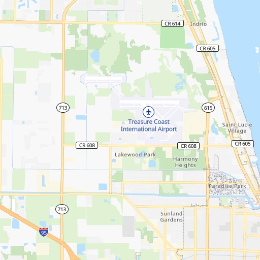
Saint Lucie County International Airport
››
Roadmap from Saint Lucie County International Airport to Spring Hill
How to get from Saint Lucie County International (airport) (Florida) to Spring Hill (Florida)
Calculate route from Saint Lucie County International (airport) (Florida, United States) to Spring Hill (Florida, United States).
The flight distance (as the crow flies) between Saint Lucie County International (airport) and Spring Hill is 238.2 km.
Roadmap (route) to go from Saint Lucie County International Airport to Spring Hill detailed above, you can also see the course layout on the map.
While doing trip Saint Lucie County International (airport) - Spring Hill by car, the calculated route ends at a distance , or more straight.
Distance and duration of the route between Saint Lucie County International (airport) and Spring Hill
Calculation of distance and route from Spring Hill to Saint Lucie County International (airport) :
238.2276.7 km4h35mn
Continue 0h0mn 156 mTurn right onto Airman's Way 0h0mn 125 mTurn left 0h1mn 668 mTurn right 0h0mn 47 mTurn left onto Hammond Road 0h0mn 185 mTurn right onto Saint Lucie Boulevard 0h2mn 2.4 kmTurn right onto North Kings Highway 0h3mn 4.1 kmTurn left onto Indrio Road 0h5mn 4.9 kmKeep right and take I 95 North toward Daytona Beach 0h9mn 14.5 kmKeep right and take FL 60 toward Vero Beach, Lake Wales 0h0mn 444 mKeep left and take FL 60 West toward Lake Wales 0h0mn 131 mKeep left and take FL 60 toward Lake Wales 2h36mn 138.7 kmTurn left onto Van Fleet Drive 0h1mn 970 mTurn right onto Broadway Avenue 0h16mn 20.2 kmTurn right onto North Florida Avenue 1h31mn 41.1 kmTurn right onto US 301 0h3mn 3.4 kmKeep left onto 7th Street 0h2mn 2.0 kmContinue onto 7th Street 0h2mn 2.5 kmTurn left 0h0mn 13 mTurn left onto US 98, US 301 0h0mn 9 mTurn right 0h0mn 50 mTurn right 0h0mn 16 mTurn right onto 14th Street 0h1mn 576 mTurn left onto Frazee Hill Road 0h3mn 2.2 kmTurn right onto Blanton Road 0h8mn 9.4 kmTurn slight right onto Lake Lola Road 0h1mn 1.6 kmTurn left onto Dan Brown Hill Road 0h7mn 5.2 kmKeep left onto Hayman Road 0h9mn 11.4 kmTurn sharp right onto Broad Street 0h0mn 590 mTurn sharp left onto Airport Boulevard 0h6mn 4.6 kmTurn right onto Anderson Snow Road 0h0mn 275 mTurn left onto Industrial Loop 0h0mn 161 mTurn right onto Dorado Street 0h1mn 334 mTurn left onto Hawthorne Road 0h0mn 94 mTurn right onto Dothan Avenue 0h0mn 98 mTurn left onto Spring Hill Drive 0h0mn 443 mTurn right onto Coronado Drive 0h3mn 2.2 kmTurn right onto Linden Drive 0h1mn 895 mArrive at destination 0h0mn 0 m
Travel from Saint Lucie County International (airport) (Florida) to a selection of major cities.
Distances from Saint Lucie County International Airport to biggest cities in Florida
- Lakeland,104,401 inhabitants.167 km
- Brandon,103,483 inhabitants.195 km
- Davie,100,882 inhabitants.160 km
- Spring Hill,98,621 inhabitants.239 km
- Boca Raton,93,235 inhabitants.130 km
- Plantation,92,560 inhabitants.152 km
- Miami Beach,92,312 inhabitants.191 km
- Deltona,88,474 inhabitants.179 km
- Lehigh Acres,86,784 inhabitants.158 km
- Sunrise,84,439 inhabitants.154 km
- Palm Coast,82,893 inhabitants.247 km
- Largo,81,000 inhabitants.243 km
- Melbourne,80,127 inhabitants.70 km
- Deerfield Beach,79,768 inhabitants.134 km
- Town 'n' Country,78,442 inhabitants.225 km
- Alafaya,78,113 inhabitants.145 km
- Kendall,75,371 inhabitants.202 km
- Fort Myers,74,013 inhabitants.175 km
- Boynton Beach,73,966 inhabitants.112 km
- Lauderhill,71,579 inhabitants.152 km
Other major cities in country :
- Seattle [WA], 684,451 inhabitants. 4,254 km
- Denver [CO], 682,545 inhabitants. 2,645 km
- El Paso [TX], 681,124 inhabitants. 2,565 km
- Detroit [MI], 677,116 inhabitants. 1,669 km
- Boston [MA], 667,137 inhabitants. 1,857 km
- Memphis [TN], 655,770 inhabitants. 1,253 km
- New South Memphis [TN], 641,608 inhabitants. 1,249 km
- Portland [OR], 632,309 inhabitants. 4,220 km
- Oklahoma City [OK], 631,346 inhabitants. 1,850 km
- Las Vegas [NV], 623,747 inhabitants. 3,407 km
- Baltimore [MD], 621,849 inhabitants. 1,358 km
- Washington, D.C. [DC], 601,723 inhabitants. 1,306 km
- Milwaukee [WI], 600,155 inhabitants. 1,859 km
- South Boston [MA], 571,281 inhabitants. 1,855 km
- Albuquerque [NM], 559,121 inhabitants. 2,630 km
- Tucson [AZ], 531,641 inhabitants. 2,986 km
- Nashville [TN], 530,852 inhabitants. 1,139 km
- Fresno [CA], 520,052 inhabitants. 3,826 km
- Sacramento [CA], 490,712 inhabitants. 3,994 km
- Kansas City [MO], 475,378 inhabitants. 1,844 km
Route from Spring Hill to major cities (United States).
- Distance Spring Hill New York City1,568 km
- Distance Spring Hill Los Angeles3,437 km
- Distance Spring Hill Chicago1,559 km
- Distance Spring Hill Brooklyn1,565 km
- Distance Spring Hill Houston1,256 km
- Distance Spring Hill Queens1,573 km
- Distance Spring Hill Philadelphia1,445 km
- Distance Spring Hill Phoenix2,864 km
- Distance Spring Hill Manhattan1,576 km
- Distance Spring Hill San Antonio1,558 km
- Distance Spring Hill San Diego3,338 km
- Distance Spring Hill The Bronx1,587 km
- Distance Spring Hill Dallas1,448 km
- Distance Spring Hill San Jose3,780 km
- Distance Spring Hill Austin1,488 km
- Distance Spring Hill San Francisco3,829 km
- Distance Spring Hill Columbus1,279 km
- Distance Spring Hill Fort Worth1,493 km
- Distance Spring Hill Indianapolis1,300 km
- Distance Spring Hill Charlotte768 km
Nearest cities to Saint Lucie County International (airport) :
- Jacksonville, 868,031 inhabitants. 340 km
- Miami, 441,003 inhabitants. 192 km
- Tampa, 369,075 inhabitants. 212 km
- Orlando, 270,934 inhabitants. 153 km
- St. Petersburg, 257,083 inhabitants. 230 km
- Hialeah, 237,069 inhabitants. 183 km
- Fort Lauderdale, 178,590 inhabitants. 154 km
- Cape Coral, 175,229 inhabitants. 188 km
- Pembroke Pines, 166,611 inhabitants. 167 km
- Port Saint Lucie, 164,603 inhabitants. 22 km
- Hollywood, 149,728 inhabitants. 167 km
- Miramar, 137,132 inhabitants. 168 km
- Gainesville, 130,128 inhabitants. 307 km
- Coral Springs, 129,485 inhabitants. 137 km
- Miami Gardens, 113,187 inhabitants. 173 km
- Clearwater, 113,003 inhabitants. 245 km
- Palm Bay, 107,888 inhabitants. 64 km
- Pompano Beach, 107,762 inhabitants. 142 km
- West Palm Beach, 106,779 inhabitants. 92 km
- Lakeland, 104,401 inhabitants. 167 km
- Brandon, 103,483 inhabitants. 195 km
- Davie, 100,882 inhabitants. 160 km
- Spring Hill, 98,621 inhabitants. 239 km
- Boca Raton, 93,235 inhabitants. 130 km
- Plantation, 92,560 inhabitants. 152 km
- Miami Beach, 92,312 inhabitants. 191 km
- Deltona, 88,474 inhabitants. 179 km
- Lehigh Acres, 86,784 inhabitants. 158 km
- Sunrise, 84,439 inhabitants. 154 km
- Palm Coast, 82,893 inhabitants. 247 km
- Largo, 81,000 inhabitants. 243 km
- Melbourne, 80,127 inhabitants. 70 km
- Deerfield Beach, 79,768 inhabitants. 134 km
- Town 'n' Country, 78,442 inhabitants. 225 km
- Alafaya, 78,113 inhabitants. 145 km
- Kendall, 75,371 inhabitants. 202 km
- Fort Myers, 74,013 inhabitants. 175 km
- Boynton Beach, 73,966 inhabitants. 112 km
- Lauderhill, 71,579 inhabitants. 152 km
- Riverview, 71,050 inhabitants. 197 km
- Weston, 69,959 inhabitants. 155 km
- Kissimmee, 69,152 inhabitants. 137 km
- Homestead, 66,498 inhabitants. 226 km
- Delray Beach, 66,255 inhabitants. 119 km
- Daytona Beach, 64,736 inhabitants. 201 km
- Tamarac, 64,681 inhabitants. 143 km
- Carol City, 63,031 inhabitants. 173 km
- Jupiter, 62,707 inhabitants. 68 km
- Wellington, 62,560 inhabitants. 94 km
- North Miami, 62,435 inhabitants. 180 km
Location Saint Lucie County International (airport) (Florida) :
| Country flag |  |
| Location | Saint Lucie County International (airport) |
| State | Florida |
| County | Saint Lucie County |
| Country | United States |
| Country code / ISO 2 | US |
| Latitude | 27.4953200 |
| Longitude | -80.3678300 |
| Altitude | 6 meters |
| Time zone | America/New_York |
Location Spring Hill (Florida) :
| Country flag | |
| Location | Spring Hill |
| State | Florida |
| County | Hernando County |
| Country | United States |
| Country code / ISO 2 | US |
| Latitude | 28.4768800 |
| Longitude | -82.5254600 |
| Altitude | 14 meters |
| Time zone | America/New_York |
