
How to get from Apalachicola Municipal (airport) (Florida) to Enterprise (Alabama)
Calculate route from Apalachicola Municipal (airport) (Florida, United States) to Enterprise (Alabama, United States).
The flight distance (as the crow flies) between Apalachicola Municipal (airport) and Enterprise is 193.2 km.
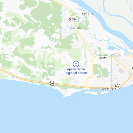
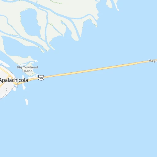
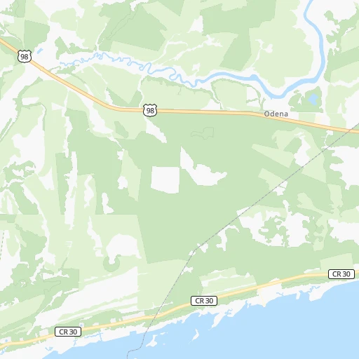
Roadmap (route) to go from Apalachicola Municipal Airport to Enterprise detailed above, you can also see the course layout on the map.
While doing trip Apalachicola Municipal (airport) - Enterprise by car, the calculated route ends at a distance , or more straight.
Distance and duration of the route between Apalachicola Municipal (airport) and Enterprise
Calculation of distance and route from Enterprise to Apalachicola Municipal (airport) :
193.2232.1 km3h15mn
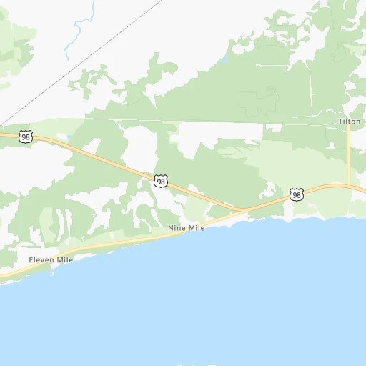
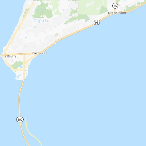
Continue 0h0mn 137 mTurn left onto Appalachee Street 0h1mn 296 mContinue 0h1mn 581 mTurn right onto US 98 1h4mn 80.9 kmKeep right onto South Tyndall Parkway 0h6mn 6.8 kmTurn right onto Transmitter Road 0h2mn 2.6 kmTurn left onto Game Farm Road 0h2mn 1.6 kmTurn right onto North East Avenue 0h4mn 3.9 kmTurn left onto CR 390 0h3mn 2.2 kmTurn right onto Ohio Avenue 0h25mn 33.2 kmTurn left onto Moss Hill Road 0h14mn 15.1 kmTurn right onto Main Street 1h10mn 83.3 kmTurn slight left onto East Park Avenue 0h1mn 1.4 kmAt roundabout, take exit 2 onto North Main Street 0h0mn 131 mTurn left onto West Lee Street 0h0mn 47 mArrive at destination 0h0mn 0 m
Travel from Apalachicola Municipal (airport) (Alabama) to a selection of major cities.
Distances from Apalachicola Municipal Airport to biggest cities in Florida
- Lakeland,104,401 inhabitants.354 km
- Brandon,103,483 inhabitants.334 km
- Davie,100,882 inhabitants.624 km
- Spring Hill,98,621 inhabitants.281 km
- Boca Raton,93,235 inhabitants.614 km
- Plantation,92,560 inhabitants.619 km
- Miami Beach,92,312 inhabitants.652 km
- Deltona,88,474 inhabitants.377 km
- Lehigh Acres,86,784 inhabitants.481 km
- Sunrise,84,439 inhabitants.628 km
- Palm Coast,82,893 inhabitants.370 km
- Largo,81,000 inhabitants.298 km
- Melbourne,80,127 inhabitants.468 km
- Deerfield Beach,79,768 inhabitants.615 km
- Town 'n' Country,78,442 inhabitants.306 km
- Alafaya,78,113 inhabitants.393 km
- Kendall,75,371 inhabitants.647 km
- Fort Myers,74,013 inhabitants.466 km
- Boynton Beach,73,966 inhabitants.604 km
- Lauderhill,71,579 inhabitants.619 km
Other major cities in country :
- Seattle [WA], 684,451 inhabitants. 3,751 km
- Denver [CO], 682,545 inhabitants. 2,131 km
- El Paso [TX], 681,124 inhabitants. 2,062 km
- Detroit [MI], 677,116 inhabitants. 1,414 km
- Boston [MA], 667,137 inhabitants. 1,881 km
- Memphis [TN], 655,770 inhabitants. 766 km
- New South Memphis [TN], 641,608 inhabitants. 761 km
- Portland [OR], 632,309 inhabitants. 3,710 km
- Oklahoma City [OK], 631,346 inhabitants. 1,332 km
- Las Vegas [NV], 623,747 inhabitants. 2,890 km
- Baltimore [MD], 621,849 inhabitants. 1,313 km
- Washington, D.C. [DC], 601,723 inhabitants. 1,256 km
- Milwaukee [WI], 600,155 inhabitants. 1,504 km
- South Boston [MA], 571,281 inhabitants. 1,880 km
- Albuquerque [NM], 559,121 inhabitants. 2,113 km
- Tucson [AZ], 531,641 inhabitants. 2,481 km
- Nashville [TN], 530,852 inhabitants. 735 km
- Fresno [CA], 520,052 inhabitants. 3,309 km
- Sacramento [CA], 490,712 inhabitants. 3,475 km
- Kansas City [MO], 475,378 inhabitants. 1,361 km
Route from Enterprise to major cities (United States).
- Distance Enterprise New York City1,492 km
- Distance Enterprise Los Angeles3,037 km
- Distance Enterprise Chicago1,184 km
- Distance Enterprise Brooklyn1,491 km
- Distance Enterprise Houston928 km
- Distance Enterprise Queens1,500 km
- Distance Enterprise Philadelphia1,362 km
- Distance Enterprise Phoenix2,470 km
- Distance Enterprise Manhattan1,499 km
- Distance Enterprise San Antonio1,231 km
- Distance Enterprise San Diego2,949 km
- Distance Enterprise The Bronx1,510 km
- Distance Enterprise Dallas1,046 km
- Distance Enterprise San Jose3,359 km
- Distance Enterprise Austin1,142 km
- Distance Enterprise Jacksonville416 km
- Distance Enterprise San Francisco3,406 km
- Distance Enterprise Columbus996 km
- Distance Enterprise Fort Worth1,093 km
- Distance Enterprise Indianapolis941 km
Nearest cities to Apalachicola Municipal (airport) :
- Tampa, 369,075 inhabitants. 320 km
- St. Petersburg, 257,083 inhabitants. 316 km
- Montgomery, 200,602 inhabitants. 318 km
- Columbus, 200,579 inhabitants. 304 km
- Tallahassee, 189,907 inhabitants. 107 km
- Gainesville, 130,128 inhabitants. 262 km
- Clearwater, 113,003 inhabitants. 293 km
- Brandon, 103,483 inhabitants. 334 km
- Spring Hill, 98,621 inhabitants. 281 km
- Largo, 81,000 inhabitants. 298 km
- Town 'n' Country, 78,442 inhabitants. 306 km
- Albany, 74,843 inhabitants. 222 km
- Warner Robins, 73,490 inhabitants. 348 km
- Riverview, 71,050 inhabitants. 335 km
- Dothan, 68,567 inhabitants. 170 km
- North Port, 62,345 inhabitants. 405 km
- Auburn, 62,059 inhabitants. 324 km
- Ocala, 58,218 inhabitants. 286 km
- Palm Harbor, 57,439 inhabitants. 287 km
- Valdosta, 55,724 inhabitants. 208 km
- Sarasota, 55,118 inhabitants. 361 km
- Bradenton, 54,437 inhabitants. 345 km
- Port Charlotte, 54,392 inhabitants. 420 km
- East Pensacola Heights, 54,104 inhabitants. 221 km
- Pensacola, 53,193 inhabitants. 224 km
- Pinellas Park, 51,617 inhabitants. 309 km
- Wesley Chapel, 44,092 inhabitants. 311 km
- University, 41,163 inhabitants. 312 km
- Carrollwood Village, 40,949 inhabitants. 307 km
- Panama City, 38,286 inhabitants. 77 km
- Phenix City, 37,570 inhabitants. 305 km
- Plant City, 37,406 inhabitants. 342 km
- Dunedin, 36,164 inhabitants. 291 km
- Valrico, 35,545 inhabitants. 338 km
- Prattville, 35,420 inhabitants. 334 km
- Egypt Lake-Leto, 35,282 inhabitants. 311 km
- Carrollwood, 33,365 inhabitants. 310 km
- Land O' Lakes, 31,996 inhabitants. 302 km
- Navarre, 31,378 inhabitants. 192 km
- East Lake, 30,962 inhabitants. 290 km
- Opelika, 29,527 inhabitants. 326 km
- Ferry Pass, 28,921 inhabitants. 228 km
- Lake Magdalene, 28,509 inhabitants. 310 km
- Enterprise, 27,978 inhabitants. 193 km
- Cantonment, 26,493 inhabitants. 243 km
- Temple Terrace, 25,731 inhabitants. 319 km
- Daphne, 24,896 inhabitants. 293 km
- Tarpon Springs, 24,605 inhabitants. 283 km
- Citrus Park, 24,252 inhabitants. 302 km
- Keystone, 24,039 inhabitants. 293 km
Location Apalachicola Municipal (airport) (Florida) :
| Country flag |  |
| Location | Apalachicola Municipal (airport) |
| State | Florida |
| County | Franklin County |
| Country | United States |
| Country code / ISO 2 | US |
| Latitude | 29.7293800 |
| Longitude | -85.0288000 |
| Altitude | 4 meters |
| Time zone | America/New_York |
Location Enterprise (Alabama) :
| Country flag | |
| Location | Enterprise |
| State | Alabama |
| County | Coffee County |
| Country | United States |
| Country code / ISO 2 | US |
| Latitude | 31.3151700 |
| Longitude | -85.8552200 |
| Altitude | 108 meters |
| Time zone | America/Chicago |

