
How to get from Heber Springs Municipal (airport) (Arkansas) to Nixa (Missouri)
Calculate route from Heber Springs Municipal (airport) (Arkansas, United States) to Nixa (Missouri, United States).
The flight distance (as the crow flies) between Heber Springs Municipal (airport) and Nixa is 205.2 km.
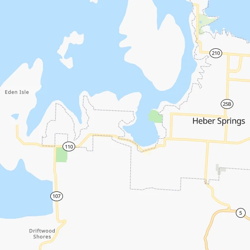
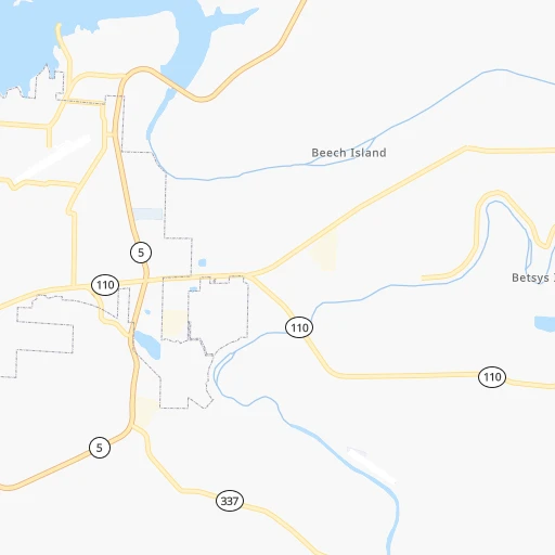
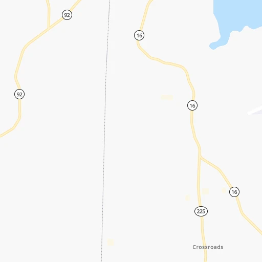
Roadmap (route) to go from Heber Springs Municipal Airport to Nixa detailed above, you can also see the course layout on the map.
While doing trip Heber Springs Municipal (airport) - Nixa by car, the calculated route ends at a distance , or more straight.
Distance and duration of the route between Heber Springs Municipal (airport) and Nixa
Calculation of distance and route from Nixa to Heber Springs Municipal (airport) :
205.2280.1 km4h40mn
Continue onto Heber Airport Road 0h0mn 74 mTurn right onto AR 980 0h0mn 306 mTurn left onto Highway 25B 0h1mn 961 mTurn left onto Tulaka Boulevard 0h1mn 836 mTurn left onto Highway 25B 0h2mn 2.3 kmTurn right onto West Main Street 0h1mn 550 mTurn left onto South 7th Street 0h3mn 2.5 kmKeep right 0h0mn 258 mContinue onto Heber Spring Road 0h9mn 10.0 kmKeep right 0h0mn 45 mTurn slight right onto Edgemont Road 0h5mn 4.7 kmTurn left onto Wesley Chapel Road 0h7mn 5.8 kmTurn left onto Wesley Chapel Road 0h0mn 245 mTurn left onto Quitman Road 0h1mn 698 mTurn right onto Bee Branch Road 0h15mn 15.0 kmTurn left onto AR 92 0h4mn 4.5 kmTurn right onto US 65 2h37mn 125.0 kmTurn left onto South Main Street 0h6mn 5.3 kmContinue onto US 62, US 65, US 412 1h1mn 93.5 kmKeep right and take MO 14, US 65 Business toward Nixa 0h0mn 452 mTurn sharp left onto West Jackson Road 0h6mn 7.0 kmArrive at destination 0h0mn 0 m
Travel from Heber Springs Municipal (airport) (Missouri) to a selection of major cities.
Distances from Heber Springs Municipal Airport to biggest cities in Arkansas
- West Memphis,25,052 inhabitants.171 km
- Searcy,24,196 inhabitants.39 km
- Van Buren,23,081 inhabitants.212 km
Other major cities in country :
- Charlotte [NC], 827,097 inhabitants. 1,014 km
- Seattle [WA], 684,451 inhabitants. 2,836 km
- Denver [CO], 682,545 inhabitants. 1,235 km
- El Paso [TX], 681,124 inhabitants. 1,404 km
- Detroit [MI], 677,116 inhabitants. 1,085 km
- Boston [MA], 667,137 inhabitants. 1,961 km
- Memphis [TN], 655,770 inhabitants. 183 km
- New South Memphis [TN], 641,608 inhabitants. 184 km
- Portland [OR], 632,309 inhabitants. 2,802 km
- Oklahoma City [OK], 631,346 inhabitants. 499 km
- Las Vegas [NV], 623,747 inhabitants. 2,083 km
- Baltimore [MD], 621,849 inhabitants. 1,423 km
- Washington, D.C. [DC], 601,723 inhabitants. 1,378 km
- Milwaukee [WI], 600,155 inhabitants. 909 km
- South Boston [MA], 571,281 inhabitants. 1,961 km
- Albuquerque [NM], 559,121 inhabitants. 1,330 km
- Tucson [AZ], 531,641 inhabitants. 1,783 km
- Nashville [TN], 530,852 inhabitants. 477 km
- Fresno [CA], 520,052 inhabitants. 2,491 km
- Sacramento [CA], 490,712 inhabitants. 2,630 km
Route from Nixa to major cities (United States).
- Distance Nixa New York City1,717 km
- Distance Nixa Los Angeles2,277 km
- Distance Nixa Chicago722 km
- Distance Nixa Brooklyn1,721 km
- Distance Nixa Houston833 km
- Distance Nixa Queens1,731 km
- Distance Nixa Philadelphia1,609 km
- Distance Nixa Phoenix1,750 km
- Distance Nixa Manhattan1,721 km
- Distance Nixa San Antonio976 km
- Distance Nixa San Diego2,226 km
- Distance Nixa The Bronx1,731 km
- Distance Nixa Dallas572 km
- Distance Nixa San Jose2,527 km
- Distance Nixa Austin859 km
- Distance Nixa Jacksonville1,310 km
- Distance Nixa San Francisco2,566 km
- Distance Nixa Columbus953 km
- Distance Nixa Fort Worth605 km
- Distance Nixa Indianapolis692 km
Nearest cities to Heber Springs Municipal (airport) :
- Memphis, 655,770 inhabitants. 183 km
- New South Memphis, 641,608 inhabitants. 184 km
- Little Rock, 197,992 inhabitants. 89 km
- Shreveport, 197,204 inhabitants. 369 km
- Springfield, 166,810 inhabitants. 222 km
- Fort Smith, 88,194 inhabitants. 217 km
- Fayetteville, 82,830 inhabitants. 203 km
- Springdale, 77,859 inhabitants. 205 km
- Jonesboro, 73,907 inhabitants. 124 km
- Bossier City, 68,094 inhabitants. 369 km
- North Little Rock, 66,504 inhabitants. 86 km
- Conway, 64,980 inhabitants. 61 km
- Rogers, 63,159 inhabitants. 211 km
- Bartlett, 58,579 inhabitants. 197 km
- Southaven, 52,589 inhabitants. 191 km
- Joplin, 51,818 inhabitants. 284 km
- Collierville, 48,863 inhabitants. 220 km
- Pine Bluff, 44,772 inhabitants. 143 km
- Bentonville, 44,499 inhabitants. 220 km
- Cape Girardeau, 39,462 inhabitants. 300 km
- Germantown, 39,240 inhabitants. 206 km
- Texarkana, 37,280 inhabitants. 298 km
- Oakville, 36,143 inhabitants. 362 km
- Olive Branch, 36,010 inhabitants. 208 km
- Hot Springs, 35,635 inhabitants. 147 km
- Hot Springs National Park, 35,193 inhabitants. 145 km
- Benton, 34,177 inhabitants. 118 km
- Greenville, 32,156 inhabitants. 250 km
- Sherwood, 30,517 inhabitants. 80 km
- Texarkana, 30,353 inhabitants. 296 km
- Russellville, 29,166 inhabitants. 105 km
- Jacksonville, 28,643 inhabitants. 73 km
- Mehlville, 28,380 inhabitants. 366 km
- Bella Vista, 27,999 inhabitants. 230 km
- Paragould, 27,900 inhabitants. 150 km
- Horn Lake, 26,915 inhabitants. 190 km
- Carbondale, 26,399 inhabitants. 351 km
- Cabot, 25,587 inhabitants. 60 km
- West Memphis, 25,052 inhabitants. 171 km
- Searcy, 24,196 inhabitants. 39 km
- Marshall, 23,820 inhabitants. 395 km
- Van Buren, 23,081 inhabitants. 212 km
- Ruston, 22,340 inhabitants. 338 km
- Oxford, 22,314 inhabitants. 261 km
- Arnold, 21,357 inhabitants. 356 km
- Nixa, 20,984 inhabitants. 206 km
- Pittsburg, 20,409 inhabitants. 320 km
- Rolla, 20,019 inhabitants. 272 km
- Bryant, 19,986 inhabitants. 111 km
- Ozark, 19,120 inhabitants. 199 km
Location Heber Springs Municipal (airport) (Arkansas) :
| Country flag |  |
| Location | Heber Springs Municipal (airport) |
| State | Arkansas |
| County | Cleburne County |
| Country | United States |
| Country code / ISO 2 | US |
| Latitude | 35.5131200 |
| Longitude | -92.0125700 |
| Altitude | 194 meters |
| Time zone | America/Chicago |
Location Nixa (Missouri) :
| Country flag | |
| Location | Nixa |
| State | Missouri |
| County | Christian County |
| Country | United States |
| Country code / ISO 2 | US |
| Latitude | 37.0433900 |
| Longitude | -93.2943500 |
| Altitude | 395 meters |
| Time zone | America/Chicago |


