
How to get from Bentonville Municipal (airport) (Arkansas) to Shawnee (Oklahoma)
Calculate route from Bentonville Municipal (airport) (Arkansas, United States) to Shawnee (Oklahoma, United States).
The flight distance (as the crow flies) between Bentonville Municipal (airport) and Shawnee is 268.8 km.
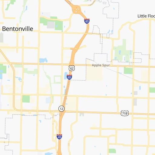
Roadmap (route) to go from Bentonville Municipal Airport to Shawnee detailed above, you can also see the course layout on the map.
While doing trip Bentonville Municipal (airport) - Shawnee by car, the calculated route ends at a distance , or more straight.
Distance and duration of the route between Bentonville Municipal (airport) and Shawnee
Calculation of distance and route from Shawnee to Bentonville Municipal (airport) :
268.8323.8 km4h37mn
Continue 0h0mn 16 mTurn right onto Southwest Aviation Street 0h0mn 249 mTurn right 0h2mn 508 mTurn right onto Southwest Municipal Drive 0h1mn 431 mTurn right onto Southwest Regional Airport Boulevard 0h9mn 11.0 kmTurn right onto Southwest Old Farm Boulevard 0h1mn 593 mKeep right 0h0mn 46 mTurn slight right onto AR 12 0h6mn 7.7 kmKeep right onto AR 12 0h7mn 9.3 kmTurn sharp left onto Dawn Hill East Road 0h0mn 24 mTurn slight right onto Dawn Hill East Road 0h7mn 3.6 kmTurn left onto Collins Road 0h6mn 7.5 kmKeep right onto AR 59 0h0mn 94 mTurn right onto US 412, AR 59 0h6mn 6.7 kmTurn slight right onto Dan P. Holmes Memorial Highway 0h9mn 13.4 kmKeep right onto Cherokee Turnpike and take US 412 West toward Tulsa 1h54mn 95.0 kmKeep left onto Dan P. Holmes Memorial Expressway and take I 44 West, US 412 West, OK 66 West toward Tulsa 0h6mn 8.5 kmKeep left onto Skelly Bypass and take I 44 West, OK 66 West toward Sapulpa, Oklahoma City 0h14mn 20.3 kmKeep left onto Skelly Bypass 0h1mn 2.1 kmKeep left onto Skelly Bypass 1h50mn 90.3 kmKeep right and take OK 18 toward Chandler, Cushing 0h1mn 922 mTurn right onto North Price Avenue 0h1mn 807 mTurn sharp right onto West 1st Street 0h0mn 84 mTurn left onto South Price Avenue 0h1mn 589 mTurn right onto Park Road 0h0mn 388 mTurn sharp left onto National Drive 0h1mn 851 mTurn left onto West 15th Street 0h0mn 66 mTurn right onto OK 18 1h32mn 41.4 kmTurn right onto East 10th Street 0h1mn 1.2 kmTurn left onto North Beard Street 0h0mn 291 mTurn right onto West Main Street 0h0mn 42 mArrive at destination 0h0mn 0 m
Travel from Bentonville Municipal (airport) (Oklahoma) to a selection of major cities.
Distances from Bentonville Municipal Airport to biggest cities in Arkansas
- West Memphis,25,052 inhabitants.388 km
- Searcy,24,196 inhabitants.255 km
- Van Buren,23,081 inhabitants.102 km
Other major cities in country :
- Charlotte [NC], 827,097 inhabitants. 1,213 km
- Seattle [WA], 684,451 inhabitants. 2,622 km
- Denver [CO], 682,545 inhabitants. 1,016 km
- El Paso [TX], 681,124 inhabitants. 1,240 km
- Detroit [MI], 677,116 inhabitants. 1,169 km
- Boston [MA], 667,137 inhabitants. 2,095 km
- Memphis [TN], 655,770 inhabitants. 400 km
- New South Memphis [TN], 641,608 inhabitants. 401 km
- Portland [OR], 632,309 inhabitants. 2,585 km
- Oklahoma City [OK], 631,346 inhabitants. 313 km
- Las Vegas [NV], 623,747 inhabitants. 1,874 km
- Baltimore [MD], 621,849 inhabitants. 1,580 km
- Washington, D.C. [DC], 601,723 inhabitants. 1,539 km
- Milwaukee [WI], 600,155 inhabitants. 920 km
- South Boston [MA], 571,281 inhabitants. 2,095 km
- Albuquerque [NM], 559,121 inhabitants. 1,132 km
- Tucson [AZ], 531,641 inhabitants. 1,601 km
- Nashville [TN], 530,852 inhabitants. 668 km
- Fresno [CA], 520,052 inhabitants. 2,279 km
- Sacramento [CA], 490,712 inhabitants. 2,414 km
Route from Shawnee to major cities (United States).
- Distance Shawnee New York City2,091 km
- Distance Shawnee Los Angeles1,953 km
- Distance Shawnee Chicago1,084 km
- Distance Shawnee Brooklyn2,094 km
- Distance Shawnee Houston636 km
- Distance Shawnee Queens2,104 km
- Distance Shawnee Philadelphia1,981 km
- Distance Shawnee Phoenix1,406 km
- Distance Shawnee Manhattan2,095 km
- Distance Shawnee San Antonio673 km
- Distance Shawnee San Diego1,886 km
- Distance Shawnee The Bronx2,105 km
- Distance Shawnee Dallas283 km
- Distance Shawnee San Jose2,244 km
- Distance Shawnee Austin568 km
- Distance Shawnee Jacksonville1,531 km
- Distance Shawnee San Francisco2,289 km
- Distance Shawnee Columbus1,330 km
- Distance Shawnee Fort Worth292 km
- Distance Shawnee Indianapolis1,070 km
Nearest cities to Bentonville Municipal (airport) :
- Kansas City, 475,378 inhabitants. 308 km
- Tulsa, 403,505 inhabitants. 161 km
- Little Rock, 197,992 inhabitants. 249 km
- Overland Park, 186,515 inhabitants. 296 km
- Springfield, 166,810 inhabitants. 127 km
- Kansas City, 151,306 inhabitants. 310 km
- Olathe, 134,305 inhabitants. 287 km
- Topeka, 127,265 inhabitants. 327 km
- Columbia, 119,108 inhabitants. 334 km
- Independence, 117,255 inhabitants. 306 km
- East Independence, 110,675 inhabitants. 306 km
- Broken Arrow, 106,563 inhabitants. 145 km
- Lee's Summit, 95,094 inhabitants. 286 km
- Lawrence, 93,917 inhabitants. 306 km
- Fort Smith, 88,194 inhabitants. 108 km
- Fayetteville, 82,830 inhabitants. 32 km
- Springdale, 77,859 inhabitants. 19 km
- North Little Rock, 66,504 inhabitants. 249 km
- Shawnee, 65,046 inhabitants. 303 km
- Conway, 64,980 inhabitants. 213 km
- Rogers, 63,159 inhabitants. 9 km
- Manhattan, 56,308 inhabitants. 378 km
- Blue Springs, 54,148 inhabitants. 297 km
- Lenexa, 52,490 inhabitants. 294 km
- Joplin, 51,818 inhabitants. 86 km
- Stillwater, 48,967 inhabitants. 256 km
- Pine Bluff, 44,772 inhabitants. 310 km
- Bentonville, 44,499 inhabitants. 3 km
- Jefferson City, 43,169 inhabitants. 307 km
- Sherman, 40,667 inhabitants. 372 km
- Muskogee, 38,456 inhabitants. 123 km
- Texarkana, 37,280 inhabitants. 325 km
- Bartlesville, 36,595 inhabitants. 164 km
- Leavenworth, 35,980 inhabitants. 336 km
- Hot Springs, 35,635 inhabitants. 231 km
- Hot Springs National Park, 35,193 inhabitants. 227 km
- Leawood, 34,579 inhabitants. 294 km
- Owasso, 34,542 inhabitants. 147 km
- Benton, 34,177 inhabitants. 247 km
- Shawnee, 31,286 inhabitants. 269 km
- Sherwood, 30,517 inhabitants. 248 km
- Liberty, 30,450 inhabitants. 323 km
- Texarkana, 30,353 inhabitants. 324 km
- Raytown, 29,401 inhabitants. 297 km
- Russellville, 29,166 inhabitants. 154 km
- Jacksonville, 28,643 inhabitants. 252 km
- Bella Vista, 27,999 inhabitants. 16 km
- Gladstone, 26,861 inhabitants. 320 km
- Cabot, 25,587 inhabitants. 251 km
- Grandview, 25,256 inhabitants. 284 km
Location Bentonville Municipal (airport) (Arkansas) :
| Country flag |  |
| Location | Bentonville Municipal (airport) |
| State | Arkansas |
| County | Benton County |
| Country | United States |
| Country code / ISO 2 | US |
| Latitude | 36.3456300 |
| Longitude | -94.2191000 |
| Altitude | 395 meters |
| Time zone | America/Chicago |
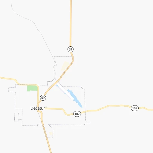
Location Shawnee (Oklahoma) :
| Country flag | |
| Location | Shawnee |
| State | Oklahoma |
| County | Pottawatomie County |
| Country | United States |
| Country code / ISO 2 | US |
| Latitude | 35.3272900 |
| Longitude | -96.9253000 |
| Altitude | 323 meters |
| Time zone | America/Chicago |


