


How to get from Estación Fertimex (Querétaro) to Tequisquiapan (Querétaro)
Calculate route from Estación Fertimex (Querétaro, Mexico) to Tequisquiapan (Querétaro, Mexico).
The flight distance (as the crow flies) between Estación Fertimex and Tequisquiapan is 49.6 km.
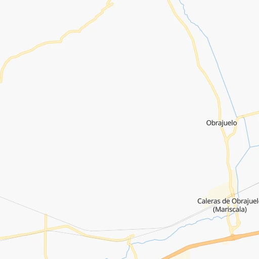
Roadmap (route) to go from Estación Fertimex to Tequisquiapan detailed above, you can also see the course layout on the map.
While doing trip Estación Fertimex - Tequisquiapan by car, the calculated route ends at a distance , or more straight.
Distance and duration of the route between Estación Fertimex and Tequisquiapan
Calculation of distance and route from Tequisquiapan to Estación Fertimex :
49.661.6 km1h51mn
Continue onto Avenida Fundadores 0h1mn 1.4 kmTurn left onto Boulevard Bernardo Quintana 0h0mn 294 mKeep left toward QRO 30 0h2mn 1.8 kmKeep right and drive toward Ciudad de México, San Juan del Río 0h10mn 15.6 kmKeep right and take MEX 57D, QRO 100 toward San Luis Potosi 0h0mn 177 mKeep left toward QRO 100 0h8mn 9.4 kmKeep right 0h1mn 371 mKeep left 0h0mn 25 mTurn right onto Querétaro-Tequisquiapan 0h0mn 311 mContinue onto Querétaro - Tequisquiapan - Límite Estados 0h26mn 30.2 kmKeep right 0h0mn 329 mKeep right 0h1mn 796 mTurn left onto Calle Juárez Poniente 0h1mn 736 mTurn sharp left onto Calle Manuel Mateos 0h0mn 122 mArrive at destination 0h0mn 0 m
Travel from Estación Fertimex (Querétaro) to a selection of major cities.
Distances from Estación Fertimex to biggest cities in Querétaro
Other major cities in country :
- Aguascalientes [01], 658,179 inhabitants. 245 km
- Acapulco de Juarez [12], 652,136 inhabitants. 420 km
- Coyoacan [09], 628,063 inhabitants. 188 km
- Saltillo [07], 621,250 inhabitants. 541 km
- Tlalpan [09], 607,545 inhabitants. 192 km
- Mexicali [02], 597,099 inhabitants. 2,008 km
- Hermosillo [26], 595,811 inhabitants. 1,429 km
- Morelia [16], 592,797 inhabitants. 132 km
- Veracruz [30], 568,313 inhabitants. 469 km
- Cancun [23], 542,043 inhabitants. 1,407 km
- Santa Maria Chimalhuacan [15], 525,389 inhabitants. 197 km
- Torreon [07], 524,066 inhabitants. 633 km
- Cuauhtemoc [09], 521,348 inhabitants. 181 km
- Ciudad Lopez Mateos [15], 521,034 inhabitants. 164 km
- Toluca [15], 505,881 inhabitants. 164 km
- Reynosa [28], 498,654 inhabitants. 646 km
- Tlaquepaque [14], 493,646 inhabitants. 306 km
- Tuxtla [05], 481,128 inhabitants. 876 km
- Cuautitlan Izcalli [15], 475,179 inhabitants. 160 km
- Victoria de Durango [10], 457,140 inhabitants. 584 km
Route from Tequisquiapan to major cities (Mexico).
- Distance Tequisquiapan Mexico City146 km
- Distance Tequisquiapan Iztapalapa156 km
- Distance Tequisquiapan Ecatepec de Morelos134 km
- Distance Tequisquiapan Guadalajara365 km
- Distance Tequisquiapan Puebla242 km
- Distance Tequisquiapan Juarez1,408 km
- Distance Tequisquiapan Tijuana2,159 km
- Distance Tequisquiapan Ciudad Nezahualcoyotl155 km
- Distance Tequisquiapan Gustavo Adolfo Madero141 km
- Distance Tequisquiapan Monterrey575 km
- Distance Tequisquiapan Leon de los Aldama197 km
- Distance Tequisquiapan Zapopan365 km
- Distance Tequisquiapan Naucalpan de Juarez135 km
- Distance Tequisquiapan Chihuahua1,099 km
- Distance Tequisquiapan Alvaro Obregon148 km
- Distance Tequisquiapan Guadalupe575 km
- Distance Tequisquiapan Merida1,071 km
- Distance Tequisquiapan Tlalnepantla131 km
- Distance Tequisquiapan San Luis Potosi213 km
- Distance Tequisquiapan Culiacan905 km
Nearest cities to Estación Fertimex :
- Mexico City, 12,294,193 inhabitants. 183 km
- Iztapalapa, 1,820,888 inhabitants. 194 km
- Ecatepec de Morelos, 1,806,226 inhabitants. 175 km
- Puebla, 1,590,256 inhabitants. 285 km
- Ciudad Nezahualcoyotl, 1,232,220 inhabitants. 194 km
- Gustavo Adolfo Madero, 1,193,161 inhabitants. 180 km
- Leon de los Aldama, 1,114,626 inhabitants. 149 km
- Naucalpan de Juarez, 846,185 inhabitants. 171 km
- Alvaro Obregon, 727,034 inhabitants. 184 km
- Tlalnepantla, 715,767 inhabitants. 170 km
- San Luis Potosi, 677,704 inhabitants. 184 km
- Aguascalientes, 658,179 inhabitants. 245 km
- Coyoacan, 628,063 inhabitants. 188 km
- Santiago de Queretaro, 626,495 inhabitants. 3 km
- Tlalpan, 607,545 inhabitants. 192 km
- Morelia, 592,797 inhabitants. 132 km
- Santa Maria Chimalhuacan, 525,389 inhabitants. 197 km
- Cuauhtemoc, 521,348 inhabitants. 181 km
- Ciudad Lopez Mateos, 521,034 inhabitants. 164 km
- Toluca, 505,881 inhabitants. 164 km
- Tlaquepaque, 493,646 inhabitants. 306 km
- Cuautitlan Izcalli, 475,179 inhabitants. 160 km
- Venustiano Carranza, 447,459 inhabitants. 184 km
- Azcapotzalco, 425,298 inhabitants. 175 km
- Xochimilco, 404,458 inhabitants. 199 km
- Tonala, 401,509 inhabitants. 299 km
- Iztacalco, 384,326 inhabitants. 188 km
- Xico, 365,777 inhabitants. 209 km
- Benito Juarez, 355,017 inhabitants. 184 km
- Miguel Hidalgo, 353,534 inhabitants. 178 km
- Ixtapaluca, 351,001 inhabitants. 211 km
- Tlahuac, 344,106 inhabitants. 204 km
- Cuernavaca, 343,769 inhabitants. 221 km
- Irapuato, 339,554 inhabitants. 104 km
- Pachuca de Soto, 319,581 inhabitants. 178 km
- Coacalco, 313,405 inhabitants. 170 km
- Tampico, 309,003 inhabitants. 319 km
- Celaya, 305,901 inhabitants. 48 km
- Los Reyes Acaquilpan, 251,168 inhabitants. 200 km
- Colonia del Valle, 250,000 inhabitants. 184 km
- Nicolas Romero, 245,383 inhabitants. 153 km
- Ojo de Agua, 242,272 inhabitants. 174 km
- Tehuacan, 241,429 inhabitants. 391 km
- Uruapan, 237,308 inhabitants. 221 km
- Magdalena Contreras, 228,927 inhabitants. 185 km
- Buenavista, 206,081 inhabitants. 166 km
- Soledad de Graciano Sanchez, 194,006 inhabitants. 187 km
- Ciudad Madero, 192,736 inhabitants. 321 km
- Ciudad Valles, 176,935 inhabitants. 209 km
- Poza Rica de Hidalgo, 174,526 inhabitants. 303 km
Location Estación Fertimex (Querétaro) :
| Country flag |  |
| Location | Estación Fertimex |
| State | Querétaro |
| County | Querétaro |
| Country | Mexico |
| Country code / ISO 2 | MX |
| Latitude | 20.6000000 |
| Longitude | -100.3611100 |
| Altitude | 0 meters |
| Time zone | America/Mexico_City |
Location Tequisquiapan (Querétaro) :
| Country flag | |
| Location | Tequisquiapan |
| State | Querétaro |
| County | Tequisquiapan |
| Country | Mexico |
| Country code / ISO 2 | MX |
| Latitude | 20.5225000 |
| Longitude | -99.8916700 |
| Altitude | 0 meters |
| Time zone | America/Mexico_City |


