
How to get from Benito Juárez (Chihuahua) to El Tobarito (Sonora)
Calculate route from Benito Juárez (Chihuahua, Mexico) to El Tobarito (Sonora, Mexico).
The flight distance (as the crow flies) between Benito Juárez and El Tobarito is 325.7 km.
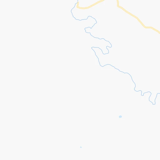
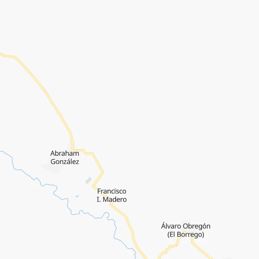
Roadmap (route) to go from Benito Juárez to El Tobarito detailed above, you can also see the course layout on the map.
While doing trip Benito Juárez - El Tobarito by car, the calculated route ends at a distance , or more straight.
Distance and duration of the route between Benito Juárez and El Tobarito
Calculation of distance and route from El Tobarito to Benito Juárez :
325.7675.9 km10h9mn
Continue 0h13mn 6.5 kmTurn right 0h20mn 10.0 kmTurn left onto Calle 21a 0h2mn 2.0 kmTurn left onto Calle Francisco I. Madero 0h1mn 826 mTurn right onto Calle Segunda 0h0mn 138 mTurn left onto Calle Hacienda de San Miguel 0h9mn 7.3 kmTurn left onto Camino Guillermo Prieto 0h1mn 789 mTurn left onto Calle Ocampo 0h1mn 460 mTurn right onto Calle Josefa Ortiz de Domínguez 0h1mn 966 mTurn right onto Carretera Buenaventura-Soto Máynez-Gómez Farías 1h43mn 45.4 kmTurn right onto Carretera San José Babícora 0h19mn 19.1 kmContinue onto Carretera San José Babícora 0h0mn 179 mTurn slight left onto Entronque (Matachí - Madera) - Entronque (Soto Máynez - Gómez Farías - Buenaventura) 0h13mn 14.6 kmTurn left onto Carretera Madera-Matachí 0h20mn 22.0 kmTurn right onto Avenida Degollado 1h51mn 59.2 kmTurn right onto Calle Juárez 0h1mn 341 mContinue onto Carretera Entronque Tomochi - Guerrero 0h17mn 18.4 kmKeep right toward MEX 16 0h0mn 295 mTurn slight right onto Carretera La Junta-Yécora 4h49mn 283.0 kmTurn sharp left onto Rosario de Tesopaco - San Nicolás 1h18mn 83.4 kmTurn right onto Boulevard Luis Donaldo Colosio Murrieta 1h52mn 57.5 kmTurn left onto Esperanza - Rosario 0h14mn 17.3 kmTurn right onto Avenida Hermanos Talamante 0h0mn 381 mMake a U-turn onto Avenida Hermanos Talamante 0h10mn 11.6 kmTurn left onto Ciudad Obregón - Navojoa 0h5mn 4.8 kmKeep right and drive toward Tobarito 0h0mn 117 mContinue onto Calle 12 0h8mn 9.2 kmTurn right 0h0mn 187 mArrive at destination 0h0mn 0 m
Travel from Benito Juárez (Sonora) to a selection of major cities.
Distances from Benito Juárez to biggest cities in Chihuahua
Other major cities in country :
- Coyoacan [09], 628,063 inhabitants. 1,458 km
- Santiago de Queretaro [22], 626,495 inhabitants. 1,271 km
- Saltillo [07], 621,250 inhabitants. 836 km
- Tlalpan [09], 607,545 inhabitants. 1,463 km
- Mexicali [02], 597,099 inhabitants. 784 km
- Hermosillo [26], 595,811 inhabitants. 303 km
- Morelia [16], 592,797 inhabitants. 1,310 km
- Veracruz [30], 568,313 inhabitants. 1,675 km
- Cancun [23], 542,043 inhabitants. 2,320 km
- Santa Maria Chimalhuacan [15], 525,389 inhabitants. 1,465 km
- Torreon [07], 524,066 inhabitants. 646 km
- Cuauhtemoc [09], 521,348 inhabitants. 1,450 km
- Ciudad Lopez Mateos [15], 521,034 inhabitants. 1,433 km
- Toluca [15], 505,881 inhabitants. 1,434 km
- Reynosa [28], 498,654 inhabitants. 1,033 km
- Tlaquepaque [14], 493,646 inhabitants. 1,116 km
- Tuxtla [05], 481,128 inhabitants. 2,091 km
- Cuautitlan Izcalli [15], 475,179 inhabitants. 1,428 km
- Victoria de Durango [10], 457,140 inhabitants. 716 km
- Heroica Matamoros [28], 449,815 inhabitants. 1,113 km
Route from El Tobarito to major cities (Mexico).
- Distance El Tobarito Mexico City1,410 km
- Distance El Tobarito Iztapalapa1,420 km
- Distance El Tobarito Ecatepec de Morelos1,403 km
- Distance El Tobarito Guadalajara997 km
- Distance El Tobarito Puebla1,512 km
- Distance El Tobarito Juarez587 km
- Distance El Tobarito Tijuana892 km
- Distance El Tobarito Ciudad Nezahualcoyotl1,421 km
- Distance El Tobarito Gustavo Adolfo Madero1,407 km
- Distance El Tobarito Monterrey972 km
- Distance El Tobarito Leon de los Aldama1,085 km
- Distance El Tobarito Zapopan992 km
- Distance El Tobarito Naucalpan de Juarez1,397 km
- Distance El Tobarito Chihuahua400 km
- Distance El Tobarito Alvaro Obregon1,409 km
- Distance El Tobarito Guadalupe978 km
- Distance El Tobarito Merida2,176 km
- Distance El Tobarito Tlalnepantla1,396 km
- Distance El Tobarito San Luis Potosi1,072 km
- Distance El Tobarito Culiacan381 km
Nearest cities to Benito Juárez :
- Juarez, 1,512,354 inhabitants. 261 km
- Chihuahua, 809,232 inhabitants. 218 km
- Ciudad Obregon, 258,162 inhabitants. 319 km
- Navojoa, 120,000 inhabitants. 332 km
- Heroica Guaymas, 103,449 inhabitants. 353 km
- Ciudad Delicias, 102,969 inhabitants. 296 km
- Parral, 101,768 inhabitants. 385 km
- Cuauhtemoc, 90,835 inhabitants. 182 km
- Agua Prieta, 77,254 inhabitants. 234 km
- Nuevo Casas Grandes, 51,356 inhabitants. 75 km
- Empalme, 38,599 inhabitants. 344 km
- Camargo, 37,743 inhabitants. 355 km
- Cananea, 33,433 inhabitants. 265 km
- Jimenez, 31,054 inhabitants. 293 km
- Huatabampo, 30,426 inhabitants. 365 km
- Meoqui, 21,179 inhabitants. 290 km
- Madera, 16,087 inhabitants. 65 km
- Pueblo Yaqui, 14,802 inhabitants. 336 km
- Villa Juarez, 14,680 inhabitants. 346 km
- Nacozari Viejo, 11,872 inhabitants. 180 km
- Ascencion, 11,781 inhabitants. 151 km
- Santa Barbara, 10,800 inhabitants. 388 km
- Anahuac, 10,696 inhabitants. 182 km
- Saucillo, 10,595 inhabitants. 321 km
- Alamos, 9,345 inhabitants. 318 km
- El Tobarito, 9,065 inhabitants. 326 km
- Vicam, 8,837 inhabitants. 328 km
- Adolfo Lopez Mateos, 8,770 inhabitants. 155 km
- Marte R. Gomez (Tobarito), 8,700 inhabitants. 326 km
- Cocorit, 8,695 inhabitants. 312 km
- Miguel Ahumada, 8,575 inhabitants. 168 km
- Etchojoa, 8,571 inhabitants. 356 km
- Bacobampo, 8,539 inhabitants. 350 km
- Ampliacion Colonia Lazaro Cardenas, 8,161 inhabitants. 272 km
- San Ignacio Rio Muerto, 7,358 inhabitants. 344 km
- San Buenaventura, 6,168 inhabitants. 48 km
- Benito Juarez, 6,138 inhabitants. 0 km
- Esqueda, 6,119 inhabitants. 192 km
- Imuris, 6,117 inhabitants. 303 km
- Campo Sesenta, 6,012 inhabitants. 332 km
- Potam, 5,859 inhabitants. 338 km
- Ejido Benito Juarez, 5,778 inhabitants. 111 km
- Pesqueira, 5,699 inhabitants. 289 km
- Puerto Palomas, 5,659 inhabitants. 228 km
- Naica, 5,494 inhabitants. 318 km
- Valentin Gomez Farias, 5,404 inhabitants. 215 km
- Rosales, 5,217 inhabitants. 290 km
- Naco, 5,193 inhabitants. 261 km
- Creel, 5,011 inhabitants. 224 km
- La Union, 5,006 inhabitants. 365 km
Location Benito Juárez (Chihuahua) :
| Country flag |  |
| Location | Benito Juárez |
| State | Chihuahua |
| County | Ignacio Zaragoza |
| Country | Mexico |
| Country code / ISO 2 | MX |
| Latitude | 29.7462400 |
| Longitude | -107.9396600 |
| Altitude | 0 meters |
| Time zone | America/Chihuahua |
Location El Tobarito (Sonora) :
| Country flag | |
| Location | El Tobarito |
| State | Sonora |
| County | Cajeme |
| Country | Mexico |
| Country code / ISO 2 | MX |
| Latitude | 27.3705700 |
| Longitude | -109.8937900 |
| Altitude | 0 meters |
| Time zone | America/Hermosillo |