
Home
››
General Roberto Fierro Villalobos International Airport
››
Roadmap from General Roberto Fierro Villalobos International Airport to Bermejillo
How to get from General Roberto Fierro Villalobos International (airport) (Chihuahua) to Bermejillo (Durango)
Calculate route from General Roberto Fierro Villalobos International (airport) (Chihuahua, Mexico) to Bermejillo (Durango, Mexico).
The flight distance (as the crow flies) between General Roberto Fierro Villalobos International (airport) and Bermejillo is 389.2 km.
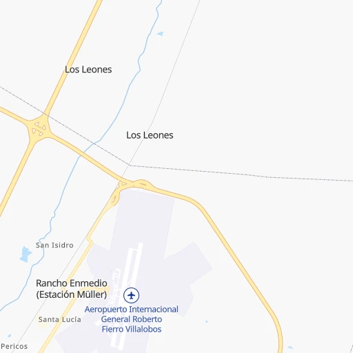
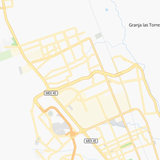
Roadmap (route) to go from General Roberto Fierro Villalobos International Airport to Bermejillo detailed above, you can also see the course layout on the map.
While doing trip General Roberto Fierro Villalobos International (airport) - Bermejillo by car, the calculated route ends at a distance , or more straight.
Distance and duration of the route between General Roberto Fierro Villalobos International (airport) and Bermejillo
Calculation of distance and route from Bermejillo to General Roberto Fierro Villalobos International (airport) :
389.2418.3 km5h1mn
Continue 0h0mn 6 mKeep right 0h1mn 1.1 kmContinue 0h2mn 2.4 kmKeep left 0h0mn 73 mTurn left onto Avenida Quinta Real 0h1mn 1.3 kmAt roundabout, take exit 2 onto Avenida Quinta Real 0h1mn 860 mAt roundabout, take exit 2 onto Avenida Quinta Real 0h1mn 1.3 kmTurn right 0h4mn 4.2 kmTurn slight left 0h3mn 3.6 kmKeep left onto MEX 45 0h0mn 522 mKeep right onto MEX 45 2h32mn 135.3 kmKeep left onto Libramiento Camargo 0h4mn 4.6 kmTurn right 0h0mn 39 mContinue 0h0mn 32 mTurn left onto Calle San Juan 0h0mn 203 mTurn slight right onto Calle Río Santa María 0h1mn 432 mTurn left onto Privada Primera 0h0mn 136 mTurn right onto Avenida Urique 0h0mn 95 mTurn left onto Validad Sebastian 1h52mn 74.9 kmKeep right onto Autopista de Peaje Jiménez-Torreón 0h25mn 37.3 kmTurn right 0h0mn 29 mTurn left onto Carretera Jiménez-Torreón 2h50mn 149.6 kmTurn left onto Avenida Donato Guerra 0h0mn 108 mTurn right onto Calle Vicente Guerrero 0h0mn 2 mArrive at destination 0h0mn 0 m
Travel from General Roberto Fierro Villalobos International (airport) (Durango) to a selection of major cities.
Distances from General Roberto Fierro Villalobos International Airport to biggest cities in Chihuahua
Other major cities in country :
- Coyoacan [09], 628,063 inhabitants. 1,250 km
- Santiago de Queretaro [22], 626,495 inhabitants. 1,065 km
- Saltillo [07], 621,250 inhabitants. 612 km
- Tlalpan [09], 607,545 inhabitants. 1,254 km
- Mexicali [02], 597,099 inhabitants. 1,008 km
- Hermosillo [26], 595,811 inhabitants. 490 km
- Morelia [16], 592,797 inhabitants. 1,113 km
- Veracruz [30], 568,313 inhabitants. 1,455 km
- Cancun [23], 542,043 inhabitants. 2,100 km
- Santa Maria Chimalhuacan [15], 525,389 inhabitants. 1,255 km
- Torreon [07], 524,066 inhabitants. 433 km
- Cuauhtemoc [09], 521,348 inhabitants. 1,241 km
- Ciudad Lopez Mateos [15], 521,034 inhabitants. 1,224 km
- Toluca [15], 505,881 inhabitants. 1,228 km
- Reynosa [28], 498,654 inhabitants. 813 km
- Tlaquepaque [14], 493,646 inhabitants. 937 km
- Tuxtla [05], 481,128 inhabitants. 1,870 km
- Cuautitlan Izcalli [15], 475,179 inhabitants. 1,219 km
- Victoria de Durango [10], 457,140 inhabitants. 537 km
- Heroica Matamoros [28], 449,815 inhabitants. 894 km
Route from Bermejillo to major cities (Mexico).
- Distance Bermejillo Mexico City854 km
- Distance Bermejillo Iztapalapa865 km
- Distance Bermejillo Ecatepec de Morelos841 km
- Distance Bermejillo Guadalajara582 km
- Distance Bermejillo Puebla944 km
- Distance Bermejillo Juarez706 km
- Distance Bermejillo Tijuana1,493 km
- Distance Bermejillo Ciudad Nezahualcoyotl863 km
- Distance Bermejillo Gustavo Adolfo Madero849 km
- Distance Bermejillo Monterrey332 km
- Distance Bermejillo Leon de los Aldama566 km
- Distance Bermejillo Zapopan575 km
- Distance Bermejillo Naucalpan de Juarez843 km
- Distance Bermejillo Chihuahua391 km
- Distance Bermejillo Alvaro Obregon857 km
- Distance Bermejillo Guadalupe338 km
- Distance Bermejillo Merida1,530 km
- Distance Bermejillo Tlalnepantla840 km
- Distance Bermejillo San Luis Potosi495 km
- Distance Bermejillo Culiacan398 km
Nearest cities to General Roberto Fierro Villalobos International (airport) :
- Chihuahua, 809,232 inhabitants. 14 km
- Ciudad Delicias, 102,969 inhabitants. 75 km
- Parral, 101,768 inhabitants. 200 km
- Cuauhtemoc, 90,835 inhabitants. 94 km
- Nuevo Casas Grandes, 51,356 inhabitants. 268 km
- Camargo, 37,743 inhabitants. 138 km
- Jimenez, 31,054 inhabitants. 69 km
- Juan Jose Rios, 26,380 inhabitants. 433 km
- Manuel Ojinaga, 22,744 inhabitants. 178 km
- Ojinaga, 22,128 inhabitants. 168 km
- Meoqui, 21,179 inhabitants. 67 km
- Madera, 16,087 inhabitants. 219 km
- Adolfo Ruiz Cortines, 12,947 inhabitants. 429 km
- Ascencion, 11,781 inhabitants. 330 km
- El Fuerte, 11,171 inhabitants. 365 km
- Santa Barbara, 10,800 inhabitants. 212 km
- Anahuac, 10,696 inhabitants. 80 km
- Saucillo, 10,595 inhabitants. 100 km
- Poanas, 10,249 inhabitants. 401 km
- Alamos, 9,345 inhabitants. 347 km
- Adolfo Lopez Mateos, 8,770 inhabitants. 133 km
- Tlahualilo de Zaragoza, 8,588 inhabitants. 382 km
- Miguel Ahumada, 8,575 inhabitants. 220 km
- Ampliacion Colonia Lazaro Cardenas, 8,161 inhabitants. 49 km
- Bermejillo, 7,692 inhabitants. 390 km
- Choix, 7,623 inhabitants. 322 km
- Concordia, 6,964 inhabitants. 430 km
- San Blas, 6,353 inhabitants. 402 km
- San Buenaventura, 6,168 inhabitants. 193 km
- Benito Juarez, 6,138 inhabitants. 224 km
- Santa Maria del Oro, 5,878 inhabitants. 312 km
- Ejido Benito Juarez, 5,778 inhabitants. 184 km
- Naica, 5,494 inhabitants. 105 km
- Valentin Gomez Farias, 5,404 inhabitants. 81 km
- Rosales, 5,217 inhabitants. 70 km
- Creel, 5,011 inhabitants. 195 km
- Mochicahui, 4,999 inhabitants. 424 km
- Ejido El Largo, 4,964 inhabitants. 249 km
- Mapimi, 4,548 inhabitants. 382 km
- La Trinidad, 4,385 inhabitants. 414 km
- Sinaloa de Leyva, 4,297 inhabitants. 391 km
- Valle de Allende, 4,198 inhabitants. 205 km
- Casas Grandes, 4,124 inhabitants. 269 km
- Colonia Revolucion, 3,995 inhabitants. 72 km
- Hercules, 3,914 inhabitants. 225 km
- Praxedis Guerrero, 3,787 inhabitants. 297 km
- Ceballos, 3,730 inhabitants. 302 km
- Ignacio Zaragoza, 3,455 inhabitants. 128 km
- Genaro Estrada, 3,355 inhabitants. 391 km
- Guadalupe y Calvo, 3,230 inhabitants. 307 km
Location General Roberto Fierro Villalobos International (airport) (Chihuahua) :
| Country flag |  |
| Location | General Roberto Fierro Villalobos International (airport) |
| State | Chihuahua |
| County | Chihuahua |
| Country | Mexico |
| Country code / ISO 2 | MX |
| Latitude | 28.7028700 |
| Longitude | -105.9645700 |
| Altitude | 1360 meters |
| Time zone | America/Chihuahua |
Location Bermejillo (Durango) :
| Country flag | |
| Location | Bermejillo |
| State | Durango |
| County | Mapimí |
| Country | Mexico |
| Country code / ISO 2 | MX |
| Latitude | 25.8868200 |
| Longitude | -103.6206900 |
| Altitude | 0 meters |
| Time zone | America/Monterrey |