
How to get from Cosalá (Sinaloa) to Tlalpan (Mexico City)
Calculate route from Cosalá (Sinaloa, Mexico) to Tlalpan (Mexico City, Mexico).
The flight distance (as the crow flies) between Cosalá and Tlalpan is 962.2 km.
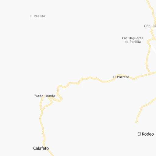
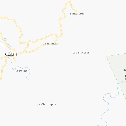
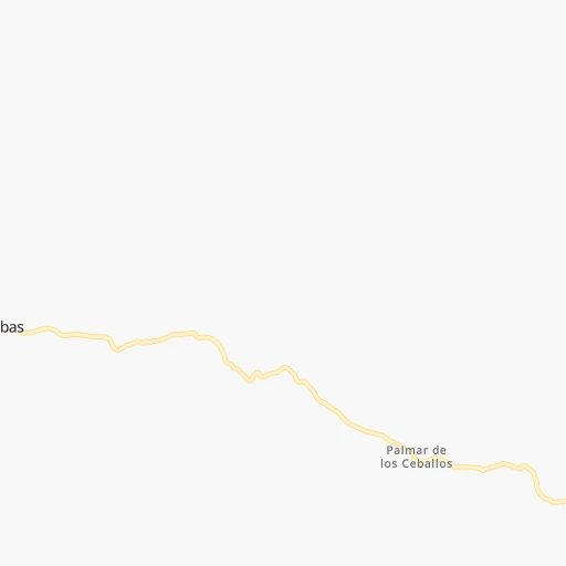
Roadmap (route) to go from Cosalá to Tlalpan detailed above, you can also see the course layout on the map.
While doing trip Cosalá - Tlalpan by car, the calculated route ends at a distance , or more straight.
Distance and duration of the route between Cosalá and Tlalpan
Calculation of distance and route from Tlalpan to Cosalá :
962.21,172.1 km13h2mn
Continue onto Calle Miguel Hidalgo y Costilla 0h1mn 332 mKeep left onto Calle Miguel Hidalgo y Costilla 0h0mn 85 mTurn slight right onto Calle Gabriel Leyva Solano 1h55mn 55.0 kmTurn left onto MEX 15 0h2mn 1.7 kmTurn right onto SIN 403 0h19mn 18.7 kmTurn right onto Calle Gabriel Leyva Solano 0h0mn 59 mTurn left onto Calle 1 de Septiembre 0h0mn 45 mTurn right onto Calle Miguel Hidalgo y Costilla 0h0mn 43 mTurn left onto Calle Mariano Calderón 0h1mn 706 mKeep left 0h1mn 632 mTurn right 0h4mn 2.0 kmTurn left 0h0mn 17 mTurn right 0h1mn 366 mTurn right 0h0mn 128 mTurn right onto Autopista Mazatlan - Culiacan 1h51mn 84.9 kmKeep left onto Autopista Mazatlan - Culiacan 3h21mn 305.2 kmKeep left onto Autopista Guadalajara - Tepic 1h46mn 76.1 kmContinue onto Autopista Guadalajara - Tepic 1h35mn 58.3 kmContinue onto Autopista Guadalajara - Tepic 0h21mn 29.2 kmKeep right onto Calzada Lázaro Cárdenas 0h2mn 2.1 kmKeep left onto Calzada Lázaro Cárdenas and drive toward Tonala, Tlaquepaque, Chapala 0h1mn 1.1 kmKeep right and drive toward Colima, Tlajomolco 0h0mn 235 mKeep left and take MEX 15D, MEX 23, MEX 80, MEX 70, MEX 90 toward Mexico, Chapala 0h20mn 28.5 kmKeep right onto Autopista Guadalajara - Morelia and take MEX 15D toward Mexico, Morelia 4h46mn 375.6 kmKeep right onto Zapotlanejo - Atlacomulco and drive toward Atlacomulco 0h4mn 5.2 kmKeep left onto MEX 55D 1h31mn 49.2 kmContinue onto Ixtlahuaca de Rayon - Toluca 0h13mn 13.6 kmTurn left onto Avenida José María Morelos y Pavón 0h10mn 15.7 kmKeep right onto Toluca - Mexico 0h20mn 27.4 kmKeep right and drive toward Centro Comercial Santa Fe, Universidad Iberoamericana 0h0mn 400 mAt roundabout, take exit 2 onto Prolongación Paseo de la Reforma 0h0mn 167 mKeep right 0h0mn 380 mKeep right 0h1mn 567 mKeep right 0h0mn 105 mKeep left 0h2mn 2.9 kmKeep left onto Avenida de los Poetas 0h5mn 8.1 kmKeep right 0h0mn 488 mKeep left 0h1mn 2.3 kmKeep right 0h1mn 865 mKeep right and drive toward Cuernavaca - Tlalpan 0h0mn 501 mKeep right 0h0mn 163 mTurn right onto Avenida Insurgentes Sur 0h0mn 374 mKeep left 0h0mn 84 mContinue onto Avenida San Fernando 0h2mn 1.9 kmTurn left onto Calle Francisco I. Madero 0h1mn 457 mTurn left onto Calle Chimalcoyotl 0h0mn 107 mTurn right onto Calle Puente de Piedra 0h0mn 101 mTurn right 0h0mn 40 mArrive at destination 0h0mn 0 m
Travel from Cosalá (Mexico City) to a selection of major cities.
Distances from Cosalá to biggest cities in Sinaloa
Other major cities in country :
- Acapulco de Juarez [12], 652,136 inhabitants. 1,099 km
- Coyoacan [09], 628,063 inhabitants. 960 km
- Santiago de Queretaro [22], 626,495 inhabitants. 775 km
- Saltillo [07], 621,250 inhabitants. 585 km
- Tlalpan [09], 607,545 inhabitants. 964 km
- Mexicali [02], 597,099 inhabitants. 1,252 km
- Hermosillo [26], 595,811 inhabitants. 674 km
- Morelia [16], 592,797 inhabitants. 773 km
- Veracruz [30], 568,313 inhabitants. 1,235 km
- Cancun [23], 542,043 inhabitants. 2,066 km
- Santa Maria Chimalhuacan [15], 525,389 inhabitants. 973 km
- Torreon [07], 524,066 inhabitants. 353 km
- Cuauhtemoc [09], 521,348 inhabitants. 955 km
- Ciudad Lopez Mateos [15], 521,034 inhabitants. 938 km
- Toluca [15], 505,881 inhabitants. 924 km
- Reynosa [28], 498,654 inhabitants. 866 km
- Tlaquepaque [14], 493,646 inhabitants. 546 km
- Tuxtla [05], 481,128 inhabitants. 1,650 km
- Cuautitlan Izcalli [15], 475,179 inhabitants. 936 km
- Victoria de Durango [10], 457,140 inhabitants. 211 km
Route from Tlalpan to major cities (Mexico).
- Distance Tlalpan Ecatepec de Morelos36 km
- Distance Tlalpan Guadalajara468 km
- Distance Tlalpan Puebla105 km
- Distance Tlalpan Juarez1,564 km
- Distance Tlalpan Tijuana2,308 km
- Distance Tlalpan Ciudad Nezahualcoyotl19 km
- Distance Tlalpan Monterrey720 km
- Distance Tlalpan Leon de los Aldama332 km
- Distance Tlalpan Zapopan469 km
- Distance Tlalpan Naucalpan de Juarez22 km
- Distance Tlalpan Chihuahua1,255 km
- Distance Tlalpan Guadalupe719 km
- Distance Tlalpan Merida1,015 km
- Distance Tlalpan Tlalnepantla27 km
- Distance Tlalpan San Luis Potosi370 km
- Distance Tlalpan Culiacan1,046 km
- Distance Tlalpan Aguascalientes434 km
- Distance Tlalpan Acapulco de Juarez283 km
- Distance Tlalpan Santiago de Queretaro193 km
- Distance Tlalpan Saltillo708 km
Nearest cities to Cosalá :
- Culiacan, 675,000 inhabitants. 82 km
- Victoria de Durango, 457,140 inhabitants. 211 km
- Mazatlan, 354,717 inhabitants. 135 km
- Tepic, 280,592 inhabitants. 372 km
- Los Mochis, 214,601 inhabitants. 279 km
- Navojoa, 120,000 inhabitants. 404 km
- Parral, 101,768 inhabitants. 298 km
- Guasave, 68,449 inhabitants. 220 km
- Guamuchil, 59,276 inhabitants. 182 km
- Huatabampo, 30,426 inhabitants. 400 km
- Navolato, 28,457 inhabitants. 110 km
- Escuinapa, 28,248 inhabitants. 199 km
- Leyva Solano, 27,536 inhabitants. 240 km
- Juan Jose Rios, 26,380 inhabitants. 262 km
- Santiago Papasquiaro, 26,121 inhabitants. 146 km
- Licenciado Benito Juarez (Campo Gobierno), 24,185 inhabitants. 91 km
- San Miguel de Papasquiaro, 22,750 inhabitants. 145 km
- Villa de Costa Rica, 21,662 inhabitants. 73 km
- Villa Juarez, 20,985 inhabitants. 90 km
- Pueblo Nuevo, 19,363 inhabitants. 176 km
- Acaponeta, 18,564 inhabitants. 253 km
- Santiago Ixcuintla, 18,365 inhabitants. 327 km
- La Cruz, 15,500 inhabitants. 59 km
- Tecuala, 14,921 inhabitants. 257 km
- El Rosario, 14,577 inhabitants. 53 km
- Vicente Guerrero, 14,559 inhabitants. 285 km
- Ciudad Guadalupe Victoria, 14,269 inhabitants. 260 km
- El Dorado, 14,136 inhabitants. 69 km
- Villa Union, 13,683 inhabitants. 145 km
- Eldorado, 13,197 inhabitants. 69 km
- Adolfo Ruiz Cortines, 12,947 inhabitants. 255 km
- Ruiz, 12,745 inhabitants. 317 km
- El Fuerte, 11,171 inhabitants. 295 km
- Villa Hidalgo, 11,076 inhabitants. 333 km
- Ahome, 10,806 inhabitants. 301 km
- Santa Barbara, 10,800 inhabitants. 280 km
- Canatlan, 10,342 inhabitants. 195 km
- General Angel Flores (La Palma), 9,812 inhabitants. 108 km
- Alamos, 9,345 inhabitants. 367 km
- Higuera de Zaragoza, 9,037 inhabitants. 315 km
- San Blas, 9,016 inhabitants. 351 km
- Cuencame de Ceniceros, 8,876 inhabitants. 307 km
- Nuevo Ideal, 8,623 inhabitants. 172 km
- Etchojoa, 8,571 inhabitants. 405 km
- Bacobampo, 8,539 inhabitants. 412 km
- Concordia, 8,328 inhabitants. 141 km
- Choix, 7,623 inhabitants. 304 km
- Topolobampo, 7,580 inhabitants. 272 km
- La Reforma, 6,943 inhabitants. 157 km
- El Diez, 6,939 inhabitants. 84 km
Location Cosalá (Sinaloa) :
| Country flag |  |
| Location | Cosalá |
| State | Sinaloa |
| County | Cosalá |
| Country | Mexico |
| Country code / ISO 2 | MX |
| Latitude | 24.4150100 |
| Longitude | -106.6907300 |
| Altitude | 0 meters |
| Time zone | America/Mazatlan |
Location Tlalpan (Mexico City) :
| Country flag | |
| Location | Tlalpan |
| State | Mexico City |
| County | Tlalpan |
| Country | Mexico |
| Country code / ISO 2 | MX |
| Latitude | 19.2951300 |
| Longitude | -99.1620600 |
| Altitude | 0 meters |
| Time zone | America/Mexico_City |


