

How to get from Creel (Chihuahua) to Pueblo Yaqui (Sonora)
Calculate route from Creel (Chihuahua, Mexico) to Pueblo Yaqui (Sonora, Mexico).
The flight distance (as the crow flies) between Creel and Pueblo Yaqui is 240.4 km.
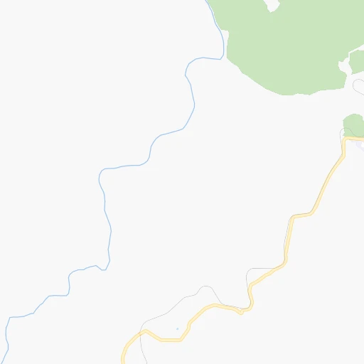
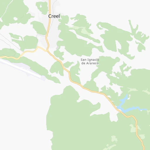
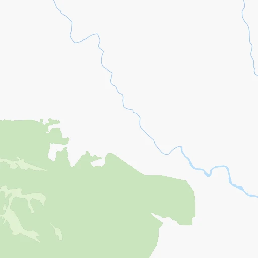
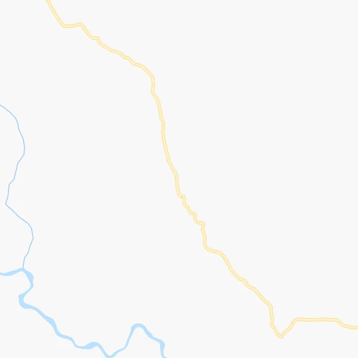
Roadmap (route) to go from Creel to Pueblo Yaqui detailed above, you can also see the course layout on the map.
While doing trip Creel - Pueblo Yaqui by car, the calculated route ends at a distance , or more straight.
Distance and duration of the route between Creel and Pueblo Yaqui
Calculation of distance and route from Pueblo Yaqui to Creel :
240.4404.7 km9h36mn
Continue onto Rarajipa 0h0mn 43 mTurn right 0h0mn 131 mTurn left onto Calle Gran Visión 0h2mn 1.8 kmAt roundabout, take exit 1 onto CHIH 77 1h44mn 48.4 kmTurn right onto Carretera Creel-San Rafael 0h27mn 28.0 kmKeep right 0h1mn 1.6 kmTurn right 1h53mn 33.4 kmTurn slight left 1h37mn 18.4 kmKeep left 0h2mn 976 mTurn left 0h0mn 46 mTurn right 0h2mn 1.3 kmContinue onto Temoris-Chinipas Rd 0h0mn 50 mTurn slight left onto Temoris-Chinipas Rd 1h35mn 17.7 kmTurn right onto Temoris-Chinipas Rd 0h21mn 10.4 kmTurn slight left onto Temoris-Chinipas Rd 1h33mn 16.5 kmTurn right 0h1mn 287 mTurn left 0h2mn 1.2 kmTurn left 0h0mn 91 mTurn slight right onto Temoris-Chinipas Rd 0h0mn 60 mTurn sharp left onto Avenida Santos Degollado 0h0mn 62 mTurn sharp right onto Calle Hidalgo 0h0mn 169 mTurn left onto Calle Mina 0h0mn 208 mTurn left 0h15mn 7.3 kmTurn right 0h12mn 5.9 kmTurn slight right 0h24mn 12.0 kmTurn sharp left 0h18mn 8.8 kmKeep left 0h2mn 1.0 kmTurn left 0h12mn 8.0 kmTurn left 0h27mn 22.7 kmKeep left 0h19mn 9.7 kmTurn slight left onto Álamos - San Bernardo 0h17mn 22.9 kmTurn right 0h3mn 2.1 kmKeep right onto Carretera Navojoa - Alamos 1h46mn 45.8 kmTurn right onto Calle Aquiles Serdán 0h3mn 2.0 kmTurn left onto Avenida Las Palmas 0h2mn 1.8 kmTurn right onto Calle Sufragio Efectivo Norte 0h2mn 1.2 kmTurn left onto Calzada de los Rotarios 0h0mn 44 mTurn right onto Carretera Navojoa - Ciudad Obregón 0h23mn 36.8 kmKeep left onto Carretera Navojoa - Ciudad Obregón 0h6mn 9.5 kmTurn left 0h0mn 221 mTurn left 0h0mn 109 mTurn right 0h0mn 209 mTurn left 0h0mn 80 mTurn right 0h0mn 126 mTurn left 0h0mn 144 mTurn right 0h3mn 1.3 kmTurn left onto 20 de Noviembre 0h22mn 24.2 kmTurn right onto Calle Francisco I. Madero 0h0mn 75 mArrive at destination 0h0mn 0 m
Travel from Creel (Sonora) to a selection of major cities.
Distances from Creel to biggest cities in Chihuahua
Other major cities in country :
- Coyoacan [09], 628,063 inhabitants. 1,273 km
- Santiago de Queretaro [22], 626,495 inhabitants. 1,085 km
- Saltillo [07], 621,250 inhabitants. 709 km
- Tlalpan [09], 607,545 inhabitants. 1,277 km
- Mexicali [02], 597,099 inhabitants. 927 km
- Hermosillo [26], 595,811 inhabitants. 360 km
- Morelia [16], 592,797 inhabitants. 1,111 km
- Veracruz [30], 568,313 inhabitants. 1,511 km
- Cancun [23], 542,043 inhabitants. 2,226 km
- Santa Maria Chimalhuacan [15], 525,389 inhabitants. 1,282 km
- Torreon [07], 524,066 inhabitants. 486 km
- Cuauhtemoc [09], 521,348 inhabitants. 1,266 km
- Ciudad Lopez Mateos [15], 521,034 inhabitants. 1,249 km
- Toluca [15], 505,881 inhabitants. 1,245 km
- Reynosa [28], 498,654 inhabitants. 946 km
- Tlaquepaque [14], 493,646 inhabitants. 906 km
- Tuxtla [05], 481,128 inhabitants. 1,930 km
- Cuautitlan Izcalli [15], 475,179 inhabitants. 1,245 km
- Victoria de Durango [10], 457,140 inhabitants. 511 km
- Heroica Matamoros [28], 449,815 inhabitants. 1,028 km
Route from Pueblo Yaqui to major cities (Mexico).
- Distance Pueblo Yaqui Mexico City1,420 km
- Distance Pueblo Yaqui Iztapalapa1,431 km
- Distance Pueblo Yaqui Ecatepec de Morelos1,413 km
- Distance Pueblo Yaqui Guadalajara1,005 km
- Distance Pueblo Yaqui Puebla1,522 km
- Distance Pueblo Yaqui Juarez596 km
- Distance Pueblo Yaqui Tijuana883 km
- Distance Pueblo Yaqui Ciudad Nezahualcoyotl1,431 km
- Distance Pueblo Yaqui Gustavo Adolfo Madero1,417 km
- Distance Pueblo Yaqui Monterrey985 km
- Distance Pueblo Yaqui Leon de los Aldama1,095 km
- Distance Pueblo Yaqui Zapopan1,001 km
- Distance Pueblo Yaqui Naucalpan de Juarez1,408 km
- Distance Pueblo Yaqui Chihuahua413 km
- Distance Pueblo Yaqui Alvaro Obregon1,419 km
- Distance Pueblo Yaqui Guadalupe991 km
- Distance Pueblo Yaqui Merida2,189 km
- Distance Pueblo Yaqui Tlalnepantla1,407 km
- Distance Pueblo Yaqui San Luis Potosi1,083 km
- Distance Pueblo Yaqui Culiacan389 km
Nearest cities to Creel :
- Chihuahua, 809,232 inhabitants. 181 km
- Culiacan, 675,000 inhabitants. 330 km
- Ciudad Obregon, 258,162 inhabitants. 229 km
- Los Mochis, 214,601 inhabitants. 257 km
- Navojoa, 120,000 inhabitants. 194 km
- Ciudad Delicias, 102,969 inhabitants. 218 km
- Parral, 101,768 inhabitants. 215 km
- Cuauhtemoc, 90,835 inhabitants. 105 km
- Guasave, 68,449 inhabitants. 257 km
- Guamuchil, 59,276 inhabitants. 259 km
- Nuevo Casas Grandes, 51,356 inhabitants. 298 km
- Camargo, 37,743 inhabitants. 243 km
- Jimenez, 31,054 inhabitants. 229 km
- Huatabampo, 30,426 inhabitants. 224 km
- Navolato, 28,457 inhabitants. 332 km
- Leyva Solano, 27,536 inhabitants. 253 km
- Juan Jose Rios, 26,380 inhabitants. 251 km
- Santiago Papasquiaro, 26,121 inhabitants. 374 km
- San Miguel de Papasquiaro, 22,750 inhabitants. 398 km
- Meoqui, 21,179 inhabitants. 220 km
- Madera, 16,087 inhabitants. 168 km
- Pueblo Yaqui, 14,802 inhabitants. 241 km
- Villa Juarez, 14,680 inhabitants. 228 km
- Adolfo Ruiz Cortines, 12,947 inhabitants. 249 km
- Nacozari Viejo, 11,872 inhabitants. 354 km
- El Fuerte, 11,171 inhabitants. 178 km
- Ahome, 10,806 inhabitants. 255 km
- Santa Barbara, 10,800 inhabitants. 208 km
- Anahuac, 10,696 inhabitants. 119 km
- Saucillo, 10,595 inhabitants. 233 km
- General Angel Flores (La Palma), 9,812 inhabitants. 326 km
- Alamos, 9,345 inhabitants. 152 km
- El Tobarito, 9,065 inhabitants. 227 km
- Higuera de Zaragoza, 9,037 inhabitants. 258 km
- Vicam, 8,837 inhabitants. 262 km
- Adolfo Lopez Mateos, 8,770 inhabitants. 86 km
- Marte R. Gomez (Tobarito), 8,700 inhabitants. 226 km
- Cocorit, 8,695 inhabitants. 230 km
- Nuevo Ideal, 8,623 inhabitants. 409 km
- Miguel Ahumada, 8,575 inhabitants. 337 km
- Etchojoa, 8,571 inhabitants. 218 km
- Bacobampo, 8,539 inhabitants. 217 km
- Ampliacion Colonia Lazaro Cardenas, 8,161 inhabitants. 210 km
- Choix, 7,623 inhabitants. 135 km
- Topolobampo, 7,580 inhabitants. 278 km
- San Ignacio Rio Muerto, 7,358 inhabitants. 260 km
- La Reforma, 6,943 inhabitants. 300 km
- San Blas, 6,353 inhabitants. 217 km
- San Buenaventura, 6,168 inhabitants. 234 km
- San Miguel Zapotitlan, 6,152 inhabitants. 245 km
Location Creel (Chihuahua) :
| Country flag |  |
| Location | Creel |
| State | Chihuahua |
| County | Bocoyna |
| Country | Mexico |
| Country code / ISO 2 | MX |
| Latitude | 27.7507500 |
| Longitude | -107.6357700 |
| Altitude | 0 meters |
| Time zone | America/Chihuahua |
Location Pueblo Yaqui (Sonora) :
| Country flag | |
| Location | Pueblo Yaqui |
| State | Sonora |
| County | Cajeme |
| Country | Mexico |
| Country code / ISO 2 | MX |
| Latitude | 27.3552100 |
| Longitude | -110.0344400 |
| Altitude | 0 meters |
| Time zone | America/Hermosillo |