
How to get from El Tigre (Jalisco) to Valle de Santiago (Guanajuato)
Calculate route from El Tigre (Jalisco, Mexico) to Valle de Santiago (Guanajuato, Mexico).
The flight distance (as the crow flies) between El Tigre and Valle de Santiago is 173.4 km.
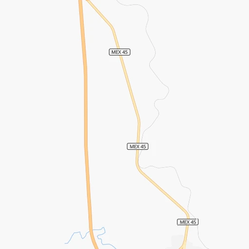
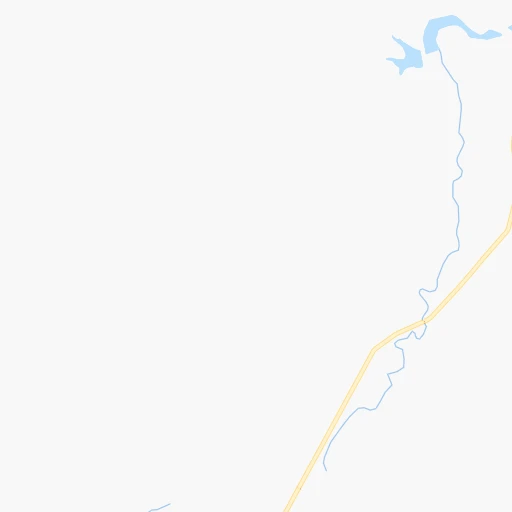
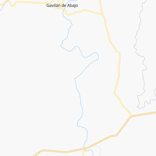
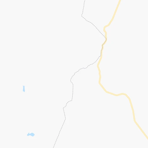
Roadmap (route) to go from El Tigre to Valle de Santiago detailed above, you can also see the course layout on the map.
While doing trip El Tigre - Valle de Santiago by car, the calculated route ends at a distance , or more straight.
Distance and duration of the route between El Tigre and Valle de Santiago
Calculation of distance and route from Valle de Santiago to El Tigre :
173.4193.3 km2h18mn
Continue 0h1mn 703 mTurn right 0h0mn 69 mTurn left 0h0mn 151 mTurn right 0h0mn 25 mTurn left 0h1mn 466 mTurn left onto Entronque Encarnación de Díaz - Autopista 45D 0h9mn 10.8 kmTurn right onto Mariscal José María González de H. 0h1mn 530 mTurn slight right onto Carretera San Juan de los Lagos - Encarnación de Díaz 0h2mn 1.9 kmTurn sharp left toward MEX 45D 1h50mn 83.4 kmKeep left onto Autopista de Peaje León-Salamanca 0h29mn 47.8 kmKeep right and take MEX 45 toward Irapuato 0h2mn 2.1 kmKeep left onto MEX 45 0h9mn 9.1 kmTurn right onto Calle José María Morelos 0h1mn 286 mTurn right onto Calle Emiliano Zapata 0h0mn 188 mTurn left onto Calle Benito Juárez 0h1mn 619 mTurn left onto Boulevard Solidaridad 0h14mn 17.0 kmKeep right and take MEX 43 toward Salamanca 0h0mn 400 mKeep right and take MEX 43 toward uriangato, morelia, valle de santiago 0h14mn 16.5 kmTurn right 0h0mn 139 mTurn slight right 0h0mn 65 mTurn sharp left onto Prolongación Libertad 0h0mn 35 mTurn sharp right onto Avenida Eufemio Arredondo 0h0mn 240 mTurn left onto Calle Petróleos 0h0mn 86 mAt roundabout, take exit 1 onto Calle Petróleos 0h0mn 43 mTurn right onto Calle Petróleos 0h0mn 247 mTurn right onto Calle Álvaro Obregón 0h0mn 66 mTurn left onto Calle J. María Magaña 0h0mn 234 mTurn right onto Calle Margarita Gertrudis Vargas 0h0mn 39 mArrive at destination 0h0mn 0 m
Travel from El Tigre (Guanajuato) to a selection of major cities.
Distances from El Tigre to biggest cities in Jalisco
- Nuevo Mexico,28,135 inhabitants.155 km
- Atotonilco el Alto,27,010 inhabitants.120 km
- Las Pintitas,26,500 inhabitants.159 km
- Sayula,25,312 inhabitants.237 km
- Tequila,25,283 inhabitants.183 km
- Teocaltiche,22,646 inhabitants.38 km
- El Salto,22,550 inhabitants.273 km
- Jalostotitlan,22,407 inhabitants.53 km
- San Miguel el Alto,22,204 inhabitants.65 km
- Zapotiltic,22,199 inhabitants.251 km
- Encarnacion de Diaz,21,861 inhabitants.8 km
- El Grullo,21,031 inhabitants.286 km
- Chapala,20,323 inhabitants.175 km
Other major cities in country :
- Coyoacan [09], 628,063 inhabitants. 408 km
- Santiago de Queretaro [22], 626,495 inhabitants. 224 km
- Saltillo [07], 621,250 inhabitants. 444 km
- Tlalpan [09], 607,545 inhabitants. 412 km
- Mexicali [02], 597,099 inhabitants. 1,791 km
- Hermosillo [26], 595,811 inhabitants. 1,211 km
- Morelia [16], 592,797 inhabitants. 239 km
- Veracruz [30], 568,313 inhabitants. 692 km
- Cancun [23], 542,043 inhabitants. 1,597 km
- Santa Maria Chimalhuacan [15], 525,389 inhabitants. 421 km
- Torreon [07], 524,066 inhabitants. 455 km
- Cuauhtemoc [09], 521,348 inhabitants. 403 km
- Ciudad Lopez Mateos [15], 521,034 inhabitants. 386 km
- Toluca [15], 505,881 inhabitants. 374 km
- Reynosa [28], 498,654 inhabitants. 641 km
- Tuxtla [05], 481,128 inhabitants. 1,101 km
- Cuautitlan Izcalli [15], 475,179 inhabitants. 384 km
- Victoria de Durango [10], 457,140 inhabitants. 366 km
- Heroica Matamoros [28], 449,815 inhabitants. 679 km
- Venustiano Carranza [09], 447,459 inhabitants. 406 km
Route from Valle de Santiago to major cities (Mexico).
- Distance Valle de Santiago Mexico City241 km
- Distance Valle de Santiago Iztapalapa251 km
- Distance Valle de Santiago Ecatepec de Morelos240 km
- Distance Valle de Santiago Guadalajara231 km
- Distance Valle de Santiago Puebla348 km
- Distance Valle de Santiago Juarez1,366 km
- Distance Valle de Santiago Tijuana2,069 km
- Distance Valle de Santiago Ciudad Nezahualcoyotl253 km
- Distance Valle de Santiago Gustavo Adolfo Madero240 km
- Distance Valle de Santiago Monterrey595 km
- Distance Valle de Santiago Zapopan232 km
- Distance Valle de Santiago Naucalpan de Juarez228 km
- Distance Valle de Santiago Chihuahua1,043 km
- Distance Valle de Santiago Alvaro Obregon238 km
- Distance Valle de Santiago Guadalupe596 km
- Distance Valle de Santiago Merida1,207 km
- Distance Valle de Santiago Tlalnepantla229 km
- Distance Valle de Santiago San Luis Potosi197 km
- Distance Valle de Santiago Culiacan803 km
- Distance Valle de Santiago Aguascalientes201 km
Nearest cities to El Tigre :
- Guadalajara, 1,640,589 inhabitants. 158 km
- Leon de los Aldama, 1,114,626 inhabitants. 79 km
- Zapopan, 987,516 inhabitants. 153 km
- San Luis Potosi, 677,704 inhabitants. 145 km
- Aguascalientes, 658,179 inhabitants. 32 km
- Santiago de Queretaro, 626,495 inhabitants. 224 km
- Morelia, 592,797 inhabitants. 239 km
- Ciudad Lopez Mateos, 521,034 inhabitants. 386 km
- Toluca, 505,881 inhabitants. 374 km
- Tlaquepaque, 493,646 inhabitants. 152 km
- Victoria de Durango, 457,140 inhabitants. 366 km
- Tonala, 401,509 inhabitants. 149 km
- Irapuato, 339,554 inhabitants. 138 km
- Celaya, 305,901 inhabitants. 191 km
- Tepic, 280,592 inhabitants. 274 km
- Nicolas Romero, 245,383 inhabitants. 376 km
- Uruapan, 237,308 inhabitants. 244 km
- Soledad de Graciano Sanchez, 194,006 inhabitants. 151 km
- Puerto Vallarta, 187,134 inhabitants. 328 km
- Delegacion Cuajimalpa de Morelos, 173,625 inhabitants. 396 km
- Metepec, 172,982 inhabitants. 380 km
- Salamanca, 138,614 inhabitants. 159 km
- Colima, 127,235 inhabitants. 304 km
- Zamora, 124,916 inhabitants. 180 km
- Huixquilucan, 124,846 inhabitants. 392 km
- Zacatecas, 118,562 inhabitants. 134 km
- San Juan del Rio, 118,173 inhabitants. 270 km
- Ciudad de Villa de Alvarez, 117,600 inhabitants. 303 km
- El Salto, 111,436 inhabitants. 154 km
- Manzanillo, 110,735 inhabitants. 352 km
- Fresnillo, 105,488 inhabitants. 187 km
- Ciudad Guzman, 101,010 inhabitants. 246 km
- Apatzingan, 98,422 inhabitants. 280 km
- Guadalupe, 94,089 inhabitants. 131 km
- Hacienda Santa Fe, 86,935 inhabitants. 168 km
- Lagos de Moreno, 84,677 inhabitants. 42 km
- Tepatitlan de Morelos, 83,694 inhabitants. 102 km
- Ocotlan, 81,527 inhabitants. 149 km
- Tecoman, 79,579 inhabitants. 344 km
- Heroica Zitacuaro, 78,950 inhabitants. 311 km
- Guanajuato, 78,364 inhabitants. 121 km
- La Piedad, 70,238 inhabitants. 142 km
- San Miguel de Allende, 69,811 inhabitants. 174 km
- San Mateo Atenco, 68,602 inhabitants. 384 km
- Matehuala, 67,717 inhabitants. 281 km
- San Francisco del Rincon, 66,949 inhabitants. 77 km
- Silao, 65,195 inhabitants. 112 km
- San Salvador Tizatlalli, 61,367 inhabitants. 380 km
- Valle de Santiago, 60,528 inhabitants. 174 km
- Dolores Hidalgo Cuna de la Independencia Nacional, 59,240 inhabitants. 145 km
Location El Tigre (Jalisco) :
| Country flag |  |
| Location | El Tigre |
| State | Jalisco |
| County | Encarnación de Díaz |
| Country | Mexico |
| Country code / ISO 2 | MX |
| Latitude | 21.6000000 |
| Longitude | -102.2500000 |
| Altitude | 0 meters |
| Time zone | America/Mexico_City |
Location Valle de Santiago (Guanajuato) :
| Country flag | |
| Location | Valle de Santiago |
| State | Guanajuato |
| County | Valle de Santiago |
| Country | Mexico |
| Country code / ISO 2 | MX |
| Latitude | 20.3914000 |
| Longitude | -101.1922200 |
| Altitude | 0 meters |
| Time zone | America/Mexico_City |
