

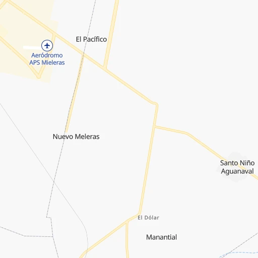


How to get from Mieleras (Coahuila) to San Miguel de Papasquiaro (Durango)
Calculate route from Mieleras (Coahuila, Mexico) to San Miguel de Papasquiaro (Durango, Mexico).
The flight distance (as the crow flies) between Mieleras and San Miguel de Papasquiaro is 211.2 km.
Roadmap (route) to go from Mieleras to San Miguel de Papasquiaro detailed above, you can also see the course layout on the map.
While doing trip Mieleras - San Miguel de Papasquiaro by car, the calculated route ends at a distance , or more straight.
Distance and duration of the route between Mieleras and San Miguel de Papasquiaro
Calculation of distance and route from San Miguel de Papasquiaro to Mieleras :
211.2372.3 km6h6mn
Continue 0h4mn 1.8 kmTurn sharp left 0h6mn 3.2 kmTurn right onto Ramal a El Esterito 0h28mn 24.9 kmTurn right onto Calle Golondrina 0h1mn 597 mTurn left onto Calle Golondrina 0h1mn 714 mTurn left 0h0mn 219 mTurn right 0h0mn 289 mTurn left onto Carretera Gómez Palacio-La Unión 0h3mn 3.6 kmContinue onto Carretera Gómez Palacio-La Unión 0h5mn 5.7 kmKeep right 0h19mn 16.0 kmTurn left onto Carretera Gómez Palacio-Cuencamé 0h13mn 17.2 kmKeep right and take MEX 40D, MEX 49D toward Durango, Zacatecas 0h27mn 48.6 kmKeep right 0h0mn 567 mTurn slight right onto Peñón Blanco - Yerbanis 1h46mn 45.5 kmTurn left onto San Juan del Rio del centaurio del Norte - Peñón Blanco 1h41mn 40.9 kmTurn right onto San Juan del Rio del Centaurio del Norte - Peñón Blanco 0h0mn 436 mContinue onto Calle Baluarte 0h2mn 1.3 kmTurn right onto Calle Felipe Ángeles 0h7mn 3.9 kmTurn slight right onto Carretera La Zarca-Durango 0h1mn 1.9 kmTurn left onto Ramal a Coneto de Comonfort 1h39mn 34.9 kmTurn left 0h10mn 8.1 kmTurn left 0h0mn 102 mTurn right 0h5mn 4.1 kmTurn left 0h0mn 201 mTurn right 0h6mn 4.7 kmTurn right 0h11mn 8.9 kmTurn sharp right onto Calle Agustín de Iturbide 0h1mn 616 mTurn right onto Calle López Mateos 0h1mn 552 mTurn right onto Carretera Guanaceví-Durango 1h55mn 64.1 kmKeep left 0h0mn 56 mTurn left onto Calle Ferrocarril 0h0mn 105 mTurn right 0h0mn 44 mTurn left onto Avenida Ferrocarril 0h2mn 1.3 kmTurn right onto Calle Azteca 0h0mn 243 mTurn left onto Calle Pino Suárez 0h19mn 16.2 kmTurn right 0h12mn 10.4 kmTurn left 0h0mn 92 mArrive at destination 0h0mn 0 m
Travel from Mieleras (Durango) to a selection of major cities.
Distances from Mieleras to biggest cities in Coahuila
Other major cities in country :
- Aguascalientes [01], 658,179 inhabitants. 410 km
- Acapulco de Juarez [12], 652,136 inhabitants. 1,020 km
- Coyoacan [09], 628,063 inhabitants. 803 km
- Santiago de Queretaro [22], 626,495 inhabitants. 619 km
- Tlalpan [09], 607,545 inhabitants. 808 km
- Mexicali [02], 597,099 inhabitants. 1,423 km
- Hermosillo [26], 595,811 inhabitants. 858 km
- Morelia [16], 592,797 inhabitants. 676 km
- Veracruz [30], 568,313 inhabitants. 1,017 km
- Cancun [23], 542,043 inhabitants. 1,751 km
- Santa Maria Chimalhuacan [15], 525,389 inhabitants. 808 km
- Cuauhtemoc [09], 521,348 inhabitants. 795 km
- Ciudad Lopez Mateos [15], 521,034 inhabitants. 778 km
- Toluca [15], 505,881 inhabitants. 783 km
- Reynosa [28], 498,654 inhabitants. 512 km
- Tlaquepaque [14], 493,646 inhabitants. 534 km
- Tuxtla [05], 481,128 inhabitants. 1,435 km
- Cuautitlan Izcalli [15], 475,179 inhabitants. 772 km
- Victoria de Durango [10], 457,140 inhabitants. 206 km
- Heroica Matamoros [28], 449,815 inhabitants. 588 km
Route from San Miguel de Papasquiaro to major cities (Mexico).
- Distance San Miguel de Papasquiaro Mexico City878 km
- Distance San Miguel de Papasquiaro Iztapalapa889 km
- Distance San Miguel de Papasquiaro Ecatepec de Morelos870 km
- Distance San Miguel de Papasquiaro Guadalajara505 km
- Distance San Miguel de Papasquiaro Puebla979 km
- Distance San Miguel de Papasquiaro Juarez775 km
- Distance San Miguel de Papasquiaro Tijuana1,422 km
- Distance San Miguel de Papasquiaro Ciudad Nezahualcoyotl889 km
- Distance San Miguel de Papasquiaro Gustavo Adolfo Madero874 km
- Distance San Miguel de Papasquiaro Monterrey514 km
- Distance San Miguel de Papasquiaro Leon de los Aldama557 km
- Distance San Miguel de Papasquiaro Zapopan499 km
- Distance San Miguel de Papasquiaro Naucalpan de Juarez866 km
- Distance San Miguel de Papasquiaro Chihuahua430 km
- Distance San Miguel de Papasquiaro Alvaro Obregon878 km
- Distance San Miguel de Papasquiaro Guadalupe520 km
- Distance San Miguel de Papasquiaro Merida1,667 km
- Distance San Miguel de Papasquiaro Tlalnepantla864 km
- Distance San Miguel de Papasquiaro San Luis Potosi536 km
- Distance San Miguel de Papasquiaro Culiacan207 km
Nearest cities to Mieleras :
- Saltillo, 621,250 inhabitants. 235 km
- Torreon, 524,066 inhabitants. 14 km
- Victoria de Durango, 457,140 inhabitants. 206 km
- Santa Catarina, 254,472 inhabitants. 291 km
- Gomez Palacio, 228,577 inhabitants. 21 km
- Monclova, 195,764 inhabitants. 253 km
- San Pedro Garza Garcia, 130,646 inhabitants. 296 km
- San Pedro Garza Garcia, 122,009 inhabitants. 297 km
- Zacatecas, 118,562 inhabitants. 307 km
- Fresnillo, 105,488 inhabitants. 256 km
- Matamoros, 104,024 inhabitants. 16 km
- Ciudad Delicias, 102,969 inhabitants. 372 km
- Parral, 101,768 inhabitants. 285 km
- Guadalupe, 94,089 inhabitants. 311 km
- Matehuala, 67,717 inhabitants. 338 km
- Frontera, 64,976 inhabitants. 252 km
- Ciudad Lerdo, 63,530 inhabitants. 21 km
- Sabinas, 49,199 inhabitants. 349 km
- Jerez de Garcia Salinas, 43,064 inhabitants. 312 km
- San Pedro, 41,165 inhabitants. 13 km
- Ramos Arizpe, 38,258 inhabitants. 241 km
- Camargo, 37,743 inhabitants. 309 km
- Nueva Rosita, 36,642 inhabitants. 350 km
- Ciudad Melchor Muzquiz, 32,799 inhabitants. 327 km
- Victor Rosales, 32,721 inhabitants. 285 km
- Parras de la Fuente, 32,253 inhabitants. 117 km
- Jimenez, 31,054 inhabitants. 381 km
- Rio Grande, 29,841 inhabitants. 182 km
- Escuinapa, 28,248 inhabitants. 381 km
- Garcia, 26,950 inhabitants. 279 km
- Santiago Papasquiaro, 26,121 inhabitants. 213 km
- San Miguel de Papasquiaro, 22,750 inhabitants. 212 km
- Meoqui, 21,179 inhabitants. 380 km
- Castanos, 20,809 inhabitants. 244 km
- Allende, 19,636 inhabitants. 407 km
- Pueblo Nuevo, 19,363 inhabitants. 308 km
- San Buenaventura, 18,822 inhabitants. 255 km
- Sombrerete, 18,805 inhabitants. 203 km
- Nava, 18,639 inhabitants. 419 km
- Acaponeta, 18,564 inhabitants. 387 km
- Parque Industrial Ciudad Mitras, 18,312 inhabitants. 294 km
- Mitras Poniente, 18,246 inhabitants. 296 km
- Palau, 16,904 inhabitants. 334 km
- Vicente Guerrero, 14,559 inhabitants. 200 km
- Ciudad Guadalupe Victoria, 14,269 inhabitants. 135 km
- Juan Aldama, 14,162 inhabitants. 128 km
- Salinas de Hidalgo, 13,973 inhabitants. 354 km
- Villa Union, 13,683 inhabitants. 384 km
- Miguel Auza, 12,685 inhabitants. 128 km
- Charcas, 11,365 inhabitants. 343 km
Location Mieleras (Coahuila) :
| Country flag |  |
| Location | Mieleras |
| State | Coahuila |
| County | Torreón |
| Country | Mexico |
| Country code / ISO 2 | MX |
| Latitude | 25.4366900 |
| Longitude | -103.3468800 |
| Altitude | 0 meters |
| Time zone | America/Monterrey |
Location San Miguel de Papasquiaro (Durango) :
| Country flag | |
| Location | San Miguel de Papasquiaro |
| State | Durango |
| County | Santiago Papasquiaro |
| Country | Mexico |
| Country code / ISO 2 | MX |
| Latitude | 24.8307800 |
| Longitude | -105.3364000 |
| Altitude | 0 meters |
| Time zone | America/Monterrey |