


How to get from Turicachi (Sonora) to Ascención (Chihuahua)
Calculate route from Turicachi (Sonora, Mexico) to Ascención (Chihuahua, Mexico).
The flight distance (as the crow flies) between Turicachi and Ascención is 153.8 km.
Roadmap (route) to go from Turicachi to Ascención detailed above, you can also see the course layout on the map.
While doing trip Turicachi - Ascención by car, the calculated route ends at a distance , or more straight.
Distance and duration of the route between Turicachi and Ascención
Calculation of distance and route from Ascención to Turicachi :
153.8272.2 km4h9mn
Continue 0h7mn 3.7 kmKeep right 0h4mn 2.2 kmTurn right 0h0mn 31 mTurn left 0h0mn 111 mTurn right 0h1mn 382 mTurn slight right 0h0mn 36 mTurn slight right 0h1mn 492 mTurn right onto Avenida José María Morelos y Pavón 1h5mn 68.8 kmTurn right onto Boulevard Los Apson 0h2mn 1.7 kmTurn left onto 2da Avenida Industrial 0h1mn 741 mTurn right onto Carretera Agua Prieta-Ascensión 2h17mn 160.4 kmTurn left onto Juan Aldama 0h26mn 30.6 kmTurn right onto Calle Trigo 0h0mn 327 mTurn left onto Calle Morelos 0h2mn 1.5 kmTurn right onto Calle Colima 0h1mn 328 mTurn left onto Calle Paseo de La Mesilla 0h1mn 283 mTurn right onto Calle Apolonio Varela 0h1mn 503 mArrive at destination 0h0mn 0 m
Travel from Turicachi (Chihuahua) to a selection of major cities.
Distances from Turicachi to biggest cities in Sonora
Other major cities in country :
- Aguascalientes [01], 658,179 inhabitants. 1,220 km
- Acapulco de Juarez [12], 652,136 inhabitants. 1,827 km
- Coyoacan [09], 628,063 inhabitants. 1,640 km
- Santiago de Queretaro [22], 626,495 inhabitants. 1,452 km
- Saltillo [07], 621,250 inhabitants. 1,024 km
- Tlalpan [09], 607,545 inhabitants. 1,645 km
- Mexicali [02], 597,099 inhabitants. 600 km
- Morelia [16], 592,797 inhabitants. 1,486 km
- Veracruz [30], 568,313 inhabitants. 1,861 km
- Cancun [23], 542,043 inhabitants. 2,500 km
- Santa Maria Chimalhuacan [15], 525,389 inhabitants. 1,647 km
- Torreon [07], 524,066 inhabitants. 831 km
- Cuauhtemoc [09], 521,348 inhabitants. 1,632 km
- Ciudad Lopez Mateos [15], 521,034 inhabitants. 1,615 km
- Toluca [15], 505,881 inhabitants. 1,614 km
- Reynosa [28], 498,654 inhabitants. 1,215 km
- Tlaquepaque [14], 493,646 inhabitants. 1,284 km
- Tuxtla [05], 481,128 inhabitants. 2,278 km
- Cuautitlan Izcalli [15], 475,179 inhabitants. 1,610 km
- Victoria de Durango [10], 457,140 inhabitants. 887 km
Route from Ascención to major cities (Mexico).
- Distance Ascención Mexico City1,574 km
- Distance Ascención Iztapalapa1,585 km
- Distance Ascención Ecatepec de Morelos1,562 km
- Distance Ascención Guadalajara1,249 km
- Distance Ascención Puebla1,664 km
- Distance Ascención Tijuana867 km
- Distance Ascención Ciudad Nezahualcoyotl1,583 km
- Distance Ascención Gustavo Adolfo Madero1,569 km
- Distance Ascención Monterrey963 km
- Distance Ascención Leon de los Aldama1,276 km
- Distance Ascención Zapopan1,243 km
- Distance Ascención Naucalpan de Juarez1,563 km
- Distance Ascención Alvaro Obregon1,576 km
- Distance Ascención Guadalupe968 km
- Distance Ascención Merida2,150 km
- Distance Ascención Tlalnepantla1,560 km
- Distance Ascención San Luis Potosi1,215 km
- Distance Ascención Culiacan705 km
- Distance Ascención Aguascalientes1,172 km
- Distance Ascención Acapulco de Juarez1,785 km
Nearest cities to Turicachi :
- Hermosillo, 595,811 inhabitants. 227 km
- Nogales, 185,882 inhabitants. 150 km
- Heroica Guaymas, 103,449 inhabitants. 338 km
- Cuauhtemoc, 90,835 inhabitants. 364 km
- Agua Prieta, 77,254 inhabitants. 68 km
- Heroica Caborca, 52,896 inhabitants. 251 km
- Nuevo Casas Grandes, 51,356 inhabitants. 159 km
- Empalme, 38,599 inhabitants. 331 km
- Cananea, 33,433 inhabitants. 78 km
- Miguel Aleman (La Doce), 30,869 inhabitants. 281 km
- Magdalena de Kino, 23,359 inhabitants. 137 km
- Madera, 16,087 inhabitants. 216 km
- Nacozari Viejo, 11,872 inhabitants. 37 km
- Ascencion, 11,781 inhabitants. 154 km
- Anahuac, 10,696 inhabitants. 367 km
- Santa Ana, 10,277 inhabitants. 153 km
- Adolfo Lopez Mateos, 8,770 inhabitants. 331 km
- San Buenaventura, 6,168 inhabitants. 222 km
- Benito Juarez, 6,138 inhabitants. 188 km
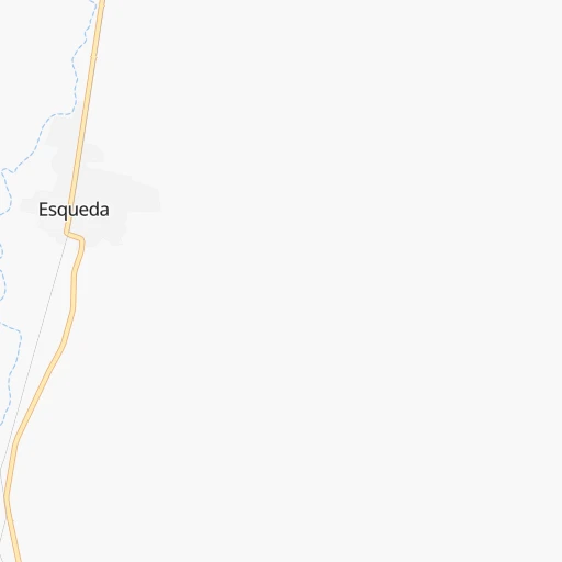
- Esqueda, 6,119 inhabitants. 5 km
- Imuris, 6,117 inhabitants. 126 km
- Bahia de Kino, 6,050 inhabitants. 314 km
- Ejido Benito Juarez, 5,778 inhabitants. 262 km
- Benjamin Hill, 5,735 inhabitants. 163 km
- Pesqueira, 5,699 inhabitants. 198 km
- Puerto Palomas, 5,659 inhabitants. 216 km
- Valentin Gomez Farias, 5,404 inhabitants. 399 km
- Naco, 5,193 inhabitants. 79 km
- Pitiquito, 5,157 inhabitants. 241 km
- Creel, 5,011 inhabitants. 378 km
- Ejido El Largo, 4,964 inhabitants. 168 km
- La Providencia, 4,916 inhabitants. 298 km
- Ures, 4,199 inhabitants. 165 km
- Casas Grandes, 4,124 inhabitants. 156 km
- Sahuaripa, 4,038 inhabitants. 187 km
- Moctezuma, 4,028 inhabitants. 102 km
- Ignacio Zaragoza, 3,455 inhabitants. 342 km
Location Turicachi (Sonora) :
| Country flag |  |
| Location | Turicachi |
| State | Sonora |
| County | Fronteras |
| Country | Mexico |
| Country code / ISO 2 | MX |
| Latitude | 30.7166700 |
| Longitude | -109.5333300 |
| Altitude | 0 meters |
| Time zone | America/Hermosillo |
Location Ascención (Chihuahua) :
| Country flag | |
| Location | Ascención |
| State | Chihuahua |
| County | Ascensión |
| Country | Mexico |
| Country code / ISO 2 | MX |
| Latitude | 31.1000000 |
| Longitude | -107.9833300 |
| Altitude | 0 meters |
| Time zone | America/Chihuahua |