


How to get from Estación Cartagena (Valparaíso) to Coronel (Biobío)
Calculate route from Estación Cartagena (Valparaíso, Chile) to Coronel (Biobío, Chile).
The flight distance (as the crow flies) between Estación Cartagena and Coronel is 410.9 km.
Roadmap (route) to go from Estación Cartagena to Coronel detailed above, you can also see the course layout on the map.
While doing trip Estación Cartagena - Coronel by car, the calculated route ends at a distance , or more straight.
Distance and duration of the route between Estación Cartagena and Coronel
Calculation of distance and route from Coronel to Estación Cartagena :
410.9544.1 km6h24mn
Continue onto Luis Enrique Delano 0h0mn 98 mTurn right onto La Marina 0h0mn 104 mTurn right onto Avenida San Martín 0h0mn 93 mKeep left onto Antiguo Camino a San Antonio 0h2mn 1.1 kmTurn right onto Avenida Manuel Bulnes 0h2mn 1.5 kmTurn right 0h0mn 28 mTurn left onto Mártires del Mar 0h1mn 626 mContinue onto Mártires del Mar 0h0mn 75 mTurn left onto Enrique Rosales 0h0mn 62 mTurn right onto Camilo Henríquez 0h0mn 58 mTurn sharp left onto Avenida Arturo Prat Chacón 0h1mn 654 mTurn right onto Pedro Montt 0h3mn 3.4 kmTurn left 0h0mn 210 mKeep right onto Avenida Divina Providencia 0h2mn 1.4 kmTurn right onto Avenida Chile 0h1mn 359 mContinue onto Ruta de la Fruta 0h2mn 1.5 kmTurn sharp left 0h1mn 1.1 kmTurn right onto Las Higueras 0h1mn 450 mTurn left onto Ruta de la Fruta 2h37mn 115.0 kmKeep right onto Entrada a San Vicente 0h18mn 19.6 kmAt roundabout, take exit 2 onto Caletera 5 Sur 0h0mn 139 mKeep left and take 5 toward Curicó 0h17mn 29.0 kmContinue onto Ruta 5 Sur 1h35mn 58.4 kmKeep left onto Ruta 5 Sur 1h0mn 102.4 kmContinue onto Ruta 5 Sur 1h52mn 90.8 kmKeep right toward 152 1h52mn 79.3 kmTurn sharp left toward 164 0h1mn 321 mTurn slight right onto Avenida Jorge Alessandri 0h3mn 3.3 kmAt roundabout, take exit 2 onto Avenida Jorge Alessandri 0h8mn 7.8 kmKeep right and take 160 toward Coronel, Lebu 0h2mn 1.8 kmKeep right and drive toward San Pedro del Valle, Colegio San Ignacio, Bayona, Centro Comercial 0h0mn 108 mTurn right onto Ruta 160 0h0mn 138 mKeep left onto Ruta 160 0h14mn 14.9 kmKeep right and drive toward Coronel 0h0mn 201 mKeep right and drive toward Coronel 0h8mn 7.7 kmTurn left onto Lota 0h1mn 462 mArrive at destination 0h0mn 0 m
Travel from Estación Cartagena (Biobío) to a selection of major cities.
Distances from Estación Cartagena to biggest cities in Valparaíso
Other major cities in country :
- Los Angeles [06], 125,430 inhabitants. 441 km
- Punta Arenas [10], 117,430 inhabitants. 2,183 km
- Lo Prado [12], 104,316 inhabitants. 83 km
- Curico [11], 102,438 inhabitants. 163 km
- Coronel [06], 92,940 inhabitants. 412 km
- Chiguayante [06], 82,545 inhabitants. 397 km
- Ovalle [07], 77,138 inhabitants. 331 km
- Linares [11], 69,535 inhabitants. 255 km
- Penaflor [12], 65,495 inhabitants. 69 km
- Melipilla [12], 63,100 inhabitants. 40 km
- Buin [12], 55,441 inhabitants. 83 km
- Talagante [12], 51,764 inhabitants. 65 km
Route from Coronel to major cities (Chile).
- Distance Coronel Santiago458 km
- Distance Coronel Puente Alto446 km
- Distance Coronel Antofagasta1,513 km
- Distance Coronel Vina del Mar469 km
- Distance Coronel Valparaiso466 km
- Distance Coronel San Bernardo443 km
- Distance Coronel Temuco196 km
- Distance Coronel Iquique1,895 km
- Distance Coronel Rancagua385 km
- Distance Coronel La Pintana446 km
- Distance Coronel Talca223 km
- Distance Coronel Arica2,085 km
- Distance Coronel Coquimbo806 km
- Distance Coronel Puerto Montt494 km
- Distance Coronel La Serena813 km
- Distance Coronel Calama1,673 km
- Distance Coronel Osorno394 km
- Distance Coronel Valdivia310 km
- Distance Coronel Quilpue470 km
- Distance Coronel Copiapo1,108 km
Nearest cities to Estación Cartagena :
- Santiago, 4,837,295 inhabitants. 90 km
- Puente Alto, 510,417 inhabitants. 96 km
- Vina del Mar, 294,551 inhabitants. 59 km
- Valparaiso, 282,448 inhabitants. 57 km
- San Bernardo, 249,858 inhabitants. 85 km
- Rancagua, 212,695 inhabitants. 106 km
- La Pintana, 201,178 inhabitants. 91 km
- Talca, 197,479 inhabitants. 209 km
- Quilpue, 130,263 inhabitants. 58 km
- Lo Prado, 104,316 inhabitants. 83 km
- Curico, 102,438 inhabitants. 163 km
- Villa Alemana, 97,320 inhabitants. 61 km
- San Antonio, 85,651 inhabitants. 5 km
- Ovalle, 77,138 inhabitants. 331 km
- Linares, 69,535 inhabitants. 255 km
- Quillota, 67,779 inhabitants. 82 km
- Penaflor, 65,495 inhabitants. 69 km
- Melipilla, 63,100 inhabitants. 40 km
- San Felipe, 59,294 inhabitants. 122 km
- Los Andes, 56,859 inhabitants. 124 km
- Buin, 55,441 inhabitants. 83 km
- Talagante, 51,764 inhabitants. 65 km
- Hacienda La Calera, 49,106 inhabitants. 93 km
- Rengo, 38,100 inhabitants. 118 km
- Constitucion, 37,917 inhabitants. 211 km
- Limache, 35,876 inhabitants. 68 km
- Santa Cruz, 33,283 inhabitants. 123 km
- Paine, 32,766 inhabitants. 86 km
- San Carlos, 31,517 inhabitants. 321 km
- Cauquenes, 31,362 inhabitants. 277 km
- San Vicente de Tagua Tagua, 29,560 inhabitants. 110 km
- Lampa, 29,250 inhabitants. 75 km
- Molina, 28,775 inhabitants. 177 km
- Machali, 27,595 inhabitants. 113 km
- Parral, 26,904 inhabitants. 289 km
- La Ligua, 24,857 inhabitants. 127 km
- Graneros, 23,301 inhabitants. 100 km
- El Monte, 23,090 inhabitants. 60 km
- Illapel, 22,816 inhabitants. 218 km
- San Vicente, 22,572 inhabitants. 110 km
- San Javier, 22,427 inhabitants. 228 km
- Chicureo Abajo, 18,000 inhabitants. 94 km
- Chimbarongo, 17,356 inhabitants. 139 km
- Cartagena, 16,875 inhabitants. 1 km
- Llaillay, 16,646 inhabitants. 100 km
- Villa Presidente Frei, Nunoa, Santiago, Chile, 15,000 inhabitants. 96 km
- Monte Patria, 13,945 inhabitants. 324 km
- San Clemente, 13,656 inhabitants. 221 km
- Salamanca, 13,265 inhabitants. 206 km
- Rauco, 8,566 inhabitants. 155 km
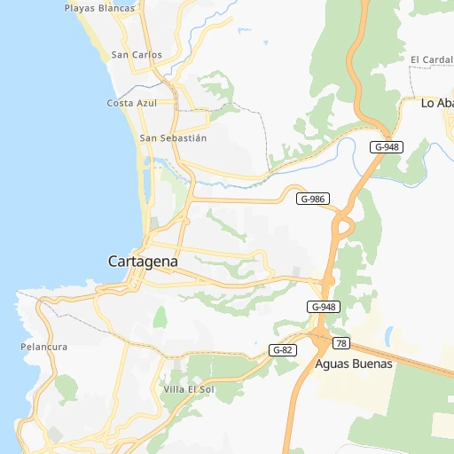
Location Estación Cartagena (Valparaíso) :
| Country flag |  |
| Location | Estación Cartagena |
| State | Valparaíso |
| County | San Antonio Province |
| Country | Chile |
| Country code / ISO 2 | CL |
| Latitude | -33.5519300 |
| Longitude | -71.6129700 |
| Altitude | 0 meters |
| Time zone | America/Santiago |
Location Coronel (Biobío) :
| Country flag | |
| Location | Coronel |
| State | Biobío |
| County | Provincia de Concepción |
| Country | Chile |
| Country code / ISO 2 | CL |
| Latitude | -37.0338600 |
| Longitude | -73.1401900 |
| Altitude | 0 meters |
| Time zone | America/Santiago |