
How to get from Estación Ylpa (Puno) to Ilabaya (Tacna)
Calculate route from Estación Ylpa (Puno, Peru) to Ilabaya (Tacna, Peru).
The flight distance (as the crow flies) between Estación Ylpa and Ilabaya is 199.9 km.
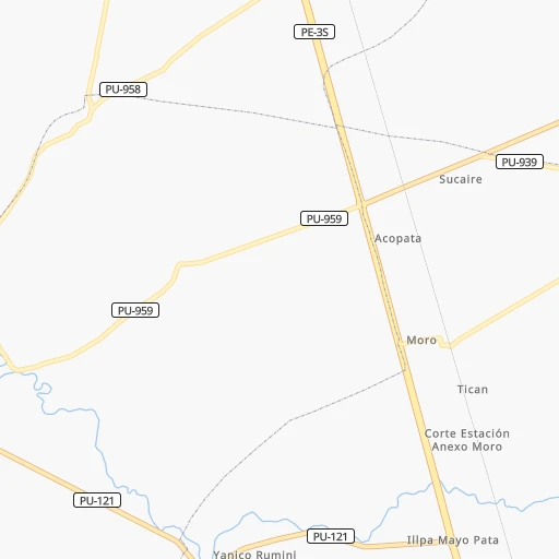
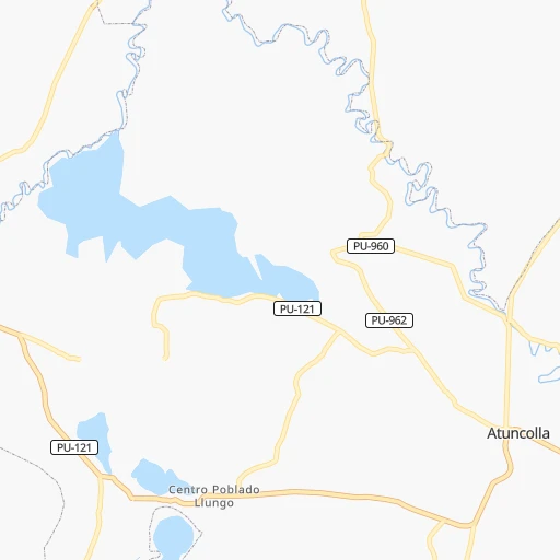
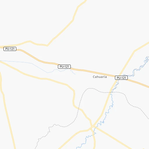
Roadmap (route) to go from Estación Ylpa to Ilabaya detailed above, you can also see the course layout on the map.
While doing trip Estación Ylpa - Ilabaya by car, the calculated route ends at a distance , or more straight.
Distance and duration of the route between Estación Ylpa and Ilabaya
Calculation of distance and route from Ilabaya to Estación Ylpa :
199.9296.9 km5h18mn
Continue 0h1mn 1.1 kmTurn right onto Carretera Longitudinal de la Sierra Sur 0h2mn 2.4 kmTurn left onto Carretera Atuncolla - Huatta 0h0mn 17 mTurn left onto Avenida Circunvalación 0h14mn 9.7 kmAt roundabout, take exit 2 onto Carretera Longitudinal de la Sierra Sur 0h1mn 1.3 kmAt roundabout, take exit 3 onto Carretera Longitudinal de la Sierra Sur 0h10mn 9.2 kmTurn sharp right onto PU-122 0h0mn 18 mTurn left 0h0mn 350 mTurn right onto Avenida Juliaca 0h1mn 587 mTurn left onto Jirón Kolles 0h0mn 132 mTurn right onto Jirón Hermilio Valdizán 0h0mn 215 mTurn slight right 0h0mn 72 mTurn left onto Avenida Alto de la Alianza 0h0mn 47 mTurn sharp right onto Jirón Cacique Andrés Ingaricona 0h0mn 105 mTurn left onto Pasaje Limbani 0h0mn 41 mTurn right onto Jirón José Sabogal 0h0mn 28 mTurn slight left onto Jirón 2 de Mayo 0h0mn 45 mTurn right onto Jirón 2 de Mayo 0h0mn 26 mKeep left onto Jirón 2 de Mayo 0h0mn 84 mTurn slight left onto Avenida La Torre 0h1mn 1.3 kmTurn left onto Jirón Cahuide 0h0mn 43 mKeep right onto Jirón Cahuide 0h0mn 432 mTurn right onto Avenida El Sol 0h0mn 132 mAt roundabout, take exit 2 onto Avenida El Sol 0h1mn 1.3 kmTurn right 0h0mn 89 mTurn left onto Jirón Leoncio Prado 0h6mn 6.9 kmKeep right onto PE-36B 2h4mn 149.3 kmKeep left onto Interoceánica 0h0mn 119 mContinue onto Carretera Binacional 0h17mn 19.3 kmTurn right onto Carretera Suches - Toquepala 0h12mn 6.0 kmKeep left 0h0mn 114 mTurn left onto TA-504 0h6mn 3.2 kmTurn right onto TA-505 0h9mn 7.9 kmTurn slight right onto TA-103 1h40mn 19.8 kmTurn right onto TA-512 0h9mn 7.6 kmKeep right onto TA-517 0h9mn 7.1 kmTurn right onto TA-524 0h5mn 5.0 kmTurn left onto TA-524 0h0mn 39 mContinue onto TA-518 0h5mn 3.8 kmTurn right 0h1mn 691 mTurn slight right onto TA-517 0h6mn 4.6 kmKeep right onto TA-517 0h17mn 8.9 kmTurn slight left onto TA-515 0h18mn 17.9 kmTurn right onto Calle Tacna 0h0mn 26 mArrive at destination 0h0mn 0 m
Travel from Estación Ylpa (Tacna) to a selection of major cities.
Distances from Estación Ylpa to biggest cities in Puno
Other major cities in country :
- Talara [20], 99,074 inhabitants. 1,740 km
- Chosica [15], 88,606 inhabitants. 830 km
- Huaraz [02], 86,934 inhabitants. 1,061 km
- Cerro de Pasco [19], 78,910 inhabitants. 872 km
- Chulucanas [20], 68,835 inhabitants. 1,614 km
- San Isidro [15], 68,309 inhabitants. 852 km
- Huaral [15], 62,174 inhabitants. 902 km
- Pisco [11], 61,869 inhabitants. 696 km
- Catacaos [20], 57,304 inhabitants. 1,640 km
- Paita [20], 56,151 inhabitants. 1,687 km
- Abancay [03], 55,111 inhabitants. 379 km
- Huacho [15], 54,545 inhabitants. 962 km
- Moquegua [18], 54,517 inhabitants. 193 km
- Ilo [18], 53,476 inhabitants. 257 km
- Tingo Maria [10], 53,177 inhabitants. 959 km
- Jaen [06], 52,493 inhabitants. 1,464 km
- Tarma [12], 51,350 inhabitants. 771 km
Route from Ilabaya to major cities (Peru).
- Distance Ilabaya Lima922 km
- Distance Ilabaya Arequipa157 km
- Distance Ilabaya Callao928 km
- Distance Ilabaya Trujillo1,388 km
- Distance Ilabaya Chiclayo1,560 km
- Distance Ilabaya Iquitos1,551 km
- Distance Ilabaya Huancayo781 km
- Distance Ilabaya Piura1,751 km
- Distance Ilabaya Chimbote1,274 km
- Distance Ilabaya Cusco461 km
- Distance Ilabaya Pucallpa1,098 km
- Distance Ilabaya Santiago de Surco913 km
- Distance Ilabaya Ica672 km
- Distance Ilabaya Juliaca218 km
- Distance Ilabaya Sullana1,780 km
- Distance Ilabaya Chincha Alta750 km
- Distance Ilabaya Huanuco1,039 km
- Distance Ilabaya Ayacucho619 km
- Distance Ilabaya Cajamarca1,434 km
- Distance Ilabaya Puno183 km
Nearest cities to Estación Ylpa :
- Arequipa, 841,130 inhabitants. 177 km
- Cusco, 312,140 inhabitants. 315 km
- Tacna, 280,098 inhabitants. 261 km
- Juliaca, 245,675 inhabitants. 21 km
- Puno, 116,552 inhabitants. 19 km
- Abancay, 55,111 inhabitants. 379 km
- Moquegua, 54,517 inhabitants. 193 km
- Ilo, 53,476 inhabitants. 257 km
- Sicuani, 33,575 inhabitants. 200 km
- La Rinconada, 29,678 inhabitants. 134 km
- Mollendo, 28,953 inhabitants. 257 km
- Santa Ana, 25,145 inhabitants. 424 km
- Ayaviri, 19,310 inhabitants. 104 km
- Camana, 16,434 inhabitants. 302 km
- Yunguyo, 16,140 inhabitants. 123 km
- Ilave, 16,033 inhabitants. 62 km
- Azangaro, 13,290 inhabitants. 86 km
- Atuncolla, 12,654 inhabitants. 9 km
- Ilabaya, 9,492 inhabitants. 200 km
- Calca, 9,179 inhabitants. 330 km
- Cocachacra, 8,799 inhabitants. 240 km
- Putina, 8,118 inhabitants. 71 km
- Hacienda Huancane, 7,831 inhabitants. 89 km
- Pacocha, 7,588 inhabitants. 258 km
- Urubamba, 7,540 inhabitants. 344 km
- Juli, 7,309 inhabitants. 89 km
- Torata, 7,054 inhabitants. 177 km
- Punta de Bombon, 6,336 inhabitants. 249 km
- Macusani, 6,044 inhabitants. 181 km
- Lluta, 5,998 inhabitants. 212 km
- Anta, 5,859 inhabitants. 332 km
- Yura, 5,686 inhabitants. 184 km
- Orcopampa, 5,643 inhabitants. 248 km
- Urcos, 5,479 inhabitants. 278 km
- Desaguadero, 5,329 inhabitants. 148 km
- Lampa, 4,780 inhabitants. 48 km
- Llongasora, 4,753 inhabitants. 132 km
- Huarancante, 4,638 inhabitants. 150 km
- Chivay, 4,543 inhabitants. 165 km
- Mosoc Cancha, 4,450 inhabitants. 190 km
- Huarichancara, 4,445 inhabitants. 107 km
- Vizcachane, 4,407 inhabitants. 123 km
- Jatun Orcochiri, 4,358 inhabitants. 138 km
- Pucara, 4,335 inhabitants. 153 km
- Santa Lucia, 4,320 inhabitants. 58 km
- Huayna Alcalde, 4,298 inhabitants. 192 km
- Nunoa, 4,271 inhabitants. 147 km
- Jayune, 4,256 inhabitants. 133 km
- Chuquitira, 4,220 inhabitants. 180 km
- Santo Tomas, 4,134 inhabitants. 257 km
Location Estación Ylpa (Puno) :
| Country flag |  |
| Location | Estación Ylpa |
| State | Puno |
| County | Provincia de Puno |
| Country | Peru |
| Country code / ISO 2 | PE |
| Latitude | -15.6742400 |
| Longitude | -70.0649700 |
| Altitude | 0 meters |
| Time zone | America/Lima |
Location Ilabaya (Tacna) :
| Country flag | |
| Location | Ilabaya |
| State | Tacna |
| County | Jorge Basadre |
| Country | Peru |
| Country code / ISO 2 | PE |
| Latitude | -17.4208300 |
| Longitude | -70.5133300 |
| Altitude | 0 meters |
| Time zone | America/Lima |