
How to get from Punata (Cochabamba) to Comarapa (Santa Cruz)
Calculate route from Punata (Cochabamba, Bolivia) to Comarapa (Santa Cruz, Bolivia).
The flight distance (as the crow flies) between Punata and Comarapa is 144.0 km.
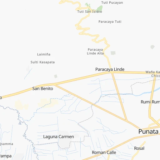
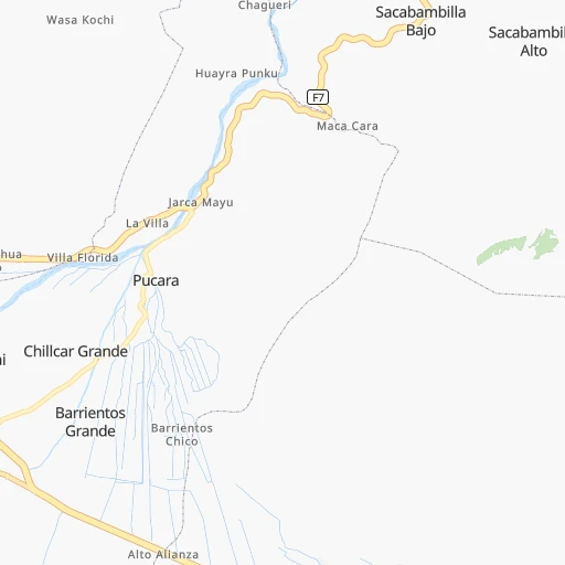
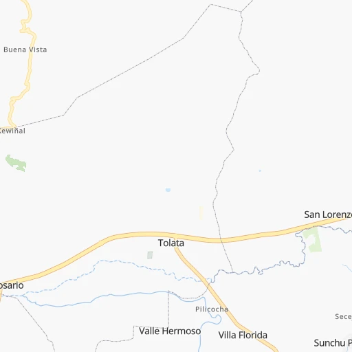
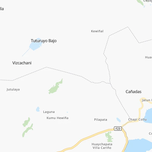
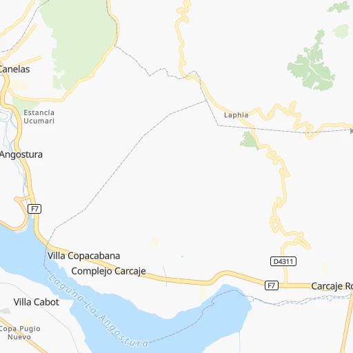
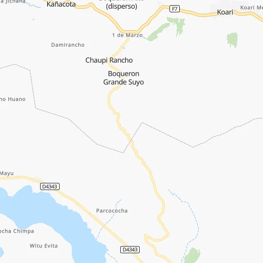
Roadmap (route) to go from Punata to Comarapa detailed above, you can also see the course layout on the map.
While doing trip Punata - Comarapa by car, the calculated route ends at a distance , or more straight.
Distance and duration of the route between Punata and Comarapa
Calculation of distance and route from Comarapa to Punata :
144.0218.1 km3h15mn
Continue 0h0mn 123 mTurn right onto Avenida Costanera 0h0mn 36 mTurn left onto Avenida Santa Cruz 0h0mn 65 mContinue onto Avenida Santa Cruz 0h3mn 3.0 kmAt roundabout, take exit 2 onto Doble Vía Avenida Petrolera-Angostura-Paracaya 0h0mn 58 mTurn slight right onto RN7: Paracaya-Epizana 2h58mn 141.9 kmTurn sharp left 0h3mn 789 mContinue onto RN7: Epizana-Comarapa 1h32mn 38.3 kmTurn right 0h2mn 1.1 kmTurn sharp left 0h5mn 2.4 kmTurn left 0h4mn 2.0 kmKeep left 0h0mn 181 mKeep left 0h6mn 2.9 kmTurn right onto RN7: Epizana-Comarapa 0h21mn 25.2 kmTurn left 0h0mn 161 mArrive at destination 0h0mn 0 m
Travel from Punata (Santa Cruz) to a selection of major cities.
Distances from Punata to biggest cities in Cochabamba
Other major cities in country :
Route from Comarapa to major cities (Bolivia).
- Distance Comarapa Cochabamba182 km
- Distance Comarapa La Paz416 km
- Distance Comarapa Sucre146 km
- Distance Comarapa Oruro277 km
- Distance Comarapa Tarija404 km
- Distance Comarapa Potosi226 km
- Distance Comarapa Sacaba170 km
- Distance Comarapa Quillacollo194 km
- Distance Comarapa Trinidad345 km
- Distance Comarapa Yacuiba465 km
- Distance Comarapa Riberalta787 km
- Distance Comarapa Tiquipaya190 km
Nearest cities to Punata :
- Santa Cruz de la Sierra, 1,364,389 inhabitants. 283 km
- Cochabamba, 900,414 inhabitants. 38 km
- La Paz, 812,799 inhabitants. 272 km
- Sucre, 224,838 inhabitants. 177 km
- Oruro, 208,684 inhabitants. 148 km
- Potosi, 141,251 inhabitants. 227 km
- Sacaba, 107,628 inhabitants. 27 km
- Montero, 88,616 inhabitants. 275 km
- Quillacollo, 87,309 inhabitants. 50 km
- Trinidad, 84,259 inhabitants. 318 km
- Tiquipaya, 53,904 inhabitants. 46 km
- Mizque, 30,481 inhabitants. 69 km
- Llallagua, 28,069 inhabitants. 126 km
- Camiri, 27,961 inhabitants. 370 km
- San Borja, 24,610 inhabitants. 315 km
- Warnes, 22,036 inhabitants. 283 km
- San Borja, 19,640 inhabitants. 322 km
- Ascencion de Guarayos, 18,816 inhabitants. 337 km
- Cotoca, 18,347 inhabitants. 297 km
- Villa Yapacani, 18,187 inhabitants. 213 km
- Santiago del Torno, 15,543 inhabitants. 265 km
- Huanuni, 15,492 inhabitants. 135 km
- Punata, 15,194 inhabitants. 0 km
- Ascension, 14,429 inhabitants. 358 km
- Mineros, 14,385 inhabitants. 281 km
- Patacamaya, 12,260 inhabitants. 224 km
- Colchani, 11,988 inhabitants. 328 km
- Portachuelo, 11,485 inhabitants. 260 km
- Uyuni, 10,293 inhabitants. 341 km
- Cliza, 8,654 inhabitants. 12 km
- Achacachi, 8,447 inhabitants. 346 km
- Vallegrande, 8,422 inhabitants. 211 km
- Monteagudo, 8,289 inhabitants. 320 km
- Aiquile, 8,224 inhabitants. 101 km
- Tarata, 8,043 inhabitants. 21 km
- Challapata, 8,016 inhabitants. 181 km
- San Julian, 7,706 inhabitants. 316 km
- La Belgica, 5,501 inhabitants. 278 km
- Santa Rosa del Sara, 5,251 inhabitants. 243 km
- Capinota, 5,157 inhabitants. 49 km
- Chimore, 5,147 inhabitants. 95 km
- Betanzos, 4,847 inhabitants. 227 km
- Comarapa, 4,445 inhabitants. 144 km
- Mairana, 4,298 inhabitants. 209 km
- Buena Vista, 4,282 inhabitants. 230 km
- San Carlos, 4,180 inhabitants. 222 km
- Jorochito, 4,013 inhabitants. 261 km
- Colquiri, 3,933 inhabitants. 138 km
- Colomi, 3,921 inhabitants. 22 km
- Arani, 3,906 inhabitants. 8 km
Location Punata (Cochabamba) :
| Country flag |  |
| Location | Punata |
| State | Cochabamba |
| County | |
| Country | Bolivia |
| Country code / ISO 2 | BO |
| Latitude | -17.5423400 |
| Longitude | -65.8347200 |
| Altitude | 0 meters |
| Time zone | America/La_Paz |
Location Comarapa (Santa Cruz) :
| Country flag | |
| Location | Comarapa |
| State | Santa Cruz |
| County | Provincia Manuel María Caballero |
| Country | Bolivia |
| Country code / ISO 2 | BO |
| Latitude | -17.9153700 |
| Longitude | -64.5316300 |
| Altitude | 0 meters |
| Time zone | America/La_Paz |