
How to get from Estación Puangue (Santiago Metropolitan) to Parral (Maule Region)
Calculate route from Estación Puangue (Santiago Metropolitan, Chile) to Parral (Maule Region, Chile).
The flight distance (as the crow flies) between Estación Puangue and Parral is 281.0 km.
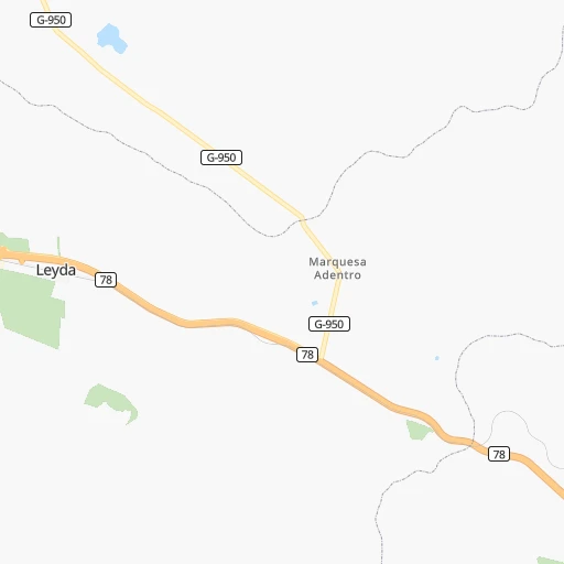
Roadmap (route) to go from Estación Puangue to Parral detailed above, you can also see the course layout on the map.
While doing trip Estación Puangue - Parral by car, the calculated route ends at a distance , or more straight.
Distance and duration of the route between Estación Puangue and Parral
Calculation of distance and route from Parral to Estación Puangue :
281.0367.8 km4h51mn
Continue onto Caletera Ruta 78 0h4mn 1.9 kmTurn slight right onto Ruta G-78 0h0mn 59 mTurn left and take 78 toward Santiago 0h8mn 14.4 kmContinue onto Ruta 78 0h17mn 27.1 kmKeep right and drive toward Talagante, Isla de Maipo 0h0mn 316 mAt roundabout, take exit 2 onto Avenida Senador Jaime Guzmán Errázuriz 0h1mn 681 mTurn left onto Carampangue 0h4mn 4.1 kmTurn right onto Camino Vecinal El Castillo 0h2mn 1.8 kmTurn sharp left onto Las Parcelas 0h3mn 3.1 kmTurn right onto La Herradura 0h1mn 841 mTurn left onto Santa Inés 0h0mn 154 mTurn right onto Brisas del Maipo 0h0mn 112 mTurn left onto El Maitén 0h1mn 663 mTurn left onto Balmaceda 0h0mn 124 mTurn right onto Bernardo O'Higgins 0h13mn 13.7 kmKeep right 0h6mn 9.9 kmContinue onto Ruta 5 Sur 1h3mn 109.2 kmContinue onto Ruta 5 Sur 1h35mn 58.4 kmKeep left onto Ruta 5 Sur 1h0mn 102.4 kmContinue onto Ruta 5 Sur 0h9mn 16.1 kmKeep right and drive toward Parral, Bullileo 0h0mn 78 mKeep left and drive toward Parral 0h0mn 20 mTurn slight left onto Caletera Ruta 5 0h2mn 1.2 kmTurn left onto Doctor Mario Mujica 0h1mn 428 mTurn right onto San Martín 0h1mn 962 mTurn right onto Igualdad 0h0mn 86 mArrive at destination 0h0mn 0 m
Travel from Estación Puangue (Maule Region) to a selection of major cities.
Distances from Estación Puangue to biggest cities in Santiago Metropolitan
Other major cities in country :
- Punta Arenas [10], 117,430 inhabitants. 2,172 km
- Curico [11], 102,438 inhabitants. 150 km
- Villa Alemana [01], 97,320 inhabitants. 67 km
- Coronel [06], 92,940 inhabitants. 411 km
- San Antonio [01], 85,651 inhabitants. 23 km
- Chiguayante [06], 82,545 inhabitants. 396 km
- Ovalle [07], 77,138 inhabitants. 339 km
- Linares [11], 69,535 inhabitants. 246 km
- Quillota [01], 67,779 inhabitants. 85 km
- San Felipe [01], 59,294 inhabitants. 116 km
- Los Andes [01], 56,859 inhabitants. 115 km
Route from Parral to major cities (Chile).
- Distance Parral Santiago318 km
- Distance Parral Puente Alto304 km
- Distance Parral Antofagasta1,397 km
- Distance Parral Vina del Mar348 km
- Distance Parral Valparaiso346 km
- Distance Parral Talcahuano133 km
- Distance Parral San Bernardo302 km
- Distance Parral Temuco297 km
- Distance Parral Iquique1,781 km
- Distance Parral Concepcion133 km
- Distance Parral Rancagua241 km
- Distance Parral La Pintana305 km
- Distance Parral Arica1,973 km
- Distance Parral Coquimbo691 km
- Distance Parral Puerto Montt601 km
- Distance Parral La Serena697 km
- Distance Parral Chillan57 km
- Distance Parral Calama1,549 km
- Distance Parral Osorno506 km
- Distance Parral Valdivia427 km
Nearest cities to Estación Puangue :
- Santiago, 4,837,295 inhabitants. 69 km
- Puente Alto, 510,417 inhabitants. 73 km
- Vina del Mar, 294,551 inhabitants. 71 km
- Valparaiso, 282,448 inhabitants. 72 km
- San Bernardo, 249,858 inhabitants. 62 km
- Rancagua, 212,695 inhabitants. 82 km
- La Pintana, 201,178 inhabitants. 68 km
- Talca, 197,479 inhabitants. 200 km
- Chillan, 150,396 inhabitants. 337 km
- Quilpue, 130,263 inhabitants. 67 km
- Lo Prado, 104,316 inhabitants. 63 km
- Curico, 102,438 inhabitants. 150 km
- Villa Alemana, 97,320 inhabitants. 67 km
- San Antonio, 85,651 inhabitants. 23 km
- Linares, 69,535 inhabitants. 246 km
- Quillota, 67,779 inhabitants. 85 km
- Penaflor, 65,495 inhabitants. 45 km
- Melipilla, 63,100 inhabitants. 15 km
- San Felipe, 59,294 inhabitants. 116 km
- Los Andes, 56,859 inhabitants. 115 km
- Buin, 55,441 inhabitants. 58 km
- Talagante, 51,764 inhabitants. 40 km
- Hacienda La Calera, 49,106 inhabitants. 97 km
- Tome, 46,698 inhabitants. 362 km
- Rengo, 38,100 inhabitants. 97 km
- Constitucion, 37,917 inhabitants. 211 km
- Limache, 35,876 inhabitants. 70 km
- Santa Cruz, 33,283 inhabitants. 111 km
- Paine, 32,766 inhabitants. 60 km
- San Carlos, 31,517 inhabitants. 314 km
- Cauquenes, 31,362 inhabitants. 273 km
- San Vicente de Tagua Tagua, 29,560 inhabitants. 92 km
- Lampa, 29,250 inhabitants. 60 km
- Molina, 28,775 inhabitants. 164 km
- Machali, 27,595 inhabitants. 89 km
- Parral, 26,904 inhabitants. 282 km
- La Ligua, 24,857 inhabitants. 133 km
- Graneros, 23,301 inhabitants. 75 km
- El Monte, 23,090 inhabitants. 35 km
- Illapel, 22,816 inhabitants. 224 km
- San Vicente, 22,572 inhabitants. 92 km
- San Javier, 22,427 inhabitants. 220 km
- Chicureo Abajo, 18,000 inhabitants. 77 km
- Chimbarongo, 17,356 inhabitants. 123 km
- Cartagena, 16,875 inhabitants. 25 km
- Llaillay, 16,646 inhabitants. 97 km
- Villa Presidente Frei, Nunoa, Santiago, Chile, 15,000 inhabitants. 75 km
- Monte Patria, 13,945 inhabitants. 330 km
- San Clemente, 13,656 inhabitants. 211 km
- Salamanca, 13,265 inhabitants. 211 km
Location Estación Puangue (Santiago Metropolitan) :
| Country flag |  |
| Location | Estación Puangue |
| State | Santiago Metropolitan |
| County | Provincia de Melipilla |
| Country | Chile |
| Country code / ISO 2 | CL |
| Latitude | -33.6428900 |
| Longitude | -71.3622600 |
| Altitude | 0 meters |
| Time zone | America/Santiago |
Location Parral (Maule Region) :
| Country flag | |
| Location | Parral |
| State | Maule Region |
| County | Provincia de Linares |
| Country | Chile |
| Country code / ISO 2 | CL |
| Latitude | -36.1431100 |
| Longitude | -71.8260500 |
| Altitude | 0 meters |
| Time zone | America/Santiago |