


How to get from Estación Putaendo (Valparaíso) to Teno (Maule Region)
Calculate route from Estación Putaendo (Valparaíso, Chile) to Teno (Maule Region, Chile).
The flight distance (as the crow flies) between Estación Putaendo and Teno is 251.7 km.
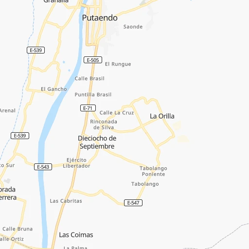
Roadmap (route) to go from Estación Putaendo to Teno detailed above, you can also see the course layout on the map.
While doing trip Estación Putaendo - Teno by car, the calculated route ends at a distance , or more straight.
Distance and duration of the route between Estación Putaendo and Teno
Calculation of distance and route from Teno to Estación Putaendo :
251.7279.5 km3h19mn
Continue 0h0mn 48 mTurn left 0h1mn 323 mTurn right onto Ruta E-535 0h2mn 1.7 kmTurn left onto Ruta E-539 0h6mn 6.0 kmTurn left onto Calle Ortiz 0h1mn 977 mTurn right onto Ruta E-539 0h2mn 2.2 kmTurn left onto Ruta E-539 0h1mn 594 mTurn right onto Ruta E-71 0h4mn 4.0 kmTurn right onto Avenida Maipú 0h2mn 1.6 kmTurn slight left 0h3mn 2.7 kmKeep right 0h19mn 14.6 kmKeep right and take 57 toward Santiago 1h35mn 50.1 kmKeep left onto Autopista Los Libertadores 0h4mn 6.5 kmKeep right toward 70 0h0mn 105 mKeep left 0h0mn 321 mTurn right onto Avenida Américo Vespucio 0h1mn 1.0 kmKeep right and take 5 toward Santiago 0h2mn 1.8 kmKeep right and drive toward Al Sur 1h40mn 60.3 kmContinue onto Ruta 5 Sur 1h3mn 109.2 kmContinue onto Ruta 5 Sur 0h6mn 9.4 kmKeep right and take J-310 toward Teno Norte, La Montaña 0h0mn 90 mKeep left and take J-310 toward Teno Norte, La Montaña 0h3mn 3.2 kmTurn right 0h0mn 306 mTurn sharp right onto Ruta J-120 0h2mn 1.4 kmTurn left onto Ortúzar 0h1mn 434 mTurn left onto Avenida Lautaro 0h0mn 110 mTurn right onto Avenida Doctor Faúndez 0h0mn 230 mArrive at destination 0h0mn 0 m
Travel from Estación Putaendo (Maule Region) to a selection of major cities.
Distances from Estación Putaendo to biggest cities in Valparaíso
Other major cities in country :
- Los Angeles [06], 125,430 inhabitants. 558 km
- Punta Arenas [10], 117,430 inhabitants. 2,284 km
- Lo Prado [12], 104,316 inhabitants. 90 km
- Curico [11], 102,438 inhabitants. 266 km
- Coronel [06], 92,940 inhabitants. 537 km
- Chiguayante [06], 82,545 inhabitants. 522 km
- Ovalle [07], 77,138 inhabitants. 230 km
- Linares [11], 69,535 inhabitants. 366 km
- Penaflor [12], 65,495 inhabitants. 109 km
- Melipilla [12], 63,100 inhabitants. 126 km
- Buin [12], 55,441 inhabitants. 122 km
- Talagante [12], 51,764 inhabitants. 116 km
Route from Teno to major cities (Chile).
- Distance Teno Santiago164 km
- Distance Teno Puente Alto150 km
- Distance Teno Antofagasta1,251 km
- Distance Teno Vina del Mar209 km
- Distance Teno Valparaiso209 km
- Distance Teno Talcahuano272 km
- Distance Teno San Bernardo149 km
- Distance Teno Temuco449 km
- Distance Teno Iquique1,635 km
- Distance Teno Concepcion276 km
- Distance Teno Rancagua87 km
- Distance Teno La Pintana151 km
- Distance Teno Arica1,827 km
- Distance Teno Coquimbo548 km
- Distance Teno Puerto Montt751 km
- Distance Teno La Serena553 km
- Distance Teno Chillan211 km
- Distance Teno Calama1,399 km
- Distance Teno Osorno658 km
- Distance Teno Valdivia580 km
Nearest cities to Estación Putaendo :
- Santiago, 4,837,295 inhabitants. 92 km
- Puente Alto, 510,417 inhabitants. 110 km
- Vina del Mar, 294,551 inhabitants. 88 km
- Valparaiso, 282,448 inhabitants. 95 km
- San Bernardo, 249,858 inhabitants. 107 km
- Rancagua, 212,695 inhabitants. 171 km
- La Pintana, 201,178 inhabitants. 106 km
- Talca, 197,479 inhabitants. 322 km
- Coquimbo, 161,317 inhabitants. 304 km
- La Serena, 154,521 inhabitants. 308 km
- Quilpue, 130,263 inhabitants. 81 km
- Lo Prado, 104,316 inhabitants. 90 km
- Curico, 102,438 inhabitants. 266 km
- Villa Alemana, 97,320 inhabitants. 75 km
- San Antonio, 85,651 inhabitants. 135 km
- Ovalle, 77,138 inhabitants. 230 km
- Quillota, 67,779 inhabitants. 56 km
- Penaflor, 65,495 inhabitants. 109 km
- Melipilla, 63,100 inhabitants. 126 km
- San Felipe, 59,294 inhabitants. 13 km
- Los Andes, 56,859 inhabitants. 26 km
- Buin, 55,441 inhabitants. 122 km
- Talagante, 51,764 inhabitants. 116 km
- Hacienda La Calera, 49,106 inhabitants. 48 km
- Rengo, 38,100 inhabitants. 198 km
- Constitucion, 37,917 inhabitants. 338 km
- Limache, 35,876 inhabitants. 66 km
- Santa Cruz, 33,283 inhabitants. 231 km
- Paine, 32,766 inhabitants. 131 km
- San Vicente de Tagua Tagua, 29,560 inhabitants. 203 km
- Lampa, 29,250 inhabitants. 74 km
- Molina, 28,775 inhabitants. 281 km
- Machali, 27,595 inhabitants. 172 km
- La Ligua, 24,857 inhabitants. 51 km
- Graneros, 23,301 inhabitants. 160 km
- El Monte, 23,090 inhabitants. 119 km
- Illapel, 22,816 inhabitants. 119 km
- San Vicente, 22,572 inhabitants. 203 km
- San Javier, 22,427 inhabitants. 342 km
- Chicureo Abajo, 18,000 inhabitants. 73 km
- Chimbarongo, 17,356 inhabitants. 233 km
- Cartagena, 16,875 inhabitants. 131 km
- Llaillay, 16,646 inhabitants. 31 km
- Villa Presidente Frei, Nunoa, Santiago, Chile, 15,000 inhabitants. 93 km
- Monte Patria, 13,945 inhabitants. 217 km
- San Clemente, 13,656 inhabitants. 331 km
- Vicuna, 13,496 inhabitants. 289 km
- Salamanca, 13,265 inhabitants. 98 km
- Rauco, 8,566 inhabitants. 261 km
- Teno, 6,858 inhabitants. 252 km
Location Estación Putaendo (Valparaíso) :
| Country flag |  |
| Location | Estación Putaendo |
| State | Valparaíso |
| County | Provincia de San Felipe de Aconcagua |
| Country | Chile |
| Country code / ISO 2 | CL |
| Latitude | -32.6333300 |
| Longitude | -70.7333300 |
| Altitude | 0 meters |
| Time zone | America/Santiago |
Location Teno (Maule Region) :
| Country flag | |
| Location | Teno |
| State | Maule Region |
| County | Provincia de Curicó |
| Country | Chile |
| Country code / ISO 2 | CL |
| Latitude | -34.8705500 |
| Longitude | -71.1621900 |
| Altitude | 0 meters |
| Time zone | America/Santiago |