


How to get from Estación Castellanos (Santa Fe) to La Paz (Entre Rios)
Calculate route from Estación Castellanos (Santa Fe, Argentina) to La Paz (Entre Rios, Argentina).
The flight distance (as the crow flies) between Estación Castellanos and La Paz is 204.7 km.
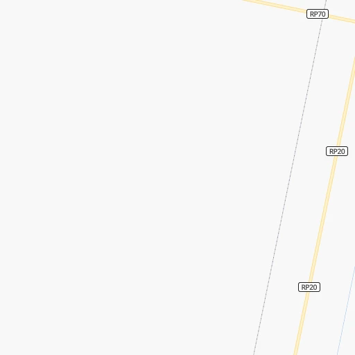
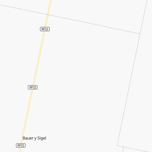
Roadmap (route) to go from Estación Castellanos to La Paz detailed above, you can also see the course layout on the map.
While doing trip Estación Castellanos - La Paz by car, the calculated route ends at a distance , or more straight.
Distance and duration of the route between Estación Castellanos and La Paz
Calculation of distance and route from La Paz to Estación Castellanos :
204.7309.1 km4h9mn
Continue onto Bulevar Centenario 0h0mn 148 mTurn right onto Juan Beapuy 0h1mn 1.0 kmTurn left onto Ruta Provincial 70 0h6mn 9.6 kmAt roundabout, take exit 2 onto RP70 0h9mn 12.3 kmKeep right onto Avenida Luis Fanti 0h2mn 2.0 kmTurn left onto José Beltramino 0h0mn 236 mTurn right onto José Manuel Estrada 0h0mn 121 mTurn left onto Dorrego 0h0mn 61 mTurn right onto Manuel Obligado 0h1mn 487 mTurn slight right onto Avenida Aristóbulo del Valle 0h1mn 739 mTurn left onto Río de Janeiro 0h1mn 539 mTurn right onto Santa Fe 0h2mn 1.5 kmContinue onto Ruta Provincial 70 1h53mn 56.4 kmAt roundabout, take exit 2 onto A Aufranc 0h0mn 283 mAt roundabout, take exit 2 onto A Aufranc 0h14mn 16.0 kmKeep right toward RNA007, RN11 0h4mn 6.6 kmKeep right 0h1mn 461 mTurn left onto Monseñor Rodríguez 0h2mn 2.1 kmTurn right onto Avenida Blas Parera 0h5mn 5.1 kmAt roundabout, take exit 2 onto Avenida Blas Parera 0h1mn 1.1 kmKeep right 0h0mn 154 mTurn right onto Avenida Blas Parera 0h2mn 1.8 kmTurn left onto Bulevar Pellegrini 0h3mn 3.2 kmKeep left and take RN168 toward Puente Oroño, Paraná 0h22mn 24.1 kmKeep right 0h1mn 680 mKeep right onto RN168 1h39mn 59.7 kmTurn left onto Ruta Nacional 12 1h4mn 87.3 kmTurn left onto Ex ruta prov. 6 0h14mn 14.4 kmTurn left onto Alvarado 0h0mn 97 mTurn right onto San Martín 0h0mn 203 mTurn left onto Saavedra 0h0mn 204 mTurn right onto 3 de Febrero 0h0mn 197 mTurn right onto Berón de Astrada 0h0mn 103 mTurn right onto Echagüe 0h0mn 40 mArrive at destination 0h0mn 0 m
Travel from Estación Castellanos (Entre Rios) to a selection of major cities.
Distances from Estación Castellanos to biggest cities in Santa Fe
Other major cities in country :
- San Fernando del Valle de Catamarca [02], 188,812 inhabitants. 497 km
- San Luis [19], 183,982 inhabitants. 492 km
- Berazategui [01], 167,498 inhabitants. 514 km
- La Rioja [12], 162,620 inhabitants. 532 km
- Rio Cuarto [05], 153,757 inhabitants. 327 km
- Balvanera [07], 152,198 inhabitants. 490 km
- Concordia [08], 145,210 inhabitants. 353 km
- Comodoro Rivadavia [04], 140,850 inhabitants. 1,706 km
- Belgrano [07], 138,942 inhabitants. 482 km
- San Nicolas de los Arroyos [01], 127,742 inhabitants. 276 km
- Villa Lugano [07], 114,000 inhabitants. 491 km
- Santa Rosa [11], 111,424 inhabitants. 647 km
- San Rafael [13], 109,163 inhabitants. 724 km
- Tandil [01], 104,325 inhabitants. 721 km
- Villa Mercedes [19], 96,781 inhabitants. 445 km
- San Carlos de Bariloche [16], 95,394 inhabitants. 1,400 km
- Trelew [04], 93,442 inhabitants. 1,377 km
- Villa Maria [05], 92,453 inhabitants. 196 km
- Zarate [01], 88,781 inhabitants. 409 km
- Pergamino [01], 87,652 inhabitants. 317 km
Route from La Paz to major cities (Argentina).
- Distance La Paz Buenos Aires447 km
- Distance La Paz Cordoba439 km
- Distance La Paz Rosario263 km
- Distance La Paz Mendoza900 km
- Distance La Paz San Miguel de Tucuman697 km
- Distance La Paz La Plata491 km
- Distance La Paz Mar del Plata830 km
- Distance La Paz Quilmes462 km
- Distance La Paz Salta873 km
- Distance La Paz Santa Fe de la Vera Cruz141 km
- Distance La Paz San Juan851 km
- Distance La Paz Resistencia371 km
- Distance La Paz Santiago del Estero556 km
- Distance La Paz Corrientes372 km
- Distance La Paz Posadas524 km
- Distance La Paz Moron445 km
- Distance La Paz San Salvador de Jujuy918 km
- Distance La Paz Bahia Blanca920 km
- Distance La Paz Neuquen1,193 km
- Distance La Paz Pilar419 km
Nearest cities to Estación Castellanos :
- Cordoba, 1,428,214 inhabitants. 235 km
- Rosario, 1,173,533 inhabitants. 219 km
- Santa Fe de la Vera Cruz, 489,505 inhabitants. 108 km
- Parana, 262,295 inhabitants. 128 km
- Rio Cuarto, 153,757 inhabitants. 327 km
- San Nicolas de los Arroyos, 127,742 inhabitants. 276 km
- Villa Maria, 92,453 inhabitants. 196 km
- Reconquista, 90,184 inhabitants. 304 km
- Zarate, 88,781 inhabitants. 409 km
- Rafaela, 88,713 inhabitants. 23 km
- Pergamino, 87,652 inhabitants. 317 km
- Campana, 81,612 inhabitants. 419 km
- Gobernador Galvez, 74,650 inhabitants. 227 km
- Venado Tuerto, 72,340 inhabitants. 283 km
- Goya, 70,245 inhabitants. 330 km
- Villa Carlos Paz, 69,451 inhabitants. 265 km
- Santo Tome, 59,072 inhabitants. 104 km
- San Francisco, 59,062 inhabitants. 42 km
- Rio Tercero, 53,389 inhabitants. 250 km
- San Pedro, 47,452 inhabitants. 336 km
- Villa Constitucion, 44,271 inhabitants. 260 km
- Alta Gracia, 40,384 inhabitants. 261 km
- Canada de Gomez, 36,000 inhabitants. 182 km
- Esperanza, 35,885 inhabitants. 80 km
- Bell Ville, 35,105 inhabitants. 182 km
- Gualeguay, 33,120 inhabitants. 313 km
- Granadero Baigorria, 32,427 inhabitants. 207 km
- Villaguay, 32,027 inhabitants. 266 km
- Casilda, 32,002 inhabitants. 211 km
- Capitan Bermudez, 27,060 inhabitants. 203 km
- Jesus Maria, 26,825 inhabitants. 227 km
- Esquina, 26,399 inhabitants. 249 km
- Victoria, 25,139 inhabitants. 216 km
- La Calera, 24,796 inhabitants. 249 km
- La Paz, 24,716 inhabitants. 205 km
- Perez, 24,436 inhabitants. 219 km
- Marcos Juarez, 24,226 inhabitants. 170 km
- Avellaneda, 23,077 inhabitants. 306 km
- San Justo, 21,809 inhabitants. 118 km
- Villa Allende, 21,683 inhabitants. 245 km
- Anatuya, 20,261 inhabitants. 324 km
- Dean Funes, 20,164 inhabitants. 266 km
- Arroyo Seco, 20,008 inhabitants. 245 km
- Laboulaye, 19,908 inhabitants. 360 km
- Vera, 19,797 inhabitants. 243 km
- Arroyito, 19,577 inhabitants. 128 km
- Diamante, 19,545 inhabitants. 140 km
- Villa Ocampo, 19,101 inhabitants. 380 km
- Cosquin, 19,070 inhabitants. 261 km
- Sunchales, 18,757 inhabitants. 33 km
Location Estación Castellanos (Santa Fe) :
| Country flag |  |
| Location | Estación Castellanos |
| State | Santa Fe |
| County | Departamento de Castellanos |
| Country | Argentina |
| Country code / ISO 2 | AR |
| Latitude | -31.2092900 |
| Longitude | -61.7249900 |
| Altitude | 0 meters |
| Time zone | America/Argentina/Cordoba |
Location La Paz (Entre Rios) :
| Country flag | |
| Location | La Paz |
| State | Entre Rios |
| County | Departamento de La Paz |
| Country | Argentina |
| Country code / ISO 2 | AR |
| Latitude | -30.7448500 |
| Longitude | -59.6456600 |
| Altitude | 0 meters |
| Time zone | America/Argentina/Cordoba |
