


How to get from Los Altos (Catamarca) to Fiambalá (Catamarca)
Calculate route from Los Altos (Catamarca, Argentina) to Fiambalá (Catamarca, Argentina).
The flight distance (as the crow flies) between Los Altos and Fiambalá is 211.7 km.
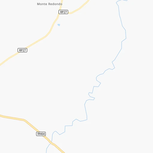
Roadmap (route) to go from Los Altos to Fiambalá detailed above, you can also see the course layout on the map.
While doing trip Los Altos - Fiambalá by car, the calculated route ends at a distance , or more straight.
Distance and duration of the route between Los Altos and Fiambalá
Calculation of distance and route from Fiambalá to Los Altos :
211.7404.4 km6h37mn
Continue onto Ruta Nacional 64 0h0mn 525 mAt roundabout, take exit 1 onto Ruta Nacional 64 0h6mn 9.6 kmAt roundabout, take exit 2 onto Ruta Nacional 38 1h46mn 66.7 kmAt roundabout, take exit 3 onto Avenida Circunvalación 0h4mn 5.9 kmKeep right onto Colectora and drive toward Terminal, Catamarca (centro) 0h0mn 545 mContinue onto Colectora and drive toward La Rioja 0h3mn 4.1 kmAt roundabout, take exit 2 onto Ruta Nacional 38 1h58mn 67.7 kmKeep right 0h0mn 419 mTurn slight right onto Ruta Nacional 60 1h38mn 41.3 kmKeep left onto Ruta Nacional 60 0h13mn 14.7 kmKeep left 0h1mn 512 mTurn slight right 0h1mn 710 mContinue onto Ruta Provincial 10 0h0mn 515 mAt roundabout, take exit 2 onto RN60 0h25mn 27.1 kmAt roundabout, take exit 1 onto Juan Bautista Alberdi 0h1mn 1.0 kmTurn left onto Paraguay 0h0mn 160 mTurn right onto Sarmiento 0h1mn 539 mTurn left onto Joaquín V González 0h0mn 426 mTurn right onto 9 de Julio 0h1mn 1.0 kmTurn left onto RN60 0h0mn 125 mTurn right onto 25 de Mayo 1h35mn 38.9 kmContinue onto Ruta Nacional 60 0h5mn 5.1 kmContinue onto Ruta Nacional 60 1h49mn 65.4 kmKeep right onto Avenida San Martín 1h45mn 49.7 kmAt roundabout, take exit 1 onto Avenida Las Américas 0h0mn 147 mContinue onto Diego de Almagro 0h1mn 539 mTurn left onto Presbítero Luis Arch 0h1mn 363 mTurn right onto Padre Azarelli 0h0mn 249 mTurn left onto Fray Mamerto Esquiú 0h0mn 247 mTurn right 0h0mn 65 mArrive at destination 0h0mn 0 m
Travel from Los Altos (Catamarca) to a selection of major cities.
Distances from Los Altos to biggest cities in Catamarca
Other major cities in country :
- Pilar [01], 226,517 inhabitants. 949 km
- Formosa [09], 221,383 inhabitants. 755 km
- San Luis [19], 183,982 inhabitants. 589 km
- Berazategui [01], 167,498 inhabitants. 1,018 km
- La Rioja [12], 162,620 inhabitants. 201 km
- Rio Cuarto [05], 153,757 inhabitants. 576 km
- Balvanera [07], 152,198 inhabitants. 994 km
- Concordia [08], 145,210 inhabitants. 813 km
- Comodoro Rivadavia [04], 140,850 inhabitants. 1,991 km
- Belgrano [07], 138,942 inhabitants. 987 km
- San Nicolas de los Arroyos [01], 127,742 inhabitants. 776 km
- Villa Lugano [07], 114,000 inhabitants. 995 km
- Santa Rosa [11], 111,424 inhabitants. 961 km
- San Rafael [13], 109,163 inhabitants. 779 km
- Tandil [01], 104,325 inhabitants. 1,191 km
- Villa Mercedes [19], 96,781 inhabitants. 626 km
- San Carlos de Bariloche [16], 95,394 inhabitants. 1,551 km
- Trelew [04], 93,442 inhabitants. 1,692 km
- Villa Maria [05], 92,453 inhabitants. 532 km
- Reconquista [21], 90,184 inhabitants. 585 km
Route from Fiambalá to major cities (Argentina).
- Distance Fiambalá Buenos Aires1,169 km
- Distance Fiambalá Cordoba532 km
- Distance Fiambalá Rosario890 km
- Distance Fiambalá Mendoza591 km
- Distance Fiambalá San Miguel de Tucuman255 km
- Distance Fiambalá La Plata1,221 km
- Distance Fiambalá Mar del Plata1,482 km
- Distance Fiambalá Quilmes1,185 km
- Distance Fiambalá Salta391 km
- Distance Fiambalá Santa Fe de la Vera Cruz800 km
- Distance Fiambalá San Juan438 km
- Distance Fiambalá Resistencia852 km
- Distance Fiambalá Santiago del Estero331 km
- Distance Fiambalá Corrientes866 km
- Distance Fiambalá Posadas1,157 km
- Distance Fiambalá Moron1,154 km
- Distance Fiambalá San Salvador de Jujuy453 km
- Distance Fiambalá Bahia Blanca1,324 km
- Distance Fiambalá Parana820 km
- Distance Fiambalá Neuquen1,255 km
Nearest cities to Los Altos :
- San Miguel de Tucuman, 781,023 inhabitants. 139 km
- Santiago del Estero, 354,692 inhabitants. 125 km
- San Fernando del Valle de Catamarca, 188,812 inhabitants. 55 km
- La Rioja, 162,620 inhabitants. 201 km
- Yerba Buena, 50,783 inhabitants. 138 km
- Tafi Viejo, 48,459 inhabitants. 148 km
- Chilecito, 42,248 inhabitants. 231 km
- Alderetes, 38,466 inhabitants. 142 km
- Aguilares, 32,494 inhabitants. 69 km
- Famailla, 30,951 inhabitants. 111 km
- Cruz del Eje, 28,166 inhabitants. 306 km
- Termas de Rio Hondo, 27,838 inhabitants. 88 km
- Jesus Maria, 26,825 inhabitants. 354 km
- Monteros, 23,771 inhabitants. 98 km
- Anatuya, 20,261 inhabitants. 265 km
- Dean Funes, 20,164 inhabitants. 287 km
- Joaquin V. Gonzalez, 19,185 inhabitants. 355 km
- Bella Vista, 15,126 inhabitants. 115 km
- Tinogasta, 14,509 inhabitants. 203 km
- Recreo, 14,204 inhabitants. 144 km
- Andalgala, 14,068 inhabitants. 95 km
- Arauco, 13,720 inhabitants. 140 km
- Chamical, 13,383 inhabitants. 269 km
- Cafayate, 11,785 inhabitants. 225 km
- El Quebrachal, 10,243 inhabitants. 339 km
- El Carril, 9,780 inhabitants. 331 km
- Capilla del Monte, 9,085 inhabitants. 327 km
- Clodomira, 9,043 inhabitants. 145 km
- Taco Pozo, 8,470 inhabitants. 349 km
- Chicoana, 8,468 inhabitants. 328 km
- El Galpon, 8,357 inhabitants. 309 km
- Fiambala, 8,061 inhabitants. 212 km
- Simoca, 7,939 inhabitants. 89 km
- Huillapima, 7,779 inhabitants. 89 km
- Villa de Soto, 7,303 inhabitants. 316 km
- La Cumbre, 7,235 inhabitants. 341 km
- Villa del Totoral, 7,110 inhabitants. 353 km
- La Cocha, 7,066 inhabitants. 31 km
- San Agustin de Valle Fertil, 6,864 inhabitants. 345 km
- Icano, 6,857 inhabitants. 98 km
- Trancas, 6,658 inhabitants. 205 km
- Los Altos, 6,421 inhabitants. 0 km
- Capayan, 6,358 inhabitants. 96 km
- Suncho Corral, 6,087 inhabitants. 204 km
- Villa Ojo de Agua, 5,832 inhabitants. 239 km
- Balnearia, 5,585 inhabitants. 429 km
- Campo Gallo, 5,455 inhabitants. 309 km
- Beltran, 5,321 inhabitants. 144 km
- Graneros, 5,263 inhabitants. 45 km
- Sumampa, 4,812 inhabitants. 248 km
Location Los Altos (Catamarca) :
| Country flag |  |
| Location | Los Altos |
| State | Catamarca |
| County | Departamento de Santa Rosa |
| Country | Argentina |
| Country code / ISO 2 | AR |
| Latitude | -28.0484500 |
| Longitude | -65.4994500 |
| Altitude | 0 meters |
| Time zone | America/Argentina/Catamarca |
Location Fiambalá (Catamarca) :
| Country flag | |
| Location | Fiambalá |
| State | Catamarca |
| County | Departamento de Tinogasta |
| Country | Argentina |
| Country code / ISO 2 | AR |
| Latitude | -27.6870500 |
| Longitude | -67.6149000 |
| Altitude | 0 meters |
| Time zone | America/Argentina/Catamarca |