


How to get from Estación Lomas Tristes (Tabasco) to Motozintla (Chiapas)
Calculate route from Estación Lomas Tristes (Tabasco, Mexico) to Motozintla (Chiapas, Mexico).
The flight distance (as the crow flies) between Estación Lomas Tristes and Motozintla is 250.8 km.
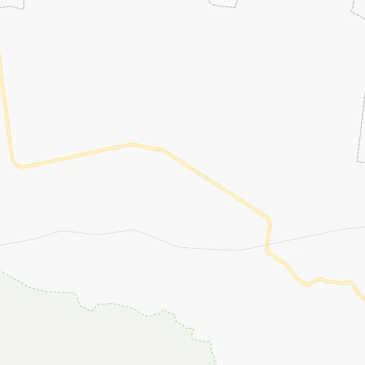
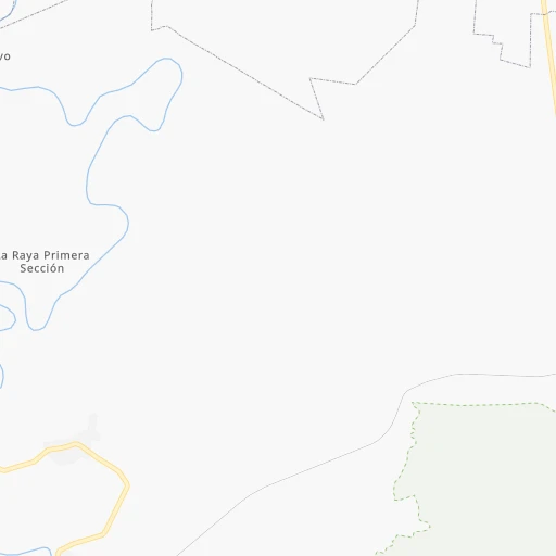
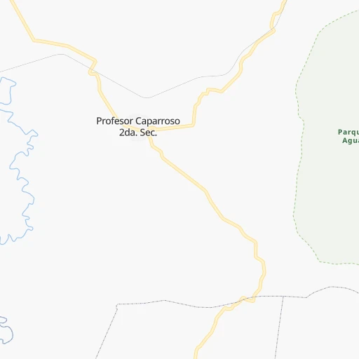
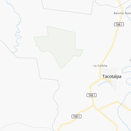
Roadmap (route) to go from Estación Lomas Tristes to Motozintla detailed above, you can also see the course layout on the map.
While doing trip Estación Lomas Tristes - Motozintla by car, the calculated route ends at a distance , or more straight.
Distance and duration of the route between Estación Lomas Tristes and Motozintla
Calculation of distance and route from Motozintla to Estación Lomas Tristes :
250.8387.1 km6h29mn
Continue 0h0mn 100 mTurn left 0h3mn 1.6 kmTurn right 0h14mn 11.5 kmTurn right 0h2mn 1.8 kmTurn left 0h5mn 2.6 kmKeep right 0h24mn 12.1 kmTurn slight right 0h13mn 11.1 kmTurn right 0h17mn 17.4 kmTurn sharp right 0h4mn 2.1 kmTurn slight right 0h11mn 10.5 kmTurn slight left 0h2mn 2.1 kmTurn right 0h0mn 261 mTurn left onto Calle Insurgentes 0h0mn 75 mTurn right 0h7mn 6.8 kmTurn right 0h4mn 4.4 kmKeep right onto Calle Carretera a Petalcingo 0h2mn 1.5 kmTurn slight left onto Avenida Tercera Norte Poniente 0h0mn 119 mTurn right onto Calle Primera Poniente Norte 0h0mn 77 mTurn left onto Avenida Segunda Norte Poniente 0h1mn 252 mTurn right onto Calle Segunda Oriente Norte 0h0mn 247 mTurn left onto Avenida Segunda Sur Oriente 0h1mn 399 mTurn right 0h0mn 69 mContinue onto Avenida Tercera Sur Oriente 0h1mn 1.2 kmTurn slight right 0h22mn 21.9 kmTurn left onto Libramiento Norte 0h2mn 2.4 kmTurn left onto Calle Central Oriente 0h7mn 6.9 kmTurn right onto Catazajá - T.C. (Tuxtla Gutiérrez - Ciudad Cuauhtémoc) 0h18mn 19.8 kmTurn right onto Internaciónal 0h0mn 25 mTurn right onto MEX 199 0h0mn 218 mKeep left onto Tercera Calle Poniente Norte 0h1mn 524 mTurn left onto Avenida Central Poniente 0h1mn 523 mTurn right onto Calle Tercera Oriente Sur 0h1mn 981 mKeep left onto Camino a Altamirano 0h2mn 1.6 kmKeep right onto Carretera La Traya - Suschila 0h7mn 6.9 kmTurn right 0h21mn 20.7 kmTurn right onto Avenida 20 de Noviembre 1h6mn 66.7 kmTurn left onto Periférico 0h8mn 7.8 kmTurn left onto Carretera Internacional a Huixtla 0h10mn 12.2 kmTurn slight right onto MEX 190 1h52mn 62.2 kmKeep right onto MEX 211 1h58mn 67.0 kmKeep right 0h1mn 362 mTurn slight left onto Avenida Sexta Norte 0h0mn 25 mTurn right onto Calle Octava Oriente 0h0mn 140 mTurn left onto Avenida Central Norte 0h0mn 74 mArrive at destination 0h0mn 0 m
Travel from Estación Lomas Tristes (Chiapas) to a selection of major cities.
Distances from Estación Lomas Tristes to biggest cities in Tabasco
Other major cities in country :
- Aguascalientes [01], 658,179 inhabitants. 1,115 km
- Acapulco de Juarez [12], 652,136 inhabitants. 774 km
- Coyoacan [09], 628,063 inhabitants. 713 km
- Santiago de Queretaro [22], 626,495 inhabitants. 878 km
- Saltillo [07], 621,250 inhabitants. 1,227 km
- Tlalpan [09], 607,545 inhabitants. 712 km
- Mexicali [02], 597,099 inhabitants. 2,831 km
- Hermosillo [26], 595,811 inhabitants. 2,263 km
- Morelia [16], 592,797 inhabitants. 928 km
- Veracruz [30], 568,313 inhabitants. 408 km
- Cancun [23], 542,043 inhabitants. 730 km
- Santa Maria Chimalhuacan [15], 525,389 inhabitants. 694 km
- Torreon [07], 524,066 inhabitants. 1,421 km
- Cuauhtemoc [09], 521,348 inhabitants. 714 km
- Ciudad Lopez Mateos [15], 521,034 inhabitants. 729 km
- Toluca [15], 505,881 inhabitants. 761 km
- Reynosa [28], 498,654 inhabitants. 1,109 km
- Tlaquepaque [14], 493,646 inhabitants. 1,168 km
- Tuxtla [05], 481,128 inhabitants. 104 km
- Cuautitlan Izcalli [15], 475,179 inhabitants. 728 km
Route from Motozintla to major cities (Mexico).
- Distance Motozintla Mexico City859 km
- Distance Motozintla Iztapalapa849 km
- Distance Motozintla Ecatepec de Morelos864 km
- Distance Motozintla Guadalajara1,319 km
- Distance Motozintla Puebla754 km
- Distance Motozintla Juarez2,323 km
- Distance Motozintla Tijuana3,145 km
- Distance Motozintla Ciudad Nezahualcoyotl848 km
- Distance Motozintla Gustavo Adolfo Madero862 km
- Distance Motozintla Monterrey1,422 km
- Distance Motozintla Leon de los Aldama1,185 km
- Distance Motozintla Zapopan1,321 km
- Distance Motozintla Naucalpan de Juarez872 km
- Distance Motozintla Chihuahua2,051 km
- Distance Motozintla Alvaro Obregon862 km
- Distance Motozintla Guadalupe1,418 km
- Distance Motozintla Merida683 km
- Distance Motozintla Tlalnepantla872 km
- Distance Motozintla San Luis Potosi1,190 km
- Distance Motozintla Culiacan1,897 km
Nearest cities to Estación Lomas Tristes :
- Tuxtla, 481,128 inhabitants. 104 km
- Villahermosa, 362,401 inhabitants. 52 km
- Coatzacoalcos, 230,717 inhabitants. 198 km
- Campeche, 205,212 inhabitants. 338 km
- Tapachula, 197,961 inhabitants. 302 km
- Minatitlan, 150,895 inhabitants. 205 km
- Ciudad del Carmen, 141,308 inhabitants. 148 km
- San Cristobal de las Casas, 128,996 inhabitants. 95 km
- Las Margaritas, 103,403 inhabitants. 160 km
- Cardenas, 85,350 inhabitants. 88 km
- Comitan, 79,944 inhabitants. 160 km
- Salina Cruz, 73,648 inhabitants. 312 km
- Juchitan de Zaragoza, 67,637 inhabitants. 281 km
- San Andres Tuxtla, 55,697 inhabitants. 286 km
- Acayucan, 46,990 inhabitants. 241 km
- Comalcalco, 40,992 inhabitants. 96 km
- Las Choapas, 40,304 inhabitants. 156 km
- Santo Domingo Tehuantepec, 37,389 inhabitants. 308 km
- Palenque, 36,669 inhabitants. 73 km
- Agua Dulce, 36,119 inhabitants. 168 km
- Cintalapa de Figueroa, 33,464 inhabitants. 150 km
- Tonala, 32,855 inhabitants. 203 km
- Tenosique, 32,415 inhabitants. 133 km
- Chiapa de Corzo, 32,182 inhabitants. 105 km
- Ocozocoautla de Espinosa, 31,596 inhabitants. 119 km
- Macuspana, 30,409 inhabitants. 21 km
- Huixtla, 29,257 inhabitants. 273 km
- Ocosingo, 28,721 inhabitants. 97 km
- Escarcega, 28,159 inhabitants. 233 km
- Huimanguillo, 26,602 inhabitants. 81 km
- Rio de Teapa, 26,500 inhabitants. 33 km
- Teapa, 26,331 inhabitants. 30 km
- Nanchital de Lazaro Cardenas del Rio, 25,982 inhabitants. 192 km
- Champoton, 24,809 inhabitants. 284 km
- Catemaco, 24,257 inhabitants. 275 km
- Paraiso, 23,830 inhabitants. 107 km
- Ixtepec, 23,150 inhabitants. 283 km
- Arriaga, 22,820 inhabitants. 200 km
- Frontera, 22,621 inhabitants. 106 km
- Allende, 21,398 inhabitants. 193 km
- Matias Romero, 21,064 inhabitants. 264 km
- Berriozabal, 20,952 inhabitants. 109 km
- Cosoleacaque, 20,371 inhabitants. 214 km
- Motozintla, 19,092 inhabitants. 251 km
- Lerdo de Tejada, 18,941 inhabitants. 323 km
- Comalapa, 18,704 inhabitants. 222 km
- Emiliano Zapata, 18,608 inhabitants. 97 km
- Cunduacan, 17,904 inhabitants. 75 km
- Mapastepec, 16,082 inhabitants. 241 km
- Fraccionamiento Ciudad Olmeca, 16,074 inhabitants. 209 km
Location Estación Lomas Tristes (Tabasco) :
| Country flag |  |
| Location | Estación Lomas Tristes |
| State | Tabasco |
| County | Tacotalpa |
| Country | Mexico |
| Country code / ISO 2 | MX |
| Latitude | 17.5873100 |
| Longitude | -92.6685800 |
| Altitude | 0 meters |
| Time zone | America/Mexico_City |
Location Motozintla (Chiapas) :
| Country flag | |
| Location | Motozintla |
| State | Chiapas |
| County | Motozintla |
| Country | Mexico |
| Country code / ISO 2 | MX |
| Latitude | 15.3669400 |
| Longitude | -92.2460500 |
| Altitude | 0 meters |
| Time zone | America/Mexico_City |