

Home
››
Cap. FAP Víctor Montes Arias Airport
››
Roadmap from Cap. FAP Víctor Montes Arias Airport to Salinera Colán
How to get from Cap. FAP Víctor Montes Arias (airport) (Piura) to Salinera Colán (Piura)
Calculate route from Cap. FAP Víctor Montes Arias (airport) (Piura, Peru) to Salinera Colán (Piura, Peru).
The flight distance (as the crow flies) between Cap. FAP Víctor Montes Arias (airport) and Salinera Colán is 54.8 km.
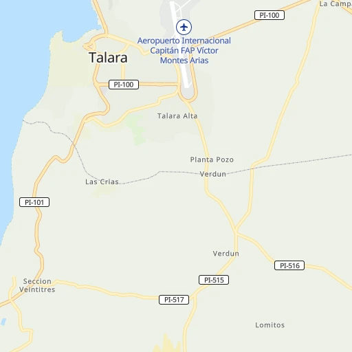
Roadmap (route) to go from Cap. FAP Víctor Montes Arias Airport to Salinera Colán detailed above, you can also see the course layout on the map.
While doing trip Cap. FAP Víctor Montes Arias (airport) - Salinera Colán by car, the calculated route ends at a distance , or more straight.
Distance and duration of the route between Cap. FAP Víctor Montes Arias (airport) and Salinera Colán
Calculation of distance and route from Salinera Colán to Cap. FAP Víctor Montes Arias (airport) :
54.868.8 km1h13mn
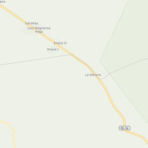
Continue onto Ingreso al Terminal 0h0mn 10 mTurn sharp left 0h0mn 21 mTurn sharp left 0h0mn 52 mContinue onto Ingreso al Terminal 0h1mn 225 mContinue onto Ingreso al Terminal 0h0mn 96 mKeep left onto Ingreso al Terminal 0h0mn 8 mTurn left 0h1mn 910 mAt roundabout, take exit 3 onto PI-100 0h0mn 476 mKeep right 0h5mn 4.2 kmKeep right onto PI-515 0h9mn 9.2 kmTurn slight left onto PI-101 0h28mn 30.4 kmKeep right 0h0mn 176 mTurn right 0h2mn 879 mTurn right 0h7mn 6.1 kmTurn right 0h12mn 10.1 kmKeep right onto PI-101 0h3mn 2.7 kmTurn right onto PI-995 0h1mn 590 mTurn left 0h2mn 1.7 kmTurn left 0h0mn 97 mTurn right 0h2mn 923 mTurn right 0h0mn 25 mArrive at destination 0h0mn 0 m
Travel from Cap. FAP Víctor Montes Arias (airport) (Piura) to a selection of major cities.
Distances from Cap. FAP Víctor Montes Arias Airport to biggest cities in Piura
Other major cities in country :
- Chosica [15], 88,606 inhabitants. 961 km
- Huaraz [02], 86,934 inhabitants. 688 km
- Cerro de Pasco [19], 78,910 inhabitants. 874 km
- San Isidro [15], 68,309 inhabitants. 958 km
- Huaral [15], 62,174 inhabitants. 890 km
- Pisco [11], 61,869 inhabitants. 1,158 km
- Abancay [03], 55,111 inhabitants. 1,364 km
- Huacho [15], 54,545 inhabitants. 831 km
- Moquegua [18], 54,517 inhabitants. 1,800 km
- Ilo [18], 53,476 inhabitants. 1,811 km
- Tingo Maria [10], 53,177 inhabitants. 783 km
- Jaen [06], 52,493 inhabitants. 299 km
- Tarma [12], 51,350 inhabitants. 978 km
Route from Salinera Colán to major cities (Peru).
- Distance Salinera Colán Lima898 km
- Distance Salinera Colán Arequipa1,638 km
- Distance Salinera Colán Callao894 km
- Distance Salinera Colán Trujillo410 km
- Distance Salinera Colán Chiclayo236 km
- Distance Salinera Colán Iquitos879 km
- Distance Salinera Colán Huancayo1,014 km
- Distance Salinera Colán Chimbote528 km
- Distance Salinera Colán Cusco1,375 km
- Distance Salinera Colán Pucallpa811 km
- Distance Salinera Colán Tacna1,863 km
- Distance Salinera Colán Santiago de Surco908 km
- Distance Salinera Colán Ica1,164 km
- Distance Salinera Colán Juliaca1,670 km
- Distance Salinera Colán Chincha Alta1,078 km
- Distance Salinera Colán Huanuco762 km
- Distance Salinera Colán Ayacucho1,176 km
- Distance Salinera Colán Cajamarca370 km
- Distance Salinera Colán Puno1,705 km
- Distance Salinera Colán Tumbes177 km
Nearest cities to Cap. FAP Víctor Montes Arias (airport) :
- Chiclayo, 577,375 inhabitants. 290 km
- Piura, 325,466 inhabitants. 97 km
- Sullana, 160,789 inhabitants. 73 km
- Cajamarca, 135,000 inhabitants. 419 km
- Tumbes, 109,223 inhabitants. 143 km
- Talara, 99,074 inhabitants. 2 km
- Chulucanas, 68,835 inhabitants. 134 km
- Catacaos, 57,304 inhabitants. 100 km
- Paita, 56,151 inhabitants. 59 km
- Jaen, 52,493 inhabitants. 299 km
- Lambayeque, 43,710 inhabitants. 280 km
- Picsi, 43,610 inhabitants. 290 km
- Chepen, 41,992 inhabitants. 358 km
- Sana, 39,200 inhabitants. 320 km
- La Union, 34,834 inhabitants. 108 km
- Ferrenafe, 34,357 inhabitants. 281 km
- Tambo Grande, 30,033 inhabitants. 108 km
- Pacasmayo, 29,165 inhabitants. 365 km
- La Peca, 27,045 inhabitants. 333 km
- Monsefu, 25,707 inhabitants. 298 km
- Marcavelica, 25,645 inhabitants. 70 km
- Querecotillo, 25,396 inhabitants. 74 km
- Guadalupe, 25,376 inhabitants. 356 km
- Sechura, 23,020 inhabitants. 119 km
- Bagua Grande, 20,382 inhabitants. 338 km
- La Breita, 17,693 inhabitants. 54 km
- Zarumilla, 16,907 inhabitants. 162 km
- San Pedro de Lloc, 16,250 inhabitants. 372 km
- Chongoyape, 16,061 inhabitants. 309 km
- Pimentel, 15,552 inhabitants. 291 km
- Chota, 14,240 inhabitants. 363 km
- Salinera Colan, 14,210 inhabitants. 55 km
- Eten, 13,693 inhabitants. 302 km
- Motupe, 13,681 inhabitants. 245 km
- Bambamarca, 13,351 inhabitants. 382 km
- Vice, 12,915 inhabitants. 107 km
- Pueblo Nuevo, 12,471 inhabitants. 198 km
- Morropon, 12,307 inhabitants. 158 km
- Zorritos, 12,261 inhabitants. 118 km
- Santa Rosa, 10,625 inhabitants. 290 km
- Reque, 9,808 inhabitants. 300 km
- Olmos, 9,800 inhabitants. 229 km
- Las Lomas, 9,450 inhabitants. 112 km
- El Alto, 9,303 inhabitants. 35 km
- Aguas Verdes, 9,106 inhabitants. 166 km
- Mancora, 9,101 inhabitants. 57 km
- Pacanga, 8,750 inhabitants. 348 km
- Huancabamba, 8,553 inhabitants. 213 km
- La Huaca, 8,468 inhabitants. 50 km
- Buenos Aires, 7,932 inhabitants. 162 km
Location Cap. FAP Víctor Montes Arias (airport) (Piura) :
| Country flag |  |
| Location | Cap. FAP Víctor Montes Arias (airport) |
| State | Piura |
| County | Provincia de Talara |
| Country | Peru |
| Country code / ISO 2 | PE |
| Latitude | -4.5766400 |
| Longitude | -81.2541400 |
| Altitude | 85 meters |
| Time zone | America/Lima |
Location Salinera Colán (Piura) :
| Country flag | |
| Location | Salinera Colán |
| State | Piura |
| County | Provincia de Paita |
| Country | Peru |
| Country code / ISO 2 | PE |
| Latitude | -5.0333300 |
| Longitude | -81.0666700 |
| Altitude | 0 meters |
| Time zone | America/Lima |
