
How to get from Jayanca (Lambayeque) to Querecotillo (Piura)
Calculate route from Jayanca (Lambayeque, Peru) to Querecotillo (Piura, Peru).
The flight distance (as the crow flies) between Jayanca and Querecotillo is 195.1 km.
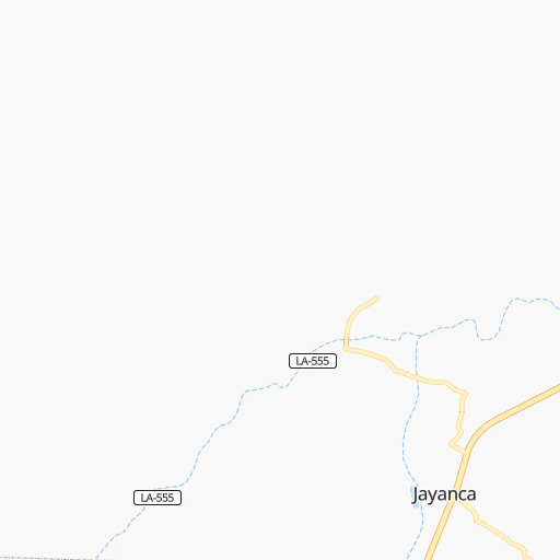
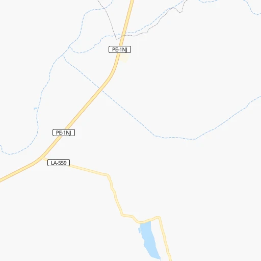
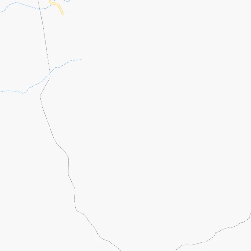
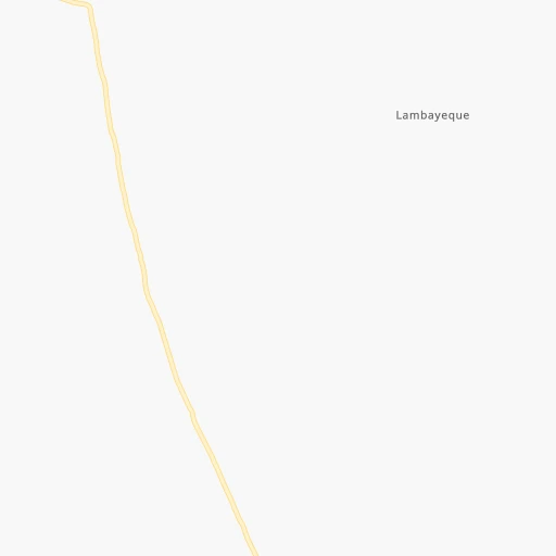
Roadmap (route) to go from Jayanca to Querecotillo detailed above, you can also see the course layout on the map.
While doing trip Jayanca - Querecotillo by car, the calculated route ends at a distance , or more straight.
Distance and duration of the route between Jayanca and Querecotillo
Calculation of distance and route from Querecotillo to Jayanca :
195.1260.6 km3h16mn
Continue 0h0mn 134 mTurn right onto Avenida Diego Ferre 0h9mn 10.4 kmTurn right onto LA-585 0h3mn 2.2 kmTurn right onto LA-585 0h1mn 484 mTurn right onto LA-585 0h1mn 470 mTurn left onto LA-579 0h2mn 2.0 kmTurn right onto Carretera Morrope - Tucume 0h11mn 10.5 kmTurn right onto Carretera Morrope - Tucume 0h5mn 4.8 kmTurn left onto Prolongación Calle San Antonio 0h4mn 4.5 kmTurn right onto Calle Marañón 0h1mn 790 mTurn right onto Carretera Panamericana Norte 2h27mn 211.5 kmAt roundabout, take exit 2 onto Carretera Panamericana Norte 0h2mn 1.8 kmAt roundabout, take exit 2 onto Carretera Panamericana Norte 0h2mn 1.7 kmKeep right onto Carretera Sullana - El Alamor 0h7mn 8.2 kmKeep right 0h0mn 121 mKeep right 0h1mn 403 mKeep left 0h0mn 48 mTurn sharp left 0h0mn 56 mTurn right 0h1mn 558 mArrive at destination 0h0mn 0 m
Travel from Jayanca (Piura) to a selection of major cities.
Distances from Jayanca to biggest cities in Lambayeque
Other major cities in country :
- Tumbes [24], 109,223 inhabitants. 322 km
- Talara [20], 99,074 inhabitants. 258 km
- Chosica [15], 88,606 inhabitants. 706 km
- Huaraz [02], 86,934 inhabitants. 431 km
- Cerro de Pasco [19], 78,910 inhabitants. 617 km
- Chulucanas [20], 68,835 inhabitants. 149 km
- San Isidro [15], 68,309 inhabitants. 706 km
- Huaral [15], 62,174 inhabitants. 637 km
- Pisco [11], 61,869 inhabitants. 906 km
- Catacaos [20], 57,304 inhabitants. 157 km
- Paita [20], 56,151 inhabitants. 204 km
- Abancay [03], 55,111 inhabitants. 1,108 km
- Huacho [15], 54,545 inhabitants. 579 km
- Moquegua [18], 54,517 inhabitants. 1,543 km
- Ilo [18], 53,476 inhabitants. 1,554 km
- Tingo Maria [10], 53,177 inhabitants. 532 km
- Jaen [06], 52,493 inhabitants. 136 km
- Tarma [12], 51,350 inhabitants. 721 km
Route from Querecotillo to major cities (Peru).
- Distance Querecotillo Lima895 km
- Distance Querecotillo Arequipa1,627 km
- Distance Querecotillo Callao892 km
- Distance Querecotillo Trujillo406 km
- Distance Querecotillo Chiclayo233 km
- Distance Querecotillo Iquitos829 km
- Distance Querecotillo Huancayo1,003 km
- Distance Querecotillo Chimbote525 km
- Distance Querecotillo Cusco1,357 km
- Distance Querecotillo Pucallpa780 km
- Distance Querecotillo Tacna1,852 km
- Distance Querecotillo Santiago de Surco906 km
- Distance Querecotillo Ica1,160 km
- Distance Querecotillo Juliaca1,653 km
- Distance Querecotillo Chincha Alta1,075 km
- Distance Querecotillo Huanuco747 km
- Distance Querecotillo Ayacucho1,164 km
- Distance Querecotillo Cajamarca351 km
- Distance Querecotillo Puno1,688 km
- Distance Querecotillo Tumbes143 km
Nearest cities to Jayanca :
- Trujillo, 747,450 inhabitants. 211 km
- Chiclayo, 577,375 inhabitants. 42 km
- Piura, 325,466 inhabitants. 161 km
- Chimbote, 316,966 inhabitants. 330 km
- Sullana, 160,789 inhabitants. 191 km
- Cajamarca, 135,000 inhabitants. 170 km
- Tumbes, 109,223 inhabitants. 322 km
- Talara, 99,074 inhabitants. 258 km
- Chulucanas, 68,835 inhabitants. 149 km
- Catacaos, 57,304 inhabitants. 157 km
- Paita, 56,151 inhabitants. 204 km
- Jaen, 52,493 inhabitants. 136 km
- Moyobamba, 44,276 inhabitants. 318 km
- Lambayeque, 43,710 inhabitants. 36 km
- Picsi, 43,610 inhabitants. 37 km
- Chepen, 41,992 inhabitants. 103 km
- Sana, 39,200 inhabitants. 64 km
- La Union, 34,834 inhabitants. 150 km
- Ferrenafe, 34,357 inhabitants. 28 km
- Chocope, 32,370 inhabitants. 169 km
- Tambo Grande, 30,033 inhabitants. 173 km
- Pacasmayo, 29,165 inhabitants. 116 km
- La Peca, 27,045 inhabitants. 176 km
- Monsefu, 25,707 inhabitants. 54 km
- Marcavelica, 25,645 inhabitants. 195 km
- Querecotillo, 25,396 inhabitants. 195 km
- Guadalupe, 25,376 inhabitants. 103 km
- Rioja, 25,057 inhabitants. 296 km
- Laredo, 24,691 inhabitants. 212 km
- Sechura, 23,020 inhabitants. 145 km
- Moche, 22,581 inhabitants. 218 km
- Santiago de Cao, 21,982 inhabitants. 186 km
- Huamachuco, 21,768 inhabitants. 249 km
- Paijan, 21,128 inhabitants. 160 km
- Viru, 20,774 inhabitants. 254 km
- Bagua Grande, 20,382 inhabitants. 168 km
- Chachapoyas, 20,279 inhabitants. 217 km
- La Breita, 17,693 inhabitants. 265 km
- Zarumilla, 16,907 inhabitants. 325 km
- San Pedro de Lloc, 16,250 inhabitants. 121 km
- Chongoyape, 16,061 inhabitants. 55 km
- Pimentel, 15,552 inhabitants. 51 km
- Coishco, 15,083 inhabitants. 322 km
- Chicama, 14,915 inhabitants. 178 km
- Celendin, 14,660 inhabitants. 193 km
- Chota, 14,240 inhabitants. 131 km
- Salinera Colan, 14,210 inhabitants. 205 km
- Puerto Santa, 14,066 inhabitants. 317 km
- Ascope, 14,015 inhabitants. 167 km
- Eten, 13,693 inhabitants. 58 km
Location Jayanca (Lambayeque) :
| Country flag |  |
| Location | Jayanca |
| State | Lambayeque |
| County | Provincia de Lambayeque |
| Country | Peru |
| Country code / ISO 2 | PE |
| Latitude | -6.3908300 |
| Longitude | -79.8219400 |
| Altitude | 0 meters |
| Time zone | America/Lima |
Location Querecotillo (Piura) :
| Country flag | |
| Location | Querecotillo |
| State | Piura |
| County | Provincia de Sullana |
| Country | Peru |
| Country code / ISO 2 | PE |
| Latitude | -4.8377800 |
| Longitude | -80.6455600 |
| Altitude | 0 meters |
| Time zone | America/Lima |
