


How to get from Sisa (San Martín) to Otuzco (La Libertad)
Calculate route from Sisa (San Martín, Peru) to Otuzco (La Libertad, Peru).
The flight distance (as the crow flies) between Sisa and Otuzco is 252.9 km.
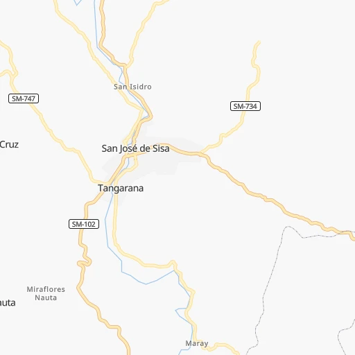
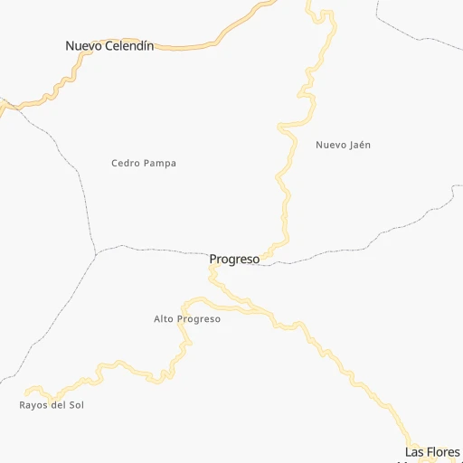
Roadmap (route) to go from Sisa to Otuzco detailed above, you can also see the course layout on the map.
While doing trip Sisa - Otuzco by car, the calculated route ends at a distance , or more straight.
Distance and duration of the route between Sisa and Otuzco
Calculation of distance and route from Otuzco to Sisa :
252.9768.8 km18h34mn
Continue 0h1mn 298 mTurn left onto SM-102 0h8mn 8.7 kmTurn right 0h15mn 14.6 kmTurn left 0h11mn 10.6 kmTurn right onto SM-759 0h0mn 467 mTurn left onto Carretera a San Pablo 0h27mn 30.2 kmAt roundabout, take exit 2 onto Carretera Marginal de la Selva 0h0mn 380 mAt roundabout, take exit 3 onto Carretera Marginal de la Selva 0h0mn 395 mAt roundabout, take exit 2 onto Carretera Marginal de la Selva 0h1mn 1.3 kmAt roundabout, take exit 1 onto Carretera Presidente Fernando Belaúnde Terry 0h5mn 6.2 kmTurn left onto SM-839 0h1mn 513 mTurn right onto SM-839 0h0mn 416 mTurn left onto SM-839 0h18mn 15.1 kmTurn right onto Avenida Aeropuerto 0h0mn 300 mTurn left onto Carretera Presidente Fernando Belaúnde Terry 0h1mn 972 mAt roundabout, take exit 3 onto Arica 0h0mn 123 mTurn right onto Arica 2h53mn 133.9 kmKeep right onto Jirón Trujillo 0h1mn 638 mTurn right onto Avenida Marginal 0h14mn 16.0 kmContinue onto Carretera Presidente Fernando Belaúnde Terry 0h15mn 17.8 kmKeep right 0h0mn 60 mKeep right onto SM-111 0h15mn 16.0 kmTurn left onto SM-111 0h9mn 9.6 kmTurn left onto SM-111 0h9mn 9.7 kmTurn right onto PE-12A 2h30mn 81.3 kmTurn right onto Carretera Cholón 1h24mn 53.1 kmTurn slight left onto PE-12A 0h2mn 980 mTurn slight left onto PE-12A 0h12mn 6.2 kmTurn right onto PE-12A 1h33mn 17.8 kmTurn right onto PE-12A 1h42mn 20.8 kmTurn left onto PE-12A 2h37mn 49.2 kmTurn sharp right onto Calle Chirimoya 0h1mn 553 mTurn right onto Avenida 28 de Julio 0h1mn 1.1 kmTurn right onto AN-558 2h37mn 48.5 kmTurn left 1h32mn 16.1 kmContinue onto AN-509 1h31mn 15.3 kmKeep left 0h1mn 267 mTurn left onto AN-508 0h9mn 4.4 kmKeep right onto AN-101 0h2mn 1.2 kmTurn slight left onto AN-507 0h22mn 11.0 kmTurn left onto Via Acceso Principal 0h3mn 2.2 kmTurn right onto Carretera Longitudinal de la Sierra Norte 0h16mn 8.0 kmTurn right 0h2mn 477 mTurn right onto Carretera Longitudinal de la Sierra Norte 0h18mn 9.6 kmTurn sharp left 0h7mn 3.6 kmTurn right 0h5mn 2.4 kmTurn sharp left onto Carretera Longitudinal de la Sierra Norte 0h8mn 3.8 kmKeep left 0h13mn 6.3 kmKeep left onto Carretera Longitudinal de la Sierra Norte 0h4mn 3.4 kmTurn right onto Carretera Longitudinal de la Sierra Norte 0h12mn 14.4 kmTurn right 0h4mn 2.2 kmContinue onto Carretera Longitudinal de la Sierra Norte 0h1mn 1.2 kmTurn sharp right onto Jirón Gallardo 0h5mn 1.5 kmTurn right onto Carretera Longitudinal de la Sierra Norte 0h1mn 608 mTurn right 0h17mn 8.4 kmTurn left 0h11mn 5.3 kmTurn right 0h12mn 6.1 kmKeep right 0h7mn 3.4 kmTurn slight right 0h6mn 2.9 kmTurn slight left onto LI-931 0h5mn 5.9 kmTurn slight left onto Carretera Trujillo - Huamachuco 1h31mn 24.7 kmKeep right 0h3mn 1.7 kmTurn left 0h0mn 45 mTurn left 0h0mn 90 mTurn right onto Carretera Trujillo - Huamachuco 0h8mn 9.4 kmKeep left 0h6mn 3.1 kmTurn right 0h14mn 6.9 kmTurn sharp left onto Carretera Trujillo - Huamachuco 0h3mn 1.4 kmTurn sharp right onto LI-114 0h4mn 4.1 kmTurn left onto LI-763 0h0mn 186 mTurn left 0h0mn 149 mTurn left 0h0mn 9 mTurn right 0h0mn 79 mTurn slight left 0h0mn 163 mTurn left 0h0mn 76 mTurn right 0h0mn 58 mTurn left 0h0mn 119 mKeep left 0h4mn 2.0 kmTurn right 0h1mn 489 mArrive at destination 0h0mn 0 m
Travel from Sisa (La Libertad) to a selection of major cities.
Distances from Sisa to biggest cities in San Martín
Other major cities in country :
- Puno [21], 116,552 inhabitants. 1,259 km
- Tumbes [24], 109,223 inhabitants. 537 km
- Talara [20], 99,074 inhabitants. 555 km
- Chosica [15], 88,606 inhabitants. 594 km
- Huaraz [02], 86,934 inhabitants. 337 km
- Cerro de Pasco [19], 78,910 inhabitants. 454 km
- Chulucanas [20], 68,835 inhabitants. 420 km
- San Isidro [15], 68,309 inhabitants. 614 km
- Huaral [15], 62,174 inhabitants. 547 km
- Pisco [11], 61,869 inhabitants. 792 km
- Catacaos [20], 57,304 inhabitants. 466 km
- Paita [20], 56,151 inhabitants. 518 km
- Abancay [03], 55,111 inhabitants. 886 km
- Huacho [15], 54,545 inhabitants. 510 km
- Moquegua [18], 54,517 inhabitants. 1,335 km
- Ilo [18], 53,476 inhabitants. 1,358 km
- Tingo Maria [10], 53,177 inhabitants. 309 km
- Jaen [06], 52,493 inhabitants. 255 km
- Tarma [12], 51,350 inhabitants. 546 km
Route from Otuzco to major cities (Peru).
- Distance Otuzco Lima492 km
- Distance Otuzco Arequipa1,217 km
- Distance Otuzco Callao490 km
- Distance Otuzco Chiclayo187 km
- Distance Otuzco Iquitos749 km
- Distance Otuzco Huancayo593 km
- Distance Otuzco Piura377 km
- Distance Otuzco Chimbote132 km
- Distance Otuzco Cusco957 km
- Distance Otuzco Pucallpa447 km
- Distance Otuzco Tacna1,443 km
- Distance Otuzco Santiago de Surco502 km
- Distance Otuzco Ica754 km
- Distance Otuzco Juliaca1,250 km
- Distance Otuzco Sullana407 km
- Distance Otuzco Chincha Alta669 km
- Distance Otuzco Huanuco343 km
- Distance Otuzco Ayacucho755 km
- Distance Otuzco Cajamarca82 km
- Distance Otuzco Puno1,285 km
Nearest cities to Sisa :
- Trujillo, 747,450 inhabitants. 308 km
- Chimbote, 316,966 inhabitants. 345 km
- Pucallpa, 310,750 inhabitants. 307 km
- Cajamarca, 135,000 inhabitants. 209 km
- Huaraz, 86,934 inhabitants. 337 km
- Tingo Maria, 53,177 inhabitants. 309 km
- Jaen, 52,493 inhabitants. 255 km
- Moyobamba, 44,276 inhabitants. 71 km
- Chepen, 41,992 inhabitants. 310 km
- Yurimaguas, 41,827 inhabitants. 101 km
- Sana, 39,200 inhabitants. 321 km
- Juanjui, 37,715 inhabitants. 63 km
- Chocope, 32,370 inhabitants. 309 km
- Pacasmayo, 29,165 inhabitants. 330 km
- Tocache, 29,029 inhabitants. 177 km
- La Peca, 27,045 inhabitants. 223 km
- Guadalupe, 25,376 inhabitants. 316 km
- Rioja, 25,057 inhabitants. 81 km
- Laredo, 24,691 inhabitants. 300 km
- Moche, 22,581 inhabitants. 309 km
- Santiago de Cao, 21,982 inhabitants. 319 km
- Huamachuco, 21,768 inhabitants. 201 km
- Paijan, 21,128 inhabitants. 314 km
- Viru, 20,774 inhabitants. 303 km
- Bagua Grande, 20,382 inhabitants. 216 km
- Chachapoyas, 20,279 inhabitants. 137 km
- Uchiza, 17,742 inhabitants. 207 km
- San Pedro de Lloc, 16,250 inhabitants. 324 km
- Chongoyape, 16,061 inhabitants. 298 km
- Bellavista, 15,231 inhabitants. 51 km
- Coishco, 15,083 inhabitants. 342 km
- Chicama, 14,915 inhabitants. 304 km
- Saposoa, 14,894 inhabitants. 37 km
- Tabalosos, 14,744 inhabitants. 29 km
- Celendin, 14,660 inhabitants. 163 km
- Chota, 14,240 inhabitants. 217 km
- Puerto Santa, 14,066 inhabitants. 341 km
- Ascope, 14,015 inhabitants. 294 km
- Contamana, 13,885 inhabitants. 202 km
- Lamas, 13,693 inhabitants. 28 km
- Cajabamba, 13,486 inhabitants. 187 km
- Bambamarca, 13,351 inhabitants. 204 km
- Caras, 10,926 inhabitants. 298 km
- Soritor, 10,858 inhabitants. 69 km
- Otuzco, 10,134 inhabitants. 253 km
- Salaverry, 10,066 inhabitants. 309 km
- Sisa, 9,477 inhabitants. 0 km
- Quiruvilca, 9,226 inhabitants. 225 km
- Lagunas, 9,197 inhabitants. 191 km
- Yauya, 9,092 inhabitants. 272 km
Location Sisa (San Martín) :
| Country flag |  |
| Location | Sisa |
| State | San Martín |
| County | El Dorado |
| Country | Peru |
| Country code / ISO 2 | PE |
| Latitude | -6.6108500 |
| Longitude | -76.6930200 |
| Altitude | 0 meters |
| Time zone | America/Lima |
Location Otuzco (La Libertad) :
| Country flag | |
| Location | Otuzco |
| State | La Libertad |
| County | Provincia de Otuzco |
| Country | Peru |
| Country code / ISO 2 | PE |
| Latitude | -7.9000000 |
| Longitude | -78.5833300 |
| Altitude | 0 meters |
| Time zone | America/Lima |