

How to get from Algeciras (Huila) to Zipaquirá (Cundinamarca)
Calculate route from Algeciras (Huila, Colombia) to Zipaquirá (Cundinamarca, Colombia).
The flight distance (as the crow flies) between Algeciras and Zipaquirá is 313.4 km.
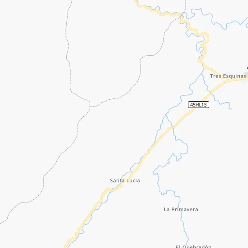
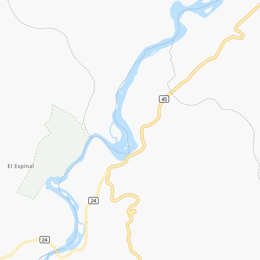
Roadmap (route) to go from Algeciras to Zipaquirá detailed above, you can also see the course layout on the map.
While doing trip Algeciras - Zipaquirá by car, the calculated route ends at a distance , or more straight.
Distance and duration of the route between Algeciras and Zipaquirá
Calculation of distance and route from Zipaquirá to Algeciras :
313.4392.3 km6h14mn
Continue onto Carrera 5 0h1mn 1.5 kmTurn right 0h18mn 17.6 kmTurn slight right onto Vía Hobo-Campoalegre 0h7mn 7.6 kmTurn left onto Calle 12 0h1mn 1.5 kmTurn left onto Vía Neiva - Campoalegre 0h10mn 11.7 kmContinue onto Vía Campoalegre-Neiva 0h11mn 12.3 kmKeep right onto Carrera 5 0h1mn 576 mAt roundabout, take exit 2 onto Carrera 5 0h2mn 2.3 kmTurn left onto Calle 5S 0h0mn 325 mAt roundabout, take exit 2 onto Carrera 2 0h0mn 234 mTurn left onto Avenida Circunvalar 0h3mn 3.8 kmContinue onto Troncal del Magdalena 0h0mn 331 mKeep right 0h0mn 108 mKeep right 2h43mn 120.2 kmAt roundabout, take exit 2 onto Carrera 17 0h9mn 10.9 kmKeep right 0h0mn 355 mKeep right 0h0mn 52 mTurn slight right 0h3mn 3.3 kmKeep right 0h1mn 634 mKeep left 0h10mn 12.4 kmKeep right onto 45 0h0mn 334 mKeep right onto 45 0h2mn 2.3 kmAt roundabout, take exit 1 onto Carrera 4 0h3mn 2.9 kmAt roundabout, take exit 1 onto Troncal del Magdalena 0h15mn 16.6 kmTurn left onto Calle 16 0h0mn 172 mTurn right onto Carrera 9 0h0mn 202 mTurn slight left onto Carrera 9 0h0mn 221 mAt roundabout, take exit 2 onto Carrera 10 0h1mn 777 mAt roundabout, take exit 3 onto Calle 30 1h40mn 40.3 kmTurn right onto Calle 7 0h0mn 116 mTurn left onto Carrera 7 0h1mn 463 mTurn slight left onto Carrera 5 0h0mn 116 mTurn right onto Calle 9 0h1mn 387 mContinue onto Vía Apulo - Tocaima 1h31mn 34.6 kmKeep right onto Vía la Gran Vía - Tena 0h4mn 3.1 kmTurn left onto Carrera 5 0h0mn 185 mTurn left onto Carrera 5 0h0mn 78 mTurn right onto Calle 6 0h0mn 68 mTurn right onto Vía Bogota 0h0mn 65 mTurn left onto Calle 6 0h0mn 90 mTurn left onto Carrera 1 0h0mn 7 mTurn right 0h4mn 1.9 kmTurn right onto Vía la Mesa - Mosquera 0h9mn 9.4 kmContinue onto Vía la Mesa - Mosquera 0h20mn 22.2 kmAt roundabout, take exit 2 onto Avenida Carrera 3 0h1mn 653 mTurn right onto Calle 3 0h1mn 558 mAt roundabout, take exit 3 onto Avenida Carrera 5 Este 0h14mn 10.1 kmAt roundabout, take exit 2 onto Vía Sibería - Cota 0h9mn 7.0 kmKeep left onto Carrera 5 0h8mn 3.8 kmContinue onto Vía Cota Chía 0h5mn 4.1 kmAt roundabout, take exit 1 onto Calle 2 0h0mn 196 mKeep left 0h0mn 103 mContinue onto Carrera 12 0h2mn 1.1 kmTurn right onto Calle 13 0h0mn 312 mTurn left onto Calle 13A 0h0mn 37 mTurn right onto Carrera 9 0h7mn 6.6 kmTurn right 0h0mn 31 mTurn left onto Calle 3 Sur 0h0mn 125 mTurn left onto Carrera 5 0h1mn 739 mTurn right onto Calle 4 0h0mn 95 mTurn left onto Carrera 4 0h0mn 403 mTurn left onto Calle 7 0h0mn 141 mTurn right onto Carrera 6 0h2mn 2.0 kmAt roundabout, take exit 3 onto Troncal Central 0h6mn 6.4 kmKeep right onto Troncal Central 0h2mn 2.0 kmKeep left onto 45A 0h0mn 52 mKeep right onto Calle 1 0h1mn 1.1 kmKeep right onto Carrera 9 0h1mn 250 mTurn left onto Calle 3 0h0mn 79 mTurn sharp left onto Carrera 8 0h0mn 27 mTurn right 0h0mn 40 mArrive at destination 0h0mn 0 m
Travel from Algeciras (Cundinamarca) to a selection of major cities.
Distances from Algeciras to biggest cities in Huila
Other major cities in country :
- Sincelejo [27], 261,187 inhabitants. 755 km
- Popayan [09], 258,653 inhabitants. 144 km
- Floridablanca [26], 252,267 inhabitants. 563 km
- Palmira [29], 247,986 inhabitants. 157 km
- Buenaventura [29], 240,387 inhabitants. 243 km
- Barrancabermeja [26], 191,403 inhabitants. 531 km
- Dos Quebradas [24], 179,583 inhabitants. 261 km
- Tulua [29], 165,501 inhabitants. 199 km
- Envigado [02], 163,007 inhabitants. 408 km
- Cartago [29], 134,827 inhabitants. 256 km
- Maicao [17], 130,348 inhabitants. 1,043 km
- Florencia [08], 130,337 inhabitants. 106 km
- Girardot City [33], 130,289 inhabitants. 206 km
- Sogamoso [36], 126,551 inhabitants. 443 km
- Buga [29], 118,004 inhabitants. 188 km
- Tunja [36], 117,479 inhabitants. 399 km
- Giron [26], 108,466 inhabitants. 559 km
- Malambo [04], 101,534 inhabitants. 930 km
- Magangue [35], 100,313 inhabitants. 750 km
- Facatativa [33], 94,611 inhabitants. 276 km
Route from Zipaquirá to major cities (Colombia).
- Distance Zipaquirá Bogota47 km
- Distance Zipaquirá Cali331 km
- Distance Zipaquirá Medellin220 km
- Distance Zipaquirá Barranquilla667 km
- Distance Zipaquirá Cartagena621 km
- Distance Zipaquirá Cucuta360 km
- Distance Zipaquirá Bucaramanga254 km
- Distance Zipaquirá Pereira189 km
- Distance Zipaquirá Santa Marta693 km
- Distance Zipaquirá Ibague151 km
- Distance Zipaquirá Bello226 km
- Distance Zipaquirá Pasto559 km
- Distance Zipaquirá Manizales168 km
- Distance Zipaquirá Neiva273 km
- Distance Zipaquirá Soledad662 km
- Distance Zipaquirá Villavicencio107 km
- Distance Zipaquirá Armenia194 km
- Distance Zipaquirá Valledupar611 km
- Distance Zipaquirá Itaguei219 km
- Distance Zipaquirá Monteria464 km
Nearest cities to Algeciras :
- Bogota, 7,674,366 inhabitants. 270 km
- Cali, 2,392,877 inhabitants. 168 km
- Pereira, 440,118 inhabitants. 258 km
- Ibague, 421,685 inhabitants. 213 km
- Pasto, 382,236 inhabitants. 263 km
- Manizales, 357,814 inhabitants. 284 km
- Neiva, 352,855 inhabitants. 45 km
- Villavicencio, 321,717 inhabitants. 260 km
- Armenia, 315,328 inhabitants. 227 km
- Soacha, 313,945 inhabitants. 259 km
- Popayan, 258,653 inhabitants. 144 km
- Palmira, 247,986 inhabitants. 157 km
- Buenaventura, 240,387 inhabitants. 243 km
- Dos Quebradas, 179,583 inhabitants. 261 km
- Tulua, 165,501 inhabitants. 199 km
- Cartago, 134,827 inhabitants. 256 km
- Florencia, 130,337 inhabitants. 106 km
- Girardot City, 130,289 inhabitants. 206 km
- Buga, 118,004 inhabitants. 188 km
- Facatativa, 94,611 inhabitants. 276 km
- Zipaquira, 91,235 inhabitants. 314 km
- Fusagasuga, 88,820 inhabitants. 228 km
- La Dorada, 81,950 inhabitants. 334 km
- Ipiales, 77,729 inhabitants. 320 km
- Yumbo, 71,436 inhabitants. 176 km
- Chinchina, 68,512 inhabitants. 276 km
- Chia, 64,569 inhabitants. 295 km
- Calarca, 62,170 inhabitants. 226 km
- Yopal, 61,029 inhabitants. 451 km
- Santa Rosa de Cabal, 57,928 inhabitants. 263 km
- Espinal, 56,213 inhabitants. 187 km
- Funza, 54,421 inhabitants. 273 km
- Pitalito, 53,685 inhabitants. 111 km
- Puerto Tejada, 53,674 inhabitants. 145 km
- Madrid, 50,437 inhabitants. 272 km
- Florida, 47,173 inhabitants. 135 km
- Jamundi, 44,833 inhabitants. 158 km
- Pradera, 44,630 inhabitants. 144 km
- Piendamo, 44,000 inhabitants. 136 km
- Sevilla, 41,612 inhabitants. 205 km
- Santander de Quilichao, 40,798 inhabitants. 141 km
- Acacias, 40,627 inhabitants. 238 km
- El Cerrito, 38,390 inhabitants. 170 km
- Montenegro, 36,499 inhabitants. 232 km
- Villamaria, 35,302 inhabitants. 282 km
- La Virginia, 33,835 inhabitants. 272 km
- Caicedonia, 32,417 inhabitants. 209 km
- Granada, 32,365 inhabitants. 212 km
- Belalcazar, 31,800 inhabitants. 74 km
- Quimbaya, 31,391 inhabitants. 239 km
Location Algeciras (Huila) :
| Country flag |  |
| Location | Algeciras |
| State | Huila |
| County | Algeciras |
| Country | Colombia |
| Country code / ISO 2 | CO |
| Latitude | 2.5238500 |
| Longitude | -75.3173300 |
| Altitude | 0 meters |
| Time zone | America/Bogota |
Location Zipaquirá (Cundinamarca) :
| Country flag | |
| Location | Zipaquirá |
| State | Cundinamarca |
| County | Zipaquirá |
| Country | Colombia |
| Country code / ISO 2 | CO |
| Latitude | 5.0220800 |
| Longitude | -74.0048100 |
| Altitude | 0 meters |
| Time zone | America/Bogota |

