
How to get from Campoalegre (Huila) to Sevilla (Valle del Cauca)
Calculate route from Campoalegre (Huila, Colombia) to Sevilla (Valle del Cauca, Colombia).
The flight distance (as the crow flies) between Campoalegre and Sevilla is 188.0 km.
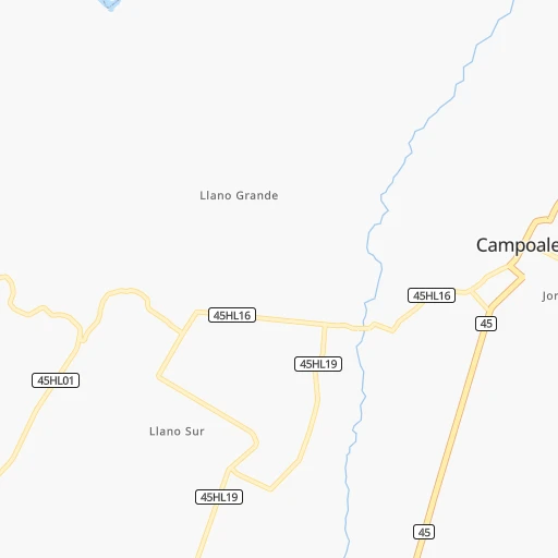
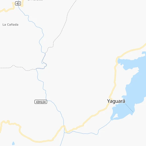
Roadmap (route) to go from Campoalegre to Sevilla detailed above, you can also see the course layout on the map.
While doing trip Campoalegre - Sevilla by car, the calculated route ends at a distance , or more straight.
Distance and duration of the route between Campoalegre and Sevilla
Calculation of distance and route from Sevilla to Campoalegre :
188.0360.3 km6h54mn
Continue onto Calle 20 0h0mn 65 mTurn right onto Carrera 7 0h0mn 191 mTurn left onto Calle 22 0h0mn 160 mTurn right onto Carrera 9 0h0mn 180 mContinue onto Vía Neiva - Campoalegre 0h10mn 11.7 kmContinue onto Vía Campoalegre-Neiva 0h11mn 12.3 kmKeep right onto Carrera 5 0h1mn 576 mAt roundabout, take exit 2 onto Carrera 5 0h2mn 2.3 kmTurn left onto Calle 5S 0h0mn 325 mAt roundabout, take exit 2 onto Carrera 2 0h0mn 234 mTurn left onto Avenida Circunvalar 0h3mn 3.8 kmContinue onto Troncal del Magdalena 0h0mn 331 mKeep right 0h0mn 108 mKeep right 2h43mn 120.2 kmAt roundabout, take exit 2 onto Carrera 17 0h9mn 10.9 kmKeep right 0h0mn 355 mKeep right 0h0mn 52 mTurn slight right 0h2mn 2.5 kmTurn left 0h0mn 86 mKeep right 0h0mn 39 mTurn right onto Vía Chicoral - Guamo 0h2mn 1.3 kmContinue onto Vía Chicoral - Guamo 0h23mn 18.9 kmContinue onto Vía San Francisco 0h2mn 1.5 kmTurn right onto Calle 5 0h0mn 56 mTurn left onto Carrera 3 0h17mn 17.6 kmContinue onto Vía Gualanday - Ibague 0h1mn 1.5 kmTurn left 0h1mn 1.0 kmAt roundabout, take exit 1 onto Variante de Picaleña 0h9mn 9.9 kmAt roundabout, take exit 2 onto Variante de Ibagué 2h34mn 83.5 kmKeep right onto Intercambiador Versalles 0h1mn 1.0 kmAt roundabout, take exit 3 onto 40 0h5mn 4.3 kmAt roundabout, take exit 2 onto Calle 20 0h0mn 280 mAt roundabout, take exit 3 onto Calle 11 0h1mn 989 mAt roundabout, take exit 3 0h1mn 522 mKeep left onto Carrera 19 0h2mn 1.7 kmKeep right onto Carrera 19 0h0mn 251 mAt roundabout, take exit 1 onto Carrera 18 0h1mn 1.3 kmAt roundabout, take exit 2 onto Armenia - Aeropuerto 0h11mn 8.6 kmAt roundabout, take exit 1 onto Glorieta Carlos Londoño G. 0h15mn 16.0 kmKeep left 0h9mn 9.4 kmTurn right 0h14mn 12.2 kmAt roundabout, take exit 2 0h2mn 1.5 kmTurn left 0h1mn 469 mTurn left onto Carrera 46 0h0mn 132 mArrive at destination 0h0mn 0 m
Travel from Campoalegre (Valle del Cauca) to a selection of major cities.
Distances from Campoalegre to biggest cities in Huila
Other major cities in country :
- Sincelejo [27], 261,187 inhabitants. 737 km
- Popayan [09], 258,653 inhabitants. 146 km
- Floridablanca [26], 252,267 inhabitants. 547 km
- Palmira [29], 247,986 inhabitants. 145 km
- Buenaventura [29], 240,387 inhabitants. 232 km
- Barrancabermeja [26], 191,403 inhabitants. 514 km
- Dos Quebradas [24], 179,583 inhabitants. 243 km
- Tulua [29], 165,501 inhabitants. 184 km
- Envigado [02], 163,007 inhabitants. 390 km
- Cartago [29], 134,827 inhabitants. 239 km
- Maicao [17], 130,348 inhabitants. 1,026 km
- Florencia [08], 130,337 inhabitants. 123 km
- Girardot City [33], 130,289 inhabitants. 189 km
- Sogamoso [36], 126,551 inhabitants. 429 km
- Buga [29], 118,004 inhabitants. 173 km
- Tunja [36], 117,479 inhabitants. 384 km
- Giron [26], 108,466 inhabitants. 543 km
- Malambo [04], 101,534 inhabitants. 912 km
- Magangue [35], 100,313 inhabitants. 733 km
- Facatativa [33], 94,611 inhabitants. 260 km
Route from Sevilla to major cities (Colombia).
- Distance Sevilla Bogota209 km
- Distance Sevilla Medellin225 km
- Distance Sevilla Barranquilla757 km
- Distance Sevilla Cartagena685 km
- Distance Sevilla Cucuta554 km
- Distance Sevilla Bucaramanga445 km
- Distance Sevilla Pereira66 km
- Distance Sevilla Santa Marta800 km
- Distance Sevilla Ibague80 km
- Distance Sevilla Bello234 km
- Distance Sevilla Pasto371 km
- Distance Sevilla Manizales101 km
- Distance Sevilla Neiva165 km
- Distance Sevilla Soledad752 km
- Distance Sevilla Villavicencio256 km
- Distance Sevilla Armenia41 km
- Distance Sevilla Soacha193 km
- Distance Sevilla Valledupar751 km
- Distance Sevilla Itaguei217 km
- Distance Sevilla Monteria499 km
Nearest cities to Campoalegre :
- Bogota, 7,674,366 inhabitants. 255 km
- Cali, 2,392,877 inhabitants. 157 km
- Pereira, 440,118 inhabitants. 241 km
- Ibague, 421,685 inhabitants. 196 km
- Pasto, 382,236 inhabitants. 273 km
- Manizales, 357,814 inhabitants. 266 km
- Neiva, 352,855 inhabitants. 27 km
- Villavicencio, 321,717 inhabitants. 249 km
- Armenia, 315,328 inhabitants. 210 km
- Soacha, 313,945 inhabitants. 244 km
- Popayan, 258,653 inhabitants. 146 km
- Palmira, 247,986 inhabitants. 145 km
- Buenaventura, 240,387 inhabitants. 232 km
- Dos Quebradas, 179,583 inhabitants. 243 km
- Tulua, 165,501 inhabitants. 184 km
- Cartago, 134,827 inhabitants. 239 km
- Florencia, 130,337 inhabitants. 123 km
- Girardot City, 130,289 inhabitants. 189 km
- Buga, 118,004 inhabitants. 173 km
- Tunja, 117,479 inhabitants. 384 km
- Facatativa, 94,611 inhabitants. 260 km
- Zipaquira, 91,235 inhabitants. 299 km
- Fusagasuga, 88,820 inhabitants. 213 km
- La Dorada, 81,950 inhabitants. 316 km
- Ipiales, 77,729 inhabitants. 331 km
- Yumbo, 71,436 inhabitants. 164 km
- Chinchina, 68,512 inhabitants. 258 km
- Chia, 64,569 inhabitants. 280 km
- Calarca, 62,170 inhabitants. 208 km
- Yopal, 61,029 inhabitants. 439 km
- Santa Rosa de Cabal, 57,928 inhabitants. 245 km
- Espinal, 56,213 inhabitants. 170 km
- Funza, 54,421 inhabitants. 258 km
- Pitalito, 53,685 inhabitants. 123 km
- Puerto Tejada, 53,674 inhabitants. 136 km
- Madrid, 50,437 inhabitants. 256 km
- Florida, 47,173 inhabitants. 124 km
- Chiquinquira, 45,294 inhabitants. 367 km
- Jamundi, 44,833 inhabitants. 149 km
- Pradera, 44,630 inhabitants. 131 km
- Piendamo, 44,000 inhabitants. 134 km
- Sevilla, 41,612 inhabitants. 188 km
- Santander de Quilichao, 40,798 inhabitants. 134 km
- Acacias, 40,627 inhabitants. 226 km
- El Cerrito, 38,390 inhabitants. 157 km
- Montenegro, 36,499 inhabitants. 215 km
- Villamaria, 35,302 inhabitants. 264 km
- La Virginia, 33,835 inhabitants. 254 km
- Caicedonia, 32,417 inhabitants. 192 km
- Granada, 32,365 inhabitants. 204 km
Location Campoalegre (Huila) :
| Country flag |  |
| Location | Campoalegre |
| State | Huila |
| County | Campoalegre |
| Country | Colombia |
| Country code / ISO 2 | CO |
| Latitude | 2.6848900 |
| Longitude | -75.3231100 |
| Altitude | 0 meters |
| Time zone | America/Bogota |
Location Sevilla (Valle del Cauca) :
| Country flag | |
| Location | Sevilla |
| State | Valle del Cauca |
| County | Sevilla |
| Country | Colombia |
| Country code / ISO 2 | CO |
| Latitude | 4.2642500 |
| Longitude | -75.9308500 |
| Altitude | 0 meters |
| Time zone | America/Bogota |