


How to get from Cravo Norte (Arauca) to Sogamoso (Boyacá)
Calculate route from Cravo Norte (Arauca, Colombia) to Sogamoso (Boyacá, Colombia).
The flight distance (as the crow flies) between Cravo Norte and Sogamoso is 308.6 km.
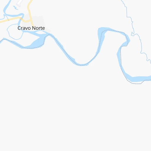
Roadmap (route) to go from Cravo Norte to Sogamoso detailed above, you can also see the course layout on the map.
While doing trip Cravo Norte - Sogamoso by car, the calculated route ends at a distance , or more straight.
Distance and duration of the route between Cravo Norte and Sogamoso
Calculation of distance and route from Sogamoso to Cravo Norte :
308.6423.8 km11h22mn
Continue onto Calle 4 0h0mn 191 mTurn right onto Carrera 6 0h0mn 334 mTurn left onto Calle 7 3h25mn 103.9 kmTurn left 0h0mn 111 mAt roundabout, take exit 1 2h57mn 75.7 kmContinue onto 65 0h4mn 4.2 kmAt roundabout, take exit 2 onto Calle 14 1h51mn 55.8 kmTurn slight right onto Vía a Sacama 2h38mn 49.2 kmTurn slight left onto Socha - Sacama 2h13mn 66.6 kmTurn slight left onto Vía Socota- Socha 0h7mn 5.6 kmTurn left onto Carrera 10 0h0mn 243 mTurn left 0h0mn 133 mTurn slight right 0h1mn 332 mKeep left onto Camino Ruta Libertadora 0h0mn 202 mTurn slight right onto Camino Ruta Libertadora 0h2mn 1.2 kmTurn left onto Paz de Río-Socha 0h9mn 7.4 kmTurn left onto Vía Paz de Río Tasco 0h8mn 8.1 kmTurn right onto Tasco - Paz del Río 1h38mn 38.3 kmAt roundabout, take exit 2 onto Vía a Nobsa 0h5mn 4.5 kmKeep right 0h0mn 213 mKeep left onto Carrera 14 0h2mn 1.4 kmTurn right onto Calle 8 0h0mn 136 mArrive at destination 0h0mn 0 m
Travel from Cravo Norte (Boyacá) to a selection of major cities.
Distances from Cravo Norte to biggest cities in Arauca
Other major cities in country :
- Monteria [12], 272,420 inhabitants. 683 km
- Sincelejo [27], 261,187 inhabitants. 663 km
- Popayan [09], 258,653 inhabitants. 831 km
- Floridablanca [26], 252,267 inhabitants. 330 km
- Palmira [29], 247,986 inhabitants. 743 km
- Buenaventura [29], 240,387 inhabitants. 803 km
- Barrancabermeja [26], 191,403 inhabitants. 412 km
- Dos Quebradas [24], 179,583 inhabitants. 627 km
- Tulua [29], 165,501 inhabitants. 709 km
- Envigado [02], 163,007 inhabitants. 596 km
- Cartago [29], 134,827 inhabitants. 656 km
- Maicao [17], 130,348 inhabitants. 608 km
- Florencia [08], 130,337 inhabitants. 795 km
- Girardot City [33], 130,289 inhabitants. 557 km
- Sogamoso [36], 126,551 inhabitants. 309 km
- Buga [29], 118,004 inhabitants. 727 km
- Tunja [36], 117,479 inhabitants. 361 km
- Giron [26], 108,466 inhabitants. 339 km
- Malambo [04], 101,534 inhabitants. 714 km
- Magangue [35], 100,313 inhabitants. 599 km
Route from Sogamoso to major cities (Colombia).
- Distance Sogamoso Bogota177 km
- Distance Sogamoso Cali472 km
- Distance Sogamoso Medellin297 km
- Distance Sogamoso Barranquilla619 km
- Distance Sogamoso Cartagena594 km
- Distance Sogamoso Cucuta247 km
- Distance Sogamoso Bucaramanga158 km
- Distance Sogamoso Pereira322 km
- Distance Sogamoso Santa Marta631 km
- Distance Sogamoso Ibague292 km
- Distance Sogamoso Bello299 km
- Distance Sogamoso Pasto696 km
- Distance Sogamoso Manizales295 km
- Distance Sogamoso Neiva405 km
- Distance Sogamoso Soledad613 km
- Distance Sogamoso Villavicencio191 km
- Distance Sogamoso Armenia332 km
- Distance Sogamoso Soacha190 km
- Distance Sogamoso Valledupar530 km
- Distance Sogamoso Itaguei300 km
Nearest cities to Cravo Norte :
- Cucuta, 721,398 inhabitants. 310 km
- Bucaramanga, 571,820 inhabitants. 335 km
- Floridablanca, 252,267 inhabitants. 330 km
- Sogamoso, 126,551 inhabitants. 309 km
- Giron, 108,466 inhabitants. 339 km
- Duitama, 92,040 inhabitants. 318 km
- Piedecuesta, 86,387 inhabitants. 324 km
- Arauca, 69,264 inhabitants. 107 km
- Villa del Rosario, 64,951 inhabitants. 303 km
- Yopal, 61,029 inhabitants. 265 km
- Los Patios, 58,661 inhabitants. 306 km
- Pamplona, 53,587 inhabitants. 295 km
- San Gil, 33,592 inhabitants. 326 km
- Tame, 29,099 inhabitants. 170 km
- Cumaribo, 23,990 inhabitants. 211 km
- Villanueva, 20,032 inhabitants. 226 km
- Malaga, 18,739 inhabitants. 283 km
- Puerto Lopez, 16,678 inhabitants. 391 km
- Puerto Santander, 16,275 inhabitants. 334 km
- Aguazul, 15,669 inhabitants. 288 km
- Tibu, 13,565 inhabitants. 382 km
- Paipa, 13,554 inhabitants. 328 km
- El Zulia, 13,521 inhabitants. 321 km
- Soata, 10,945 inhabitants. 274 km
- Puerto Carreno, 10,216 inhabitants. 301 km
- Arauquita, 9,950 inhabitants. 158 km
- Chinacota, 9,667 inhabitants. 302 km
- Sardinata, 7,872 inhabitants. 349 km
- Monterrey, 7,759 inhabitants. 338 km
- Inirida, 7,298 inhabitants. 371 km
- Mani, 7,031 inhabitants. 283 km
- Santa Rosa de Viterbo, 6,923 inhabitants. 311 km
- Puerto Gaitan, 5,928 inhabitants. 304 km
- Toledo, 5,911 inhabitants. 276 km
- Aquitania, 5,718 inhabitants. 309 km
- Belen, 5,411 inhabitants. 302 km
- El Playon, 5,334 inhabitants. 356 km
- Pesca, 5,113 inhabitants. 326 km
- Tauramena, 4,805 inhabitants. 316 km
- Cravo Norte, 4,787 inhabitants. 0 km
- Trinidad, 4,752 inhabitants. 190 km
- Fortul, 4,607 inhabitants. 182 km
- Pore, 4,133 inhabitants. 208 km
- Toca, 3,946 inhabitants. 340 km
- La Primavera, 3,920 inhabitants. 93 km
- Chitaga, 3,871 inhabitants. 287 km
- Capitanejo, 3,791 inhabitants. 277 km
- Boavita, 3,749 inhabitants. 263 km
- Puerto Rondon, 3,724 inhabitants. 99 km
- Villanueva, 3,707 inhabitants. 331 km
Location Cravo Norte (Arauca) :
| Country flag |  |
| Location | Cravo Norte |
| State | Arauca |
| County | Cravo Norte |
| Country | Colombia |
| Country code / ISO 2 | CO |
| Latitude | 6.3017300 |
| Longitude | -70.2041500 |
| Altitude | 0 meters |
| Time zone | America/Bogota |
Location Sogamoso (Boyacá) :
| Country flag | |
| Location | Sogamoso |
| State | Boyacá |
| County | Sogamoso |
| Country | Colombia |
| Country code / ISO 2 | CO |
| Latitude | 5.7143400 |
| Longitude | -72.9339100 |
| Altitude | 0 meters |
| Time zone | America/Bogota |


