


How to get from Maracay (Aragua) to Guanare (Portuguesa)
Calculate route from Maracay (Aragua, Venezuela) to Guanare (Portuguesa, Venezuela).
The flight distance (as the crow flies) between Maracay and Guanare is 270.4 km.
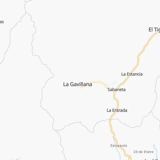
Roadmap (route) to go from Maracay to Guanare detailed above, you can also see the course layout on the map.
While doing trip Maracay - Guanare by car, the calculated route ends at a distance , or more straight.
Distance and duration of the route between Maracay and Guanare
Calculation of distance and route from Guanare to Maracay :
270.4312.8 km5h48mn
Continue 0h0mn 10 mTurn left 0h0mn 60 mTurn left 0h0mn 83 mTurn right 0h1mn 435 mTurn right onto Avenida Aragua 0h3mn 2.4 kmTurn right onto Calle Carabobo 0h1mn 466 mTurn left onto Avenida El Canal 0h2mn 773 mTurn right 0h1mn 721 mTurn left 0h0mn 45 mTurn right onto Autopista Regional del Centro 0h2mn 3.0 kmKeep left onto Carril 2/ Cobro Manual Vehículos Livianos /Peaje La Cabrera 0h14mn 21.9 kmKeep left onto Peaje de Guacara / Vehículos Livianos / Canal Prepagado / Carril 1 0h12mn 18.5 kmKeep right onto Distribuidor San Blas and take T-5, L-1 toward Valencia, Puerto Cabello, San Carlos, Barinas, Barquisimeto 0h4mn 3.4 kmTurn left onto Avenida Aranzazu 0h0mn 491 mTurn right onto Calle 91 Michelena 0h4mn 3.5 kmContinue onto Avenida Lisandro Alvarado 0h2mn 1.6 kmKeep left toward T-5 1h2mn 70.1 kmKeep right onto Carretera Nacional San Carlos - Tinaco and drive toward San Carlos 0h2mn 1.1 kmTurn left 0h0mn 120 mTurn right onto Avenida 5 de Julio 0h1mn 1.3 kmTurn left onto Carretera Nacional San Carlos - Tinaco and drive toward San Carlos 0h17mn 15.4 kmAt roundabout, take exit 2 onto Avenida Bolívar 0h2mn 989 mTurn right onto Calle Federación 0h0mn 138 mTurn left onto Calle Madariaga 0h1mn 690 mTurn right onto Calle Manrique 0h0mn 42 mKeep left onto Calle Manrique 0h0mn 76 mTurn left onto Avenida Circunvalación 0h1mn 649 mTurn right onto Avenida José Laurencio Silva 0h0mn 80 mContinue onto Carretera Vieja Acarigua - San Carlos and drive toward Acarigua 0h8mn 8.4 kmKeep left onto Eje Agrícola Mapurite 0h0mn 85 mKeep right onto Distribuidor Mapurite and take T-5 toward Acarigua 1h32mn 34.0 kmKeep right onto Distribuidor Onoto and take T-5 toward San Rafael 0h1mn 607 mTurn right onto Carretera Vieja Acarigua - San Carlos 0h12mn 14.9 kmAt roundabout, take exit 2 onto Carretera Nacional Acarigua - San Carlos 0h4mn 4.9 kmContinue onto Carretera Nacional Acarigua - San Carlos 0h8mn 10.0 kmAt roundabout, take exit 3 onto Avenida Los Llanos 0h2mn 1.7 kmAt roundabout, take exit 3 onto Avenida Los Llanos 0h3mn 2.3 kmKeep right onto Avenida Los Agricultores 0h1mn 1.0 kmKeep left onto Redoma de La Espiga 0h0mn 113 mKeep right onto Avenida Los Pioneros 0h1mn 1.6 kmKeep left toward T-4, T-5 0h2mn 1.8 kmAt roundabout, take exit 1 onto Carretera Nacional Guanare - Acarigua 1h34mn 36.7 kmAt roundabout, take exit 1 onto Carretera Nacional Guanare - Acarigua 0h7mn 7.5 kmKeep left onto Empalme de Morador and take T-5 toward Guanare 0h29mn 30.4 kmKeep right onto Empalme de Los Naranjos and take T-5 toward Carretera Vieja 0h0mn 150 mTurn slight left onto Carretera Nacional Guanare - Acarigua 0h6mn 5.6 kmKeep right onto Avenida 23 de Enero 0h2mn 1.6 kmTurn left onto Paseo Los Ilustres 0h0mn 81 mTurn right onto Calle 1 Bis 0h0mn 131 mTurn right 0h0mn 43 mTurn left onto Calle 2 0h0mn 81 mTurn right onto Carrera 6 0h1mn 456 mTurn left onto Avenida Tomás Montilla / Calle 7 0h1mn 562 mTurn sharp right onto Carrera 12 0h0mn 77 mArrive at destination 0h0mn 0 m
Travel from Maracay (Portuguesa) to a selection of major cities.
Distances from Maracay to biggest cities in Aragua
Other major cities in country :
- Guatire [15], 191,903 inhabitants. 118 km
- Cua [15], 182,558 inhabitants. 78 km
- Guarenas [15], 181,612 inhabitants. 110 km
- Puerto Cabello [07], 174,000 inhabitants. 55 km
- Ocumare del Tuy [15], 166,072 inhabitants. 90 km
- Guacara [07], 151,752 inhabitants. 31 km
- El Tigre [02], 150,999 inhabitants. 396 km
- Acarigua [18], 143,704 inhabitants. 192 km
- Los Teques [15], 140,617 inhabitants. 61 km
- Punto Fijo [11], 131,784 inhabitants. 328 km
- Charallave [15], 129,182 inhabitants. 80 km
- Anaco [02], 117,596 inhabitants. 354 km
- Calabozo [12], 117,132 inhabitants. 147 km
- Guanare [18], 112,286 inhabitants. 271 km
- Carupano [19], 112,082 inhabitants. 477 km
- Ejido [14], 106,915 inhabitants. 443 km
- Catia La Mar [26], 106,822 inhabitants. 74 km
- Mariara [07], 105,486 inhabitants. 15 km
- Carora [13], 93,788 inhabitants. 273 km
- Valera [21], 93,756 inhabitants. 346 km
Route from Guanare to major cities (Venezuela).
- Distance Guanare Caracas353 km
- Distance Guanare Maracaibo273 km
- Distance Guanare Maracay271 km
- Distance Guanare Valencia228 km
- Distance Guanare Barquisimeto121 km
- Distance Guanare Ciudad Guayana785 km
- Distance Guanare Barcelona568 km
- Distance Guanare Maturin725 km
- Distance Guanare Puerto La Cruz576 km
- Distance Guanare Petare359 km
- Distance Guanare Barinas69 km
- Distance Guanare Turmero282 km
- Distance Guanare Ciudad Bolivar690 km
- Distance Guanare Merida163 km
- Distance Guanare Alto Barinas73 km
- Distance Guanare Santa Teresa del Tuy363 km
- Distance Guanare Cumana630 km
- Distance Guanare San Cristobal308 km
- Distance Guanare Nuestra Senora del Rosario de Baruta350 km
- Distance Guanare Mucumpiz168 km
Nearest cities to Maracay :
- Caracas, 3,000,000 inhabitants. 83 km
- Maracay, 1,754,256 inhabitants. 0 km
- Valencia, 1,385,083 inhabitants. 46 km
- Barquisimeto, 809,490 inhabitants. 194 km
- Barcelona, 424,795 inhabitants. 318 km
- Puerto La Cruz, 370,000 inhabitants. 324 km
- Petare, 364,684 inhabitants. 89 km
- Barinas, 353,442 inhabitants. 339 km
- Turmero, 344,700 inhabitants. 13 km
- Alto Barinas, 284,289 inhabitants. 342 km
- Santa Teresa del Tuy, 278,890 inhabitants. 101 km
- Nuestra Senora del Rosario de Baruta, 244,216 inhabitants. 81 km
- Coro, 195,227 inhabitants. 262 km
- Guatire, 191,903 inhabitants. 118 km
- Cua, 182,558 inhabitants. 78 km
- Guarenas, 181,612 inhabitants. 110 km
- Puerto Cabello, 174,000 inhabitants. 55 km
- Ocumare del Tuy, 166,072 inhabitants. 90 km
- Guacara, 151,752 inhabitants. 31 km
- El Limon, 148,247 inhabitants. 9 km
- Acarigua, 143,704 inhabitants. 192 km
- Los Teques, 140,617 inhabitants. 61 km
- Punto Fijo, 131,784 inhabitants. 328 km
- Charallave, 129,182 inhabitants. 80 km
- Palo Negro, 128,875 inhabitants. 9 km
- Cagua, 119,033 inhabitants. 15 km
- Calabozo, 117,132 inhabitants. 147 km
- Guanare, 112,286 inhabitants. 271 km
- Catia La Mar, 106,822 inhabitants. 74 km
- Mariara, 105,486 inhabitants. 15 km
- Carora, 93,788 inhabitants. 273 km
- Yaritagua, 89,662 inhabitants. 169 km
- Valle de La Pascua, 89,080 inhabitants. 208 km
- San Juan de los Morros, 87,739 inhabitants. 44 km
- La Victoria, 87,045 inhabitants. 28 km
- Tinaquillo, 82,145 inhabitants. 86 km
- El Cafetal, 80,029 inhabitants. 87 km
- San Fernando de Apure, 78,779 inhabitants. 262 km
- San Carlos, 77,192 inhabitants. 126 km
- San Felipe, 76,766 inhabitants. 127 km
- Villa de Cura, 76,614 inhabitants. 25 km
- Araure, 73,054 inhabitants. 195 km
- Guigue, 71,530 inhabitants. 27 km
- Chacao, 64,609 inhabitants. 86 km
- San Antonio de Los Altos, 63,873 inhabitants. 72 km
- Caucaguita, 59,000 inhabitants. 87 km
- Punta Cardon, 58,926 inhabitants. 328 km
- Los Dos Caminos, 58,168 inhabitants. 88 km
- El Hatillo, 57,591 inhabitants. 86 km
- La Dolorita, 56,846 inhabitants. 93 km
Location Maracay (Aragua) :
| Country flag |  |
| Location | Maracay |
| State | Aragua |
| County | Municipio Girardot |
| Country | Venezuela |
| Country code / ISO 2 | VE |
| Latitude | 10.2353500 |
| Longitude | -67.5911300 |
| Altitude | 0 meters |
| Time zone | America/Caracas |
Location Guanare (Portuguesa) :
| Country flag | |
| Location | Guanare |
| State | Portuguesa |
| County | Municipio Guanare |
| Country | Venezuela |
| Country code / ISO 2 | VE |
| Latitude | 9.0418300 |
| Longitude | -69.7420600 |
| Altitude | 0 meters |
| Time zone | America/Caracas |