
How to get from Oro Negro (airport) (Zulia) to Palo Negro (Aragua)
Calculate route from Oro Negro (airport) (Zulia, Venezuela) to Palo Negro (Aragua, Venezuela).
The flight distance (as the crow flies) between Oro Negro (airport) and Palo Negro is 413.4 km.
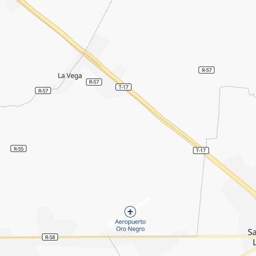
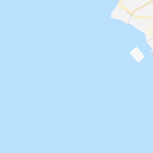
Roadmap (route) to go from Oro Negro Airport to Palo Negro detailed above, you can also see the course layout on the map.
While doing trip Oro Negro (airport) - Palo Negro by car, the calculated route ends at a distance , or more straight.
Distance and duration of the route between Oro Negro (airport) and Palo Negro
Calculation of distance and route from Palo Negro to Oro Negro (airport) :
413.4517.8 km8h32mn
Continue onto Vía Aeropuerto 0h2mn 1.2 kmKeep left 0h0mn 61 mTurn left onto Carretera La Plata 0h14mn 15.9 kmContinue onto Carretera Lara - Zulia 1h32mn 37.3 kmContinue onto Carretera Lara - Zulia 1h52mn 62.1 kmKeep left onto Peaje Jacinto Lara / Canal Exclusivo Cobretag / Carril 1 and drive toward Carora, Agua Viva, Barquisimeto 0h1mn 404 mContinue onto Carretera Lara - Zulia 1h57mn 66.6 kmContinue onto Carretera Lara - Zulia 1h3mn 85.5 kmKeep right toward T-1 0h0mn 224 mKeep right 0h0mn 206 mAt roundabout, take exit 2 onto Redoma del Obelisco 0h2mn 2.7 kmTurn right onto Calle 42 0h0mn 102 mTurn left onto Carrera 19 0h6mn 7.3 kmTurn right onto calle juan mendez 0h0mn 66 mTurn left onto calle turen 0h0mn 176 mTurn left onto calle el naranjillo 0h0mn 109 mTurn sharp left 0h0mn 64 mKeep left 0h0mn 90 mTurn right onto Avenida Intercomunal de Cabudare 0h0mn 142 mContinue onto Avenida Intercomunal de Cabudare 0h0mn 291 mKeep right onto Distribuidor Guardagallo and take T-1 toward Yaritagua, Chivacoa 0h7mn 7.5 kmKeep left onto Peaje Caseteja / Vehículos Livianos / Carril 3 and drive toward San Felipe, Morón, Nirgua 1h38mn 40.5 kmKeep right onto Distribuidor Chivacoa and drive toward Nirgua 0h1mn 620 mKeep right onto Distribuidor Chivacoa and drive toward Nirgua 0h1mn 482 mContinue onto Carretera Panamericana Chivacoa - Nirgua 1h59mn 63.4 kmKeep left onto Peaje Hato Viejo / Canal Exclusivo Cobretag / Carril 1 and drive toward Valencia 0h1mn 246 mContinue onto Carretera Panamericana Nirgua - Tocuyito 1h37mn 39.7 kmTurn left onto R-6 0h13mn 6.3 kmContinue onto R-6 0h13mn 10.7 kmTurn left onto Avenida Lisandro Alvarado 0h4mn 3.5 kmTurn left onto Avenida Aranzazu 0h0mn 487 mTurn right onto Avenida Lara 0h4mn 3.1 kmKeep left onto Distribuidor San Blas toward T-1 0h11mn 18.2 kmKeep left onto Peaje de Guacara / Vehículos Livianos / Canal Prepagado / Carril 1 0h19mn 30.4 kmKeep right onto Distribuidor Palo Negro and take R-8 toward Maracay, Santa Rita, Palo Negro 0h1mn 900 mAt roundabout, take exit 1 onto Avenida Los Aviadores 0h0mn 276 mKeep right 0h6mn 6.6 kmContinue onto Avenida Principal de Palo Negro 0h3mn 3.1 kmTurn left onto Calle Rivas Dávila 0h0mn 254 mTurn right onto Calle Gran Demócrata 0h0mn 263 mTurn left onto Calle Miranda 0h1mn 384 mTurn right onto Calle Ricaurte 0h0mn 163 mArrive at destination 0h0mn 0 m
Travel from Oro Negro (airport) (Aragua) to a selection of major cities.
Distances from Oro Negro Airport to biggest cities in Zulia
Other major cities in country :
- Guatire [15], 191,903 inhabitants. 523 km
- Cua [15], 182,558 inhabitants. 486 km
- Guarenas [15], 181,612 inhabitants. 515 km
- Puerto Cabello [07], 174,000 inhabitants. 361 km
- Ocumare del Tuy [15], 166,072 inhabitants. 498 km
- Guacara [07], 151,752 inhabitants. 377 km
- El Tigre [02], 150,999 inhabitants. 792 km
- El Limon [04], 148,247 inhabitants. 404 km
- Acarigua [18], 143,704 inhabitants. 248 km
- Los Teques [15], 140,617 inhabitants. 468 km
- Punto Fijo [11], 131,784 inhabitants. 195 km
- Charallave [15], 129,182 inhabitants. 489 km
- Palo Negro [04], 128,875 inhabitants. 414 km
- Cagua [04], 119,033 inhabitants. 423 km
- Anaco [02], 117,596 inhabitants. 758 km
- Calabozo [12], 117,132 inhabitants. 455 km
- Guanare [18], 112,286 inhabitants. 225 km
- Carupano [19], 112,082 inhabitants. 884 km
- Ejido [14], 106,915 inhabitants. 199 km
- Catia La Mar [26], 106,822 inhabitants. 470 km
Route from Palo Negro to major cities (Venezuela).
- Distance Palo Negro Caracas81 km
- Distance Palo Negro Maracaibo449 km
- Distance Palo Negro Valencia51 km
- Distance Palo Negro Barquisimeto199 km
- Distance Palo Negro Ciudad Guayana575 km
- Distance Palo Negro Barcelona313 km
- Distance Palo Negro Maturin480 km
- Distance Palo Negro Puerto La Cruz319 km
- Distance Palo Negro Petare87 km
- Distance Palo Negro Barinas340 km
- Distance Palo Negro Ciudad Bolivar495 km
- Distance Palo Negro Merida434 km
- Distance Palo Negro Alto Barinas343 km
- Distance Palo Negro Santa Teresa del Tuy96 km
- Distance Palo Negro Cumana369 km
- Distance Palo Negro San Cristobal580 km
- Distance Palo Negro Nuestra Senora del Rosario de Baruta78 km
- Distance Palo Negro Mucumpiz440 km
- Distance Palo Negro Cabimas429 km
- Distance Palo Negro Coro270 km
Nearest cities to Oro Negro (airport) :
- Maracaibo, 2,225,000 inhabitants. 49 km
- Barquisimeto, 809,490 inhabitants. 217 km
- Barinas, 353,442 inhabitants. 226 km
- Merida, 300,000 inhabitants. 195 km
- Alto Barinas, 284,289 inhabitants. 228 km
- San Cristobal, 246,583 inhabitants. 302 km
- Mucumpiz, 215,259 inhabitants. 214 km
- Cabimas, 200,818 inhabitants. 16 km
- Coro, 195,227 inhabitants. 216 km
- Acarigua, 143,704 inhabitants. 248 km
- Punto Fijo, 131,784 inhabitants. 195 km
- Guanare, 112,286 inhabitants. 225 km
- Ejido, 106,915 inhabitants. 199 km
- Carora, 93,788 inhabitants. 137 km
- Valera, 93,756 inhabitants. 137 km
- Yaritagua, 89,662 inhabitants. 242 km
- San Carlos, 77,192 inhabitants. 309 km
- San Felipe, 76,766 inhabitants. 282 km
- Araure, 73,054 inhabitants. 243 km
- La Villa del Rosario, 65,011 inhabitants. 109 km
- Machiques, 62,968 inhabitants. 138 km
- El Vigia, 59,092 inhabitants. 195 km
- Punta Cardon, 58,926 inhabitants. 191 km
- San Carlos del Zulia, 56,582 inhabitants. 162 km
- El Tocuyo, 53,099 inhabitants. 178 km
- Rubio, 51,568 inhabitants. 314 km
- Chivacoa, 45,904 inhabitants. 266 km
- Lagunillas, 44,257 inhabitants. 23 km
- Quibor, 41,526 inhabitants. 192 km
- Colon, 38,233 inhabitants. 276 km
- Trujillo, 38,110 inhabitants. 145 km
- Los Rastrojos, 34,636 inhabitants. 230 km
- Barinitas, 34,397 inhabitants. 201 km
- San Antonio del Tachira, 32,458 inhabitants. 306 km
- Santa Rita, 31,810 inhabitants. 31 km
- Nirgua, 30,188 inhabitants. 302 km
- Villa Bruzual, 27,993 inhabitants. 266 km
- Tariba, 27,432 inhabitants. 297 km
- La Fria, 27,077 inhabitants. 257 km
- Tucacas, 12,500 inhabitants. 332 km
Location Oro Negro (airport) (Zulia) :
| Country flag |  |
| Location | Oro Negro (airport) |
| State | Zulia |
| County | |
| Country | Venezuela |
| Country code / ISO 2 | VE |
| Latitude | 10.3307500 |
| Longitude | -71.3192500 |
| Altitude | 0 meters |
| Time zone | America/Caracas |
Location Palo Negro (Aragua) :
| Country flag | |
| Location | Palo Negro |
| State | Aragua |
| County | Municipio Libertador |
| Country | Venezuela |
| Country code / ISO 2 | VE |
| Latitude | 10.1738900 |
| Longitude | -67.5419400 |
| Altitude | 0 meters |
| Time zone | America/Caracas |