


How to get from Petare (Miranda) to Barquisimeto (Lara)
Calculate route from Petare (Miranda, Venezuela) to Barquisimeto (Lara, Venezuela).
The flight distance (as the crow flies) between Petare and Barquisimeto is 281.8 km.
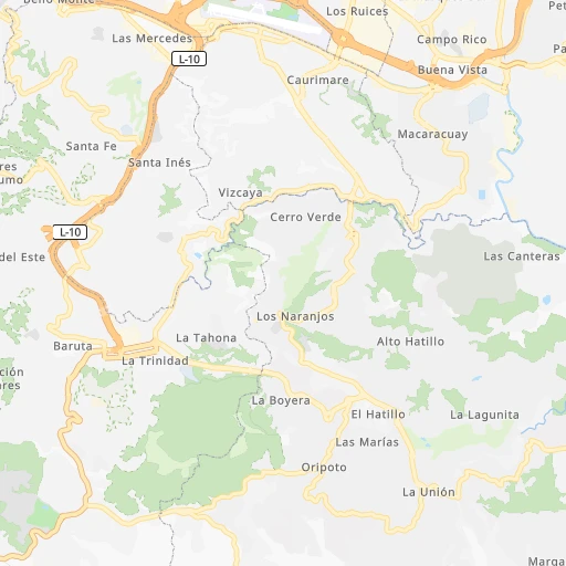
Roadmap (route) to go from Petare to Barquisimeto detailed above, you can also see the course layout on the map.
While doing trip Petare - Barquisimeto by car, the calculated route ends at a distance , or more straight.
Distance and duration of the route between Petare and Barquisimeto
Calculation of distance and route from Barquisimeto to Petare :
281.8350.1 km5h17mn
Continue 0h0mn 19 mTurn sharp left onto Avenida Principal de Campo Rico 0h1mn 436 mTurn right onto Avenida Francisco de Miranda 0h0mn 54 mTurn left onto Avenida San Francisco 0h0mn 354 mKeep right onto Distribuidor Macaracuay and take T-9 toward Chuao, Plaza Venezuela, Centro, Antímano, Caricuao 0h6mn 7.2 kmKeep right onto Distribuidor El Pulpo and take T-9, T-1 toward El Valle, Coche, Maracay 0h6mn 6.4 kmKeep right onto Distribuidor La Gaviota and take L-1 toward San Antonio, Los Teques 0h26mn 22.8 kmContinue onto Carretera Panamericana 0h29mn 22.6 kmTurn right onto Distribuidor Tejerías and take T-1, L-1 toward Caracas, La Victoria, Cagua, Maracay, Valencia 0h0mn 147 mKeep left onto Carril 1 / Cobretag / Peaje Las Tejerías and take T-1 toward Caracas, La Victoria, Cagua, Maracay, Valencia 0h0mn 77 mKeep right onto Distribuidor Tejerías and take T-1 toward La Victoria, Maracay, Valencia, Puerto Cabello, San Carlos, Barquisimeto 1h36mn 56.8 kmKeep left onto Carril 2/ Cobro Manual Vehículos Livianos /Peaje La Cabrera 0h14mn 21.9 kmKeep left onto Peaje de Guacara / Vehículos Livianos / Canal Prepagado / Carril 1 0h12mn 18.5 kmKeep right onto Distribuidor San Blas and take T-5, L-1 toward Valencia, Puerto Cabello, San Carlos, Barinas, Barquisimeto 0h4mn 3.4 kmTurn left onto Avenida Aranzazu 0h0mn 491 mTurn right onto Calle 91 Michelena 0h4mn 3.5 kmContinue onto Avenida Lisandro Alvarado 0h2mn 1.6 kmKeep left toward T-5 0h9mn 9.7 kmKeep right onto Distribuidor La Encrucijada and take T-11 toward Nirgua 0h1mn 631 mContinue onto Distribuidor La Encrucijada and take T-11 toward Nirgua 0h1mn 425 mContinue onto Carretera Panamericana Nirgua - Tocuyito 1h45mn 47.7 kmKeep left onto Peaje Hato Viejo / Canal Exclusivo Cobretag / Carril 1 and drive toward Barquisimeto 0h1mn 246 mContinue onto Carretera Panamericana Nirgua - Tocuyito 1h0mn 64.0 kmKeep right onto Distribuidor Chivacoa and drive toward Barquisimeto 0h1mn 509 mContinue onto Distribuidor Chivacoa and drive toward Barquisimeto 1h38mn 41.1 kmKeep left onto Peaje Caseteja / Vehículos Livianos / Carril 4 and drive toward Cabudare, Barquisimeto, Maracaibo 0h7mn 7.4 kmKeep left onto Avenida Venezuela 0h9mn 8.3 kmTurn left onto Avenida Rómulo Gallegos - Calle 42 0h1mn 664 mTurn right onto Avenida Pedro León Torres 0h2mn 2.8 kmAt roundabout, take exit 4 onto Avenida Rotaria 0h0mn 288 mTurn right 0h0mn 34 mTurn slight right 0h0mn 24 mTurn left 0h0mn 21 mTurn slight left 0h0mn 7 mArrive at destination 0h0mn 0 m
Travel from Petare (Lara) to a selection of major cities.
Distances from Petare to biggest cities in Miranda
Other major cities in country :
- Guacara [07], 151,752 inhabitants. 120 km
- El Tigre [02], 150,999 inhabitants. 332 km
- El Limon [04], 148,247 inhabitants. 92 km
- Acarigua [18], 143,704 inhabitants. 281 km
- Punto Fijo [11], 131,784 inhabitants. 393 km
- Palo Negro [04], 128,875 inhabitants. 87 km
- Cagua [04], 119,033 inhabitants. 78 km
- Anaco [02], 117,596 inhabitants. 283 km
- Calabozo [12], 117,132 inhabitants. 186 km
- Guanare [18], 112,286 inhabitants. 359 km
- Carupano [19], 112,082 inhabitants. 390 km
- Ejido [14], 106,915 inhabitants. 532 km
- Catia La Mar [26], 106,822 inhabitants. 27 km
- Mariara [07], 105,486 inhabitants. 101 km
- Carora [13], 93,788 inhabitants. 359 km
- Valera [21], 93,756 inhabitants. 435 km
- Yaritagua [22], 89,662 inhabitants. 257 km
- Valle de La Pascua [12], 89,080 inhabitants. 167 km
- San Juan de los Morros [12], 87,739 inhabitants. 87 km
- Porlamar [17], 87,120 inhabitants. 326 km
Route from Barquisimeto to major cities (Venezuela).
- Distance Barquisimeto Caracas275 km
- Distance Barquisimeto Maracaibo256 km
- Distance Barquisimeto Maracay194 km
- Distance Barquisimeto Valencia148 km
- Distance Barquisimeto Ciudad Guayana762 km
- Distance Barquisimeto Barcelona512 km
- Distance Barquisimeto Maturin678 km
- Distance Barquisimeto Puerto La Cruz518 km
- Distance Barquisimeto Petare282 km
- Distance Barquisimeto Barinas186 km
- Distance Barquisimeto Turmero207 km
- Distance Barquisimeto Ciudad Bolivar675 km
- Distance Barquisimeto Merida257 km
- Distance Barquisimeto Alto Barinas190 km
- Distance Barquisimeto Santa Teresa del Tuy296 km
- Distance Barquisimeto Cumana568 km
- Distance Barquisimeto San Cristobal406 km
- Distance Barquisimeto Nuestra Senora del Rosario de Baruta275 km
- Distance Barquisimeto Mucumpiz268 km
- Distance Barquisimeto Cabimas233 km
Nearest cities to Petare :
- Caracas, 3,000,000 inhabitants. 7 km
- Maracay, 1,754,256 inhabitants. 89 km
- Valencia, 1,385,083 inhabitants. 135 km
- Barquisimeto, 809,490 inhabitants. 282 km
- Barcelona, 424,795 inhabitants. 236 km
- Puerto La Cruz, 370,000 inhabitants. 241 km
- Petare, 364,684 inhabitants. 0 km
- Turmero, 344,700 inhabitants. 78 km
- Santa Teresa del Tuy, 278,890 inhabitants. 32 km
- Cumana, 257,783 inhabitants. 288 km
- Nuestra Senora del Rosario de Baruta, 244,216 inhabitants. 9 km
- Coro, 195,227 inhabitants. 329 km
- Guatire, 191,903 inhabitants. 30 km
- Cua, 182,558 inhabitants. 36 km
- Guarenas, 181,612 inhabitants. 21 km
- Puerto Cabello, 174,000 inhabitants. 133 km
- Ocumare del Tuy, 166,072 inhabitants. 41 km
- Guacara, 151,752 inhabitants. 120 km
- El Tigre, 150,999 inhabitants. 332 km
- El Limon, 148,247 inhabitants. 92 km
- Acarigua, 143,704 inhabitants. 281 km
- Los Teques, 140,617 inhabitants. 29 km
- Charallave, 129,182 inhabitants. 27 km
- Palo Negro, 128,875 inhabitants. 87 km
- Cagua, 119,033 inhabitants. 78 km
- Anaco, 117,596 inhabitants. 283 km
- Calabozo, 117,132 inhabitants. 186 km
- Guanare, 112,286 inhabitants. 359 km
- Catia La Mar, 106,822 inhabitants. 27 km
- Mariara, 105,486 inhabitants. 101 km
- Yaritagua, 89,662 inhabitants. 257 km
- Valle de La Pascua, 89,080 inhabitants. 167 km
- San Juan de los Morros, 87,739 inhabitants. 87 km
- Porlamar, 87,120 inhabitants. 326 km
- La Victoria, 87,045 inhabitants. 63 km
- Tinaquillo, 82,145 inhabitants. 175 km
- El Cafetal, 80,029 inhabitants. 2 km
- San Fernando de Apure, 78,779 inhabitants. 298 km
- San Carlos, 77,192 inhabitants. 214 km
- San Felipe, 76,766 inhabitants. 212 km
- Villa de Cura, 76,614 inhabitants. 89 km
- Araure, 73,054 inhabitants. 284 km
- Guigue, 71,530 inhabitants. 114 km
- Chacao, 64,609 inhabitants. 4 km
- San Antonio de Los Altos, 63,873 inhabitants. 18 km
- San Jose de Guanipa, 62,128 inhabitants. 341 km
- Caucaguita, 59,000 inhabitants. 14 km
- Los Dos Caminos, 58,168 inhabitants. 2 km
- El Hatillo, 57,591 inhabitants. 7 km
- La Dolorita, 56,846 inhabitants. 3 km
Location Petare (Miranda) :
| Country flag |  |
| Location | Petare |
| State | Miranda |
| County | Municipio Sucre |
| Country | Venezuela |
| Country code / ISO 2 | VE |
| Latitude | 10.4826900 |
| Longitude | -66.8146800 |
| Altitude | 0 meters |
| Time zone | America/Caracas |
Location Barquisimeto (Lara) :
| Country flag | |
| Location | Barquisimeto |
| State | Lara |
| County | Municipio Iribarren |
| Country | Venezuela |
| Country code / ISO 2 | VE |
| Latitude | 10.0647000 |
| Longitude | -69.3570300 |
| Altitude | 0 meters |
| Time zone | America/Caracas |