
How to get from Estación Táchira (Táchira) to Cúa (Miranda)
Calculate route from Estación Táchira (Táchira, Venezuela) to Cúa (Miranda, Venezuela).
The flight distance (as the crow flies) between Estación Táchira and Cúa is 631.2 km.
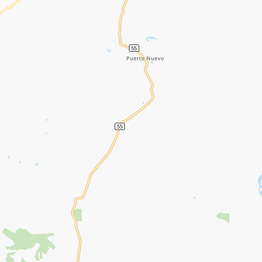
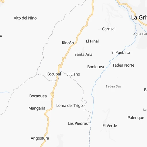
Roadmap (route) to go from Estación Táchira to Cúa detailed above, you can also see the course layout on the map.
While doing trip Estación Táchira - Cúa by car, the calculated route ends at a distance , or more straight.
Distance and duration of the route between Estación Táchira and Cúa
Calculation of distance and route from Cúa to Estación Táchira :
631.2809.1 km12h36mn
Continue 0h0mn 79 mTurn right 0h0mn 142 mTurn left 0h1mn 607 mTurn left 0h0mn 191 mTurn right onto Autopista San Cristóbal - La Fría 0h18mn 18.8 kmContinue onto Carretera Panamericana La Fría - Coloncito 0h16mn 19.3 kmAt roundabout, take exit 2 onto Carretera Panamericana 1h57mn 67.8 kmContinue onto Carretera Panamericana 0h2mn 2.4 kmAt roundabout, take exit 1 onto Carretera Panamericana El Vigía - Mucujepe 2h20mn 167.5 kmKeep right onto Carretera Panamericana Trujillo - Lara 1h1mn 72.3 kmTurn slight right onto Carretera Panamericana Trujillo - Lara 1h34mn 40.8 kmKeep right onto Distribuidor Sabaneta and take T-1 toward Barquisimeto 0h2mn 1.0 kmContinue onto Carretera Lara - Zulia 1h3mn 85.5 kmKeep right toward T-1 0h0mn 224 mKeep right 0h0mn 206 mAt roundabout, take exit 2 onto Redoma del Obelisco 0h2mn 2.7 kmTurn right onto Calle 42 0h0mn 102 mTurn left onto Carrera 19 0h6mn 7.3 kmTurn right onto calle juan mendez 0h0mn 66 mTurn left onto calle turen 0h0mn 176 mTurn left onto calle el naranjillo 0h0mn 109 mTurn sharp left 0h0mn 64 mKeep left 0h0mn 90 mTurn right onto Avenida Intercomunal de Cabudare 0h0mn 142 mContinue onto Avenida Intercomunal de Cabudare 0h0mn 291 mKeep right onto Distribuidor Guardagallo and take T-1 toward Yaritagua, Chivacoa 0h7mn 7.5 kmKeep left onto Peaje Caseteja / Vehículos Livianos / Carril 3 and drive toward San Felipe, Morón, Nirgua 1h38mn 40.5 kmKeep right onto Distribuidor Chivacoa and drive toward Nirgua 0h1mn 620 mKeep right onto Distribuidor Chivacoa and drive toward Nirgua 0h1mn 482 mContinue onto Carretera Panamericana Chivacoa - Nirgua 1h59mn 63.4 kmKeep left onto Peaje Hato Viejo / Canal Exclusivo Cobretag / Carril 1 and drive toward Valencia 0h1mn 246 mContinue onto Carretera Panamericana Nirgua - Tocuyito 1h37mn 39.7 kmTurn left onto R-6 0h13mn 6.3 kmContinue onto R-6 0h13mn 10.7 kmTurn left onto Avenida Lisandro Alvarado 0h4mn 3.5 kmTurn left onto Avenida Aranzazu 0h0mn 487 mTurn right onto Avenida Lara 0h4mn 3.1 kmKeep left onto Distribuidor San Blas toward T-1 0h11mn 18.2 kmKeep left onto Peaje de Guacara / Vehículos Livianos / Canal Prepagado / Carril 1 1h8mn 103.5 kmKeep right onto Distribuidor Paracotos and take R-4, R-68 toward Paracotos 0h0mn 75 mTurn right onto Distribuidor Paracotos 0h1mn 641 mContinue onto Vía a Taica 0h5mn 4.2 kmTurn slight left onto Carretera Taica - Magdalena 0h2mn 837 mKeep right 0h1mn 646 mTurn right onto Carretera Taica - Magdalena 0h11mn 5.7 kmTurn slight left onto Carretera Taica - Magdalena 0h1mn 402 mTurn right onto Vía a Magdalena 0h8mn 6.7 kmTurn right onto Carretera Charallave - Cúa 0h1mn 669 mKeep left 0h2mn 1.7 kmTurn left 0h0mn 69 mTurn right 0h0mn 49 mTurn slight right onto Av. Monseñor Pellín 0h1mn 510 mTurn left 0h0mn 179 mTurn right 0h0mn 241 mTurn left 0h0mn 53 mTurn left 0h0mn 115 mTurn sharp right 0h0mn 35 mArrive at destination 0h0mn 0 m
Travel from Estación Táchira (Miranda) to a selection of major cities.
Distances from Estación Táchira to biggest cities in Táchira
Other major cities in country :
- Coro [11], 195,227 inhabitants. 462 km
- Guatire [15], 191,903 inhabitants. 680 km
- Cua [15], 182,558 inhabitants. 632 km
- Guarenas [15], 181,612 inhabitants. 672 km
- Puerto Cabello [07], 174,000 inhabitants. 533 km
- Ocumare del Tuy [15], 166,072 inhabitants. 642 km
- Guacara [07], 151,752 inhabitants. 535 km
- El Tigre [02], 150,999 inhabitants. 885 km
- El Limon [04], 148,247 inhabitants. 563 km
- Acarigua [18], 143,704 inhabitants. 372 km
- Los Teques [15], 140,617 inhabitants. 624 km
- Punto Fijo [11], 131,784 inhabitants. 457 km
- Charallave [15], 129,182 inhabitants. 638 km
- Palo Negro [04], 128,875 inhabitants. 566 km
- Cagua [04], 119,033 inhabitants. 575 km
- Anaco [02], 117,596 inhabitants. 869 km
- Calabozo [12], 117,132 inhabitants. 538 km
- Guanare [18], 112,286 inhabitants. 295 km
- Carupano [19], 112,082 inhabitants. 1,028 km
- Ejido [14], 106,915 inhabitants. 121 km
Route from Cúa to major cities (Venezuela).
- Distance Cúa Caracas36 km
- Distance Cúa Maracaibo521 km
- Distance Cúa Maracay78 km
- Distance Cúa Valencia123 km
- Distance Cúa Barquisimeto271 km
- Distance Cúa Ciudad Guayana508 km
- Distance Cúa Barcelona241 km
- Distance Cúa Maturin408 km
- Distance Cúa Puerto La Cruz247 km
- Distance Cúa Barinas403 km
- Distance Cúa Turmero65 km
- Distance Cúa Ciudad Bolivar431 km
- Distance Cúa Merida501 km
- Distance Cúa Alto Barinas407 km
- Distance Cúa Cumana297 km
- Distance Cúa San Cristobal645 km
- Distance Cúa Mucumpiz506 km
- Distance Cúa Cabimas501 km
- Distance Cúa Coro335 km
- Distance Cúa Puerto Cabello130 km
Nearest cities to Estación Táchira :
- Maracaibo, 2,225,000 inhabitants. 292 km
- Barquisimeto, 809,490 inhabitants. 385 km
- Barinas, 353,442 inhabitants. 232 km
- Merida, 300,000 inhabitants. 131 km
- Alto Barinas, 284,289 inhabitants. 229 km
- San Cristobal, 246,583 inhabitants. 39 km
- Mucumpiz, 215,259 inhabitants. 127 km
- Cabimas, 200,818 inhabitants. 269 km
- Guanare, 112,286 inhabitants. 295 km
- Ejido, 106,915 inhabitants. 121 km
- Carora, 93,788 inhabitants. 330 km
- Valera, 93,756 inhabitants. 225 km
- La Villa del Rosario, 65,011 inhabitants. 246 km
- Machiques, 62,968 inhabitants. 219 km
- El Vigia, 59,092 inhabitants. 86 km
- San Carlos del Zulia, 56,582 inhabitants. 105 km
- El Tocuyo, 53,099 inhabitants. 328 km
- Rubio, 51,568 inhabitants. 48 km
- Lagunillas, 44,257 inhabitants. 249 km
- Quibor, 41,526 inhabitants. 353 km
- Colon, 38,233 inhabitants. 10 km
- Trujillo, 38,110 inhabitants. 243 km
- Barinitas, 34,397 inhabitants. 215 km
- San Antonio del Tachira, 32,458 inhabitants. 40 km
- Santa Rita, 31,810 inhabitants. 281 km
- Guasdualito, 30,860 inhabitants. 194 km
- Tariba, 27,432 inhabitants. 33 km
- La Fria, 27,077 inhabitants. 11 km
Location Estación Táchira (Táchira) :
| Country flag |  |
| Location | Estación Táchira |
| State | Táchira |
| County | |
| Country | Venezuela |
| Country code / ISO 2 | VE |
| Latitude | 8.1166700 |
| Longitude | -72.2500000 |
| Altitude | 0 meters |
| Time zone | America/Caracas |
Location Cúa (Miranda) :
| Country flag | |
| Location | Cúa |
| State | Miranda |
| County | Municipio Urdaneta |
| Country | Venezuela |
| Country code / ISO 2 | VE |
| Latitude | 10.1624500 |
| Longitude | -66.8824800 |
| Altitude | 0 meters |
| Time zone | America/Caracas |