


How to get from Al Bawīţī (Giza) to Arish (North Sinai)
Calculate route from Al Bawīţī (Giza, Egypt) to Arish (North Sinai, Egypt).
The flight distance (as the crow flies) between Al Bawīţī and Arish is 567.4 km.
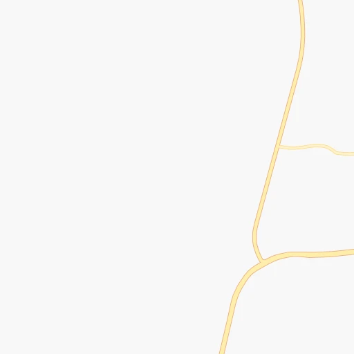
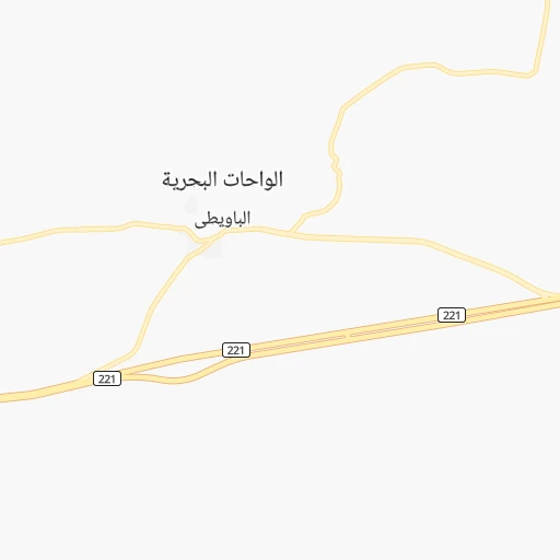
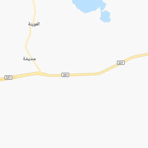
Roadmap (route) to go from Al Bawīţī to Arish detailed above, you can also see the course layout on the map.
While doing trip Al Bawīţī - Arish by car, the calculated route ends at a distance , or more straight.
Distance and duration of the route between Al Bawīţī and Arish
Calculation of distance and route from Arish to Al Bawīţī :
567.4679.1 km10h45mn
Continue 0h0mn 38 mTurn right 0h0mn 33 mTurn right 0h0mn 135 mTurn right onto طريق الواحات البحريه, الفرافرة 0h1mn 1.2 kmTurn right 0h0mn 141 mTurn left onto شارع الاثار 0h0mn 134 mTurn right 0h1mn 278 mTurn left 0h0mn 106 mTurn right 0h0mn 148 mTurn left 0h0mn 11 mTurn sharp right 0h0mn 129 mTurn right 0h0mn 122 mTurn left 0h0mn 223 mTurn left 0h0mn 42 mTurn right 0h0mn 95 mTurn left 0h0mn 87 mTurn right 0h1mn 379 mTurn right onto طريق الجيزة, الواحات البحريه 0h0mn 128 mTurn left 0h0mn 121 mTurn left onto طريق الواحات البحرية, الفرافرة 0h25mn 29.7 kmContinue onto طريق الجيزة, الواحات البحريه 4h37mn 253.5 kmTurn slight right onto طريق الواحات 1h51mn 59.4 kmKeep left and drive toward الطريق الدائرى 0h12mn 15.1 kmKeep right and drive toward جامعة القاهرة, فيصل, بولاق الدكرور, صفط اللبن 0h0mn 31 mKeep right and drive toward جامعة القاهرة, فيصل, بولاق الدكرور 0h5mn 5.3 kmTurn left onto شارع الدقى 0h1mn 655 mKeep right onto شارع الدقى 0h0mn 232 mTurn right onto شارع التحرير 0h1mn 790 mAt roundabout, take exit 2 onto كوبري الجلاء 0h1mn 835 mAt roundabout, take exit 3 onto شارع الجزيره 0h0mn 400 mKeep right 0h2mn 2.7 kmKeep right and drive toward شارع رمسيس 0h2mn 2.0 kmKeep left onto شارع رمسيس 0h2mn 1.9 kmKeep right onto شارع رمسيس and drive toward طريق صلاح سالم, ميدان العباسية 0h0mn 21 mKeep left onto امتداد شارع رمسيس 0h0mn 246 mContinue onto شارع الخليفه المأمون 0h3mn 3.7 kmContinue onto شارع الخليفه المأمون 0h2mn 1.8 kmKeep left onto شارع الحجاز 0h2mn 1.8 kmContinue onto شارع الحجاز 0h1mn 1.1 kmContinue onto شارع الحجاز 0h1mn 952 mKeep left and drive toward طريق الدائرى, طريق الإسماعيلية الصحراوى, محور جوزيف تيتو 0h0mn 116 mKeep right and drive toward طريق الدائرى, طريق الإسماعيلية الصحراوى, محور جوزيف تيتو 0h0mn 544 mTurn left onto شارع جوزيف تيتو 1h10mn 96.2 kmContinue onto طريق القاهرة, الاسماعيليه الصحراوي and drive toward دمياط, يورسعيد, العريش 0h7mn 8.7 kmKeep left onto طريق القاهرة, الاسماعيليه الصحراوي and drive toward بورسعيد, العريش, نفق تحيا مصر 0h22mn 26.0 kmKeep right onto كوبرى الفردان الشمالى and drive toward الإسماعيلية 0h0mn 9 mKeep right onto طريق المعاهده 0h1mn 890 mContinue onto طريق المعاهده 0h1mn 681 mTurn left onto طريق بورسعيد, الاسماعيلية 0h1mn 647 mTurn right 0h8mn 300 mKeep right 0h2mn 122 mTurn right onto شارع الكورنيش 0h0mn 157 mTurn left onto شارع الكورنيش 0h2mn 2.0 kmMake a U-turn onto شارع الكورنيش 0h0mn 135 mTurn right onto شارع الكورنيش 0h1mn 769 mTurn slight right onto شارع الجيش 0h5mn 4.7 kmAt roundabout, take exit 2 onto طريق القنطره شرق, العريش 2h49mn 127.5 kmTurn left 0h0mn 46 mTurn right onto طريق القنطره شرق, العريش 0h1mn 603 mTurn sharp right 0h0mn 45 mTurn sharp left onto طريق القنطره شرق, العريش 0h9mn 10.6 kmTurn left 0h0mn 10 mTurn right onto 40 0h1mn 1.6 kmTurn right 0h0mn 9 mTurn left onto 40 0h8mn 8.8 kmTurn right 0h1mn 467 mTurn left 0h1mn 1.2 kmTurn left 0h0mn 24 mTurn right 0h0mn 235 mTurn right 0h0mn 59 mTurn right 0h0mn 31 mTurn left 0h0mn 39 mArrive at destination 0h0mn 0 m
Travel from Al Bawīţī (North Sinai) to a selection of major cities.
Distances from Al Bawīţī to biggest cities in Giza
Other major cities in country :
- New Cairo [11], 200,000 inhabitants. 315 km
- Bani Suwayf [18], 189,624 inhabitants. 232 km
- Shibin al Kawm [09], 186,345 inhabitants. 321 km
- Banha [12], 167,029 inhabitants. 325 km
- Talkha [01], 157,737 inhabitants. 387 km
- Kafr ash Shaykh [21], 143,970 inhabitants. 367 km
- Mallawi [10], 142,504 inhabitants. 206 km
- Dikirnis [01], 137,542 inhabitants. 403 km
- Idfu [16], 133,000 inhabitants. 548 km
- Bilbays [14], 129,211 inhabitants. 349 km
- Arish [27], 128,855 inhabitants. 568 km
- Jirja [24], 128,250 inhabitants. 374 km
- Bilqas [01], 103,596 inhabitants. 400 km
- Disuq [21], 102,037 inhabitants. 354 km
- Abu Kabir [14], 100,684 inhabitants. 379 km
- Qalyub [12], 100,495 inhabitants. 305 km
- Akhmim [24], 99,446 inhabitants. 347 km
- Al Matariyah [01], 99,357 inhabitants. 439 km
- Hurghada [02], 95,622 inhabitants. 502 km
- Zefta [05], 92,667 inhabitants. 350 km
Route from Arish to major cities (Egypt).
- Distance Arish Cairo272 km
- Distance Arish Alexandria370 km
- Distance Arish Giza278 km
- Distance Arish Port Said145 km
- Distance Arish Suez177 km
- Distance Arish Al Mahallah al Kubra252 km
- Distance Arish Luxor615 km
- Distance Arish Asyut508 km
- Distance Arish Al Mansurah231 km
- Distance Arish Tanda270 km
- Distance Arish Al Fayyum349 km
- Distance Arish Zagazig228 km
- Distance Arish Ismailia157 km
- Distance Arish Kafr ad Dawwar350 km
- Distance Arish Aswan789 km
- Distance Arish Qina563 km
- Distance Arish Halwan279 km
- Distance Arish Damanhur318 km
- Distance Arish Al Minya447 km
- Distance Arish Idku334 km
Nearest cities to Al Bawīţī :
- Cairo, 7,734,614 inhabitants. 300 km
- Alexandria, 3,811,516 inhabitants. 333 km
- Giza, 2,443,203 inhabitants. 293 km
- Al Mahallah al Kubra, 431,052 inhabitants. 367 km
- Asyut, 420,585 inhabitants. 263 km
- Al Mansurah, 420,195 inhabitants. 385 km
- Tanda, 404,901 inhabitants. 341 km
- Al Fayyum, 306,393 inhabitants. 220 km
- Zagazig, 285,097 inhabitants. 357 km
- Kafr ad Dawwar, 267,370 inhabitants. 333 km
- Halwan, 230,000 inhabitants. 289 km
- Damanhur, 227,943 inhabitants. 337 km
- Al Minya, 227,150 inhabitants. 187 km
- Idku, 210,678 inhabitants. 357 km
- Sohag, 209,419 inhabitants. 343 km
- New Cairo, 200,000 inhabitants. 315 km
- Bani Suwayf, 189,624 inhabitants. 232 km
- Shibin al Kawm, 186,345 inhabitants. 321 km
- Banha, 167,029 inhabitants. 325 km
- Talkha, 157,737 inhabitants. 387 km
- Kafr ash Shaykh, 143,970 inhabitants. 367 km
- Mallawi, 142,504 inhabitants. 206 km
- Dikirnis, 137,542 inhabitants. 403 km
- Bilbays, 129,211 inhabitants. 349 km
- Al Hawamidiyah, 106,841 inhabitants. 289 km
- Bilqas, 103,596 inhabitants. 400 km
- Disuq, 102,037 inhabitants. 354 km
- Abu Kabir, 100,684 inhabitants. 379 km
- Qalyub, 100,495 inhabitants. 305 km
- Akhmim, 99,446 inhabitants. 347 km
- Zefta, 92,667 inhabitants. 350 km
- Tahta, 90,591 inhabitants. 314 km
- Samalut, 90,465 inhabitants. 181 km
- Bush, 86,608 inhabitants. 238 km
- Hawsh `Isa, 85,352 inhabitants. 317 km
- Munuf, 83,651 inhabitants. 309 km
- Ashmun, 82,507 inhabitants. 298 km
- Manfalut, 78,744 inhabitants. 237 km
- Kafr az Zayyat, 73,725 inhabitants. 334 km
- Abu Tij, 71,257 inhabitants. 282 km
- Abnub, 68,749 inhabitants. 255 km
- Al Qusiyah, 68,394 inhabitants. 217 km
- Al Jammaliyah, 68,381 inhabitants. 428 km
- Dayrut, 67,788 inhabitants. 210 km
- Al Kharijah, 67,700 inhabitants. 363 km
- Toukh, 67,599 inhabitants. 318 km
- Awsim, 63,862 inhabitants. 296 km
- Al Fashn, 63,793 inhabitants. 206 km
- Fuwwah, 63,310 inhabitants. 357 km
- Faqus, 62,821 inhabitants. 388 km
Location Al Bawīţī (Giza) :
| Country flag |  |
| Location | Al Bawīţī |
| State | Giza |
| County | |
| Country | Egypt |
| Country code / ISO 2 | EG |
| Latitude | 28.3491900 |
| Longitude | 28.8659100 |
| Altitude | 0 meters |
| Time zone | Africa/Cairo |
Location Arish (North Sinai) :
| Country flag | |
| Location | Arish |
| State | North Sinai |
| County | |
| Country | Egypt |
| Country code / ISO 2 | EG |
| Latitude | 31.1315900 |
| Longitude | 33.7984400 |
| Altitude | 0 meters |
| Time zone | Africa/Cairo |
