


How to get from Estación Ceballos (Ciego de Ávila) to San Cristobal (Artemisa)
Calculate route from Estación Ceballos (Ciego de Ávila, Cuba) to San Cristobal (Artemisa, Cuba).
The flight distance (as the crow flies) between Estación Ceballos and San Cristobal is 450.4 km.
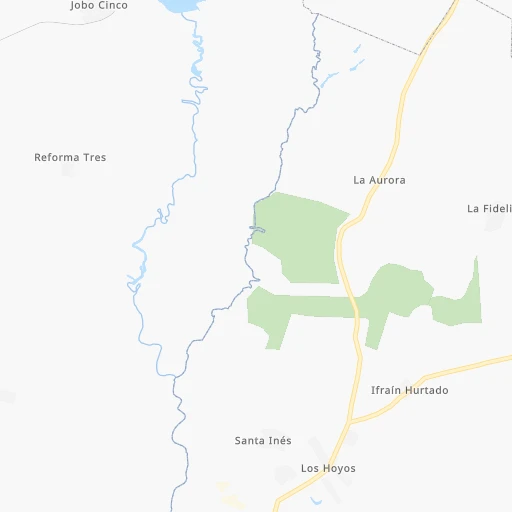
Roadmap (route) to go from Estación Ceballos to San Cristobal detailed above, you can also see the course layout on the map.
While doing trip Estación Ceballos - San Cristobal by car, the calculated route ends at a distance , or more straight.
Distance and duration of the route between Estación Ceballos and San Cristobal
Calculation of distance and route from San Cristobal to Estación Ceballos :
450.4511.7 km7h35mn
Continue 0h5mn 1.3 kmTurn right onto Carretera Ceballos Pina 0h0mn 397 mTurn left onto Avenida Las Palmas 0h0mn 282 mTurn right onto 4ta 0h11mn 9.9 kmTurn right 0h3mn 2.8 kmKeep right 1h46mn 51.8 kmKeep right onto Carretera Majá - Taguasco 1h9mn 91.5 kmKeep left onto Autopista Nacional 3h41mn 238.4 kmKeep right onto Enlace a Carretera Central Madruga 0h0mn 317 mTurn sharp left onto Carretera Central 0h6mn 5.0 kmTurn left onto Desvio del Vidrio 0h4mn 3.6 kmContinue onto 2-376 0h22mn 25.8 kmKeep right onto B 0h0mn 184 mTurn right onto Carretera de Bejucal 0h0mn 244 mKeep left onto Carretera Bejucal - La Ceiba 0h4mn 4.4 kmContinue onto Carretera Bejucal - La Ceiba 0h4mn 4.5 kmTurn left onto Carretera a San Antonio de los Baños 0h3mn 4.0 kmKeep right onto 41 0h1mn 684 mKeep right onto 35 (Nodarse) 0h2mn 1.7 kmTurn right onto Calle 78 0h0mn 224 mTurn left onto Calle 29 0h1mn 763 mContinue onto Carretera San Antonio - Vereda 0h6mn 6.1 kmKeep right onto Carretera San Antonio - Cuatro Caminos de Guanajay 0h15mn 17.0 kmTurn left onto Enlace a Autopista Pinar del Río 0h27mn 37.4 kmKeep left 0h0mn 18 mTurn slight left 0h0mn 362 mTurn right onto Carretera Central 0h1mn 1.1 kmKeep right onto Circunvalación 0h2mn 1.3 kmTurn right onto L 0h1mn 277 mTurn left onto 12 0h0mn 171 mTurn left onto 14 0h0mn 102 mTurn left onto 16 0h0mn 60 mTurn left onto E 0h0mn 38 mArrive at destination 0h0mn 0 m
Travel from Estación Ceballos (Artemisa) to a selection of major cities.
Distances from Estación Ceballos to biggest cities in Ciego de Ávila
Other major cities in country :
- Guanabacoa [02], 112,964 inhabitants. 387 km
- Palma Soriano [15], 102,826 inhabitants. 347 km
- Alamar [02], 100,000 inhabitants. 386 km
- Cardenas [03], 98,515 inhabitants. 279 km
- La Habana Vieja [02], 95,383 inhabitants. 392 km
- Moa [12], 92,852 inhabitants. 420 km
- Puerto Padre [13], 76,838 inhabitants. 238 km
- Contramaestre [15], 70,438 inhabitants. 320 km
- Guira de Melena [AR], 69,879 inhabitants. 398 km
- Consolacion del Sur [01], 69,857 inhabitants. 495 km
- Gueines [MA], 68,935 inhabitants. 351 km
- Artemisa [AR], 68,073 inhabitants. 423 km
- San Luis [15], 67,293 inhabitants. 360 km
- Colon [03], 63,882 inhabitants. 237 km
- Florida [05], 63,007 inhabitants. 73 km
- Sagua la Grande [16], 62,073 inhabitants. 165 km
- Trinidad [14], 60,206 inhabitants. 129 km
- San Cristobal [AR], 59,579 inhabitants. 451 km
- Placetas [16], 55,408 inhabitants. 101 km
- San Jose de las Lajas [MA], 54,847 inhabitants. 367 km
Route from San Cristobal to major cities (Cuba).
- Distance San Cristobal Havana83 km
- Distance San Cristobal Santiago de Cuba807 km
- Distance San Cristobal Camaguey551 km
- Distance San Cristobal Holguin731 km
- Distance San Cristobal Guantanamo862 km
- Distance San Cristobal Santa Clara320 km
- Distance San Cristobal Diez de Octubre83 km
- Distance San Cristobal Arroyo Naranjo79 km
- Distance San Cristobal Las Tunas660 km
- Distance San Cristobal Bayamo713 km
- Distance San Cristobal Boyeros75 km
- Distance San Cristobal Pinar del Rio74 km
- Distance San Cristobal Cienfuegos276 km
- Distance San Cristobal Habana del Este89 km
- Distance San Cristobal San Miguel del Padron87 km
- Distance San Cristobal Centro Habana85 km
- Distance San Cristobal Matanzas156 km
- Distance San Cristobal Ciego de Avila453 km
- Distance San Cristobal Cerro82 km
- Distance San Cristobal Manzanillo669 km
Nearest cities to Estación Ceballos :
- Santiago de Cuba, 555,865 inhabitants. 373 km
- Camaguey, 347,562 inhabitants. 108 km
- Holguin, 319,102 inhabitants. 284 km
- Santa Clara, 250,512 inhabitants. 134 km
- Las Tunas, 203,684 inhabitants. 217 km
- Bayamo, 192,632 inhabitants. 281 km
- Cienfuegos, 186,644 inhabitants. 176 km
- Matanzas, 146,733 inhabitants. 314 km
- Ciego de Avila, 142,027 inhabitants. 14 km
- Manzanillo, 128,188 inhabitants. 248 km
- Sancti Spiritus, 127,069 inhabitants. 72 km
- Palma Soriano, 102,826 inhabitants. 347 km
- Cardenas, 98,515 inhabitants. 279 km
- Puerto Padre, 76,838 inhabitants. 238 km
- Contramaestre, 70,438 inhabitants. 320 km
- San Luis, 67,293 inhabitants. 360 km
- Moron, 66,060 inhabitants. 20 km
- Colon, 63,882 inhabitants. 237 km
- Florida, 63,007 inhabitants. 73 km
- Sagua la Grande, 62,073 inhabitants. 165 km
- Trinidad, 60,206 inhabitants. 129 km
- Placetas, 55,408 inhabitants. 101 km
- Jaguey Grande, 54,363 inhabitants. 253 km
- Nuevitas, 54,022 inhabitants. 161 km
- Bartolome Maso, 53,024 inhabitants. 275 km
- Corralillo, 51,881 inhabitants. 220 km
- Jesus Menendez, 51,002 inhabitants. 252 km
- Jobabo, 49,403 inhabitants. 192 km
- Jovellanos, 47,164 inhabitants. 268 km
- Santo Domingo, 45,476 inhabitants. 169 km
- Cabaiguan, 44,515 inhabitants. 78 km
- San German, 43,892 inhabitants. 311 km
- Ranchuelo, 43,695 inhabitants. 151 km
- Cacocum, 42,623 inhabitants. 286 km
- Yaguajay, 42,218 inhabitants. 64 km
- Manicaragua, 41,532 inhabitants. 128 km
- Amancio, 41,523 inhabitants. 176 km
- Jiguani, 41,106 inhabitants. 300 km
- Cifuentes, 40,142 inhabitants. 154 km
- Guaimaro, 39,358 inhabitants. 177 km
- Caibarien, 39,140 inhabitants. 96 km
- Cumanayagua, 38,687 inhabitants. 151 km
- Condado, 38,248 inhabitants. 113 km
- Camajuani, 35,515 inhabitants. 118 km
- Santa Cruz del Sur, 34,601 inhabitants. 160 km
- Remedios, 34,108 inhabitants. 101 km
- Union de Reyes, 33,646 inhabitants. 301 km
- Vertientes, 29,704 inhabitants. 100 km
- Ciro Redondo, 29,560 inhabitants. 8 km
- Yara, 28,944 inhabitants. 265 km
Location Estación Ceballos (Ciego de Ávila) :
| Country flag |  |
| Location | Estación Ceballos |
| State | Ciego de Ávila |
| County | |
| Country | Cuba |
| Country code / ISO 2 | CU |
| Latitude | 21.9666700 |
| Longitude | -78.7500000 |
| Altitude | 0 meters |
| Time zone | America/Havana |
Location San Cristobal (Artemisa) :
| Country flag | |
| Location | San Cristobal |
| State | Artemisa |
| County | |
| Country | Cuba |
| Country code / ISO 2 | CU |
| Latitude | 22.7165800 |
| Longitude | -83.0564700 |
| Altitude | 0 meters |
| Time zone | America/Havana |
