


How to get from Estación Céspedes (Camagüey) to Placetas (Villa Clara)
Calculate route from Estación Céspedes (Camagüey, Cuba) to Placetas (Villa Clara, Cuba).
The flight distance (as the crow flies) between Estación Céspedes and Placetas is 162.9 km.
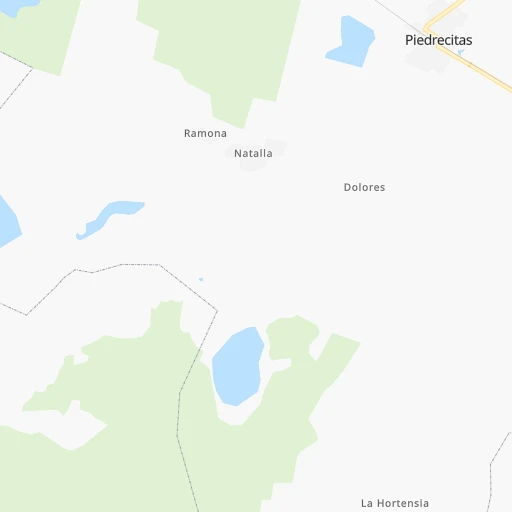
Roadmap (route) to go from Estación Céspedes to Placetas detailed above, you can also see the course layout on the map.
While doing trip Estación Céspedes - Placetas by car, the calculated route ends at a distance , or more straight.
Distance and duration of the route between Estación Céspedes and Placetas
Calculation of distance and route from Placetas to Estación Céspedes :
162.9180.2 km3h38mn
Continue onto Calle 12 0h0mn 21 mTurn left onto Calle 43 0h1mn 405 mTurn right onto Calle 20 0h2mn 1.7 kmTurn right onto Carretera a Piedrecitas 0h4mn 3.6 kmTurn right onto Calle 25 0h1mn 582 mTurn right onto Calle 3 0h1mn 544 mTurn left onto Carretera a Piedrecitas 0h3mn 2.5 kmTurn left onto Carretera Central 1h41mn 48.4 kmAt roundabout, take exit 2 onto Carretera Central 0h2mn 1.9 kmAt roundabout, take exit 2 onto Carretera Central 0h1mn 676 mKeep right onto Carretera Central (Chicho Valdés) 0h4mn 2.9 kmAt roundabout, take exit 2 onto Carretera Central 1h47mn 52.7 kmKeep right onto Carretera Majá - Taguasco 1h30mn 38.5 kmKeep right onto Enlace a Cerretera Central - Placetas 0h0mn 503 mTurn slight right onto Carretera Central 0h20mn 24.3 kmTurn left onto 3ra del Sur 0h1mn 656 mTurn right onto Paseo Martí 0h0mn 112 mTurn left onto 2da del Sur 0h0mn 226 mArrive at destination 0h0mn 0 m
Travel from Estación Céspedes (Villa Clara) to a selection of major cities.
Distances from Estación Céspedes to biggest cities in Camagüey
Other major cities in country :
- Guanabacoa [02], 112,964 inhabitants. 448 km
- Palma Soriano [15], 102,826 inhabitants. 283 km
- Alamar [02], 100,000 inhabitants. 447 km
- Cardenas [03], 98,515 inhabitants. 342 km
- La Habana Vieja [02], 95,383 inhabitants. 453 km
- Moa [12], 92,852 inhabitants. 361 km
- Puerto Padre [13], 76,838 inhabitants. 179 km
- Contramaestre [15], 70,438 inhabitants. 256 km
- Guira de Melena [AR], 69,879 inhabitants. 456 km
- Consolacion del Sur [01], 69,857 inhabitants. 549 km
- Gueines [MA], 68,935 inhabitants. 410 km
- Artemisa [AR], 68,073 inhabitants. 481 km
- San Luis [15], 67,293 inhabitants. 297 km
- Moron [07], 66,060 inhabitants. 68 km
- Colon [03], 63,882 inhabitants. 298 km
- Sagua la Grande [16], 62,073 inhabitants. 229 km
- Trinidad [14], 60,206 inhabitants. 178 km
- San Cristobal [AR], 59,579 inhabitants. 508 km
- Placetas [16], 55,408 inhabitants. 163 km
- San Jose de las Lajas [MA], 54,847 inhabitants. 427 km
Route from Placetas to major cities (Cuba).
- Distance Placetas Havana295 km
- Distance Placetas Santiago de Cuba472 km
- Distance Placetas Camaguey207 km
- Distance Placetas Holguin385 km
- Distance Placetas Guantanamo521 km
- Distance Placetas Diez de Octubre291 km
- Distance Placetas Arroyo Naranjo290 km
- Distance Placetas Las Tunas318 km
- Distance Placetas Bayamo379 km
- Distance Placetas Boyeros293 km
- Distance Placetas Pinar del Rio416 km
- Distance Placetas Cienfuegos84 km
- Distance Placetas Habana del Este290 km
- Distance Placetas San Miguel del Padron284 km
- Distance Placetas Centro Habana293 km
- Distance Placetas Matanzas214 km
- Distance Placetas Ciego de Avila106 km
- Distance Placetas Cerro293 km
- Distance Placetas Manzanillo342 km
- Distance Placetas Sancti Spiritus48 km
Nearest cities to Estación Céspedes :
- Santiago de Cuba, 555,865 inhabitants. 309 km
- Camaguey, 347,562 inhabitants. 44 km
- Holguin, 319,102 inhabitants. 223 km
- Santa Clara, 250,512 inhabitants. 196 km
- Las Tunas, 203,684 inhabitants. 155 km
- Bayamo, 192,632 inhabitants. 217 km
- Cienfuegos, 186,644 inhabitants. 232 km
- Ciego de Avila, 142,027 inhabitants. 57 km
- Manzanillo, 128,188 inhabitants. 184 km
- Sancti Spiritus, 127,069 inhabitants. 126 km
- Palma Soriano, 102,826 inhabitants. 283 km
- Cardenas, 98,515 inhabitants. 342 km
- Puerto Padre, 76,838 inhabitants. 179 km
- Contramaestre, 70,438 inhabitants. 256 km
- San Luis, 67,293 inhabitants. 297 km
- Moron, 66,060 inhabitants. 68 km
- Colon, 63,882 inhabitants. 298 km
- Florida, 63,007 inhabitants. 9 km
- Sagua la Grande, 62,073 inhabitants. 229 km
- Trinidad, 60,206 inhabitants. 178 km
- Placetas, 55,408 inhabitants. 163 km
- Jaguey Grande, 54,363 inhabitants. 312 km
- Nuevitas, 54,022 inhabitants. 106 km
- Banes, 53,104 inhabitants. 275 km
- Bartolome Maso, 53,024 inhabitants. 211 km
- Corralillo, 51,881 inhabitants. 284 km
- Jesus Menendez, 51,002 inhabitants. 193 km
- Jobabo, 49,403 inhabitants. 128 km
- Jovellanos, 47,164 inhabitants. 329 km
- Santo Domingo, 45,476 inhabitants. 231 km
- Cabaiguan, 44,515 inhabitants. 137 km
- San German, 43,892 inhabitants. 249 km
- Ranchuelo, 43,695 inhabitants. 212 km
- Cacocum, 42,623 inhabitants. 224 km
- Yaguajay, 42,218 inhabitants. 129 km
- Manicaragua, 41,532 inhabitants. 186 km
- Amancio, 41,523 inhabitants. 112 km
- Jiguani, 41,106 inhabitants. 236 km
- Cifuentes, 40,142 inhabitants. 217 km
- Guaimaro, 39,358 inhabitants. 113 km
- Caibarien, 39,140 inhabitants. 160 km
- Cumanayagua, 38,687 inhabitants. 208 km
- Condado, 38,248 inhabitants. 164 km
- Camajuani, 35,515 inhabitants. 181 km
- Santa Cruz del Sur, 34,601 inhabitants. 101 km
- Remedios, 34,108 inhabitants. 165 km
- Vertientes, 29,704 inhabitants. 39 km
- Ciro Redondo, 29,560 inhabitants. 65 km
- Yara, 28,944 inhabitants. 201 km
- Gibara, 27,603 inhabitants. 229 km
Location Estación Céspedes (Camagüey) :
| Country flag |  |
| Location | Estación Céspedes |
| State | Camagüey |
| County | |
| Country | Cuba |
| Country code / ISO 2 | CU |
| Latitude | 21.5833300 |
| Longitude | -78.2833300 |
| Altitude | 0 meters |
| Time zone | America/Havana |
Location Placetas (Villa Clara) :
| Country flag | |
| Location | Placetas |
| State | Villa Clara |
| County | |
| Country | Cuba |
| Country code / ISO 2 | CU |
| Latitude | 22.3118400 |
| Longitude | -79.6544000 |
| Altitude | 0 meters |
| Time zone | America/Havana |