
How to get from Ahuehuetzingo (Puebla) to Chalco (México)
Calculate route from Ahuehuetzingo (Puebla, Mexico) to Chalco (México, Mexico).
The flight distance (as the crow flies) between Ahuehuetzingo and Chalco is 90.0 km.
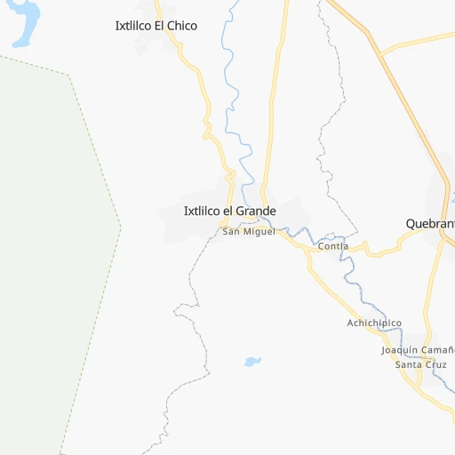
Roadmap (route) to go from Ahuehuetzingo to Chalco detailed above, you can also see the course layout on the map.
While doing trip Ahuehuetzingo - Chalco by car, the calculated route ends at a distance , or more straight.
Distance and duration of the route between Ahuehuetzingo and Chalco
Calculation of distance and route from Chalco to Ahuehuetzingo :
90.0130.0 km2h50mn
Continue onto Carretera Federal Izúcar - Amayuca 0h10mn 10.9 kmKeep right onto MOR 31 0h0mn 243 mTurn slight right onto Independencia 0h2mn 2.4 kmTurn right onto Calle Emiliano Zapata 0h2mn 953 mTurn right onto Calle Galeana 0h0mn 129 mTurn left onto Calle Villa Hermosa 0h5mn 5.1 kmTurn left onto Calle Emiliano Zapata 0h8mn 7.8 kmTurn sharp right 0h7mn 8.2 kmTurn sharp left onto Cuautla - Izúcar de Matamoros 0h5mn 5.6 kmContinue onto Cuautla - Izúcar de Matamoros 0h16mn 26.1 kmKeep right and take MEX 115 toward Amecameca, Chalco 0h14mn 15.5 kmKeep left onto Autopista Amecameca - Cuautla 1h37mn 44.2 kmKeep left and drive toward Chalco 0h3mn 2.6 kmTurn sharp right onto Calle Enseñanza Técnica 0h0mn 243 mArrive at destination 0h0mn 0 m
Travel from Ahuehuetzingo (México) to a selection of major cities.
Distances from Ahuehuetzingo to biggest cities in Puebla
- San Bernardino Tlaxcalancingo,20,363 inhabitants.71 km
Other major cities in country :
- Acapulco de Juarez [12], 652,136 inhabitants. 227 km
- Coyoacan [09], 628,063 inhabitants. 110 km
- Santiago de Queretaro [22], 626,495 inhabitants. 297 km
- Saltillo [07], 621,250 inhabitants. 809 km
- Tlalpan [09], 607,545 inhabitants. 105 km
- Mexicali [02], 597,099 inhabitants. 2,302 km
- Hermosillo [26], 595,811 inhabitants. 1,723 km
- Morelia [16], 592,797 inhabitants. 300 km
- Veracruz [30], 568,313 inhabitants. 274 km
- Cancun [23], 542,043 inhabitants. 1,270 km
- Santa Maria Chimalhuacan [15], 525,389 inhabitants. 109 km
- Torreon [07], 524,066 inhabitants. 927 km
- Cuauhtemoc [09], 521,348 inhabitants. 119 km
- Ciudad Lopez Mateos [15], 521,034 inhabitants. 136 km
- Toluca [15], 505,881 inhabitants. 139 km
- Reynosa [28], 498,654 inhabitants. 846 km
- Tlaquepaque [14], 493,646 inhabitants. 544 km
- Tuxtla [05], 481,128 inhabitants. 617 km
- Cuautitlan Izcalli [15], 475,179 inhabitants. 142 km
- Victoria de Durango [10], 457,140 inhabitants. 877 km
Route from Chalco to major cities (Mexico).
- Distance Chalco Mexico City30 km
- Distance Chalco Iztapalapa20 km
- Distance Chalco Guadalajara496 km
- Distance Chalco Puebla77 km
- Distance Chalco Juarez1,580 km
- Distance Chalco Tijuana2,330 km
- Distance Chalco Gustavo Adolfo Madero34 km
- Distance Chalco Monterrey729 km
- Distance Chalco Leon de los Aldama357 km
- Distance Chalco Zapopan497 km
- Distance Chalco Chihuahua1,274 km
- Distance Chalco Alvaro Obregon34 km
- Distance Chalco Guadalupe728 km
- Distance Chalco Merida988 km
- Distance Chalco San Luis Potosi388 km
- Distance Chalco Culiacan1,070 km
- Distance Chalco Aguascalientes458 km
- Distance Chalco Acapulco de Juarez289 km
- Distance Chalco Coyoacan29 km
- Distance Chalco Santiago de Queretaro215 km
Nearest cities to Ahuehuetzingo :
- Mexico City, 12,294,193 inhabitants. 116 km
- Iztapalapa, 1,820,888 inhabitants. 106 km
- Ecatepec de Morelos, 1,806,226 inhabitants. 132 km
- Puebla, 1,590,256 inhabitants. 76 km
- Ciudad Nezahualcoyotl, 1,232,220 inhabitants. 109 km
- Gustavo Adolfo Madero, 1,193,161 inhabitants. 122 km
- Naucalpan de Juarez, 846,185 inhabitants. 127 km
- Alvaro Obregon, 727,034 inhabitants. 114 km
- Tlalnepantla, 715,767 inhabitants. 131 km
- Acapulco de Juarez, 652,136 inhabitants. 227 km
- Coyoacan, 628,063 inhabitants. 110 km
- Santiago de Queretaro, 626,495 inhabitants. 297 km
- Tlalpan, 607,545 inhabitants. 105 km
- Morelia, 592,797 inhabitants. 300 km
- Veracruz, 568,313 inhabitants. 274 km
- Santa Maria Chimalhuacan, 525,389 inhabitants. 109 km
- Cuauhtemoc, 521,348 inhabitants. 119 km
- Ciudad Lopez Mateos, 521,034 inhabitants. 136 km
- Toluca, 505,881 inhabitants. 139 km
- Cuautitlan Izcalli, 475,179 inhabitants. 142 km
- Venustiano Carranza, 447,459 inhabitants. 117 km
- Azcapotzalco, 425,298 inhabitants. 125 km
- Xalapa de Enriquez, 425,148 inhabitants. 215 km
- Xochimilco, 404,458 inhabitants. 98 km
- Iztacalco, 384,326 inhabitants. 112 km
- Xico, 365,777 inhabitants. 93 km
- Benito Juarez, 355,017 inhabitants. 115 km
- Miguel Hidalgo, 353,534 inhabitants. 121 km
- Ixtapaluca, 351,001 inhabitants. 95 km
- Tlahuac, 344,106 inhabitants. 97 km
- Cuernavaca, 343,769 inhabitants. 79 km
- Irapuato, 339,554 inhabitants. 375 km
- Pachuca de Soto, 319,581 inhabitants. 181 km
- Coacalco, 313,405 inhabitants. 136 km
- Celaya, 305,901 inhabitants. 322 km
- Oaxaca, 262,566 inhabitants. 258 km
- Los Reyes Acaquilpan, 251,168 inhabitants. 104 km
- Colonia del Valle, 250,000 inhabitants. 114 km
- Nicolas Romero, 245,383 inhabitants. 146 km
- Ojo de Agua, 242,272 inhabitants. 138 km
- Tehuacan, 241,429 inhabitants. 131 km
- Magdalena Contreras, 228,927 inhabitants. 111 km
- Buenavista, 206,081 inhabitants. 136 km
- Poza Rica de Hidalgo, 174,526 inhabitants. 259 km
- Delegacion Cuajimalpa de Morelos, 173,625 inhabitants. 120 km
- San Pablo de las Salinas, 173,557 inhabitants. 140 km
- Metepec, 172,982 inhabitants. 133 km
- Chilpancingo, 165,250 inhabitants. 139 km
- Chalco, 163,996 inhabitants. 90 km
- Jiutepec, 162,427 inhabitants. 72 km
Location Ahuehuetzingo (Puebla) :
| Country flag |  |
| Location | Ahuehuetzingo |
| State | Puebla |
| County | Chietla |
| Country | Mexico |
| Country code / ISO 2 | MX |
| Latitude | 18.4902500 |
| Longitude | -98.6375500 |
| Altitude | 0 meters |
| Time zone | America/Mexico_City |
Location Chalco (México) :
| Country flag | |
| Location | Chalco |
| State | México |
| County | Chalco |
| Country | Mexico |
| Country code / ISO 2 | MX |
| Latitude | 19.2617400 |
| Longitude | -98.8977500 |
| Altitude | 0 meters |
| Time zone | America/Mexico_City |

