

How to get from Estación Bertha (Veracruz) to Santo Domingo Tehuantepec (Oaxaca)
Calculate route from Estación Bertha (Veracruz, Mexico) to Santo Domingo Tehuantepec (Oaxaca, Mexico).
The flight distance (as the crow flies) between Estación Bertha and Santo Domingo Tehuantepec is 216.2 km.
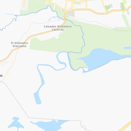
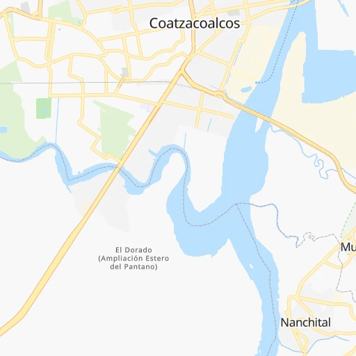
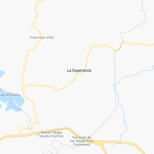
Roadmap (route) to go from Estación Bertha to Santo Domingo Tehuantepec detailed above, you can also see the course layout on the map.
While doing trip Estación Bertha - Santo Domingo Tehuantepec by car, the calculated route ends at a distance , or more straight.
Distance and duration of the route between Estación Bertha and Santo Domingo Tehuantepec
Calculation of distance and route from Santo Domingo Tehuantepec to Estación Bertha :
216.2282.3 km4h57mn
Continue onto Calle Miguel Hernández Callejas 0h1mn 642 mTurn left onto Calle Eduardo Soto Innes 0h0mn 84 mTurn right onto Avenida Agua Marina 0h1mn 575 mTurn right onto Avenida Universidad Veracruzana 0h0mn 137 mMake a U-turn onto Avenida Universidad Veracruzana 0h4mn 4.5 kmTurn slight right onto Carretera Coatzacoalcos-Minatitlán (Vía Canticas) 0h12mn 14.6 kmTurn right onto Calle Sor Juana Inés de la Cruz 0h0mn 180 mTurn left onto Carretera Antigua 0h2mn 1.7 kmTurn left 0h0mn 248 mTurn right onto Autopista Nuevo Teapa - Cosoleacaque 0h26mn 42.2 kmKeep right 0h0mn 354 mKeep left 0h3mn 3.7 kmContinue onto Carretera Federal Sayula de Alemán - Matías Romero Avendano 1h1mn 71.1 kmTurn slight right onto Carretera Federal Sayula de Alemán - Matías Romero Avendano 0h17mn 19.6 kmContinue onto Carretera Transistmica 0h0mn 324 mKeep left onto Carretera Transistmica 0h2mn 2.5 kmContinue onto Carretera Transistmica 1h34mn 41.5 kmKeep right 0h3mn 4.8 kmContinue onto Orizaba 0h26mn 27.3 kmKeep left onto MEX 185 1h42mn 46.4 kmTurn right onto Callejón de la Istmeña 0h0mn 41 mArrive at destination 0h0mn 0 m
Travel from Estación Bertha (Oaxaca) to a selection of major cities.
Distances from Estación Bertha to biggest cities in Veracruz
- Tlapacoyan,33,667 inhabitants.352 km
- Perote,32,559 inhabitants.332 km
- Coatzintla,30,607 inhabitants.409 km
- Huatusco,29,387 inhabitants.286 km
- Cosamaloapan,28,768 inhabitants.142 km
- Nanchital de Lazaro Cardenas del Rio,25,982 inhabitants.10 km
- La Isla,24,558 inhabitants.184 km
- Catemaco,24,257 inhabitants.74 km
- Ixtaczoquitlan,23,522 inhabitants.284 km
- Misantla,23,242 inhabitants.320 km
- Alamo,22,740 inhabitants.456 km
- Alvarado,21,518 inhabitants.153 km
- Allende,21,398 inhabitants.10 km
- Fortin de las Flores,21,370 inhabitants.279 km
- Cosoleacaque,20,371 inhabitants.22 km
Other major cities in country :
- Aguascalientes [01], 658,179 inhabitants. 916 km
- Acapulco de Juarez [12], 652,136 inhabitants. 593 km
- Coyoacan [09], 628,063 inhabitants. 512 km
- Santiago de Queretaro [22], 626,495 inhabitants. 678 km
- Saltillo [07], 621,250 inhabitants. 1,055 km
- Tlalpan [09], 607,545 inhabitants. 510 km
- Mexicali [02], 597,099 inhabitants. 2,647 km
- Hermosillo [26], 595,811 inhabitants. 2,075 km
- Morelia [16], 592,797 inhabitants. 727 km
- Cancun [23], 542,043 inhabitants. 869 km
- Santa Maria Chimalhuacan [15], 525,389 inhabitants. 492 km
- Torreon [07], 524,066 inhabitants. 1,238 km
- Cuauhtemoc [09], 521,348 inhabitants. 513 km
- Ciudad Lopez Mateos [15], 521,034 inhabitants. 527 km
- Toluca [15], 505,881 inhabitants. 560 km
- Reynosa [28], 498,654 inhabitants. 968 km
- Tlaquepaque [14], 493,646 inhabitants. 966 km
- Tuxtla [05], 481,128 inhabitants. 211 km
- Cuautitlan Izcalli [15], 475,179 inhabitants. 526 km
- Victoria de Durango [10], 457,140 inhabitants. 1,243 km
Route from Santo Domingo Tehuantepec to major cities (Mexico).
- Distance Santo Domingo Tehuantepec Mexico City537 km
- Distance Santo Domingo Tehuantepec Iztapalapa527 km
- Distance Santo Domingo Tehuantepec Ecatepec de Morelos545 km
- Distance Santo Domingo Tehuantepec Guadalajara987 km
- Distance Santo Domingo Tehuantepec Puebla436 km
- Distance Santo Domingo Tehuantepec Juarez2,056 km
- Distance Santo Domingo Tehuantepec Tijuana2,837 km
- Distance Santo Domingo Tehuantepec Ciudad Nezahualcoyotl526 km
- Distance Santo Domingo Tehuantepec Gustavo Adolfo Madero541 km
- Distance Santo Domingo Tehuantepec Monterrey1,167 km
- Distance Santo Domingo Tehuantepec Leon de los Aldama863 km
- Distance Santo Domingo Tehuantepec Zapopan989 km
- Distance Santo Domingo Tehuantepec Naucalpan de Juarez550 km
- Distance Santo Domingo Tehuantepec Chihuahua1,765 km
- Distance Santo Domingo Tehuantepec Alvaro Obregon539 km
- Distance Santo Domingo Tehuantepec Guadalupe1,164 km
- Distance Santo Domingo Tehuantepec Merida787 km
- Distance Santo Domingo Tehuantepec Tlalnepantla551 km
- Distance Santo Domingo Tehuantepec San Luis Potosi885 km
- Distance Santo Domingo Tehuantepec Culiacan1,577 km
Nearest cities to Estación Bertha :
- Veracruz, 568,313 inhabitants. 211 km
- Tuxtla, 481,128 inhabitants. 211 km
- Xalapa de Enriquez, 425,148 inhabitants. 300 km
- Villahermosa, 362,401 inhabitants. 165 km
- Oaxaca, 262,566 inhabitants. 266 km
- Tehuacan, 241,429 inhabitants. 310 km
- Coatzacoalcos, 230,717 inhabitants. 5 km
- Poza Rica de Hidalgo, 174,526 inhabitants. 411 km
- Minatitlan, 150,895 inhabitants. 16 km
- Ciudad del Carmen, 141,308 inhabitants. 286 km
- Cordoba, 134,403 inhabitants. 271 km
- Tuxpam de Rodriguez Cano, 134,394 inhabitants. 440 km
- San Cristobal de las Casas, 128,996 inhabitants. 250 km
- Orizaba, 121,348 inhabitants. 288 km
- Las Margaritas, 103,403 inhabitants. 334 km
- Martinez de la Torre, 100,377 inhabitants. 347 km
- Tuxtepec, 92,121 inhabitants. 174 km
- Cardenas, 85,350 inhabitants. 118 km
- Comitan, 79,944 inhabitants. 326 km
- Salina Cruz, 73,648 inhabitants. 230 km
- Teziutlan, 70,819 inhabitants. 356 km
- Juchitan de Zaragoza, 67,637 inhabitants. 197 km
- Santa Cruz Xoxocotlan, 61,846 inhabitants. 269 km
- San Andres Tuxtla, 55,697 inhabitants. 85 km
- Coatepec, 48,453 inhabitants. 300 km
- Papantla de Olarte, 47,958 inhabitants. 395 km
- Acayucan, 46,990 inhabitants. 50 km
- Comalcalco, 40,992 inhabitants. 134 km
- Las Choapas, 40,304 inhabitants. 48 km
- Rio Blanco, 39,543 inhabitants. 293 km
- Loma Bonita, 39,166 inhabitants. 148 km
- Santo Domingo Tehuantepec, 37,389 inhabitants. 217 km
- Palenque, 36,669 inhabitants. 274 km
- Agua Dulce, 36,119 inhabitants. 36 km
- Ciudad Mendoza, 35,546 inhabitants. 294 km
- Tlapacoyan, 33,667 inhabitants. 352 km
- Cintalapa de Figueroa, 33,464 inhabitants. 180 km
- Tonala, 32,855 inhabitants. 240 km
- Perote, 32,559 inhabitants. 332 km
- Chiapa de Corzo, 32,182 inhabitants. 222 km
- Ocozocoautla de Espinosa, 31,596 inhabitants. 192 km
- Coatzintla, 30,607 inhabitants. 409 km
- Macuspana, 30,409 inhabitants. 204 km
- Huatusco, 29,387 inhabitants. 286 km
- Huixtla, 29,257 inhabitants. 396 km
- Cosamaloapan, 28,768 inhabitants. 142 km
- Ocosingo, 28,721 inhabitants. 288 km
- Huimanguillo, 26,602 inhabitants. 120 km
- Rio de Teapa, 26,500 inhabitants. 172 km
- Teapa, 26,331 inhabitants. 175 km
Location Estación Bertha (Veracruz) :
| Country flag |  |
| Location | Estación Bertha |
| State | Veracruz |
| County | Coatzacoalcos |
| Country | Mexico |
| Country code / ISO 2 | MX |
| Latitude | 18.1300000 |
| Longitude | -94.4825500 |
| Altitude | 0 meters |
| Time zone | America/Mexico_City |
Location Santo Domingo Tehuantepec (Oaxaca) :
| Country flag | |
| Location | Santo Domingo Tehuantepec |
| State | Oaxaca |
| County | Santo Domingo Tehuantepec |
| Country | Mexico |
| Country code / ISO 2 | MX |
| Latitude | 16.3246300 |
| Longitude | -95.2410400 |
| Altitude | 0 meters |
| Time zone | America/Mexico_City |


