

How to get from Cárdenas (San Luis Potosí) to Mexicali (Baja California)
Calculate route from Cárdenas (San Luis Potosí, Mexico) to Mexicali (Baja California, Mexico).
The flight distance (as the crow flies) between Cárdenas and Mexicali is 1,951.6 km.
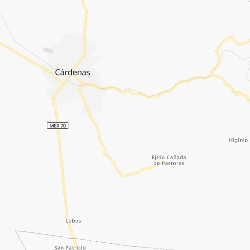
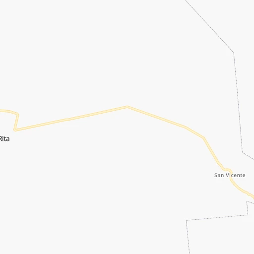
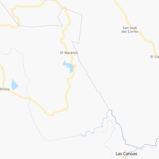
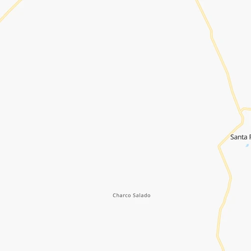
Roadmap (route) to go from Cárdenas to Mexicali detailed above, you can also see the course layout on the map.
While doing trip Cárdenas - Mexicali by car, the calculated route ends at a distance , or more straight.
Distance and duration of the route between Cárdenas and Mexicali
Calculation of distance and route from Mexicali to Cárdenas :
1,951.62,330.1 km30h40mn
Continue onto Belisario Domínguez 0h4mn 1.9 kmTurn left onto Calle Álvaro Obregón 0h1mn 722 mTurn left onto Calle Doctor Amonario Díaz de León de la Rosa 0h0mn 73 mTurn right onto Calle General Miguel Barragán 0h3mn 3.7 kmKeep right 0h1mn 302 mTurn slight right onto Carretera Cárdenas-Ciudad del Maíz 1h41mn 49.8 kmTurn left onto Calle Francisco Javier Mina 0h0mn 30 mTurn right onto Calle Riva Palacio 0h0mn 290 mTurn left 0h0mn 8 mTurn right 0h0mn 19 mTurn sharp left onto Carretera El Huizache-Ciudad del Maíz 2h34mn 112.3 kmKeep right 1h2mn 79.7 kmKeep right 0h0mn 54 mTurn left 0h2mn 969 mTurn left 0h0mn 82 mTurn right onto Boulevard Héroes Potosinos 0h2mn 1.6 kmTurn left onto Calle Vicente Guerrero 0h0mn 252 mTurn right onto Calle José María Morelos y Pavón 0h3mn 2.5 kmAt roundabout, take exit 2 onto Avenida Miguel Hidalgo 0h7mn 6.2 kmTurn left onto Carretera Cedral-Matehuala 2h35mn 107.3 kmTurn right onto Carretera Zacatecas-Saltillo 0h13mn 17.9 kmTurn left 1h35mn 47.5 kmKeep left 0h14mn 19.8 kmTurn left onto Carretera Concepción del Oro-Mazapil-Nieves 1h4mn 57.5 kmTurn right onto E.C. (Nieves - Mazapil) - Apizolaya - San Gerónimo 0h9mn 9.3 kmTurn left onto ZAC 2 0h1mn 1.0 kmTurn slight left onto Viesca - Ahuichila 0h2mn 1.6 kmContinue onto Viesca - Ahuichila 2h57mn 116.0 kmTurn left 0h0mn 53 mContinue onto Carretera Torreón-Saltillo 0h24mn 28.2 kmKeep right onto Carretera Saltillo-Torreón 0h0mn 274 mContinue onto Carretera Torreón-Saltillo 0h1mn 1.3 kmKeep right toward COAH 70 0h0mn 311 mTurn slight right onto Libramiento Norte Matamoros-La Partida 0h22mn 20.2 kmKeep right toward COAH 60 0h0mn 233 mKeep right toward COAH 60 0h17mn 16.2 kmKeep right 0h22mn 26.7 kmKeep left onto Autopista de Peaje Torreón-Jiménez 3h8mn 274.8 kmKeep left onto Autopista de Peaje Camargo-Delicias 2h40mn 140.4 kmKeep right 0h1mn 876 mAt roundabout, take exit 2 onto Prolongación Pacheco 0h5mn 5.3 kmTurn left onto Avenida Teofilo Borunda 0h0mn 336 mTurn right 1h12mn 101.1 kmKeep left 0h1mn 776 mTurn slight right onto Supercarretera Ricardo Flores Magón-Ojo Laguna 0h1mn 430 mContinue onto Supercarretera Ricardo Flores Magón-Ojo Laguna 1h56mn 76.0 kmAt roundabout, take exit 3 onto Carretera Buenaventura-Flores Magón 0h9mn 11.6 kmContinue onto Supercarretera Galeana-Ricardo Flores Magón 0h15mn 18.1 kmContinue onto Supercarretera Galeana-Ricardo Flores Magón 1h3mn 83.0 kmTurn left onto Calle Alamedas 0h1mn 900 mTurn right onto Avenida Constitución Oriente 0h0mn 89 mTurn left onto Calle Lerdo 0h0mn 190 mTurn right onto Avenida Benito Juárez 0h2mn 2.5 kmContinue onto Carretera Janos-Nuevo Casas Grandes 1h42mn 55.9 kmTurn left onto Carretera Ascensión-Agua Prieta 0h0mn 160 mContinue onto Carretera Agua Prieta-Ascensión 0h4mn 4.3 kmTurn slight right onto Carretera Agua Prieta-Ascensión 2h10mn 151.1 kmTurn right onto Avenida 44 A 0h0mn 87 mTurn left onto Calle 16 0h3mn 2.4 kmTurn right onto Boulevard 20 de Noviembre 0h2mn 1.6 kmTurn left onto Calle Internacional 0h2mn 1.6 kmTurn right onto Truck Inspection Lane 0h0mn 143 mTurn right onto 1st Street 0h0mn 15 mTurn left onto North Customs Avenue 0h0mn 157 mTurn right onto Pan American Avenue 0h0mn 111 mTurn sharp left onto 3rd Street 0h0mn 95 mTurn right onto Chiricahua Road 0h0mn 232 mTurn left onto 5th Street 0h1mn 565 mTurn right onto Chino Road 0h2mn 1.5 kmTurn left onto AZ 80, US 80 Hist 0h23mn 33.5 kmTurn right onto Old Douglas Road 0h1mn 938 mKeep right onto Old Douglas Road 0h14mn 16.3 kmContinue onto AZ 80, US 80 Hist 1h53mn 63.3 kmKeep right onto AZ 80, US 80 Hist 0h3mn 2.9 kmKeep left onto I 10 Bus, US 80 Hist and take I 10 West toward Tucson 1h52mn 86.0 kmKeep left 0h2mn 1.9 kmKeep left 1h45mn 79.6 kmKeep right onto Phoenix Bypass Route and take I 8 West toward San Diego 3h50mn 299.9 kmContinue onto Kumeyaay Highway and drive toward Weigh Station 0h0mn 28 mContinue onto Kumeyaay Highway and drive toward Weigh Station 0h20mn 34.3 kmKeep right and take CA 98 toward Calexico 0h0mn 420 mKeep left and take CA 98 toward Calexico 0h0mn 31 mTurn left onto CA 98 0h28mn 27.8 kmTurn left onto CA 7 0h1mn 1.0 kmKeep right onto CA 7 0h0mn 483 mTurn right onto CA 7 0h2mn 2.2 kmKeep right 0h1mn 700 mTurn left onto Avenida República de Brasil 0h6mn 5.6 kmTurn left onto Calzada Justo Sierra 0h2mn 2.0 kmKeep right onto Calzada Francisco López Montejano 0h3mn 2.5 kmKeep right 0h0mn 41 mTurn right 0h0mn 3 mKeep right and take MEX 5 toward Calexico 0h0mn 204 mTurn right 0h0mn 39 mKeep left 0h0mn 122 mKeep left 0h0mn 148 mArrive at destination 0h0mn 0 m
Travel from Cárdenas (Baja California) to a selection of major cities.
Distances from Cárdenas to biggest cities in San Luis Potosí
Other major cities in country :
- Acapulco de Juarez [12], 652,136 inhabitants. 574 km
- Coyoacan [09], 628,063 inhabitants. 300 km
- Santiago de Queretaro [22], 626,495 inhabitants. 174 km
- Saltillo [07], 621,250 inhabitants. 405 km
- Tlalpan [09], 607,545 inhabitants. 306 km
- Mexicali [02], 597,099 inhabitants. 1,955 km
- Hermosillo [26], 595,811 inhabitants. 1,383 km
- Morelia [16], 592,797 inhabitants. 301 km
- Veracruz [30], 568,313 inhabitants. 483 km
- Cancun [23], 542,043 inhabitants. 1,330 km
- Santa Maria Chimalhuacan [15], 525,389 inhabitants. 297 km
- Torreon [07], 524,066 inhabitants. 549 km
- Cuauhtemoc [09], 521,348 inhabitants. 290 km
- Ciudad Lopez Mateos [15], 521,034 inhabitants. 275 km
- Toluca [15], 505,881 inhabitants. 302 km
- Reynosa [28], 498,654 inhabitants. 475 km
- Tlaquepaque [14], 493,646 inhabitants. 405 km
- Tuxtla [05], 481,128 inhabitants. 902 km
- Cuautitlan Izcalli [15], 475,179 inhabitants. 266 km
- Victoria de Durango [10], 457,140 inhabitants. 559 km
Route from Mexicali to major cities (Mexico).
- Distance Mexicali Mexico City2,191 km
- Distance Mexicali Iztapalapa2,202 km
- Distance Mexicali Ecatepec de Morelos2,182 km
- Distance Mexicali Guadalajara1,790 km
- Distance Mexicali Puebla2,291 km
- Distance Mexicali Juarez853 km
- Distance Mexicali Ciudad Nezahualcoyotl2,202 km
- Distance Mexicali Gustavo Adolfo Madero2,188 km
- Distance Mexicali Monterrey1,660 km
- Distance Mexicali Leon de los Aldama1,870 km
- Distance Mexicali Zapopan1,785 km
- Distance Mexicali Naucalpan de Juarez2,179 km
- Distance Mexicali Chihuahua1,001 km
- Distance Mexicali Alvaro Obregon2,191 km
- Distance Mexicali Guadalupe1,665 km
- Distance Mexicali Merida2,865 km
- Distance Mexicali Tlalnepantla2,178 km
- Distance Mexicali San Luis Potosi1,843 km
- Distance Mexicali Culiacan1,174 km
- Distance Mexicali Aguascalientes1,766 km
Nearest cities to Cárdenas :
- Mexico City, 12,294,193 inhabitants. 292 km
- Iztapalapa, 1,820,888 inhabitants. 301 km
- Ecatepec de Morelos, 1,806,226 inhabitants. 274 km
- Puebla, 1,590,256 inhabitants. 363 km
- Ciudad Nezahualcoyotl, 1,232,220 inhabitants. 297 km
- Gustavo Adolfo Madero, 1,193,161 inhabitants. 285 km
- Leon de los Aldama, 1,114,626 inhabitants. 229 km
- Naucalpan de Juarez, 846,185 inhabitants. 284 km
- Alvaro Obregon, 727,034 inhabitants. 298 km
- Tlalnepantla, 715,767 inhabitants. 278 km
- San Luis Potosi, 677,704 inhabitants. 136 km
- Aguascalientes, 658,179 inhabitants. 270 km
- Coyoacan, 628,063 inhabitants. 300 km
- Santiago de Queretaro, 626,495 inhabitants. 174 km
- Tlalpan, 607,545 inhabitants. 306 km
- Morelia, 592,797 inhabitants. 301 km
- Santa Maria Chimalhuacan, 525,389 inhabitants. 297 km
- Cuauhtemoc, 521,348 inhabitants. 290 km
- Ciudad Lopez Mateos, 521,034 inhabitants. 275 km
- Toluca, 505,881 inhabitants. 302 km
- Cuautitlan Izcalli, 475,179 inhabitants. 266 km
- Venustiano Carranza, 447,459 inhabitants. 291 km
- Azcapotzalco, 425,298 inhabitants. 284 km
- Xalapa de Enriquez, 425,148 inhabitants. 397 km
- Xochimilco, 404,458 inhabitants. 311 km
- Iztacalco, 384,326 inhabitants. 296 km
- Xico, 365,777 inhabitants. 313 km
- Benito Juarez, 355,017 inhabitants. 294 km
- Miguel Hidalgo, 353,534 inhabitants. 290 km
- Ixtapaluca, 351,001 inhabitants. 310 km
- Tlahuac, 344,106 inhabitants. 310 km
- Irapuato, 339,554 inhabitants. 229 km
- Pachuca de Soto, 319,581 inhabitants. 231 km
- Coacalco, 313,405 inhabitants. 270 km
- Tampico, 309,003 inhabitants. 191 km
- Celaya, 305,901 inhabitants. 203 km
- Ciudad Victoria, 269,923 inhabitants. 201 km
- Los Reyes Acaquilpan, 251,168 inhabitants. 302 km
- Colonia del Valle, 250,000 inhabitants. 296 km
- Nicolas Romero, 245,383 inhabitants. 265 km
- Ojo de Agua, 242,272 inhabitants. 267 km
- Uruapan, 237,308 inhabitants. 381 km
- Magdalena Contreras, 228,927 inhabitants. 301 km
- Buenavista, 206,081 inhabitants. 271 km
- Soledad de Graciano Sanchez, 194,006 inhabitants. 133 km
- Ciudad Madero, 192,736 inhabitants. 191 km
- Ciudad Valles, 176,935 inhabitants. 68 km
- Poza Rica de Hidalgo, 174,526 inhabitants. 281 km
- Delegacion Cuajimalpa de Morelos, 173,625 inhabitants. 295 km
- San Pablo de las Salinas, 173,557 inhabitants. 266 km
Location Cárdenas (San Luis Potosí) :
| Country flag |  |
| Location | Cárdenas |
| State | San Luis Potosí |
| County | Cárdenas |
| Country | Mexico |
| Country code / ISO 2 | MX |
| Latitude | 22.0000000 |
| Longitude | -99.6666700 |
| Altitude | 0 meters |
| Time zone | America/Mexico_City |
Location Mexicali (Baja California) :
| Country flag | |
| Location | Mexicali |
| State | Baja California |
| County | Mexicali |
| Country | Mexico |
| Country code / ISO 2 | MX |
| Latitude | 32.6278100 |
| Longitude | -115.4544600 |
| Altitude | 0 meters |
| Time zone | America/Tijuana |


