


How to get from Empacadora (Tamaulipas) to Chiautla (México)
Calculate route from Empacadora (Tamaulipas, Mexico) to Chiautla (México, Mexico).
The flight distance (as the crow flies) between Empacadora and Chiautla is 328.1 km.
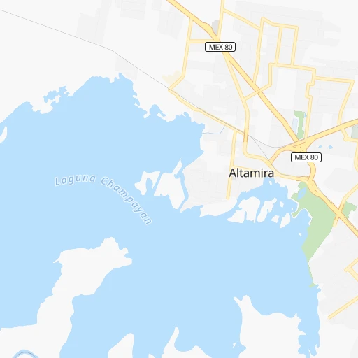
Roadmap (route) to go from Empacadora to Chiautla detailed above, you can also see the course layout on the map.
While doing trip Empacadora - Chiautla by car, the calculated route ends at a distance , or more straight.
Distance and duration of the route between Empacadora and Chiautla
Calculation of distance and route from Chiautla to Empacadora :
328.1425.3 km5h58mn
Continue 0h0mn 106 mTurn right 0h2mn 2.5 kmKeep left onto Sexta Avenida 0h2mn 1.8 kmKeep left 0h1mn 626 mTurn right onto Río Tamesi 0h5mn 4.9 kmKeep right onto Boulevard Adolfo López Mateos 0h5mn 5.5 kmKeep left onto Calle Santo Niño 0h0mn 19 mTurn sharp left onto Boulevard Licenciado Adolfo López Mateos 0h0mn 143 mTurn right onto MEX 180 1h55mn 62.6 kmKeep right onto Autopista Tuxpan - Tampico 0h29mn 47.7 kmKeep left onto MEX 180D 2h44mn 163.2 kmContinue onto Tejocotal - Nuevo Necaxa 1h35mn 57.3 kmKeep left onto Venta de Carpio - T.C. (Pachuca - Túxpam) and drive toward Ciudad de México, Pirámides 1h39mn 59.2 kmTurn sharp right 0h1mn 262 mTurn sharp right onto (México - Tulancingo) - Oxtotipac 0h1mn 1.1 kmKeep right onto (A Oxtotipac) - Belén 0h3mn 2.3 kmTurn right 0h2mn 1.7 kmTurn left onto Calle Vicente Guerrero 0h2mn 1.9 kmTurn right onto Avenida Río Bravo 0h9mn 8.8 kmTurn right onto Benito Juarez 0h0mn 79 mTurn left onto Avenida Guerrero 0h1mn 909 mTurn right onto Carretera a Papalotla 0h3mn 2.3 kmTurn left onto Avenida del Trabajo 0h0mn 228 mTurn right onto Calle 16 de Septiembre 0h0mn 43 mArrive at destination 0h0mn 0 m
Travel from Empacadora (México) to a selection of major cities.
Distances from Empacadora to biggest cities in Tamaulipas
Other major cities in country :
- Aguascalientes [01], 658,179 inhabitants. 457 km
- Acapulco de Juarez [12], 652,136 inhabitants. 648 km
- Coyoacan [09], 628,063 inhabitants. 360 km
- Santiago de Queretaro [22], 626,495 inhabitants. 325 km
- Saltillo [07], 621,250 inhabitants. 467 km
- Tlalpan [09], 607,545 inhabitants. 365 km
- Mexicali [02], 597,099 inhabitants. 2,074 km
- Hermosillo [26], 595,811 inhabitants. 1,511 km
- Morelia [16], 592,797 inhabitants. 452 km
- Veracruz [30], 568,313 inhabitants. 397 km
- Cancun [23], 542,043 inhabitants. 1,148 km
- Santa Maria Chimalhuacan [15], 525,389 inhabitants. 344 km
- Torreon [07], 524,066 inhabitants. 666 km
- Cuauhtemoc [09], 521,348 inhabitants. 349 km
- Ciudad Lopez Mateos [15], 521,034 inhabitants. 342 km
- Toluca [15], 505,881 inhabitants. 387 km
- Tlaquepaque [14], 493,646 inhabitants. 592 km
- Tuxtla [05], 481,128 inhabitants. 798 km
- Cuautitlan Izcalli [15], 475,179 inhabitants. 332 km
- Victoria de Durango [10], 457,140 inhabitants. 718 km
Route from Chiautla to major cities (Mexico).
- Distance Chiautla Mexico City29 km
- Distance Chiautla Iztapalapa29 km
- Distance Chiautla Guadalajara488 km
- Distance Chiautla Puebla91 km
- Distance Chiautla Juarez1,553 km
- Distance Chiautla Tijuana2,310 km
- Distance Chiautla Gustavo Adolfo Madero25 km
- Distance Chiautla Monterrey698 km
- Distance Chiautla Leon de los Aldama340 km
- Distance Chiautla Zapopan488 km
- Distance Chiautla Chihuahua1,248 km
- Distance Chiautla Alvaro Obregon40 km
- Distance Chiautla Guadalupe697 km
- Distance Chiautla Merida980 km
- Distance Chiautla San Luis Potosi362 km
- Distance Chiautla Culiacan1,053 km
- Distance Chiautla Aguascalientes439 km
- Distance Chiautla Acapulco de Juarez320 km
- Distance Chiautla Coyoacan37 km
- Distance Chiautla Santiago de Queretaro195 km
Nearest cities to Empacadora :
- Mexico City, 12,294,193 inhabitants. 350 km
- Iztapalapa, 1,820,888 inhabitants. 355 km
- Ecatepec de Morelos, 1,806,226 inhabitants. 329 km
- Ciudad Nezahualcoyotl, 1,232,220 inhabitants. 349 km
- Gustavo Adolfo Madero, 1,193,161 inhabitants. 343 km
- Naucalpan de Juarez, 846,185 inhabitants. 349 km
- Alvaro Obregon, 727,034 inhabitants. 360 km
- Tlalnepantla, 715,767 inhabitants. 341 km
- Santiago de Queretaro, 626,495 inhabitants. 325 km
- Santa Maria Chimalhuacan, 525,389 inhabitants. 344 km
- Cuauhtemoc, 521,348 inhabitants. 349 km
- Ciudad Lopez Mateos, 521,034 inhabitants. 342 km
- Cuautitlan Izcalli, 475,179 inhabitants. 332 km
- Venustiano Carranza, 447,459 inhabitants. 348 km
- Azcapotzalco, 425,298 inhabitants. 346 km
- Xalapa de Enriquez, 425,148 inhabitants. 330 km
- Iztacalco, 384,326 inhabitants. 352 km
- Benito Juarez, 355,017 inhabitants. 354 km
- Miguel Hidalgo, 353,534 inhabitants. 352 km
- Pachuca de Soto, 319,581 inhabitants. 264 km
- Coacalco, 313,405 inhabitants. 328 km
- Tampico, 309,003 inhabitants. 13 km
- Celaya, 305,901 inhabitants. 366 km
- Ciudad Victoria, 269,923 inhabitants. 202 km
- Los Reyes Acaquilpan, 251,168 inhabitants. 351 km
- Colonia del Valle, 250,000 inhabitants. 356 km
- Nicolas Romero, 245,383 inhabitants. 336 km
- Ojo de Agua, 242,272 inhabitants. 319 km
- Buenavista, 206,081 inhabitants. 333 km
- Ciudad Madero, 192,736 inhabitants. 10 km
- Ciudad Valles, 176,935 inhabitants. 123 km
- Poza Rica de Hidalgo, 174,526 inhabitants. 207 km
- Delegacion Cuajimalpa de Morelos, 173,625 inhabitants. 363 km
- San Pablo de las Salinas, 173,557 inhabitants. 324 km
- Tuxpam de Rodriguez Cano, 134,394 inhabitants. 163 km
- Huixquilucan, 124,846 inhabitants. 366 km
- San Juan del Rio, 118,173 inhabitants. 309 km
- Texcoco de Mora, 115,378 inhabitants. 333 km
- Tantoyuca, 103,610 inhabitants. 117 km
- Tulancingo, 102,383 inhabitants. 257 km
- Temapache, 101,558 inhabitants. 145 km
- Martinez de la Torre, 100,377 inhabitants. 268 km
- Colonia Lindavista, 100,000 inhabitants. 343 km
- Cuautitlan, 84,737 inhabitants. 327 km
- Chicoloapan, 84,440 inhabitants. 343 km
- Ciudad Mante, 79,981 inhabitants. 120 km
- Heroica Zitacuaro, 78,950 inhabitants. 414 km
- Fuentes del Valle, 74,087 inhabitants. 329 km
- Chiautla, 73,696 inhabitants. 329 km
- Teziutlan, 70,819 inhabitants. 287 km
Location Empacadora (Tamaulipas) :
| Country flag |  |
| Location | Empacadora |
| State | Tamaulipas |
| County | Altamira |
| Country | Mexico |
| Country code / ISO 2 | MX |
| Latitude | 22.3500000 |
| Longitude | -97.8833300 |
| Altitude | 0 meters |
| Time zone | America/Mexico_City |
Location Chiautla (México) :
| Country flag | |
| Location | Chiautla |
| State | México |
| County | Chiautla |
| Country | Mexico |
| Country code / ISO 2 | MX |
| Latitude | 19.5489500 |
| Longitude | -98.8823600 |
| Altitude | 0 meters |
| Time zone | America/Mexico_City |
