
How to get from La Esperanza (Veracruz) to San Andrés Tuxtla (Veracruz)
Calculate route from La Esperanza (Veracruz, Mexico) to San Andrés Tuxtla (Veracruz, Mexico).
The flight distance (as the crow flies) between La Esperanza and San Andrés Tuxtla is 118.1 km.
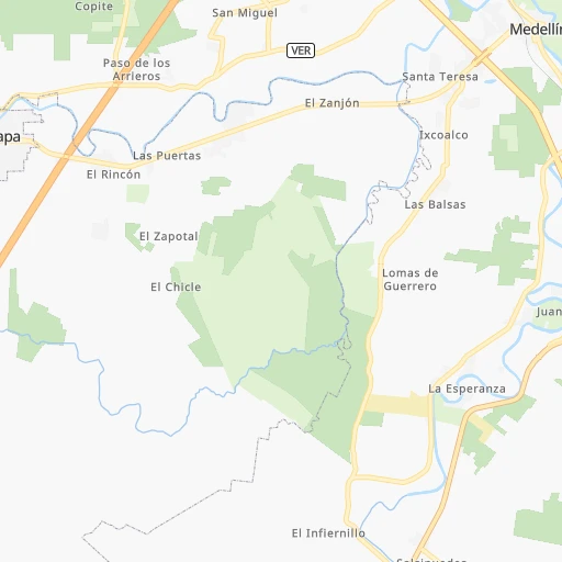
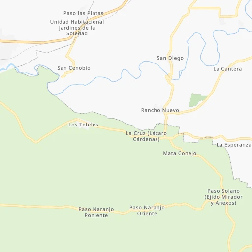
Roadmap (route) to go from La Esperanza to San Andrés Tuxtla detailed above, you can also see the course layout on the map.
While doing trip La Esperanza - San Andrés Tuxtla by car, the calculated route ends at a distance , or more straight.
Distance and duration of the route between La Esperanza and San Andrés Tuxtla
Calculation of distance and route from San Andrés Tuxtla to La Esperanza :
118.1131.7 km2h58mn
Continue onto Carretera Costera del Golfo 2h44mn 121.2 kmTurn right onto Calle Felipe Carrillo Puerto 0h1mn 360 mTurn sharp right onto Carretera Costera del Golfo 0h0mn 88 mTurn left 0h0mn 209 mTurn right 0h0mn 113 mTurn left onto Carretera Costera del Golfo 0h2mn 2.6 kmTurn left onto Benito Juárez 0h8mn 5.3 kmTurn left onto Prolongación Benito Juárez 0h1mn 733 mTurn left onto Carretera Costera del Golfo 0h0mn 275 mTurn right onto Avenida Benito Juárez 0h1mn 741 mTurn right onto Calle Ignacio Allende 0h0mn 62 mArrive at destination 0h0mn 0 m
Travel from La Esperanza (Veracruz) to a selection of major cities.
Distances from La Esperanza to biggest cities in Veracruz
- Tlapacoyan,33,667 inhabitants.152 km
- Perote,32,559 inhabitants.129 km
- Coatzintla,30,607 inhabitants.213 km
- Huatusco,29,387 inhabitants.87 km
- Cosamaloapan,28,768 inhabitants.83 km
- Nanchital de Lazaro Cardenas del Rio,25,982 inhabitants.213 km
- La Isla,24,558 inhabitants.48 km
- Catemaco,24,257 inhabitants.129 km
- Ixtaczoquitlan,23,522 inhabitants.98 km
- Misantla,23,242 inhabitants.124 km
- Alamo,22,740 inhabitants.263 km
- Alvarado,21,518 inhabitants.50 km
- Allende,21,398 inhabitants.210 km
- Fortin de las Flores,21,370 inhabitants.91 km
- Cosoleacaque,20,371 inhabitants.197 km
Other major cities in country :
- Aguascalientes [01], 658,179 inhabitants. 714 km
- Acapulco de Juarez [12], 652,136 inhabitants. 466 km
- Coyoacan [09], 628,063 inhabitants. 319 km
- Santiago de Queretaro [22], 626,495 inhabitants. 476 km
- Saltillo [07], 621,250 inhabitants. 869 km
- Tlalpan [09], 607,545 inhabitants. 318 km
- Mexicali [02], 597,099 inhabitants. 2,448 km
- Hermosillo [26], 595,811 inhabitants. 1,875 km
- Morelia [16], 592,797 inhabitants. 534 km
- Cancun [23], 542,043 inhabitants. 1,001 km
- Santa Maria Chimalhuacan [15], 525,389 inhabitants. 297 km
- Torreon [07], 524,066 inhabitants. 1,042 km
- Cuauhtemoc [09], 521,348 inhabitants. 318 km
- Ciudad Lopez Mateos [15], 521,034 inhabitants. 332 km
- Toluca [15], 505,881 inhabitants. 369 km
- Reynosa [28], 498,654 inhabitants. 815 km
- Tlaquepaque [14], 493,646 inhabitants. 769 km
- Tuxtla [05], 481,128 inhabitants. 409 km
- Cuautitlan Izcalli [15], 475,179 inhabitants. 329 km
- Victoria de Durango [10], 457,140 inhabitants. 1,041 km
Route from San Andrés Tuxtla to major cities (Mexico).
- Distance San Andrés Tuxtla Mexico City426 km
- Distance San Andrés Tuxtla Iztapalapa418 km
- Distance San Andrés Tuxtla Ecatepec de Morelos425 km
- Distance San Andrés Tuxtla Guadalajara893 km
- Distance San Andrés Tuxtla Puebla322 km
- Distance San Andrés Tuxtla Juarez1,860 km
- Distance San Andrés Tuxtla Tijuana2,682 km
- Distance San Andrés Tuxtla Ciudad Nezahualcoyotl414 km
- Distance San Andrés Tuxtla Gustavo Adolfo Madero426 km
- Distance San Andrés Tuxtla Monterrey961 km
- Distance San Andrés Tuxtla Leon de los Aldama739 km
- Distance San Andrés Tuxtla Zapopan893 km
- Distance San Andrés Tuxtla Naucalpan de Juarez439 km
- Distance San Andrés Tuxtla Chihuahua1,585 km
- Distance San Andrés Tuxtla Alvaro Obregon432 km
- Distance San Andrés Tuxtla Guadalupe958 km
- Distance San Andrés Tuxtla Merida650 km
- Distance San Andrés Tuxtla Tlalnepantla436 km
- Distance San Andrés Tuxtla San Luis Potosi729 km
- Distance San Andrés Tuxtla Culiacan1,443 km
Nearest cities to La Esperanza :
- Mexico City, 12,294,193 inhabitants. 316 km
- Iztapalapa, 1,820,888 inhabitants. 308 km
- Ecatepec de Morelos, 1,806,226 inhabitants. 312 km
- Puebla, 1,590,256 inhabitants. 216 km
- Ciudad Nezahualcoyotl, 1,232,220 inhabitants. 304 km
- Gustavo Adolfo Madero, 1,193,161 inhabitants. 315 km
- Veracruz, 568,313 inhabitants. 16 km
- Santa Maria Chimalhuacan, 525,389 inhabitants. 297 km
- Cuauhtemoc, 521,348 inhabitants. 318 km
- Venustiano Carranza, 447,459 inhabitants. 314 km
- Xalapa de Enriquez, 425,148 inhabitants. 98 km
- Xochimilco, 404,458 inhabitants. 312 km
- Iztacalco, 384,326 inhabitants. 312 km
- Xico, 365,777 inhabitants. 296 km
- Ixtapaluca, 351,001 inhabitants. 289 km
- Tlahuac, 344,106 inhabitants. 302 km
- Pachuca de Soto, 319,581 inhabitants. 297 km
- Coacalco, 313,405 inhabitants. 318 km
- Oaxaca, 262,566 inhabitants. 227 km
- Los Reyes Acaquilpan, 251,168 inhabitants. 299 km
- Ojo de Agua, 242,272 inhabitants. 309 km
- Tehuacan, 241,429 inhabitants. 146 km
- Coatzacoalcos, 230,717 inhabitants. 205 km
- Ciudad Valles, 176,935 inhabitants. 445 km
- Poza Rica de Hidalgo, 174,526 inhabitants. 216 km
- San Pablo de las Salinas, 173,557 inhabitants. 317 km
- Chalco, 163,996 inhabitants. 290 km
- Cholula, 151,667 inhabitants. 227 km
- Minatitlan, 150,895 inhabitants. 204 km
- Cuautla, 146,178 inhabitants. 294 km
- Cordoba, 134,403 inhabitants. 83 km
- Tuxpam de Rodriguez Cano, 134,394 inhabitants. 251 km
- Orizaba, 121,348 inhabitants. 102 km
- Milpa Alta, 115,895 inhabitants. 303 km
- Texcoco de Mora, 115,378 inhabitants. 292 km
- Tantoyuca, 103,610 inhabitants. 337 km
- Tulancingo, 102,383 inhabitants. 260 km
- Temapache, 101,558 inhabitants. 275 km
- Martinez de la Torre, 100,377 inhabitants. 150 km
- Colonia Lindavista, 100,000 inhabitants. 317 km
- Tuxtepec, 92,121 inhabitants. 105 km
- Atlixco, 85,891 inhabitants. 241 km
- Cardenas, 85,350 inhabitants. 315 km
- Tlaxcala, 84,670 inhabitants. 218 km
- Chicoloapan, 84,440 inhabitants. 292 km
- San Andres Cholula, 80,118 inhabitants. 226 km
- Amozoc de Mota, 77,106 inhabitants. 199 km
- San Martin Texmelucan de Labastida, 75,903 inhabitants. 242 km
- Fuentes del Valle, 74,087 inhabitants. 321 km
- Chiautla, 73,696 inhabitants. 293 km
Location La Esperanza (Veracruz) :
| Country flag |  |
| Location | La Esperanza |
| State | Veracruz |
| County | Medellín |
| Country | Mexico |
| Country code / ISO 2 | MX |
| Latitude | 19.0333300 |
| Longitude | -96.1500000 |
| Altitude | 0 meters |
| Time zone | America/Mexico_City |
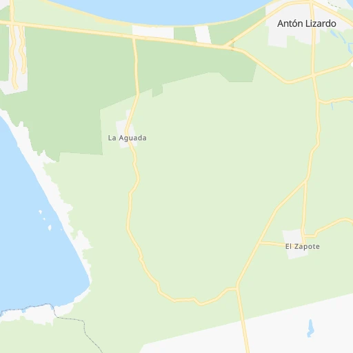
Location San Andrés Tuxtla (Veracruz) :
| Country flag | |
| Location | San Andrés Tuxtla |
| State | Veracruz |
| County | San Andrés Tuxtla |
| Country | Mexico |
| Country code / ISO 2 | MX |
| Latitude | 18.4487000 |
| Longitude | -95.2132700 |
| Altitude | 0 meters |
| Time zone | America/Mexico_City |


