


How to get from Estación La Presa (México) to Zinacantepec (México)
Calculate route from Estación La Presa (México, Mexico) to Zinacantepec (México, Mexico).
The flight distance (as the crow flies) between Estación La Presa and Zinacantepec is 9.7 km.
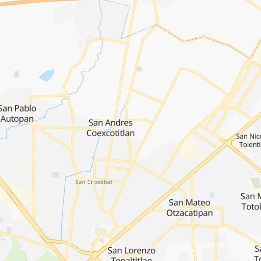
Roadmap (route) to go from Estación La Presa to Zinacantepec detailed above, you can also see the course layout on the map.
While doing trip Estación La Presa - Zinacantepec by car, the calculated route ends at a distance , or more straight.
Distance and duration of the route between Estación La Presa and Zinacantepec
Calculation of distance and route from Zinacantepec to Estación La Presa :
9.712.9 km0h18mn
Continue onto Ixtlahuaca de Rayon - Toluca 0h1mn 1.0 kmKeep right 0h0mn 534 mTurn sharp right onto Calle Ocote 0h2mn 820 mTurn slight left onto Avenida Nicolas Bravo 0h1mn 704 mTurn right onto Calle Libertad 0h1mn 484 mTurn slight right onto Calle Independencia 0h0mn 19 mTurn left onto Calle Espiridion Ramírez 0h0mn 72 mTurn right onto Avenida De Los Ángeles 0h1mn 296 mTurn slight right onto Avenida Los Ángeles 0h4mn 2.7 kmTurn right onto Calle Francisco Villa 0h0mn 131 mTurn left 0h0mn 182 mTurn right onto Avenida Adolfo Ruíz Cortiez 0h3mn 2.3 kmTurn left onto Carretera a Almoloya de Juárez 0h1mn 754 mTurn right onto Calle Adolfo Lopez Mateos 0h1mn 608 mTurn right onto Calle Emiliano Zapata 0h0mn 27 mTurn left 0h0mn 110 mTurn right onto Calle Independencia 0h0mn 100 mTurn sharp left onto Calle Lázaro Cárdenas 0h1mn 315 mTurn right onto Boulevard Licenciado Adolfo López Mateos 0h0mn 132 mKeep left 0h0mn 92 mTurn left onto Avenida 16 de Septiembre 0h0mn 260 mContinue onto Avenida 16 de Septiembre 0h1mn 1.0 kmTurn left onto Calle Benito Juarez Garcia 0h0mn 159 mArrive at destination 0h0mn 0 m
Travel from Estación La Presa (México) to a selection of major cities.
Distances from Estación La Presa to biggest cities in México
- Colonia Lindavista,100,000 inhabitants.61 km
- Cuautitlan,84,737 inhabitants.63 km
- Chicoloapan,84,440 inhabitants.83 km
- Fuentes del Valle,74,087 inhabitants.65 km
- Chiautla,73,696 inhabitants.87 km
- San Mateo Atenco,68,602 inhabitants.19 km
- Tultepec,65,338 inhabitants.69 km
- Teoloyucan,61,376 inhabitants.68 km
- San Salvador Tizatlalli,61,367 inhabitants.15 km
- Zinacantepec,54,220 inhabitants.10 km
- Zumpango,50,742 inhabitants.79 km
- San Buenaventura,44,761 inhabitants.87 km
- Tepotzotlan,44,517 inhabitants.63 km
- Santiago Teyahualco,41,757 inhabitants.68 km
- Colonia Santa Teresa,36,845 inhabitants.72 km
- San Jeronimo Cuatro Vientos,36,778 inhabitants.89 km
- Coyotepec,35,793 inhabitants.68 km
- San Martin Azcatepec,35,390 inhabitants.83 km
- Melchor Ocampo,34,489 inhabitants.68 km
- San Isidro,33,737 inhabitants.77 km
Other major cities in country :
- Saltillo [07], 621,250 inhabitants. 689 km
- Tlalpan [09], 607,545 inhabitants. 56 km
- Mexicali [02], 597,099 inhabitants. 2,156 km
- Hermosillo [26], 595,811 inhabitants. 1,576 km
- Morelia [16], 592,797 inhabitants. 162 km
- Veracruz [30], 568,313 inhabitants. 373 km
- Cancun [23], 542,043 inhabitants. 1,356 km
- Torreon [07], 524,066 inhabitants. 788 km
- Cuauhtemoc [09], 521,348 inhabitants. 58 km
- Reynosa [28], 498,654 inhabitants. 762 km
- Tlaquepaque [14], 493,646 inhabitants. 403 km
- Tuxtla [05], 481,128 inhabitants. 753 km
- Victoria de Durango [10], 457,140 inhabitants. 730 km
- Heroica Matamoros [28], 449,815 inhabitants. 760 km
- Venustiano Carranza [09], 447,459 inhabitants. 62 km
- San Nicolas de los Garza [19], 443,273 inhabitants. 713 km
- Azcapotzalco [09], 425,298 inhabitants. 54 km
- Xalapa de Enriquez [30], 425,148 inhabitants. 291 km
- Xochimilco [09], 404,458 inhabitants. 62 km
- Tonala [14], 401,509 inhabitants. 397 km
Route from Zinacantepec to major cities (Mexico).
- Distance Zinacantepec Mexico City66 km
- Distance Zinacantepec Iztapalapa71 km
- Distance Zinacantepec Guadalajara412 km
- Distance Zinacantepec Puebla163 km
- Distance Zinacantepec Juarez1,540 km
- Distance Zinacantepec Tijuana2,265 km
- Distance Zinacantepec Gustavo Adolfo Madero69 km
- Distance Zinacantepec Monterrey714 km
- Distance Zinacantepec Leon de los Aldama289 km
- Distance Zinacantepec Zapopan414 km
- Distance Zinacantepec Chihuahua1,225 km
- Distance Zinacantepec Alvaro Obregon56 km
- Distance Zinacantepec Guadalupe714 km
- Distance Zinacantepec Merida1,074 km
- Distance Zinacantepec San Luis Potosi344 km
- Distance Zinacantepec Culiacan999 km
- Distance Zinacantepec Aguascalientes393 km
- Distance Zinacantepec Acapulco de Juarez272 km
- Distance Zinacantepec Coyoacan61 km
- Distance Zinacantepec Santiago de Queretaro160 km
Nearest cities to Estación La Presa :
- Mexico City, 12,294,193 inhabitants. 59 km
- Iztapalapa, 1,820,888 inhabitants. 66 km
- Ecatepec de Morelos, 1,806,226 inhabitants. 71 km
- Puebla, 1,590,256 inhabitants. 160 km
- Ciudad Nezahualcoyotl, 1,232,220 inhabitants. 71 km
- Gustavo Adolfo Madero, 1,193,161 inhabitants. 62 km
- Leon de los Aldama, 1,114,626 inhabitants. 286 km
- Naucalpan de Juarez, 846,185 inhabitants. 49 km
- Alvaro Obregon, 727,034 inhabitants. 51 km
- Tlalnepantla, 715,767 inhabitants. 55 km
- San Luis Potosi, 677,704 inhabitants. 339 km
- Aguascalientes, 658,179 inhabitants. 390 km
- Acapulco de Juarez, 652,136 inhabitants. 280 km
- Coyoacan, 628,063 inhabitants. 55 km
- Santiago de Queretaro, 626,495 inhabitants. 155 km
- Tlalpan, 607,545 inhabitants. 56 km
- Morelia, 592,797 inhabitants. 162 km
- Santa Maria Chimalhuacan, 525,389 inhabitants. 78 km
- Cuauhtemoc, 521,348 inhabitants. 58 km
- Ciudad Lopez Mateos, 521,034 inhabitants. 50 km
- Toluca, 505,881 inhabitants. 9 km
- Cuautitlan Izcalli, 475,179 inhabitants. 59 km
- Venustiano Carranza, 447,459 inhabitants. 62 km
- Azcapotzalco, 425,298 inhabitants. 54 km
- Xalapa de Enriquez, 425,148 inhabitants. 291 km
- Xochimilco, 404,458 inhabitants. 62 km
- Iztacalco, 384,326 inhabitants. 62 km
- Xico, 365,777 inhabitants. 78 km
- Benito Juarez, 355,017 inhabitants. 56 km
- Miguel Hidalgo, 353,534 inhabitants. 52 km
- Ixtapaluca, 351,001 inhabitants. 85 km
- Tlahuac, 344,106 inhabitants. 72 km
- Cuernavaca, 343,769 inhabitants. 68 km
- Irapuato, 339,554 inhabitants. 228 km
- Pachuca de Soto, 319,581 inhabitants. 131 km
- Coacalco, 313,405 inhabitants. 68 km
- Tampico, 309,003 inhabitants. 375 km
- Celaya, 305,901 inhabitants. 175 km
- Oaxaca, 262,566 inhabitants. 404 km
- Los Reyes Acaquilpan, 251,168 inhabitants. 74 km
- Colonia del Valle, 250,000 inhabitants. 55 km
- Nicolas Romero, 245,383 inhabitants. 51 km
- Ojo de Agua, 242,272 inhabitants. 79 km
- Tehuacan, 241,429 inhabitants. 261 km
- Uruapan, 237,308 inhabitants. 249 km
- Magdalena Contreras, 228,927 inhabitants. 50 km
- Buenavista, 206,081 inhabitants. 61 km
- Soledad de Graciano Sanchez, 194,006 inhabitants. 341 km
- Ciudad Madero, 192,736 inhabitants. 377 km
- Ciudad Valles, 176,935 inhabitants. 302 km
Location Estación La Presa (México) :
| Country flag |  |
| Location | Estación La Presa |
| State | México |
| County | Toluca |
| Country | Mexico |
| Country code / ISO 2 | MX |
| Latitude | 19.3586100 |
| Longitude | -99.6861100 |
| Altitude | 0 meters |
| Time zone | America/Mexico_City |
Location Zinacantepec (México) :
| Country flag | |
| Location | Zinacantepec |
| State | México |
| County | Zinacantepec |
| Country | Mexico |
| Country code / ISO 2 | MX |
| Latitude | 19.2842800 |
| Longitude | -99.7339400 |
| Altitude | 0 meters |
| Time zone | America/Mexico_City |


