


How to get from Puente de Ixtla (Morelos) to Celaya (Guanajuato)
Calculate route from Puente de Ixtla (Morelos, Mexico) to Celaya (Guanajuato, Mexico).
The flight distance (as the crow flies) between Puente de Ixtla and Celaya is 263.8 km.
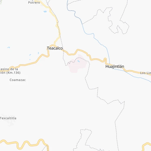
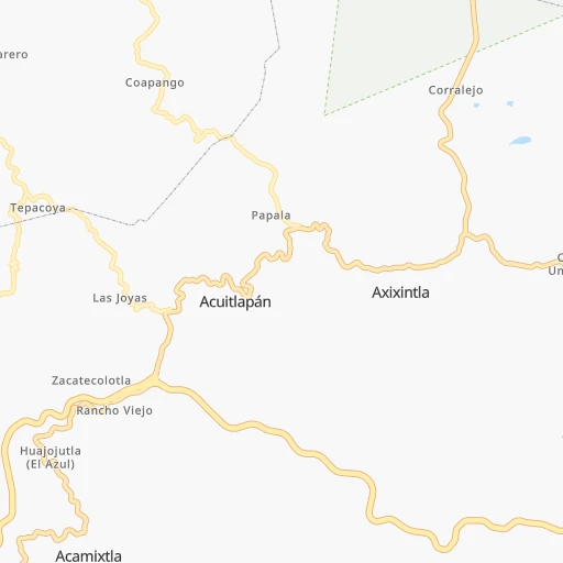
Roadmap (route) to go from Puente de Ixtla to Celaya detailed above, you can also see the course layout on the map.
While doing trip Puente de Ixtla - Celaya by car, the calculated route ends at a distance , or more straight.
Distance and duration of the route between Puente de Ixtla and Celaya
Calculation of distance and route from Celaya to Puente de Ixtla :
263.8341.6 km5h43mn
Continue onto Calle Xicoténcatl 0h0mn 106 mTurn right onto Calle Ahuízotl 0h0mn 38 mTurn left onto Calle Xochicalco 0h1mn 397 mTurn right 0h0mn 8 mTurn left 0h0mn 15 mTurn right onto Calle Porfirio Díaz 0h0mn 95 mTurn left onto Tehuixtla 0h0mn 559 mTurn sharp right onto Calle Reforma 0h0mn 137 mTurn left onto Calle Allende 0h0mn 150 mTurn right onto Boulevard Gilberto Figueroa 0h1mn 640 mContinue onto Avenida México 0h0mn 11 mKeep left onto Avenida México 0h0mn 498 mKeep right 0h0mn 38 mTurn slight right onto Carretera Federal Cuernavaca - Taxco 0h0mn 497 mTurn right 0h13mn 13.2 kmTurn slight right onto Avenida Guerrero 0h6mn 4.7 kmTurn left onto Avenida No Reelección Sur 0h1mn 299 mKeep left onto Avenida Francisco I. Madero 0h2mn 1.1 kmTurn left onto Carretera Miacatlan-Palpan 0h9mn 9.3 kmTurn right 0h1mn 374 mTurn slight right onto Carretera Estatal Miacatlan - Palpan 0h6mn 6.4 kmKeep left onto Calle Tolteca 0h0mn 203 mKeep right 0h3mn 1.3 kmTurn right onto Carretera Municipal a San Andrés Nicolás 0h5mn 5.2 kmContinue onto Carretera (El Capulin - Chalma) - San Andrés Nicolás Bravo 0h1mn 1.5 kmTurn sharp left onto Calle Via Alfredo del Mazo Velez 0h9mn 8.1 kmTurn left onto Calle Del Progreso 0h2mn 993 mTurn left onto Calle Via Alfredo del Mazo Velez 0h7mn 6.4 kmTurn sharp right 0h1mn 466 mKeep right 0h2mn 1.1 kmTurn right onto Calle Independencia 0h1mn 851 mTurn slight left onto Calle Vía Alfredo del Mazo Velez 0h8mn 6.8 kmTurn right onto Calle José María Morelos 0h1mn 572 mTurn slight right onto Calle Benito Juárez 0h3mn 2.5 kmTurn slight right 0h5mn 4.7 kmTurn left onto Calle León Guzmán 0h2mn 914 mTurn left onto Carretera Tenango - La Marqueza 0h2mn 2.0 kmKeep right 0h1mn 410 mTurn slight right onto Autopista Vía Rápida a Malinalco 0h3mn 3.1 kmKeep left 0h4mn 3.6 kmKeep right 0h5mn 6.4 kmKeep right onto Carretera Toluca-Tenango 0h0mn 489 mTurn right onto Calle Allende 0h0mn 26 mAt roundabout, take exit 2 onto Carretera Toluca-Tenango 0h8mn 9.4 kmTurn right onto Avenida Isidro Fabela 0h1mn 1.2 kmContinue onto Avenida Isidro Fabela 1h43mn 63.0 kmKeep left 0h0mn 166 mTurn sharp right onto Circuito Vial Jorge Jiménez Cantú 0h2mn 2.2 kmKeep right onto Calle Panamericana Kilómetro 1 0h2mn 2.2 kmKeep left onto Autopista Arco Norte 0h8mn 13.3 kmKeep right and take MEX 55 toward Acambay 0h0mn 534 mKeep left and take MEX 55 toward Acambay 0h0mn 125 mTurn left 0h11mn 12.9 kmKeep right 1h30mn 35.8 kmKeep right 1h55mn 90.7 kmKeep right and take GTO 8 toward Apaseo El Alto, Apaseo El Grande 0h0mn 243 mKeep left and take GTO 8 toward Apaseo el Alto 0h0mn 101 mTurn left onto Calle Rodolfo Piña Soria 0h0mn 240 mKeep right toward MEX 45 0h9mn 10.0 kmKeep right onto Boulevard Adolfo López Mateos 0h2mn 1.6 kmTurn right onto Calle Plan de Iguala 0h0mn 167 mTurn right onto Calle José María Morelos 0h0mn 26 mTurn left onto 16 de Septiembre 0h0mn 144 mTurn left onto Calle Francisco I. Madero 0h2mn 1.2 kmArrive at destination 0h0mn 0 m
Travel from Puente de Ixtla (Guanajuato) to a selection of major cities.
Distances from Puente de Ixtla to biggest cities in Morelos
Other major cities in country :
- Aguascalientes [01], 658,179 inhabitants. 478 km
- Acapulco de Juarez [12], 652,136 inhabitants. 206 km
- Coyoacan [09], 628,063 inhabitants. 83 km
- Santiago de Queretaro [22], 626,495 inhabitants. 247 km
- Saltillo [07], 621,250 inhabitants. 778 km
- Tlalpan [09], 607,545 inhabitants. 78 km
- Mexicali [02], 597,099 inhabitants. 2,243 km
- Hermosillo [26], 595,811 inhabitants. 1,663 km
- Morelia [16], 592,797 inhabitants. 231 km
- Veracruz [30], 568,313 inhabitants. 340 km
- Cancun [23], 542,043 inhabitants. 1,336 km
- Santa Maria Chimalhuacan [15], 525,389 inhabitants. 98 km
- Torreon [07], 524,066 inhabitants. 880 km
- Cuauhtemoc [09], 521,348 inhabitants. 94 km
- Ciudad Lopez Mateos [15], 521,034 inhabitants. 105 km
- Toluca [15], 505,881 inhabitants. 83 km
- Reynosa [28], 498,654 inhabitants. 838 km
- Tlaquepaque [14], 493,646 inhabitants. 474 km
- Tuxtla [05], 481,128 inhabitants. 690 km
- Cuautitlan Izcalli [15], 475,179 inhabitants. 115 km
Route from Celaya to major cities (Mexico).
- Distance Celaya Mexico City215 km
- Distance Celaya Iztapalapa225 km
- Distance Celaya Ecatepec de Morelos210 km
- Distance Celaya Guadalajara269 km
- Distance Celaya Puebla320 km
- Distance Celaya Juarez1,368 km
- Distance Celaya Tijuana2,088 km
- Distance Celaya Ciudad Nezahualcoyotl226 km
- Distance Celaya Gustavo Adolfo Madero212 km
- Distance Celaya Monterrey576 km
- Distance Celaya Zapopan269 km
- Distance Celaya Naucalpan de Juarez202 km
- Distance Celaya Chihuahua1,049 km
- Distance Celaya Alvaro Obregon213 km
- Distance Celaya Guadalupe577 km
- Distance Celaya Merida1,167 km
- Distance Celaya Tlalnepantla202 km
- Distance Celaya San Luis Potosi182 km
- Distance Celaya Culiacan825 km
- Distance Celaya Aguascalientes215 km
Nearest cities to Puente de Ixtla :
- Mexico City, 12,294,193 inhabitants. 93 km
- Iztapalapa, 1,820,888 inhabitants. 87 km
- Ecatepec de Morelos, 1,806,226 inhabitants. 114 km
- Puebla, 1,590,256 inhabitants. 127 km
- Ciudad Nezahualcoyotl, 1,232,220 inhabitants. 93 km
- Gustavo Adolfo Madero, 1,193,161 inhabitants. 100 km
- Leon de los Aldama, 1,114,626 inhabitants. 373 km
- Naucalpan de Juarez, 846,185 inhabitants. 97 km
- Alvaro Obregon, 727,034 inhabitants. 84 km
- Tlalnepantla, 715,767 inhabitants. 104 km
- Acapulco de Juarez, 652,136 inhabitants. 206 km
- Coyoacan, 628,063 inhabitants. 83 km
- Santiago de Queretaro, 626,495 inhabitants. 247 km
- Tlalpan, 607,545 inhabitants. 78 km
- Morelia, 592,797 inhabitants. 231 km
- Santa Maria Chimalhuacan, 525,389 inhabitants. 98 km
- Cuauhtemoc, 521,348 inhabitants. 94 km
- Ciudad Lopez Mateos, 521,034 inhabitants. 105 km
- Toluca, 505,881 inhabitants. 83 km
- Cuautitlan Izcalli, 475,179 inhabitants. 115 km
- Venustiano Carranza, 447,459 inhabitants. 95 km
- Azcapotzalco, 425,298 inhabitants. 98 km
- Xalapa de Enriquez, 425,148 inhabitants. 273 km
- Xochimilco, 404,458 inhabitants. 75 km
- Iztacalco, 384,326 inhabitants. 90 km
- Xico, 365,777 inhabitants. 83 km
- Benito Juarez, 355,017 inhabitants. 89 km
- Miguel Hidalgo, 353,534 inhabitants. 92 km
- Ixtapaluca, 351,001 inhabitants. 90 km
- Tlahuac, 344,106 inhabitants. 82 km
- Cuernavaca, 343,769 inhabitants. 36 km
- Irapuato, 339,554 inhabitants. 314 km
- Pachuca de Soto, 319,581 inhabitants. 178 km
- Coacalco, 313,405 inhabitants. 115 km
- Celaya, 305,901 inhabitants. 264 km
- Oaxaca, 262,566 inhabitants. 325 km
- Los Reyes Acaquilpan, 251,168 inhabitants. 91 km
- Colonia del Valle, 250,000 inhabitants. 87 km
- Nicolas Romero, 245,383 inhabitants. 114 km
- Ojo de Agua, 242,272 inhabitants. 123 km
- Tehuacan, 241,429 inhabitants. 203 km
- Uruapan, 237,308 inhabitants. 302 km
- Magdalena Contreras, 228,927 inhabitants. 81 km
- Buenavista, 206,081 inhabitants. 112 km
- Poza Rica de Hidalgo, 174,526 inhabitants. 289 km
- Delegacion Cuajimalpa de Morelos, 173,625 inhabitants. 84 km
- San Pablo de las Salinas, 173,557 inhabitants. 119 km
- Metepec, 172,982 inhabitants. 78 km
- Chilpancingo, 165,250 inhabitants. 120 km
- Chalco, 163,996 inhabitants. 85 km
Location Puente de Ixtla (Morelos) :
| Country flag |  |
| Location | Puente de Ixtla |
| State | Morelos |
| County | Puente de Ixtla |
| Country | Mexico |
| Country code / ISO 2 | MX |
| Latitude | 18.6147200 |
| Longitude | -99.3180600 |
| Altitude | 900 meters |
| Time zone | America/Mexico_City |
Location Celaya (Guanajuato) :
| Country flag | |
| Location | Celaya |
| State | Guanajuato |
| County | Celaya |
| Country | Mexico |
| Country code / ISO 2 | MX |
| Latitude | 20.5235300 |
| Longitude | -100.8157000 |
| Altitude | 0 meters |
| Time zone | America/Mexico_City |


