
How to get from Temapache (Veracruz) to Ecatepec de Morelos (México)
Calculate route from Temapache (Veracruz, Mexico) to Ecatepec de Morelos (México, Mexico).
The flight distance (as the crow flies) between Temapache and Ecatepec de Morelos is 219.6 km.
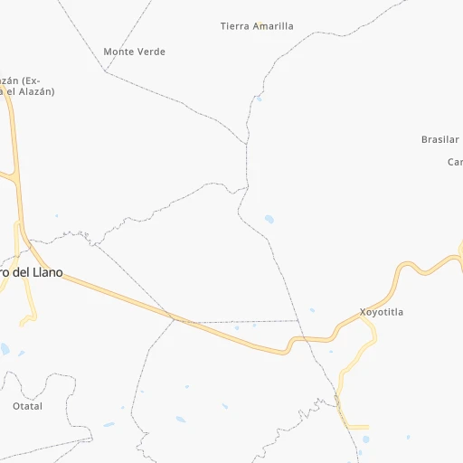
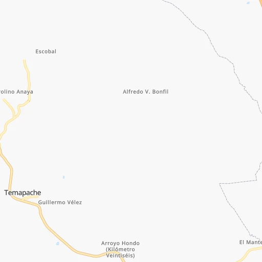
Roadmap (route) to go from Temapache to Ecatepec de Morelos detailed above, you can also see the course layout on the map.
While doing trip Temapache - Ecatepec de Morelos by car, the calculated route ends at a distance , or more straight.
Distance and duration of the route between Temapache and Ecatepec de Morelos
Calculation of distance and route from Ecatepec de Morelos to Temapache :
219.6288.9 km3h14mn
Continue onto 20 de Noviembre 0h0mn 44 mTurn right 0h1mn 256 mTurn left onto Carretera Federal Tuxpan - Tampico 0h19mn 22.1 kmKeep left 0h0mn 58 mKeep right 0h0mn 367 mKeep right 0h0mn 424 mTurn sharp left onto Autopista Tuxpan - Tampico 1h18mn 119.9 kmContinue onto Tejocotal - Nuevo Necaxa 1h35mn 57.3 kmKeep left onto Venta de Carpio - T.C. (Pachuca - Túxpam) and drive toward Ciudad de México, Pirámides 1h55mn 83.1 kmKeep right and drive toward Pachuca 0h0mn 578 mKeep left and drive toward Pachuca, Lecheria 0h0mn 368 mKeep right and take MEX 132 toward Lecheria 0h3mn 3.0 kmKeep left and drive toward Ecatepec 0h1mn 558 mTurn right onto Avenida Insurgentes 0h1mn 609 mTurn right onto Calle Puerto La Cruz 0h0mn 91 mTurn left onto Calle Puerto Bolívar 0h0mn 107 mTurn sharp right onto Calle Río Grande 0h0mn 44 mArrive at destination 0h0mn 0 m
Travel from Temapache (México) to a selection of major cities.
Distances from Temapache to biggest cities in Veracruz
- Perote,32,559 inhabitants.173 km
- Coatzintla,30,607 inhabitants.67 km
- Huatusco,29,387 inhabitants.225 km
- Cosamaloapan,28,768 inhabitants.357 km
- Nanchital de Lazaro Cardenas del Rio,25,982 inhabitants.476 km
- La Isla,24,558 inhabitants.316 km
- Catemaco,24,257 inhabitants.396 km
- Ixtaczoquitlan,23,522 inhabitants.254 km
- Misantla,23,242 inhabitants.151 km
- Alamo,22,740 inhabitants.18 km
- Alvarado,21,518 inhabitants.322 km
- Allende,21,398 inhabitants.470 km
- Fortin de las Flores,21,370 inhabitants.249 km
- Cosoleacaque,20,371 inhabitants.465 km
Other major cities in country :
- Aguascalientes [01], 658,179 inhabitants. 489 km
- Acapulco de Juarez [12], 652,136 inhabitants. 527 km
- Coyoacan [09], 628,063 inhabitants. 249 km
- Santiago de Queretaro [22], 626,495 inhabitants. 291 km
- Saltillo [07], 621,250 inhabitants. 595 km
- Tlalpan [09], 607,545 inhabitants. 253 km
- Mexicali [02], 597,099 inhabitants. 2,182 km
- Hermosillo [26], 595,811 inhabitants. 1,613 km
- Morelia [16], 592,797 inhabitants. 400 km
- Cancun [23], 542,043 inhabitants. 1,121 km
- Santa Maria Chimalhuacan [15], 525,389 inhabitants. 228 km
- Torreon [07], 524,066 inhabitants. 773 km
- Cuauhtemoc [09], 521,348 inhabitants. 239 km
- Ciudad Lopez Mateos [15], 521,034 inhabitants. 238 km
- Toluca [15], 505,881 inhabitants. 289 km
- Reynosa [28], 498,654 inhabitants. 562 km
- Tlaquepaque [14], 493,646 inhabitants. 590 km
- Tuxtla [05], 481,128 inhabitants. 676 km
- Cuautitlan Izcalli [15], 475,179 inhabitants. 228 km
- Victoria de Durango [10], 457,140 inhabitants. 793 km
Route from Ecatepec de Morelos to major cities (Mexico).
- Distance Ecatepec de Morelos Mexico City21 km
- Distance Ecatepec de Morelos Iztapalapa28 km
- Distance Ecatepec de Morelos Guadalajara468 km
- Distance Ecatepec de Morelos Puebla110 km
- Distance Ecatepec de Morelos Juarez1,538 km
- Distance Ecatepec de Morelos Tijuana2,292 km
- Distance Ecatepec de Morelos Gustavo Adolfo Madero13 km
- Distance Ecatepec de Morelos Monterrey688 km
- Distance Ecatepec de Morelos Leon de los Aldama321 km
- Distance Ecatepec de Morelos Zapopan469 km
- Distance Ecatepec de Morelos Chihuahua1,232 km
- Distance Ecatepec de Morelos Alvaro Obregon31 km
- Distance Ecatepec de Morelos Guadalupe687 km
- Distance Ecatepec de Morelos Merida998 km
- Distance Ecatepec de Morelos San Luis Potosi347 km
- Distance Ecatepec de Morelos Culiacan1,034 km
- Distance Ecatepec de Morelos Aguascalientes420 km
- Distance Ecatepec de Morelos Acapulco de Juarez320 km
- Distance Ecatepec de Morelos Coyoacan31 km
- Distance Ecatepec de Morelos Santiago de Queretaro177 km
Nearest cities to Temapache :
- Mexico City, 12,294,193 inhabitants. 239 km
- Iztapalapa, 1,820,888 inhabitants. 241 km
- Ecatepec de Morelos, 1,806,226 inhabitants. 220 km
- Puebla, 1,590,256 inhabitants. 233 km
- Ciudad Nezahualcoyotl, 1,232,220 inhabitants. 234 km
- Gustavo Adolfo Madero, 1,193,161 inhabitants. 233 km
- Naucalpan de Juarez, 846,185 inhabitants. 243 km
- Alvaro Obregon, 727,034 inhabitants. 250 km
- Tlalnepantla, 715,767 inhabitants. 235 km
- Coyoacan, 628,063 inhabitants. 249 km
- Santiago de Queretaro, 626,495 inhabitants. 291 km
- Tlalpan, 607,545 inhabitants. 253 km
- Veracruz, 568,313 inhabitants. 262 km
- Santa Maria Chimalhuacan, 525,389 inhabitants. 228 km
- Cuauhtemoc, 521,348 inhabitants. 239 km
- Ciudad Lopez Mateos, 521,034 inhabitants. 238 km
- Toluca, 505,881 inhabitants. 289 km
- Cuautitlan Izcalli, 475,179 inhabitants. 228 km
- Venustiano Carranza, 447,459 inhabitants. 237 km
- Azcapotzalco, 425,298 inhabitants. 239 km
- Xalapa de Enriquez, 425,148 inhabitants. 187 km
- Xochimilco, 404,458 inhabitants. 253 km
- Iztacalco, 384,326 inhabitants. 240 km
- Xico, 365,777 inhabitants. 242 km
- Benito Juarez, 355,017 inhabitants. 244 km
- Miguel Hidalgo, 353,534 inhabitants. 244 km
- Ixtapaluca, 351,001 inhabitants. 234 km
- Tlahuac, 344,106 inhabitants. 244 km
- Cuernavaca, 343,769 inhabitants. 290 km
- Pachuca de Soto, 319,581 inhabitants. 155 km
- Coacalco, 313,405 inhabitants. 221 km
- Tampico, 309,003 inhabitants. 133 km
- Ciudad Victoria, 269,923 inhabitants. 336 km
- Los Reyes Acaquilpan, 251,168 inhabitants. 235 km
- Colonia del Valle, 250,000 inhabitants. 245 km
- Nicolas Romero, 245,383 inhabitants. 235 km
- Ojo de Agua, 242,272 inhabitants. 210 km
- Tehuacan, 241,429 inhabitants. 291 km
- Magdalena Contreras, 228,927 inhabitants. 253 km
- Buenavista, 206,081 inhabitants. 227 km
- Ciudad Madero, 192,736 inhabitants. 136 km
- Ciudad Valles, 176,935 inhabitants. 176 km
- Poza Rica de Hidalgo, 174,526 inhabitants. 62 km
- Delegacion Cuajimalpa de Morelos, 173,625 inhabitants. 256 km
- San Pablo de las Salinas, 173,557 inhabitants. 217 km
- Metepec, 172,982 inhabitants. 287 km
- Chalco, 163,996 inhabitants. 240 km
- Jiutepec, 162,427 inhabitants. 291 km
- Cholula, 151,667 inhabitants. 233 km
- Cuautla, 146,178 inhabitants. 285 km
Location Temapache (Veracruz) :
| Country flag |  |
| Location | Temapache |
| State | Veracruz |
| County | Álamo Temapache |
| Country | Mexico |
| Country code / ISO 2 | MX |
| Latitude | 21.0661100 |
| Longitude | -97.6420700 |
| Altitude | 0 meters |
| Time zone | America/Mexico_City |
Location Ecatepec de Morelos (México) :
| Country flag | |
| Location | Ecatepec de Morelos |
| State | México |
| County | Ecatepec de Morelos |
| Country | Mexico |
| Country code / ISO 2 | MX |
| Latitude | 19.6049200 |
| Longitude | -99.0606400 |
| Altitude | 0 meters |
| Time zone | America/Mexico_City |


