


How to get from Tezoyuca (Morelos) to Uruapan (Michoacán)
Calculate route from Tezoyuca (Morelos, Mexico) to Uruapan (Michoacán, Mexico).
The flight distance (as the crow flies) between Tezoyuca and Uruapan is 308.9 km.
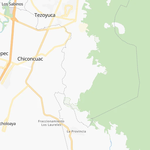
Roadmap (route) to go from Tezoyuca to Uruapan detailed above, you can also see the course layout on the map.
While doing trip Tezoyuca - Uruapan by car, the calculated route ends at a distance , or more straight.
Distance and duration of the route between Tezoyuca and Uruapan
Calculation of distance and route from Uruapan to Tezoyuca :
308.9430.7 km5h16mn
Continue onto Privada Lapizlazuli 0h1mn 317 mAt roundabout, take exit 2 onto Avenida Las Garzas 0h0mn 188 mAt roundabout, take exit 1 onto Avenida Las Garzas 0h1mn 676 mTurn right onto Avenida Las Garzas 0h0mn 2 mKeep left onto Avenida Las Garzas 0h0mn 17 mTurn right onto Avenida Las Garzas 0h0mn 336 mTurn right onto Avenida Emiliano Zapata 0h4mn 3.3 kmKeep right onto Calle Caminante del Mayab 0h1mn 466 mTurn left 0h1mn 193 mTurn left 0h0mn 78 mTurn left 0h0mn 28 mTurn sharp right onto Autopista México-Cuernavaca 0h5mn 7.5 kmKeep right and take MEX 95 toward Cuernavaca Centro 0h1mn 1.3 kmContinue onto Avenida Morelos Sur 0h2mn 1.6 kmTurn slight right onto Avenida José María Morelos y Pavón 0h6mn 5.0 kmAt roundabout, take exit 2 onto Avenida Emiliano Zapata 0h2mn 1.7 kmContinue onto Carretera Federal México-Cuernavaca 0h2mn 2.6 kmKeep right onto Calle Nacional 0h1mn 346 mKeep left onto Callejón Tejocote 0h0mn 59 mTurn left onto Callejón Tejocote 0h0mn 17 mTurn left onto Calle Tejocote 0h0mn 25 mTurn right onto Calle Tejocote 0h0mn 67 mTurn right onto Calle Tejocote 0h0mn 28 mTurn left onto Carretera Federal México-Cuernavaca 0h0mn 61 mKeep left onto Avenida Nacional 0h1mn 434 mKeep left onto Carretera Federal México-Cuernavaca 0h0mn 161 mTurn left onto Nacional 0h1mn 402 mTurn right onto Carretera Federal México-Cuernavaca 0h1mn 983 mKeep left onto MEX 95 0h3mn 3.7 kmTurn left onto Calle Zempoala 0h22mn 20.1 kmTurn sharp right 0h6mn 3.0 kmTurn left 0h3mn 1.3 kmTurn right 0h2mn 1.1 kmContinue 0h1mn 666 mTurn right onto Carretera Santiago Tianguistenco-Chalma 0h2mn 2.2 kmTurn left 0h0mn 50 mTurn right 0h7mn 7.3 kmTurn left onto Carretera Santiago Tianguistenco-Chalma 0h2mn 1.9 kmTurn left 0h0mn 71 mTurn sharp left onto Carr. Tenango - La Marqueza 0h0mn 298 mKeep right and drive toward Guadalajara, Morelia, Toluca 0h3mn 2.9 kmKeep right 0h0mn 108 mTurn right onto Mexicaltzingo-Tianguistengo-Xalatlaco 0h11mn 11.5 kmKeep right onto Mexicaltzingo-Tianguistengo-Xalatlaco 0h1mn 611 mTurn right onto Mexicaltzingo-Tianguistengo-Xalatlaco 0h8mn 9.2 kmTurn right onto Avenida Isidro Fabela 0h1mn 1.2 kmContinue onto Avenida Isidro Fabela 1h43mn 63.0 kmKeep left 0h0mn 166 mTurn sharp right onto Circuito Vial Jorge Jiménez Cantú 0h2mn 2.2 kmKeep right onto Calle Panamericana Kilómetro 1 0h3mn 3.3 kmTurn sharp left 1h27mn 144.9 kmKeep right and take MEX 37D toward Uruapan, Morelia 1h15mn 120.1 kmKeep right onto Prolongación Jalisco 0h1mn 519 mTurn left onto Calle Paseo General Lázaro Cárdenas 0h1mn 1.1 kmTurn right onto Calle Jesús González Ortega 0h1mn 373 mArrive at destination 0h0mn 0 m
Travel from Tezoyuca (Michoacán) to a selection of major cities.
Distances from Tezoyuca to biggest cities in Morelos
Other major cities in country :
- Aguascalientes [01], 658,179 inhabitants. 471 km
- Acapulco de Juarez [12], 652,136 inhabitants. 231 km
- Coyoacan [09], 628,063 inhabitants. 60 km
- Santiago de Queretaro [22], 626,495 inhabitants. 235 km
- Saltillo [07], 621,250 inhabitants. 760 km
- Tlalpan [09], 607,545 inhabitants. 54 km
- Mexicali [02], 597,099 inhabitants. 2,237 km
- Hermosillo [26], 595,811 inhabitants. 1,657 km
- Morelia [16], 592,797 inhabitants. 233 km
- Veracruz [30], 568,313 inhabitants. 323 km
- Cancun [23], 542,043 inhabitants. 1,317 km
- Santa Maria Chimalhuacan [15], 525,389 inhabitants. 73 km
- Torreon [07], 524,066 inhabitants. 867 km
- Cuauhtemoc [09], 521,348 inhabitants. 71 km
- Ciudad Lopez Mateos [15], 521,034 inhabitants. 84 km
- Toluca [15], 505,881 inhabitants. 73 km
- Reynosa [28], 498,654 inhabitants. 815 km
- Tlaquepaque [14], 493,646 inhabitants. 476 km
- Tuxtla [05], 481,128 inhabitants. 683 km
- Cuautitlan Izcalli [15], 475,179 inhabitants. 93 km
Route from Uruapan to major cities (Mexico).
- Distance Uruapan Mexico City307 km
- Distance Uruapan Iztapalapa314 km
- Distance Uruapan Ecatepec de Morelos315 km
- Distance Uruapan Guadalajara198 km
- Distance Uruapan Puebla407 km
- Distance Uruapan Juarez1,439 km
- Distance Uruapan Tijuana2,084 km
- Distance Uruapan Ciudad Nezahualcoyotl319 km
- Distance Uruapan Gustavo Adolfo Madero309 km
- Distance Uruapan Monterrey720 km
- Distance Uruapan Leon de los Aldama195 km
- Distance Uruapan Zapopan202 km
- Distance Uruapan Naucalpan de Juarez296 km
- Distance Uruapan Chihuahua1,105 km
- Distance Uruapan Alvaro Obregon300 km
- Distance Uruapan Guadalupe722 km
- Distance Uruapan Merida1,311 km
- Distance Uruapan Tlalnepantla301 km
- Distance Uruapan San Luis Potosi325 km
- Distance Uruapan Culiacan813 km
Nearest cities to Tezoyuca :
- Mexico City, 12,294,193 inhabitants. 69 km
- Iztapalapa, 1,820,888 inhabitants. 62 km
- Ecatepec de Morelos, 1,806,226 inhabitants. 90 km
- Puebla, 1,590,256 inhabitants. 106 km
- Ciudad Nezahualcoyotl, 1,232,220 inhabitants. 68 km
- Gustavo Adolfo Madero, 1,193,161 inhabitants. 77 km
- Leon de los Aldama, 1,114,626 inhabitants. 367 km
- Naucalpan de Juarez, 846,185 inhabitants. 75 km
- Alvaro Obregon, 727,034 inhabitants. 61 km
- Tlalnepantla, 715,767 inhabitants. 81 km
- Acapulco de Juarez, 652,136 inhabitants. 231 km
- Coyoacan, 628,063 inhabitants. 60 km
- Santiago de Queretaro, 626,495 inhabitants. 235 km
- Tlalpan, 607,545 inhabitants. 54 km
- Morelia, 592,797 inhabitants. 233 km
- Santa Maria Chimalhuacan, 525,389 inhabitants. 73 km
- Cuauhtemoc, 521,348 inhabitants. 71 km
- Ciudad Lopez Mateos, 521,034 inhabitants. 84 km
- Toluca, 505,881 inhabitants. 73 km
- Cuautitlan Izcalli, 475,179 inhabitants. 93 km
- Venustiano Carranza, 447,459 inhabitants. 71 km
- Azcapotzalco, 425,298 inhabitants. 76 km
- Xalapa de Enriquez, 425,148 inhabitants. 252 km
- Xochimilco, 404,458 inhabitants. 50 km
- Iztacalco, 384,326 inhabitants. 66 km
- Xico, 365,777 inhabitants. 57 km
- Benito Juarez, 355,017 inhabitants. 66 km
- Miguel Hidalgo, 353,534 inhabitants. 70 km
- Ixtapaluca, 351,001 inhabitants. 65 km
- Tlahuac, 344,106 inhabitants. 57 km
- Cuernavaca, 343,769 inhabitants. 14 km
- Irapuato, 339,554 inhabitants. 308 km
- Pachuca de Soto, 319,581 inhabitants. 153 km
- Coacalco, 313,405 inhabitants. 92 km
- Celaya, 305,901 inhabitants. 256 km
- Oaxaca, 262,566 inhabitants. 325 km
- Los Reyes Acaquilpan, 251,168 inhabitants. 66 km
- Colonia del Valle, 250,000 inhabitants. 64 km
- Nicolas Romero, 245,383 inhabitants. 94 km
- Ojo de Agua, 242,272 inhabitants. 99 km
- Tehuacan, 241,429 inhabitants. 192 km
- Uruapan, 237,308 inhabitants. 309 km
- Magdalena Contreras, 228,927 inhabitants. 58 km
- Buenavista, 206,081 inhabitants. 89 km
- Poza Rica de Hidalgo, 174,526 inhabitants. 264 km
- Delegacion Cuajimalpa de Morelos, 173,625 inhabitants. 63 km
- San Pablo de las Salinas, 173,557 inhabitants. 96 km
- Metepec, 172,982 inhabitants. 67 km
- Chilpancingo, 165,250 inhabitants. 144 km
- Chalco, 163,996 inhabitants. 59 km
Location Tezoyuca (Morelos) :
| Country flag |  |
| Location | Tezoyuca |
| State | Morelos |
| County | Emiliano Zapata |
| Country | Mexico |
| Country code / ISO 2 | MX |
| Latitude | 18.8081300 |
| Longitude | -99.1841200 |
| Altitude | 0 meters |
| Time zone | America/Mexico_City |
Location Uruapan (Michoacán) :
| Country flag | |
| Location | Uruapan |
| State | Michoacán |
| County | Uruapan |
| Country | Mexico |
| Country code / ISO 2 | MX |
| Latitude | 19.4111600 |
| Longitude | -102.0564400 |
| Altitude | 0 meters |
| Time zone | America/Mexico_City |


