

How to get from Astorga (Paraná) to Ibiporã (Paraná)
Calculate route from Astorga (Paraná, Brazil) to Ibiporã (Paraná, Brazil).
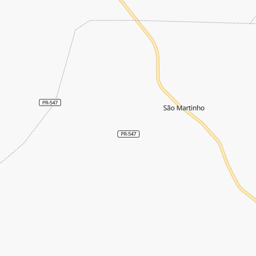
The flight distance (as the crow flies) between Astorga and Ibiporã is 63.2 km.
Roadmap (route) to go from Astorga to Ibiporã detailed above, you can also see the course layout on the map.
While doing trip Astorga - Ibiporã by car, the calculated route ends at a distance , or more straight.
Distance and duration of the route between Astorga and Ibiporã
Calculation of distance and route from Ibiporã to Astorga :
63.278.0 km1h11mn
Continue onto Rua Ceará 0h0mn 43 mTurn left onto Rua João Nelson Arcipretti 0h0mn 230 mTurn left onto Avenida Interventor Manoel Ribas 0h1mn 1.1 kmKeep right onto Avenida Presidente Getúlio Vargas 0h0mn 105 mKeep right onto Avenida Presidente Getúlio Vargas 0h12mn 12.4 kmKeep left onto Estrada do Lixao 0h3mn 2.2 kmAt roundabout, take exit 2 onto Avenida Presidente Campos Salles 0h3mn 2.1 kmTurn right onto Avenida Presidente Campos Salles 0h0mn 28 mAt roundabout, take exit 2 onto Rodovia Antônio Mendes Vasconcelos 0h9mn 10.3 kmKeep left and drive toward Retorno 0h0mn 66 mTurn sharp right 0h0mn 57 mTurn sharp left 0h1mn 309 mTurn right 0h0mn 184 mTurn left onto Rodovia Hermínio Antônio Pennacchi 0h20mn 25.6 kmKeep right 0h16mn 17.3 kmContinue onto Avenida Brasília and drive toward Ibiporã 0h1mn 674 mAt roundabout, take exit 3 onto Rodovia BR-369 0h2mn 1.8 kmAt roundabout, take exit 3 onto Rodovia BR-369 0h3mn 3.1 kmTurn left onto Rua Vicente Machado 0h0mn 106 mTurn right 0h0mn 26 mContinue 0h0mn 21 mTurn right onto Avenida Santos Dumont 0h0mn 207 mEnter roundabout 0h0mn 112 mArrive at destination 0h0mn 0 m
Travel from Astorga (Paraná) to a selection of major cities.
Distances from Astorga to biggest cities in Paraná
- Campo Mourao,75,401 inhabitants.116 km
- Paranavai,72,848 inhabitants.84 km
- Pato Branco,65,754 inhabitants.349 km
- Telemaco Borba,58,880 inhabitants.162 km
- Francisco Beltrao,57,618 inhabitants.347 km
- Cianorte,55,994 inhabitants.107 km
- Rolandia,51,004 inhabitants.32 km
- Uniao da Vitoria,48,741 inhabitants.339 km
- Cornelio Procopio,48,487 inhabitants.104 km
- Irati,45,830 inhabitants.269 km
- Ibipora,44,790 inhabitants.63 km
- Marechal Candido Rondon,43,028 inhabitants.284 km
- Castro,42,091 inhabitants.241 km
- Piraquara,41,161 inhabitants.360 km
- Palmas,39,150 inhabitants.363 km
- Mandaguari,38,238 inhabitants.35 km
- Santo Antonio da Platina,35,260 inhabitants.163 km
- Jacarezinho,35,090 inhabitants.174 km
- Paicandu,34,365 inhabitants.46 km
- Medianeira,34,069 inhabitants.337 km
Other major cities in country :
- Campo Grande [11], 729,151 inhabitants. 437 km
- Jaboatao [30], 702,621 inhabitants. 2,444 km
- Osasco [27], 677,856 inhabitants. 499 km
- Santo Andre [27], 662,373 inhabitants. 526 km
- Joao Pessoa [17], 650,883 inhabitants. 2,540 km
- Jaboatao dos Guararapes [30], 630,008 inhabitants. 2,448 km
- Contagem [15], 627,123 inhabitants. 869 km
- Ribeirao Preto [27], 619,746 inhabitants. 458 km
- Sao Jose dos Campos [27], 613,764 inhabitants. 591 km
- Uberlandia [15], 563,536 inhabitants. 595 km
- Sorocaba [27], 558,862 inhabitants. 431 km
- Cuiaba [14], 521,934 inhabitants. 969 km
- Aparecida de Goiania [29], 510,770 inhabitants. 757 km
- Aracaju [28], 490,175 inhabitants. 2,069 km
- Feira de Santana [05], 481,911 inhabitants. 1,815 km
- Juiz de Fora [15], 470,193 inhabitants. 871 km
- Belford Roxo [21], 466,096 inhabitants. 849 km
- Joinville [26], 461,304 inhabitants. 445 km
- Niteroi [21], 456,456 inhabitants. 878 km
- Sao Joao de Meriti [21], 454,849 inhabitants. 851 km
Route from Ibiporã to major cities (Brazil).
- Distance Ibiporã Sao Paulo452 km
- Distance Ibiporã Rio de Janeiro806 km
- Distance Ibiporã Salvador1,751 km
- Distance Ibiporã Fortaleza2,559 km
- Distance Ibiporã Belo Horizonte825 km
- Distance Ibiporã Brasilia895 km
- Distance Ibiporã Manaus2,444 km
- Distance Ibiporã Recife2,418 km
- Distance Ibiporã Belem2,444 km
- Distance Ibiporã Porto Alegre753 km
- Distance Ibiporã Goiania757 km
- Distance Ibiporã Guarulhos462 km
- Distance Ibiporã Campinas410 km
- Distance Ibiporã Nova Iguacu780 km
- Distance Ibiporã Maceio2,224 km
- Distance Ibiporã Sao Luis2,421 km
- Distance Ibiporã Duque de Caxias794 km
- Distance Ibiporã Natal2,582 km
- Distance Ibiporã Teresina2,209 km
- Distance Ibiporã Sao Bernardo do Campo460 km
Nearest cities to Astorga :
- Curitiba, 1,718,421 inhabitants. 344 km
- Campo Grande, 729,151 inhabitants. 437 km
- Londrina, 471,832 inhabitants. 52 km
- Sao Jose do Rio Preto, 374,699 inhabitants. 357 km
- Bauru, 335,024 inhabitants. 286 km
- Maringa, 311,724 inhabitants. 35 km
- Foz do Iguacu, 293,523 inhabitants. 393 km
- Ponta Grossa, 292,177 inhabitants. 257 km
- Cascavel, 257,172 inhabitants. 264 km
- Colombo, 217,000 inhabitants. 338 km
- Marilia, 212,218 inhabitants. 210 km
- Presidente Prudente, 209,502 inhabitants. 126 km
- Aracatuba, 170,024 inhabitants. 259 km
- Guarapuava, 150,850 inhabitants. 241 km
- Sao Jose dos Pinhais, 124,224 inhabitants. 357 km
- Toledo, 119,313 inhabitants. 268 km
- Pinhais, 117,000 inhabitants. 351 km
- Araucaria, 111,302 inhabitants. 348 km
- Catanduva, 109,612 inhabitants. 362 km
- Umuarama, 107,319 inhabitants. 180 km
- Apucarana, 107,085 inhabitants. 41 km
- Birigui, 102,277 inhabitants. 256 km
- Assis, 101,597 inhabitants. 143 km
- Ourinhos, 97,799 inhabitants. 186 km
- Arapongas, 97,512 inhabitants. 32 km
- Campo Largo, 94,668 inhabitants. 329 km
- Cambe, 91,080 inhabitants. 40 km
- Almirante Tamandare, 89,499 inhabitants. 334 km
- Sarandi, 84,697 inhabitants. 32 km
- Avare, 81,285 inhabitants. 281 km
- Tres Lagoas, 78,712 inhabitants. 272 km
- Campo Mourao, 75,401 inhabitants. 116 km
- Paranavai, 72,848 inhabitants. 84 km
- Votuporanga, 69,863 inhabitants. 358 km
- Lins, 69,451 inhabitants. 263 km
- Pato Branco, 65,754 inhabitants. 349 km
- Itapeva, 62,957 inhabitants. 297 km
- Tupa, 62,035 inhabitants. 187 km
- Fernandopolis, 61,931 inhabitants. 360 km
- Telemaco Borba, 58,880 inhabitants. 162 km
- Francisco Beltrao, 57,618 inhabitants. 347 km
- Lencois Paulista, 57,375 inhabitants. 302 km
- Cianorte, 55,994 inhabitants. 107 km
- Penapolis, 54,477 inhabitants. 260 km
- Andradina, 52,406 inhabitants. 262 km
- Rolandia, 51,004 inhabitants. 32 km
- Ibitinga, 49,074 inhabitants. 335 km
- Uniao da Vitoria, 48,741 inhabitants. 339 km
- Cornelio Procopio, 48,487 inhabitants. 104 km
- Irati, 45,830 inhabitants. 269 km
Location Astorga (Paraná) :
| Country flag |  |
| Location | Astorga |
| State | Paraná |
| County | Astorga |
| Country | Brazil |
| Country code / ISO 2 | BR |
| Latitude | -23.2325000 |
| Longitude | -51.6655600 |
| Altitude | 0 meters |
| Time zone | America/Sao_Paulo |
Location Ibiporã (Paraná) :
| Country flag | |
| Location | Ibiporã |
| State | Paraná |
| County | Ibiporã |
| Country | Brazil |
| Country code / ISO 2 | BR |
| Latitude | -23.2691700 |
| Longitude | -51.0480600 |
| Altitude | 0 meters |
| Time zone | America/Sao_Paulo |
